Front Range temperatures through the week will largely hover near to above normal, though there will be a brief dip in temperatures one day behind a late-spring cold front. Rain chances will focus on the early to middle part of the week with our best shot of raindrops coming on Wednesday. Drier and warmer weather will resume for the latter part of the week with 80-degree temperatures in sight. We also provide an update on the chance of seeing more aurora this week. Read on for more details.
This week’s highlights include:
- Diurnally driven showers: Our week starts with isolated/scattered diurnally driven showers or storms, but activity will not be widespread
- Rain chances: Highest Wednesday into early Thursday with a cold front
- Temperature Trends: Temperatures hover near to above normal from the upper 60s to low/upper 70s, with a blip of below normal highs Wednesday with a front
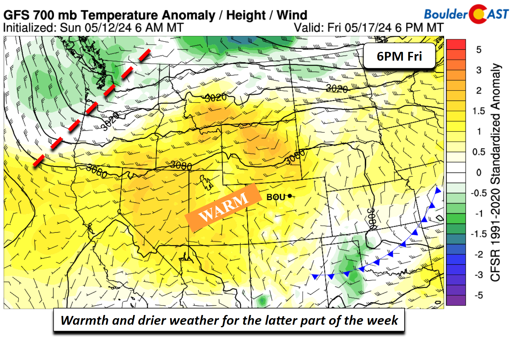
- Drying out: Rain chances decline late-week into the early part of the weekend as drier westerly flow and ridging build eastward
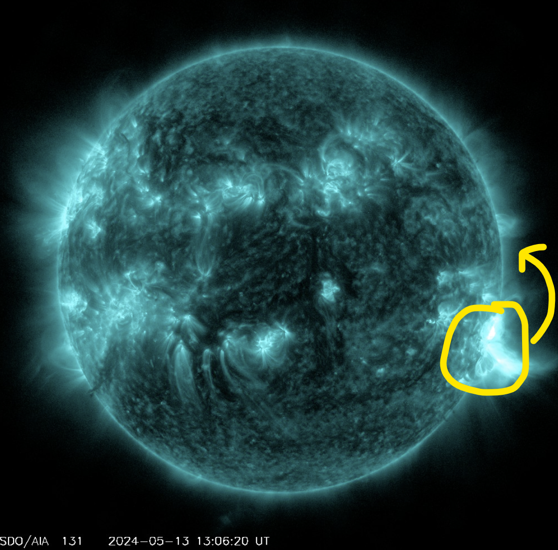
- Northern Lights Going Dark: The massive sunspot cluster responsible for the historic aurora viewing this past weekend is about to rotate to the backside of the sun and it will no longer impact Earth. Hope you got to see something while it lasted!
DISCLAIMER: This weekly outlook forecast is created Monday morning and covers the entire upcoming week. Accuracy will decrease as the week progresses as this post is NOT updated. To receive daily updated forecasts from our team, among many other perks, subscribe to BoulderCAST Premium.
Daily Forecast Updates
Get our daily forecast discussion every morning delivered to your inbox.
All Our Model Data
Access to all our Colorado-centric high-resolution weather model graphics. Seriously — every one!
Ski & Hiking Forecasts
6-day forecasts for all the Colorado ski resorts, plus more than 120 hiking trails, including every 14er.
Smoke Forecasts
Wildfire smoke concentration predictions up to 72 hours into the future.
Exclusive Content
Weekend outlooks every Thursday, bonus storm updates, historical data and much more!
No Advertisements
Enjoy ad-free viewing on the entire site.
Slightly unsettled into midweek
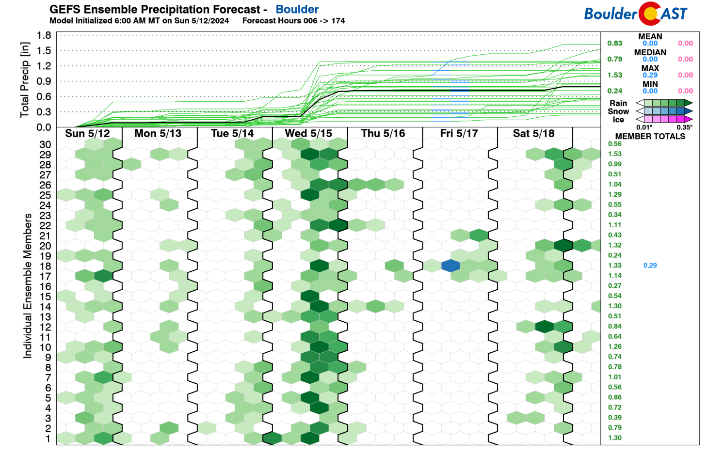
Below shows the GEFS ensemble precipitation forecast for the week. Most of the ensemble members are the wettest at the beginning part of the week, with lesser rain chances Thursday/Friday. We’ll discuss why this is in a second, but certainly it looks more unsettled to start. Wednesday, in fact, looks to be the wettest day of the week with a cold front.
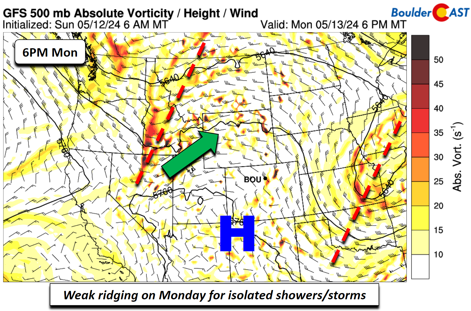
We’ll start the week with ridging in place. A weak trough is over the Midwest and its influence is long gone from Colorado. However, there is another trough in the northwest US and over Idaho/Montana. While this trough is far enough removed, it could send some energy into our area this afternoon and evening.
Along with a weak surface trough and instability, widely scattered showers and storms over the High Country could drift east into the Metro area. Most of these showers will be limited once they track east-southeast, but there is a10-20% late-day rain chance on Monday with temperatures in the lower 70s.
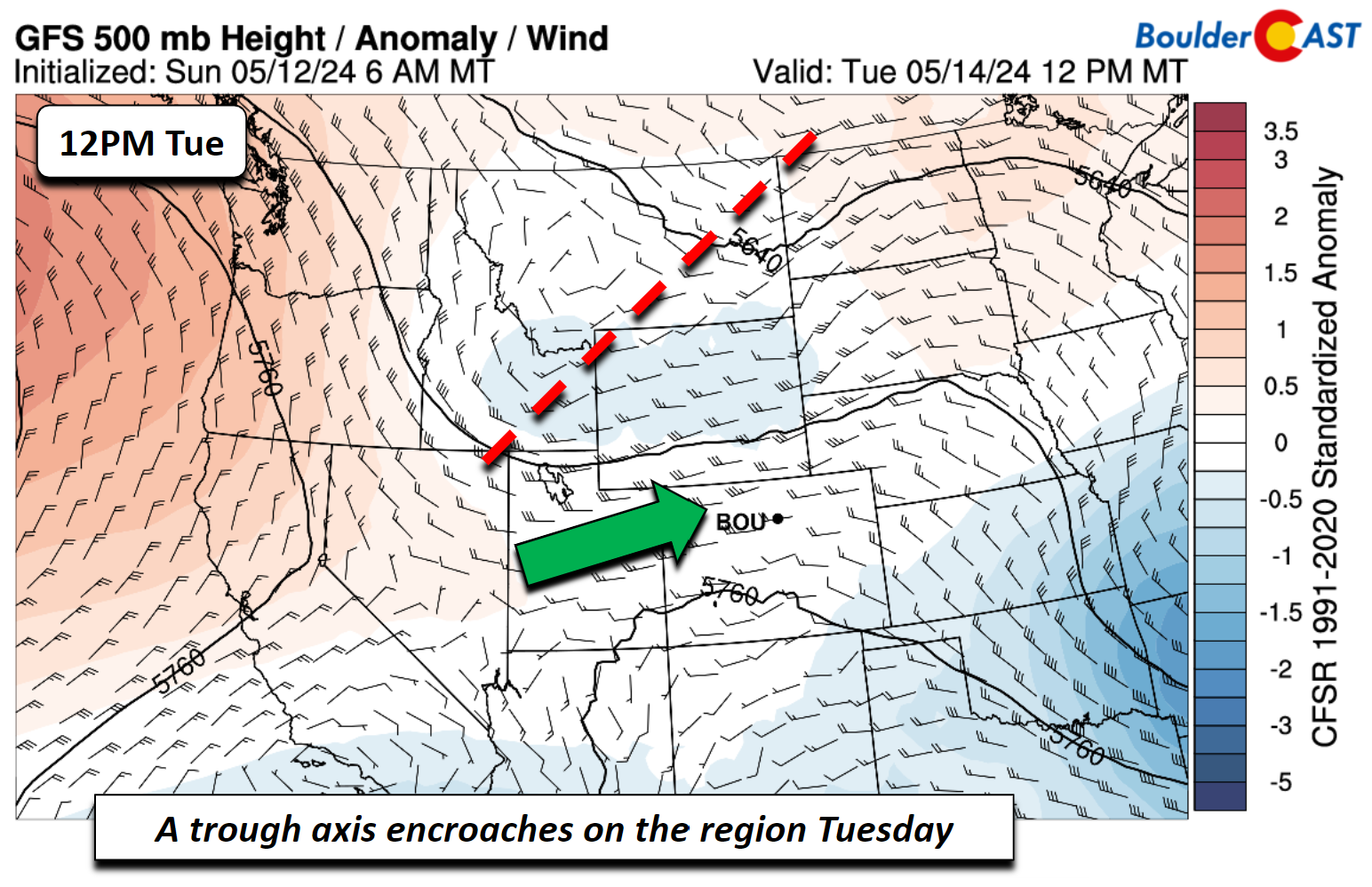
On Tuesday, that trough that was to the northwest will inch closer into southeast Idaho and northwest Wyoming. This closer proximity along with an approaching cold front should favor more scattered shower/storms during the afternoon and evening, diurnally-driven, probably up to 30-40% chances. Highs will still manage to get well into the 70s before any storm activity unfolds.
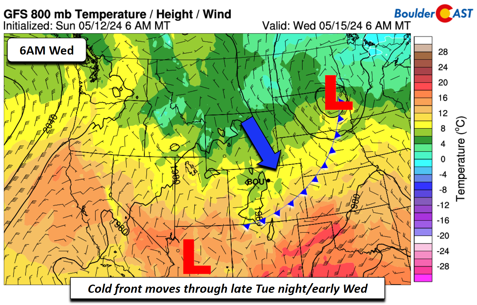
A fairly strong cold front for late-spring will push through sometime late Tuesday night or early Wednesday, reaching southeast Colorado in the afternoon. This will bring upslope flow to the Front Range and our coolest temperatures of the week — well below normal. Highs may struggle to get out of the upper 50s, but current model consensus is for highs in the lower 60s.
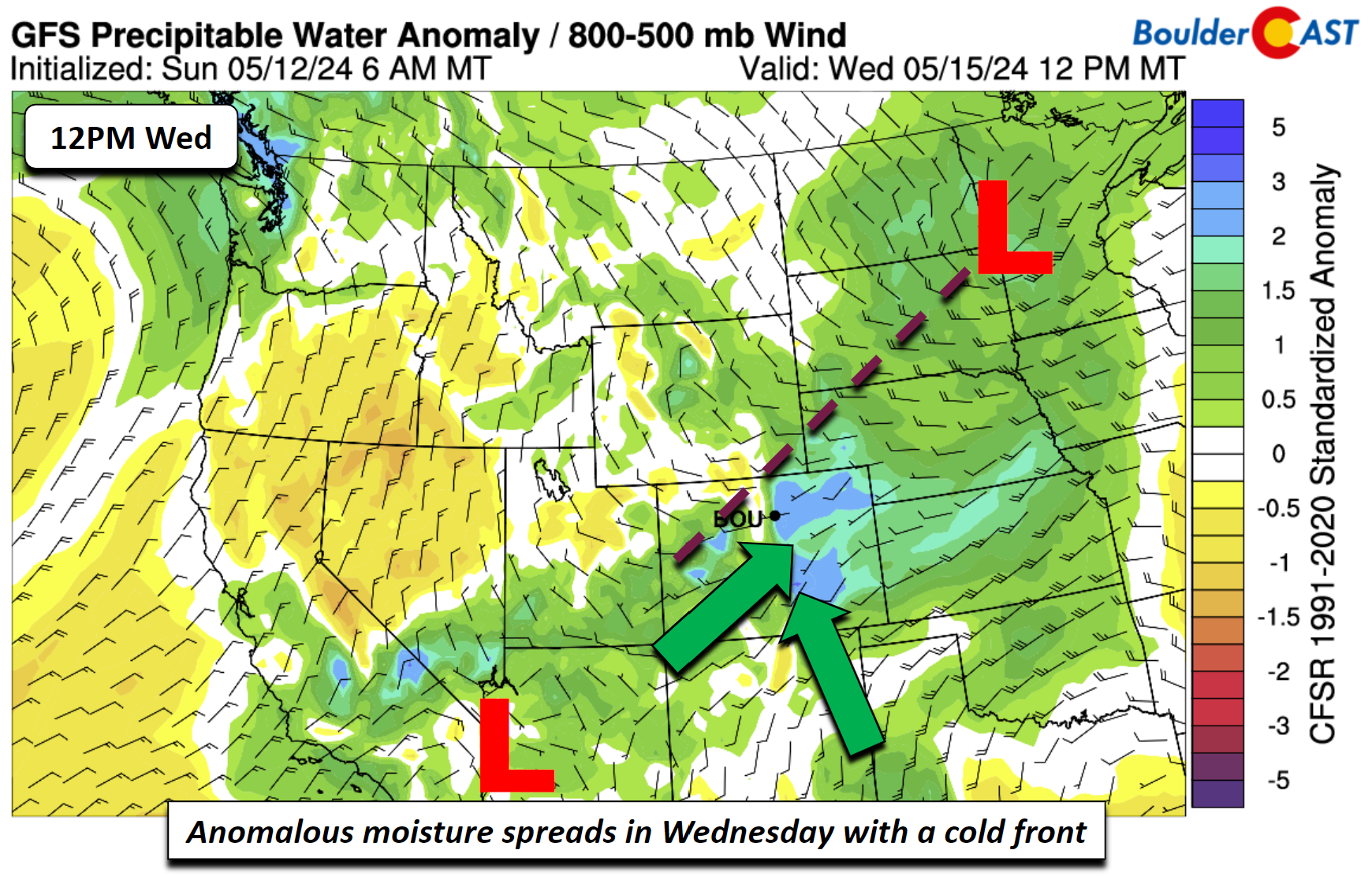
Along with that front, moisture will be anomalous and funneling in from the southwest (low pressure in Arizona) and from the west, with the trough over the region. This will combine with the upslope for a better chance of more widespread showers and perhaps a few rumbles of thunder as well. No severe threat is expected.
Warmer & drier to end the week
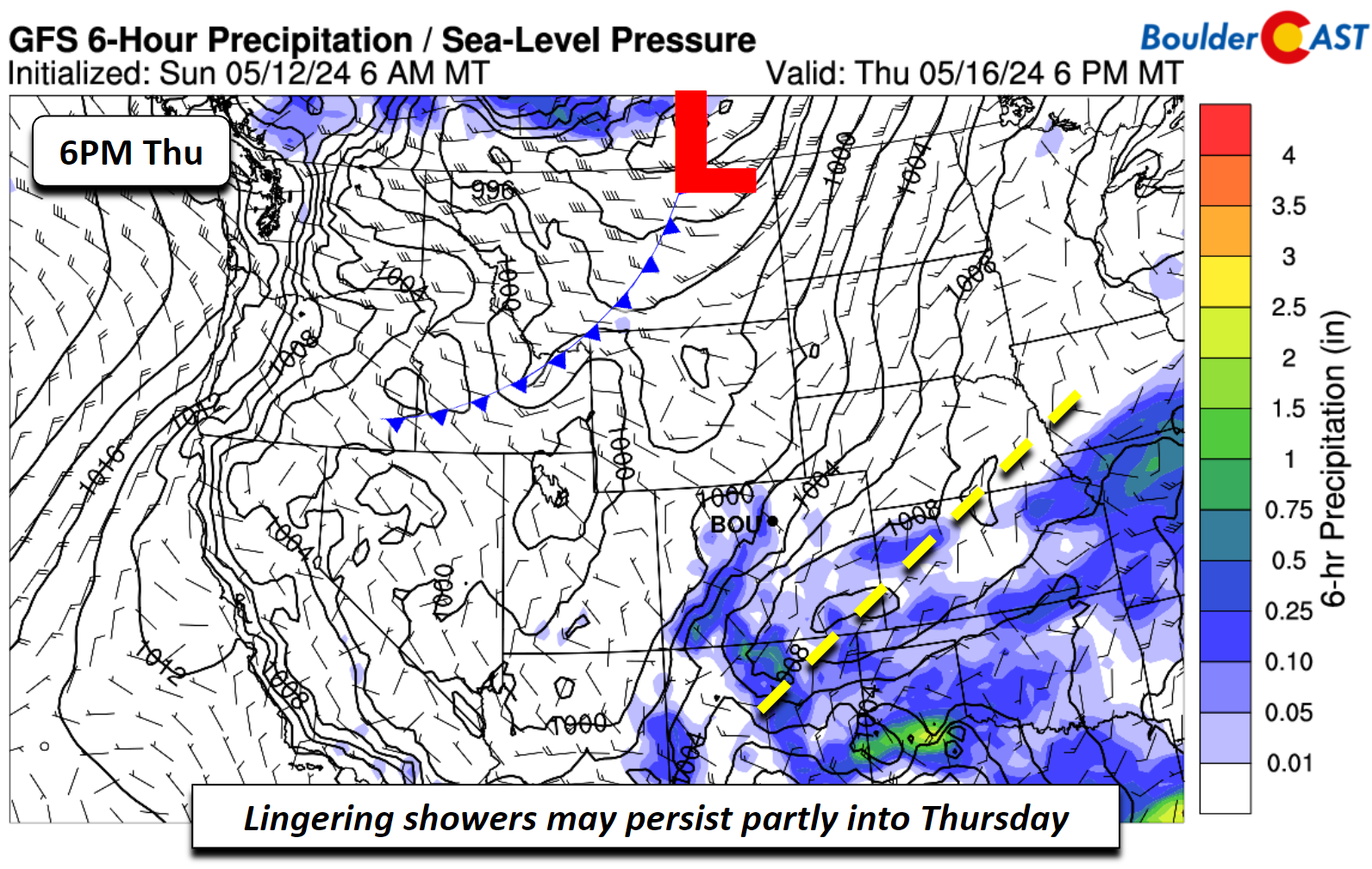
The front on Thursday washes out, leaving behind a surface trough over northern New Mexico and into western Kansas. There could still be some lingering showers on the first half of Thursday, but drier air will be slowly working in, such that rain chances will be about 10% or so. Highs should manage to get into the upper 60s, though it could be slightly cooler if the trough is slower to move out. Remember this is still four days away!
By the end of the week on Friday, southwest to westerly flow will take over and ridging will build back in across the Rockies. This will favor highs above normal in the upper 70s and less rain chances (largely dry). There could be a return chance of showers by Saturday, but that’s too far out to discern at this stage.
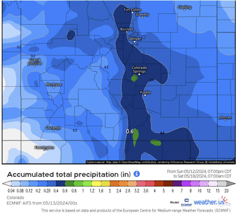
Despite daily chances for rainfall each day this week, overall amounts will not be that impressive with just 0.25 to 0.5″ expected for the Front Range through Friday night. The larger amounts are favored across the higher terrain. Due to thunderstorm potential, locally higher totals are possible, of course.
Here’s a look at the weather for the extended. After a few somewhat rainier days, things really improve later in the week!
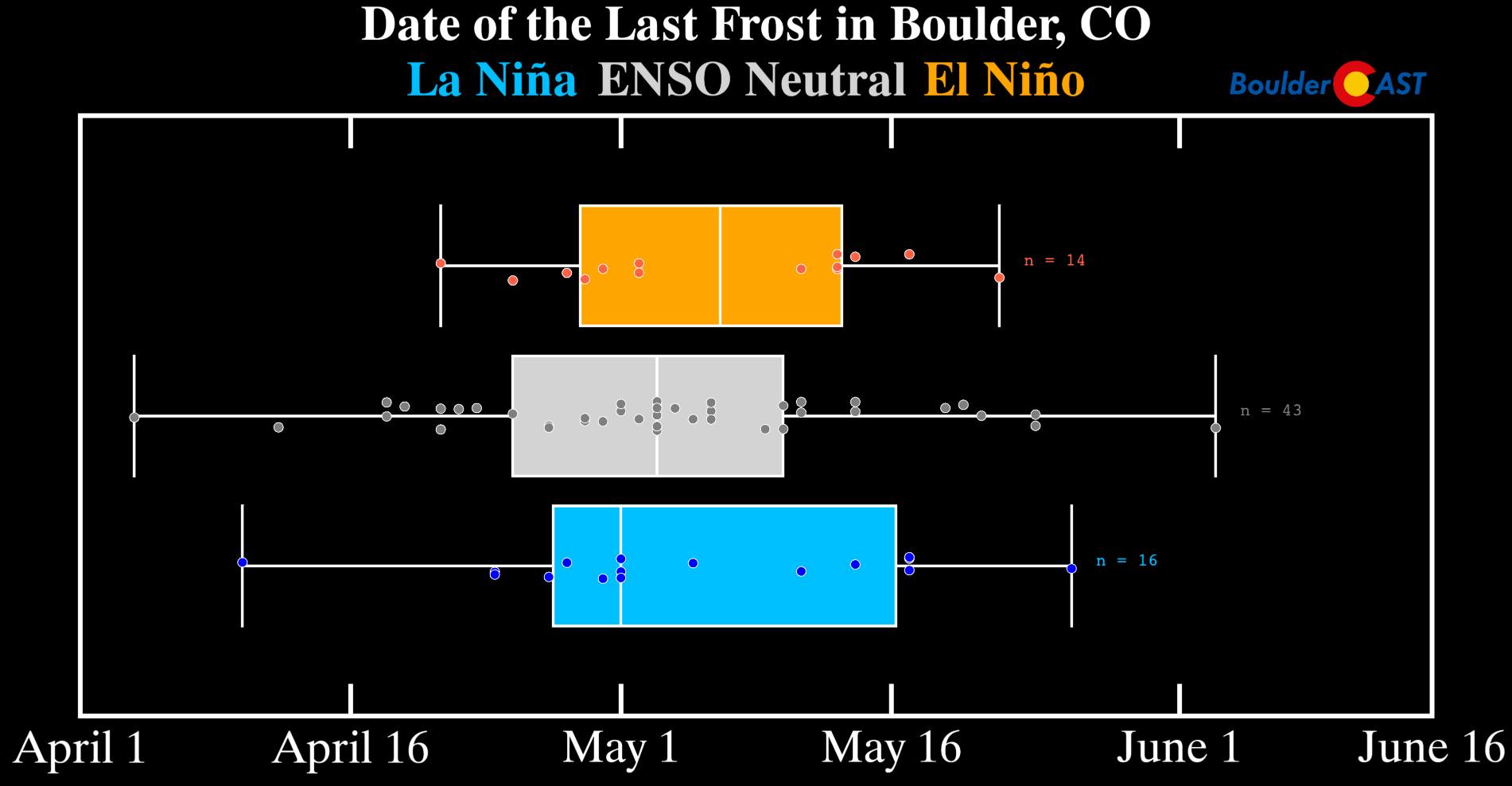
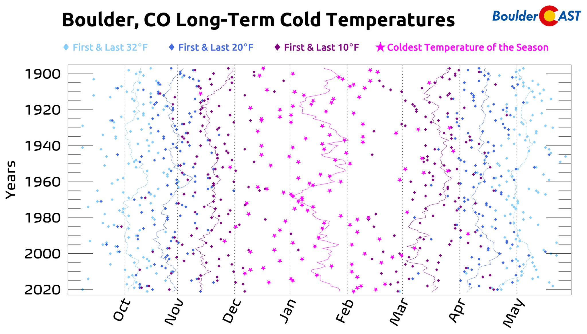
For those of you hopeful to plant your gardens soon, keep in mind that El Niño conditions typically mean a later last frost for our area, relative to other ENSO patterns. After May 16th, there is a very low chance of frost (<10%), and with nothing nearly cold enough for frost on the horizon, we should be in the clear for an official start to the Front Range growing season!
And finally, the massive sunspot cluster responsible for the historically expansive aurora viewing this past weekend is about to rotate to the backside of the sun and it will no longer impact Earth — even if the sun keeps spitting out particles there.
Hopefully you were able to catch a glimpse while it lasted! Have a great week!
Get BoulderCAST updates delivered to your inbox:
Forecast Specifics:
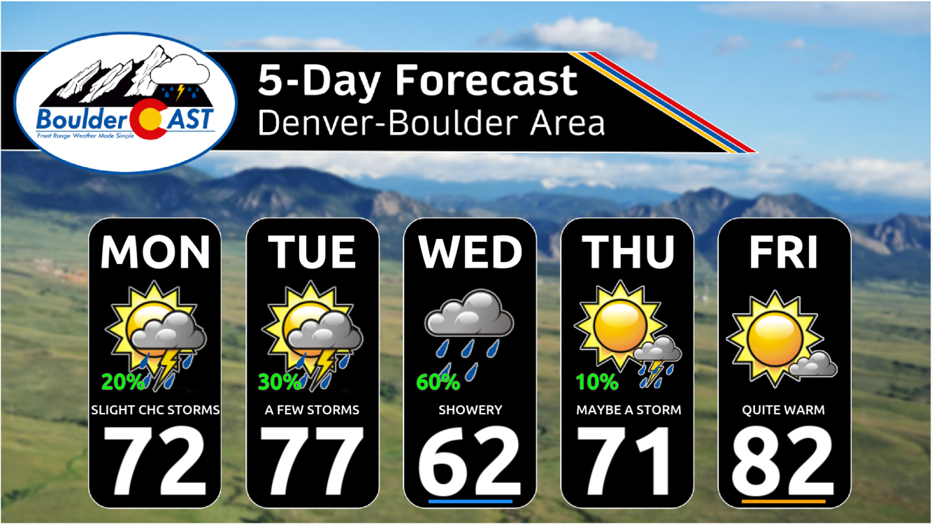
Monday: Sunny skies becoming partly cloudy with a 20% chance of afternoon/evening isolated storms. Highs in the lower 70s on the Plains and lower 60s in the Foothills.
Tuesday: Sunny skies becoming partly cloudy with a 30-40% chance of afternoon/evening scattered storms. Highs in the upper 70s on the Plains and upper 60s in the Foothills.
Wednesday: Partly to mostly cloudy with scattered to widespread rain showers and a few rumbles of thunder. Highs in the low 60s on the Plains, but could be stuck in the upper 50s. Highs in the low 50s in the Foothills.
Thursday: Warmer with a slight chance of a few showers in the early afternoon or evening. Highs near 70 degrees for the Plains and upper 50s in the Foothills.
Friday: Mostly sunny, dry and warm with temperatures topping out in the lower 80s on the Plains and upper 60s for the Foothills.
DISCLAIMER: This weekly outlook forecast is created Monday morning and covers the entire upcoming week. Accuracy will decrease as the week progresses as this post is NOT updated. To receive daily updated forecasts from our team, among many other perks, subscribe to BoulderCAST Premium.
Daily Forecast Updates
Get our daily forecast discussion every morning delivered to your inbox.
All Our Model Data
Access to all our Colorado-centric high-resolution weather model graphics. Seriously — every one!
Ski & Hiking Forecasts
6-day forecasts for all the Colorado ski resorts, plus more than 120 hiking trails, including every 14er.
Smoke Forecasts
Wildfire smoke concentration predictions up to 72 hours into the future.
Exclusive Content
Weekend outlooks every Thursday, bonus storm updates, historical data and much more!
No Advertisements
Enjoy ad-free viewing on the entire site.
Enjoy our content? Give it a share!





You must be logged in to post a comment.