This week in Colorado weather will feature favorable upslope conditions across the Mountains into at least midweek, but mostly dry conditions and seasonal temperatures for the Plains. The deep moisture will bring hefty snow totals to the High Country over the coming days, with powder measured by the foot in many areas. Little if any precipitation will occur across the Denver Metro area, though Wednesday will bring our best chance with a stronger trough of low pressure moving through. The week ends with drier zonal flow but there are some signs of a possible snow event developing for the weekend.
This week’s highlights include:
- Highs remain near or below average through the week, generally in the 50s
- A slight chance of rain/snow almost every day, but Wednesday is our best chance with a stronger storm system moving through
- A series of decaying atmospheric rivers will bring hefty snow totals to the Mountains into early Thursday — heaviest once again in the San Juan area
- We are watching a possible weekend system that could bring snow to the Plains, but uncertainty is high
DISCLAIMER: This weekly outlook forecast is created Monday morning and covers the entire upcoming week. Accuracy will decrease as the week progresses as this post is NOT updated. To receive daily updated forecasts from our team, among many other perks, subscribe to BoulderCAST Premium.
50s this week with minimal precipitation chances on the Plains
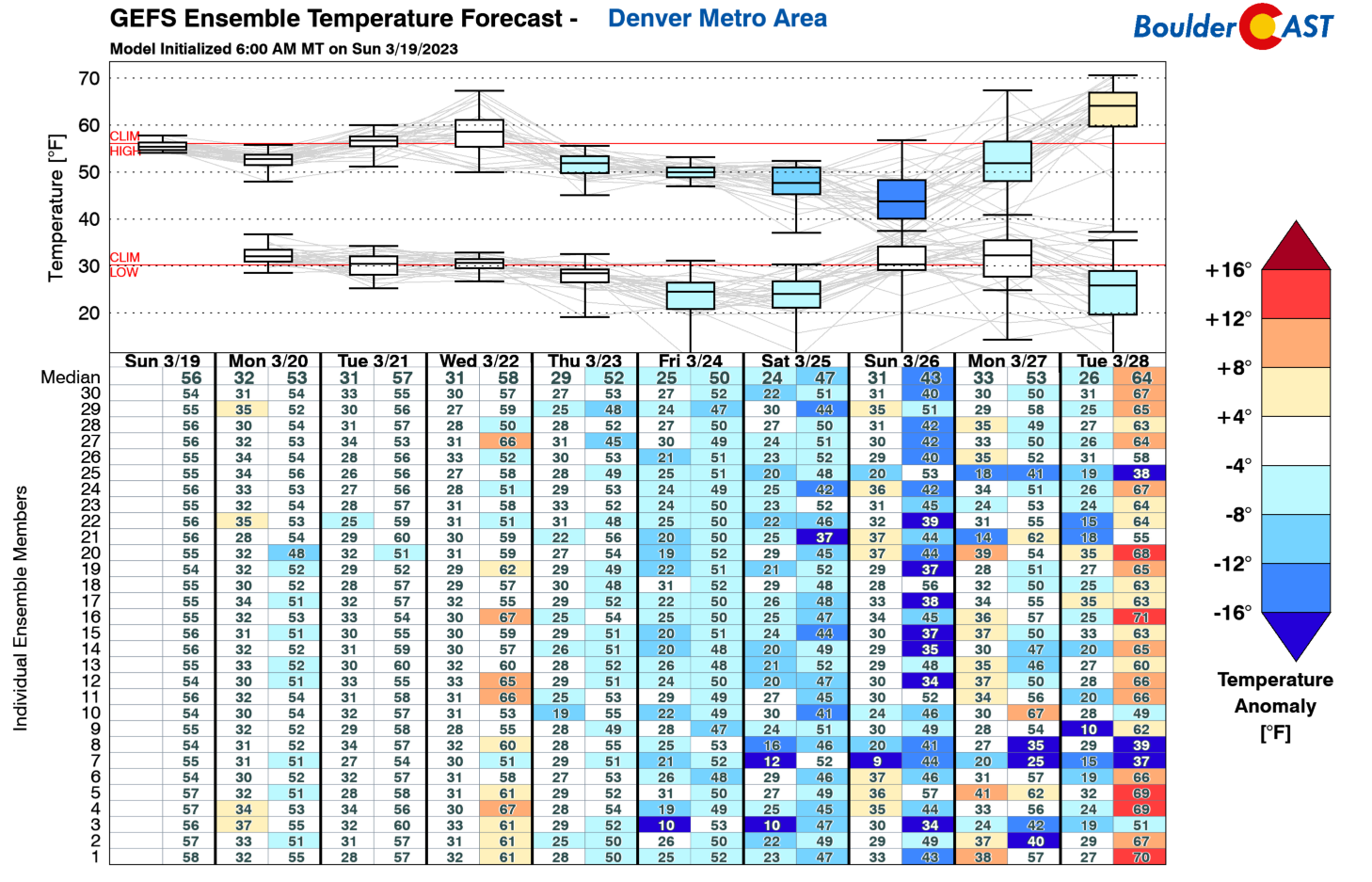
The week ahead for the Front Range will largely feature near to above normal temperatures into Wednesday in the mid to upper 50s, but there will be a trend toward cooler weather by week’s end and the upcoming weekend. The reason for the switch in temperatures will involve a cold front and trough passage Thursday, which we will discuss later.
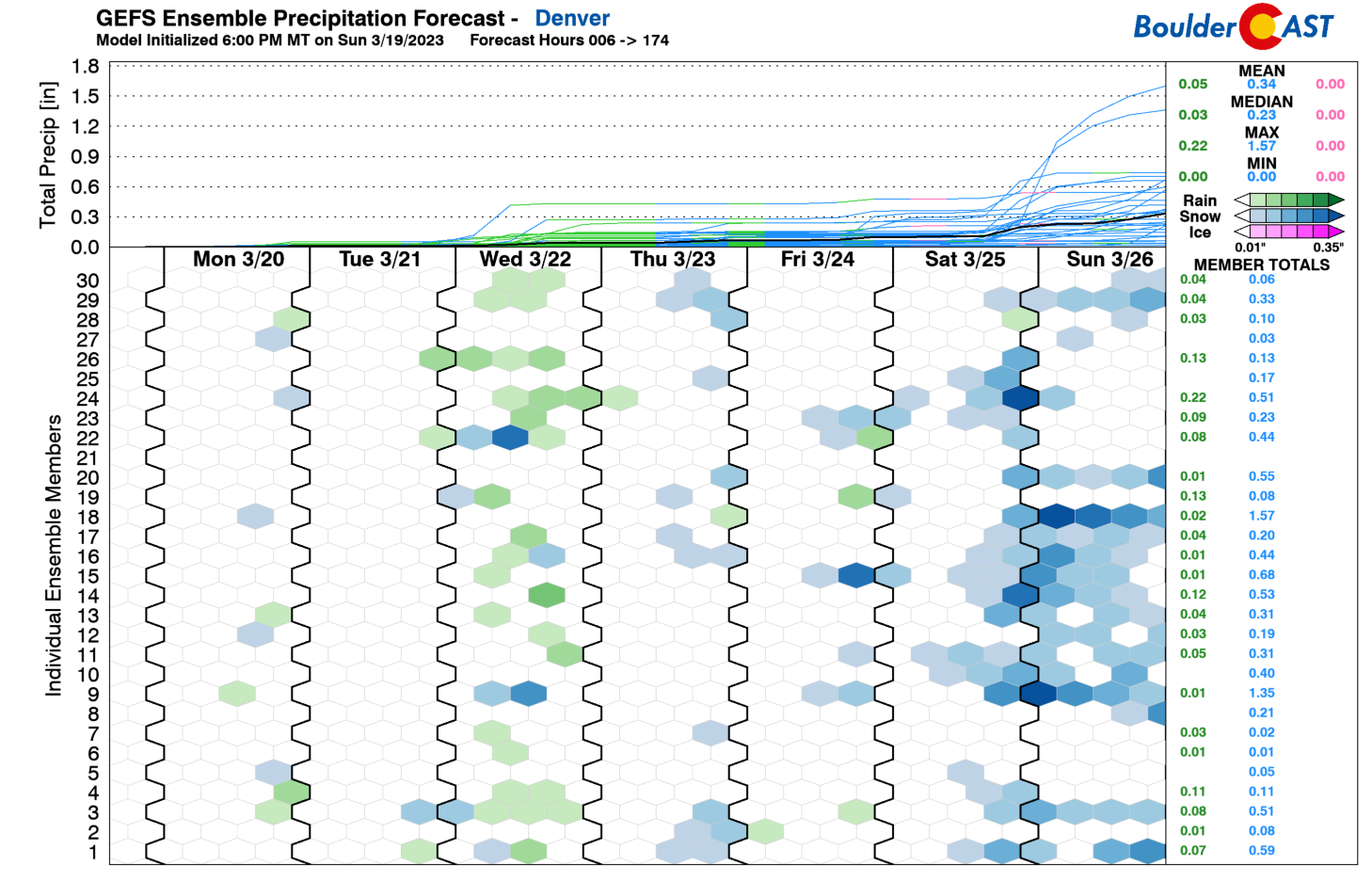
As for our precipitation chances, you’ll notice below that the GEFS pretty much indicates a chance of light precipitation in the form of rain/snow nearly every day this week. However, it would appear our best chance will be Wednesday with a more potent upper-trough. The upcoming weekend shows more of a possible signal in snow chances come late Saturday and Sunday, but we’ll discuss that towards the end of this post.
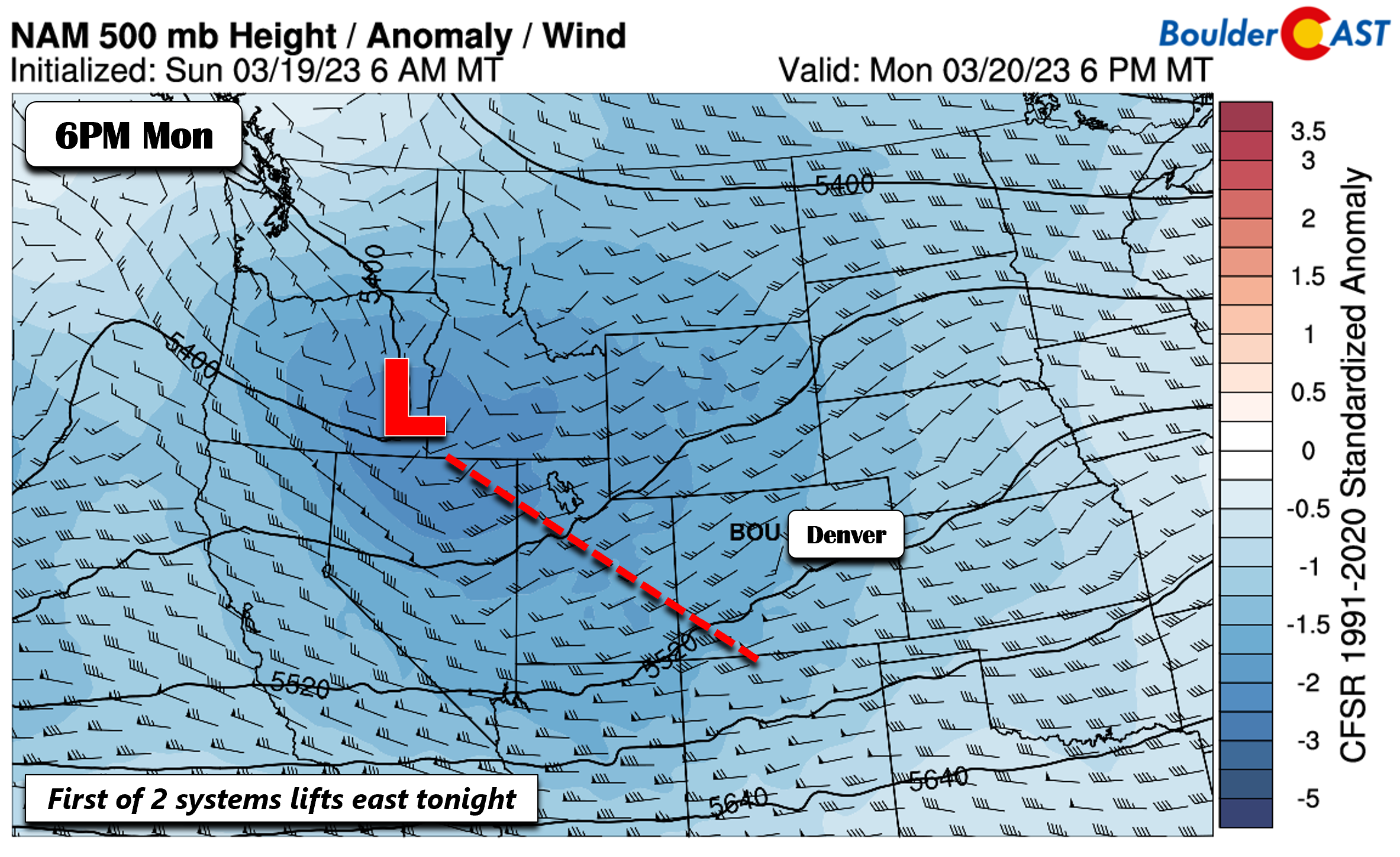
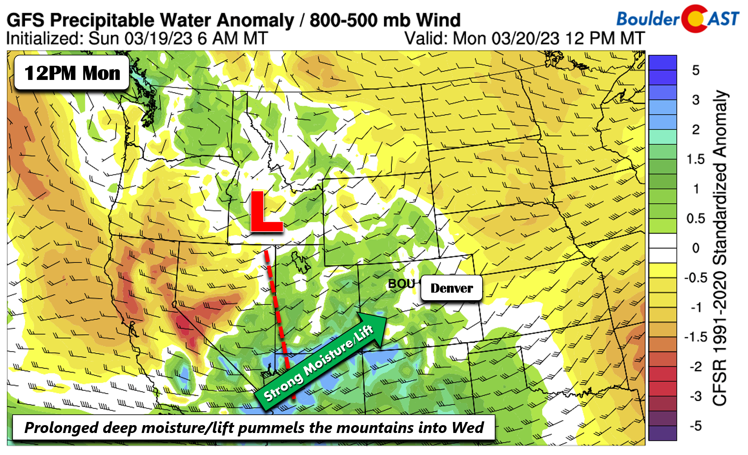
On Monday a mid-level trough will be situated over Idaho, with broad southwest flow over the state today and tonight. This trough is the first of two that will impact the state this week. The second one arrives on Wednesday.
This first trough Monday sends a plume of atmospheric moisture from the Pacific into the Four Corners and western Colorado. This will be the first of two main snowfall events for the High Country in the coming days, the first being Monday into early Tuesday.
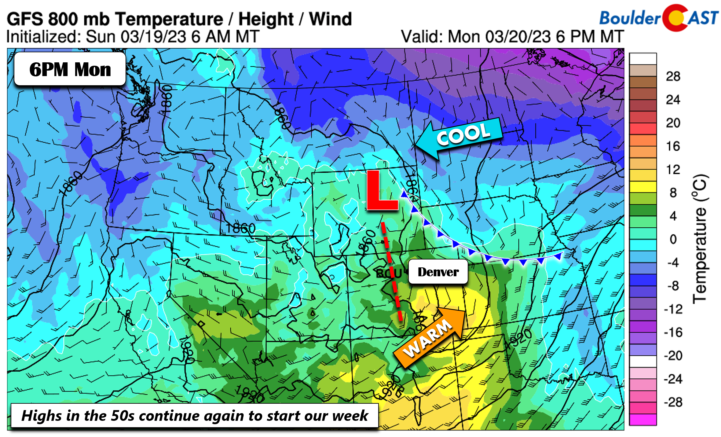
Further east, a weak surface low over northeast Wyoming will be tied to a surface cold front over Nebraska and downslope flow on the Plains. Weak upslope flow today will keep temperatures in the lower 50s, but some middle 50s will exist in south Denver. We cannot rule out some light rain/flurries Monday afternoon into the night with the first system tracking through, but downslope flow should favor mostly dry conditions and just a little virga here and there.
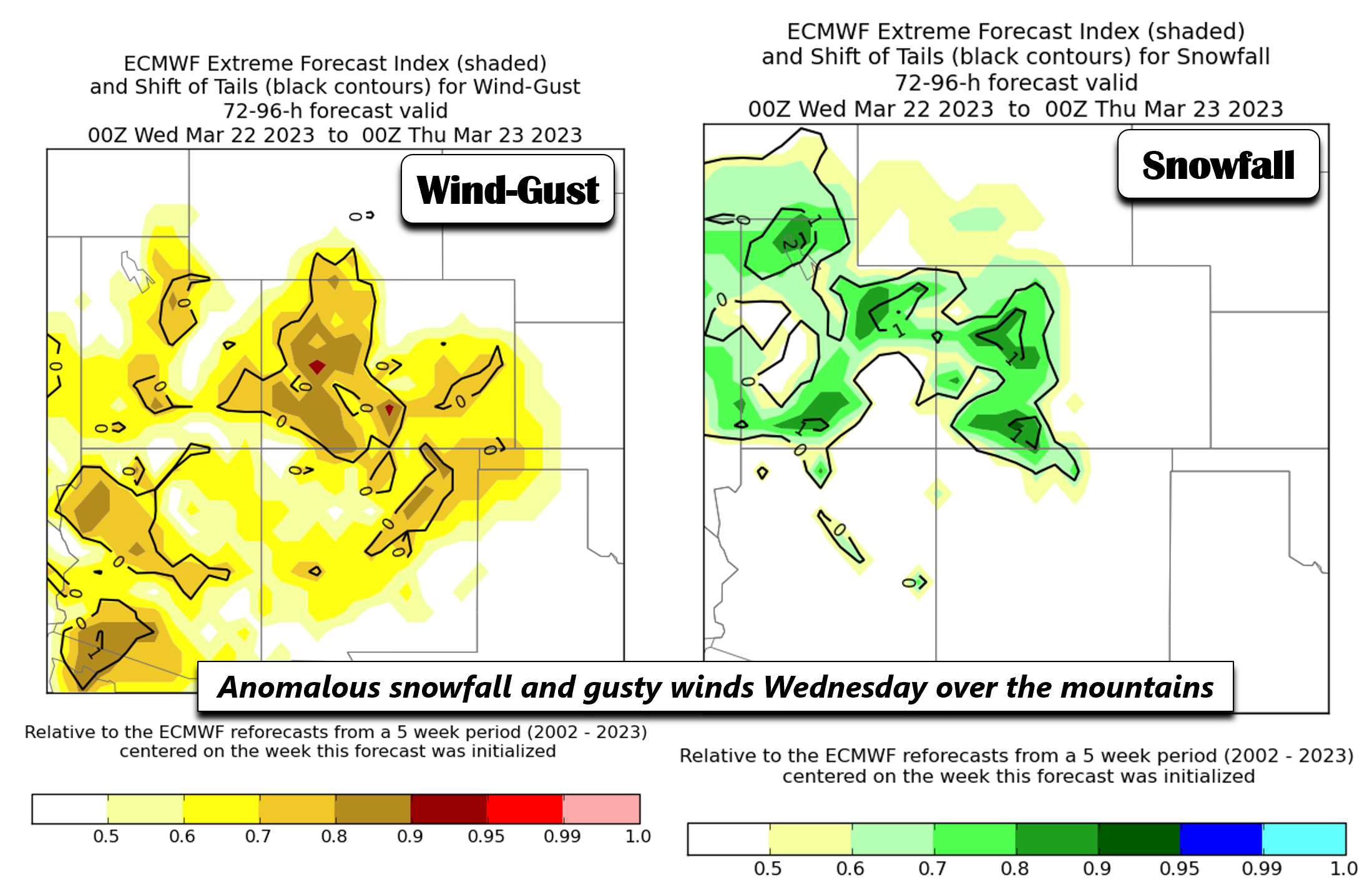
The ECMWF extreme forecast index, which looks at all 50 members of the ECMWF ensemble system, favors breezy conditions and anomalous snowfall for the High Country Tuesday into Wednesday. Some of these gusty winds may also impact the Plains Wednesday. The anomalous snowfall is directly tied to the two troughs tracking through with deep moisture from the Pacific.
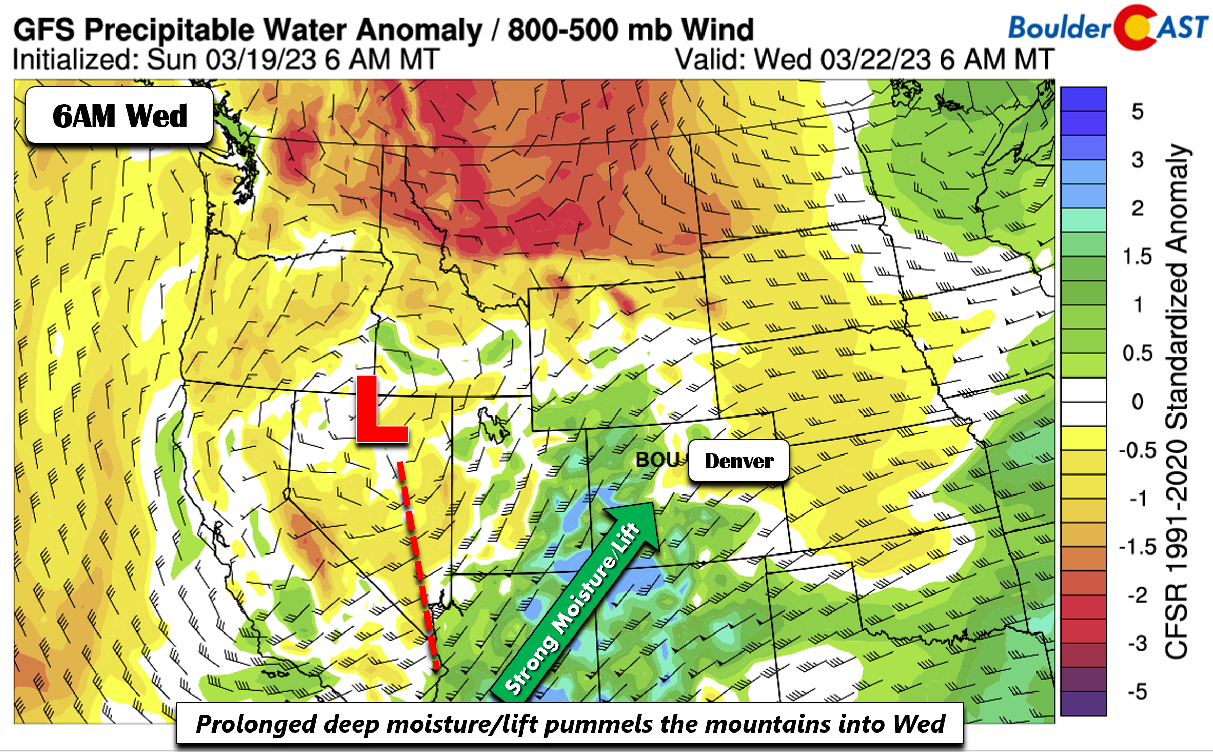
The second of two troughs arrives sometime early Wednesday morning. This second system takes a more southern track, largely going directly across Colorado Wednesday night. A deeper plume of moisture also impacts the state, especially over southwest Colorado — this is yet another remnant atmospheric river. This second system will also bring a chance of precipitation on the Plains with some weak surface upslope and instability developing.
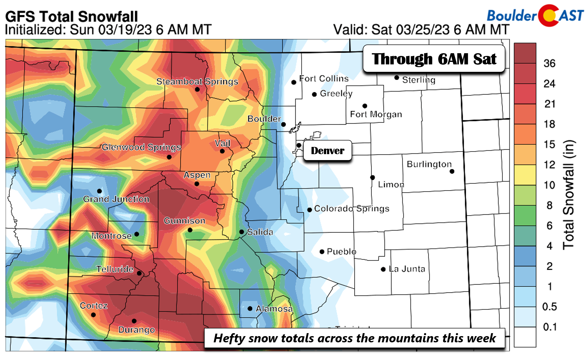
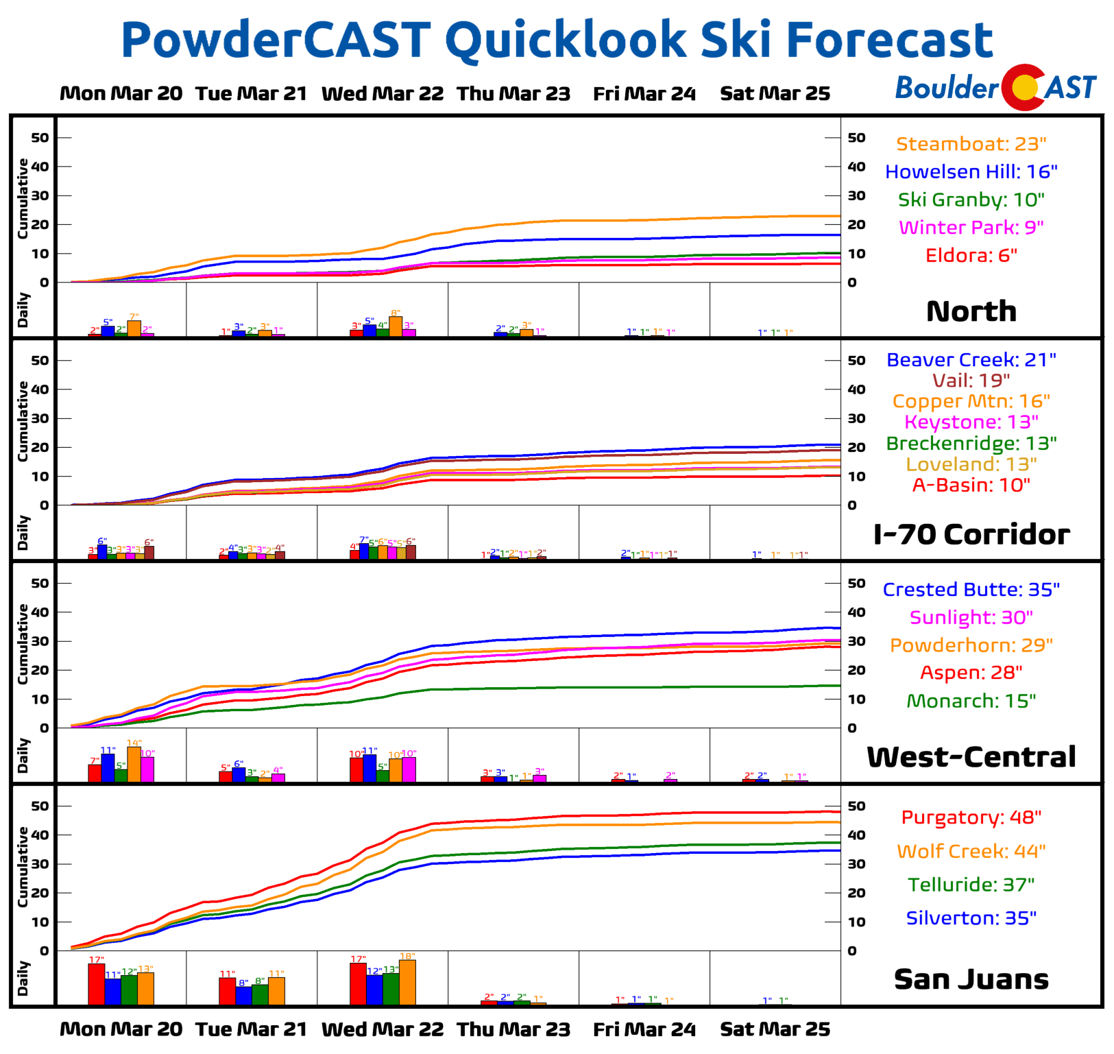
The two troughs (the first Monday and the second Wednesday) will bring hefty snow totals to the mountains and ski resorts through the week. We’ll likely be measuring snow amounts in feet and not inches, especially across southwest Colorado. Wolf creek, Aspen, Telluride, Durango to Vail are all favored resorts to get significant fresh powder.
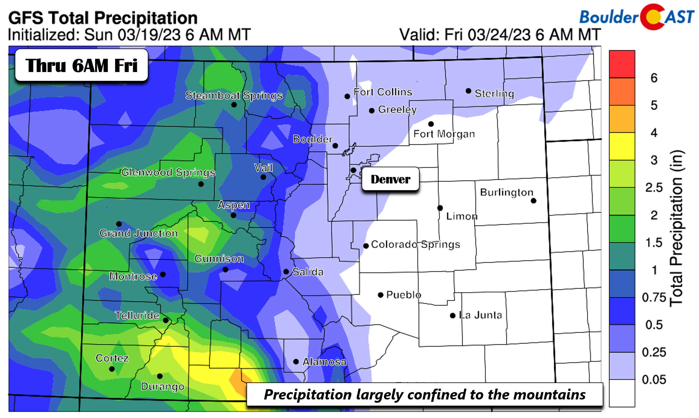
Precipitation totals through early Friday show that little if any will fall on the Plains. The light amounts shown below are a result predominantly from the system on Wednesday. Outside of that, expect mostly dry time through the week.
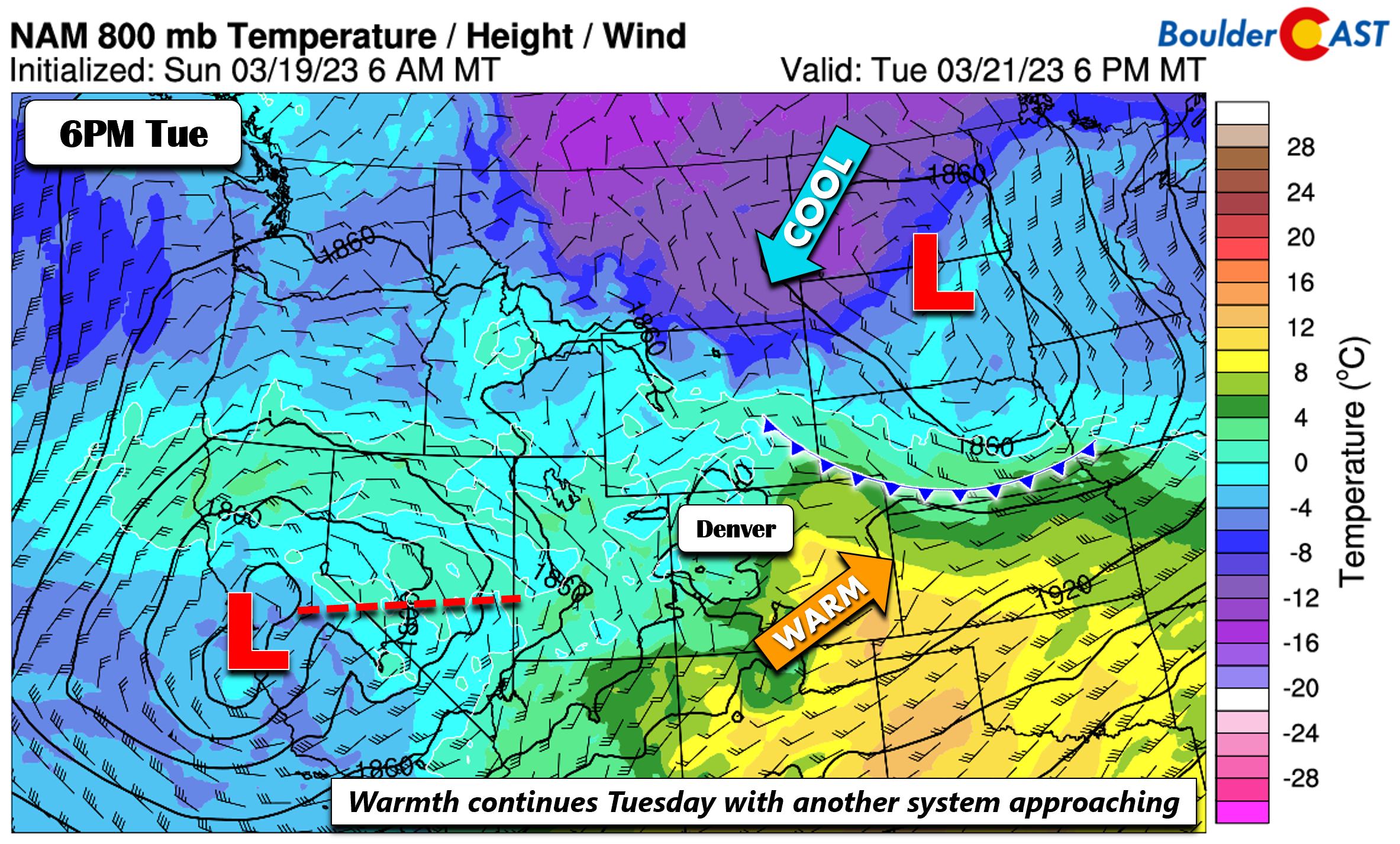
On Tuesday, the first system will reach the Dakotas, with a weakened cold front over southwest Nebraska. Warmer flow persists on the Plains, but weak surface upslope may exist across northeast Denver with the front nearby. Our next system is waiting to approach over central California.
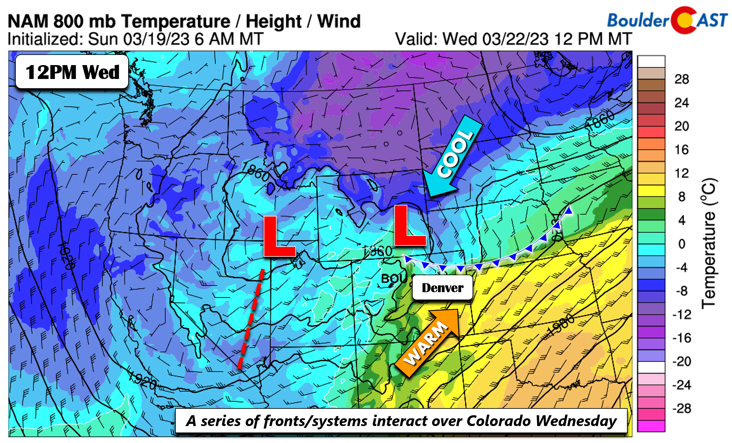
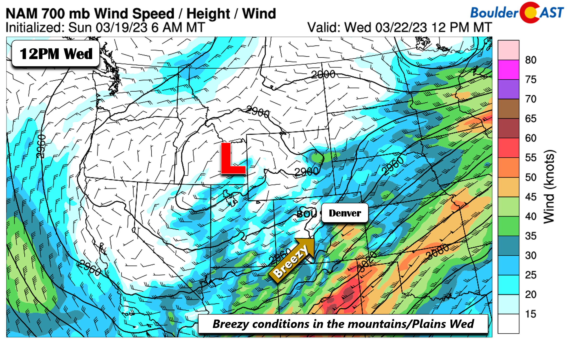
Come Wednesday, the system over California moves inland into Utah, while the cold front continues to remain nearby northeast Colorado. The warm airmass over the Plains gets shunted to our southeast, but a persistent downslope flow will not only favor gusty winds on the higher terrain but also the Plains up to 30 MPH.
The 700 mb flow on Wednesday will be out of the southwest between 30 and 60 MPH, strongest over southern and southeast parts of the state. Fortunately, no fire danger concern is anticipated with the deep moisture engulfing the mountains. Precipitation chances will increase Wednesday, especially morning to early evening. Snow levels are somewhat high such that rain and snow are both possible. Highs in the 40s/50s will limit any accumulation, even if snow levels ultimately do trend colder.
Somewhat chillier with a chance of weekend snow?
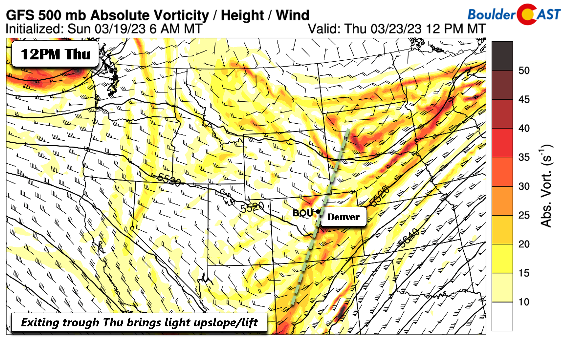
As we head into the latter part of the week, the second trough Wednesday becomes somewhat sheared out (weakens) by Thursday. Nevertheless, nearly every model has some form of light precipitation on the Plains and mountains. This appears associated with the trough passage and some weak surface upslope behind a cold front. Highs will also be cooler around 50 degrees. We don’t expect any real snow accumulation and even rain may continue to mix in.
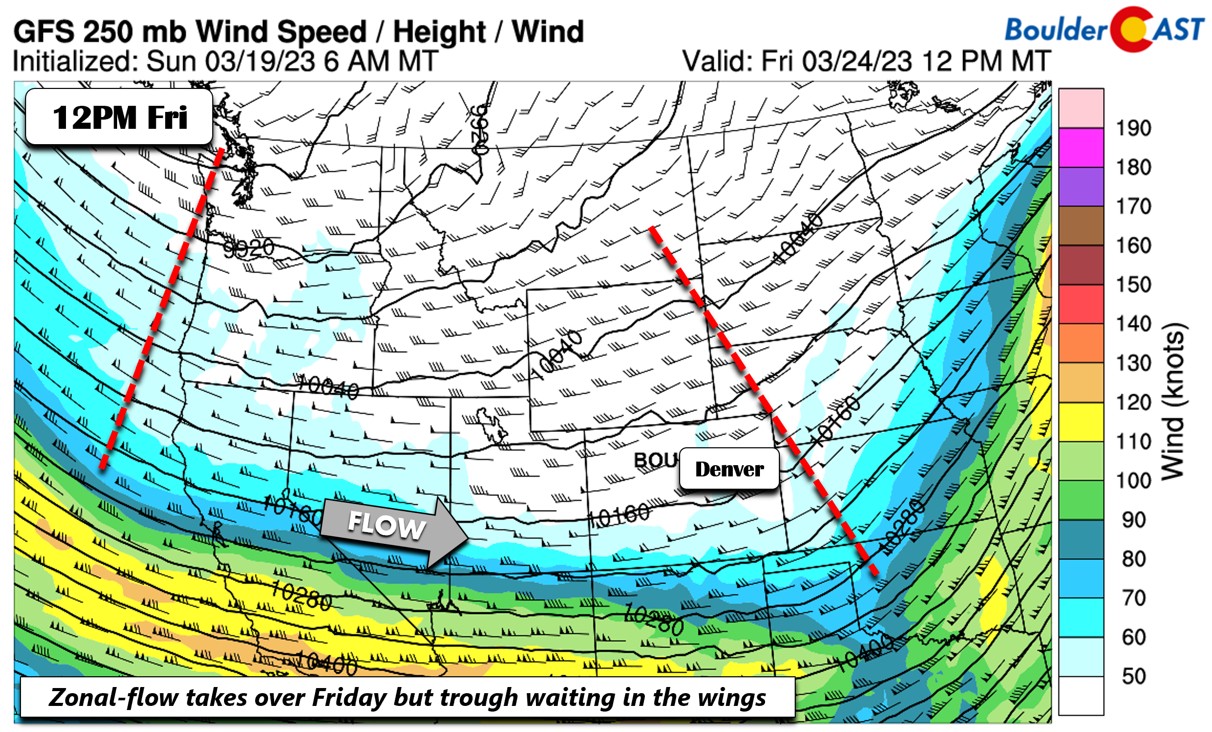
Most guidance shows that a zonal flow will takeover on Friday, which should favor a dry/cool end in the lower 50s. Still, some models paint a few hundredths of an inch of precipitation for the Mountains/Plains. This would appear weak at best but possibly tied to another shortwave embedded in the flow. Our confidence on this is low though at the moment, but we will include yet another miniscule chance of rain/snow in the forecast for Friday.
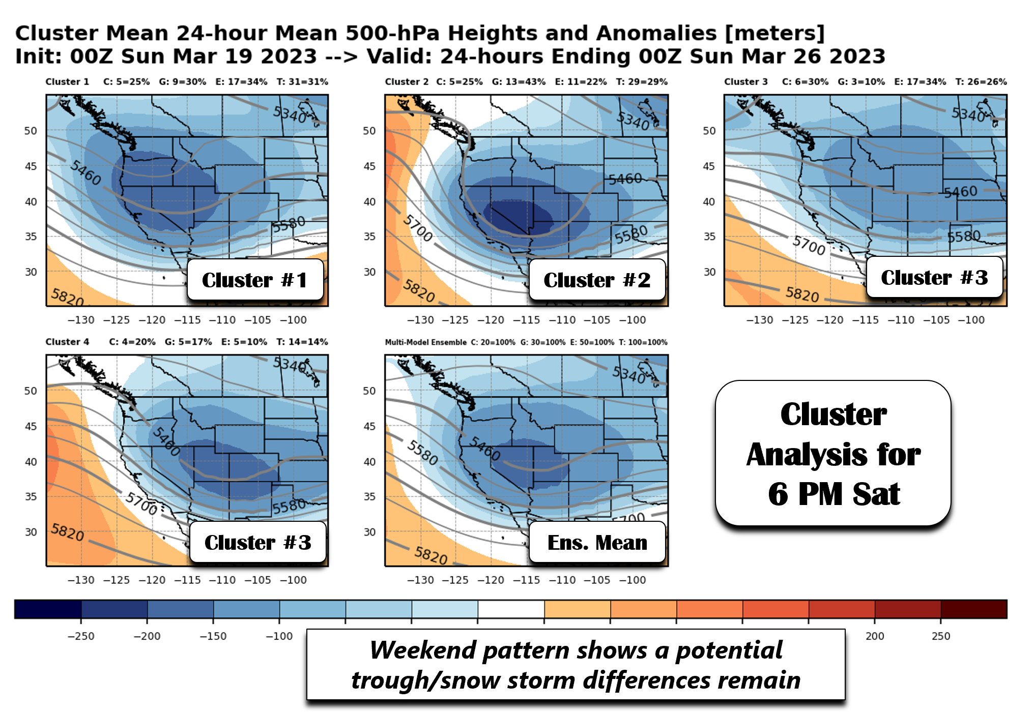
Looking into the upcoming weekend, ensemble systems from the GEFS/CMC/ECMWF show a potential transition from a dry zonal flow to another trough digging into southern Nevada or the Four Corners region. By Saturday evening, the first four ensemble cluster solutions vary both on timing and on placement/pattern. Nevertheless, two of the four clusters show an approaching trough from the west/northwest, while only one solution shows a weaker zonal flow (cluster 3).
While uncertainty remains high, there are signs that we could see snow chances elevate by the latter part of the weekend with chillier temperatures in tow. Stay tuned for updates as we get closer.
Happy Equinox and enjoy the first week of Spring!
Forecast Specifics:
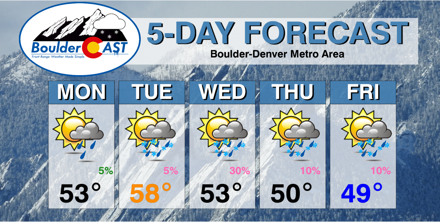
Monday: Partly to mostly cloudy and seasonal with highs in the middle 50s on the Plains and lower 40s in the Foothills. A very slight chance of late-day rain (Plains) and snow (higher Foothills) with no accumulation.
Tuesday: Partly cloudy with a slight chance of rain/snow developing in the evening and overnight. Otherwise, highs slightly above normal in the middle to upper 50s for the Plains and middle 40s in the Foothills. Breezy during the afternoon with gusts of 15 to 25 MPH across the Plains from the west-southwest.
Wednesday: Mostly cloudy with possible light rain showers but some snow also mixing in for the morning/afternoon. Precipitation amounts of a tenth of an inch or less. Little if any snow accumulation. Highs around 50 degrees on the Plains and upper 30s in the Foothills. Winds gusty up to 30 MPH around Boulder and Denver.
Thursday: Sunny in the morning, then increasing clouds and cooler. More seasonal with a slight chance of rain/snow showers. Highs in the low 50s on the Pains and 40 degrees in the Foothills.
Friday: Partly sunny and cool with upper 40s on the Plains and upper 30s in the Foothills. A slight chance of late-day rain/snow showers.
PowderCAST: A series of snow events will impact the High Country through early Thursday. The first comes Monday into early Tuesday, and a second Tuesday night into early Thursday. Snow totals through this period to range from 10 to 30 inches, though locally higher amounts are possible in the San Juans up to 4 feet. Another chance of snow may arrive Friday into Saturday, but amounts look to be on the lighter side with that system. Avalanche warnings may be needed later this week due to the widespread heavy snow.
Help support our team of Front Range weather forecasters by joining BoulderCAST Premium. We talk Boulder and Denver weather every single day. Sign up now to get access to our daily forecast discussion email each morning, complete six-day skiing and hiking forecasts powered by machine learning, first-class access to all our Colorado-centric high-resolution weather graphics, bonus storm updates and much more! Or not, we just appreciate your readership!
Spread the word, share the BoulderCAST forecast!






You must be logged in to post a comment.