After a fairly wet weekend, this week starts off drier as monsoon moisture gets shunted away to the south. This change will be accompanied by near-average temperatures in the upper 80s to around 90 degrees. Following a stronger cold front, an unsettled and cooler pattern will take hold for the end of the week with temperatures dropping back into the 70s. For once, our weekly outlook does not include any extreme heat!
This week’s highlights include:
- The deeper monsoon moisture gets shunted to the south to start the week towards southern Colorado
- Expect a drier trend through midweek, along with near-normal temperatures in the middle 80s to lower 90s
- A more unsettled pattern returns by Thursday and Friday with a cold frontal passage and increasing moisture again
- Highs for the latter part of the week will be cooler in the upper 70s
DISCLAIMER: This weekly outlook forecast is created Monday morning and covers the entire upcoming week. Accuracy will decrease as the week progresses as this post is NOT updated. To receive daily updated forecasts from our team, among many other perks, subscribe to BoulderCAST Premium.
Drying out and warmer to start the week
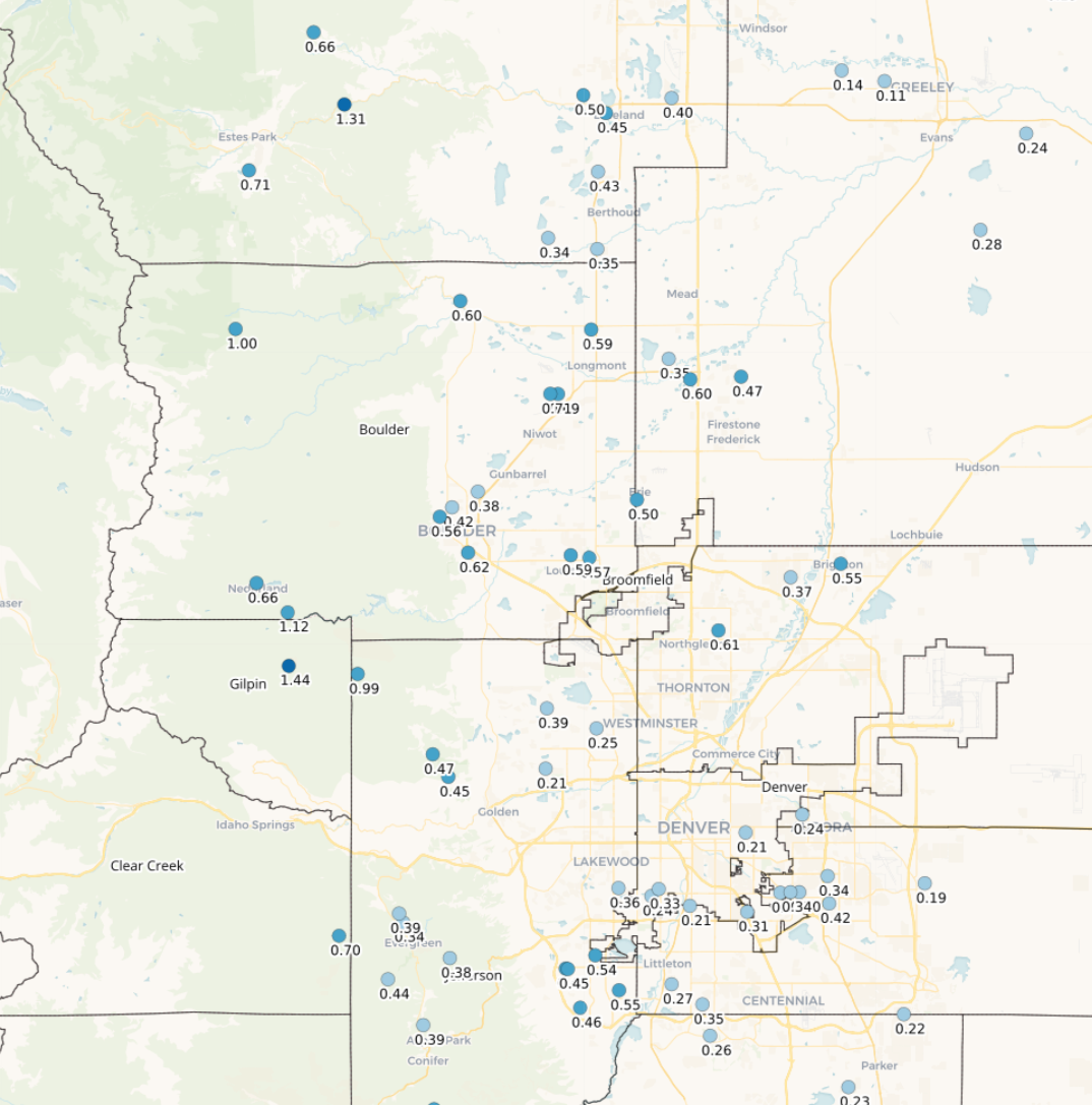
Front Range rainfall totals from the weekend (July 22-24, 2022). Highest amounts in the Foothills, but generally 0.25 to 0.5″ fell in the lower elevations.
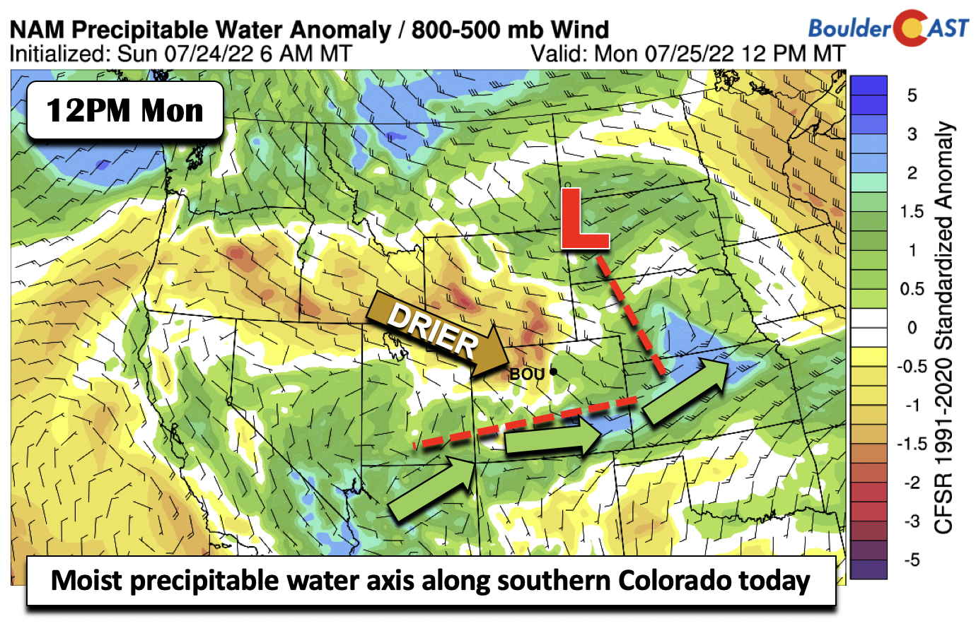
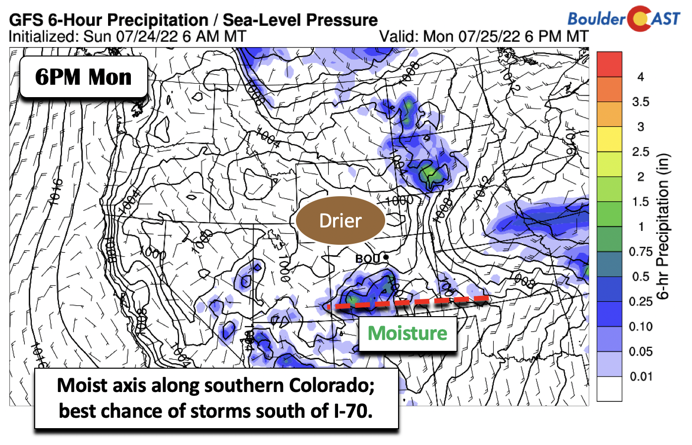
fter a wet Sunday, where the majority of the Front Range saw precipitation, some rather heavy, we are going to start the week off much drier. The dry trend will continue more or less until mid-week, after which a pattern change will turn us cooler and more unsettled. The atmospheric setup at the mid-levels on Monday features a shortwave that was over Idaho yesterday now over South Dakota. Northwesterly flow has taken hold over much of central and northern Colorado, which is bringing in much drier air. The copious monsoon moisture has not shifted well off to our east and south over far southern Colorado and Kansas.
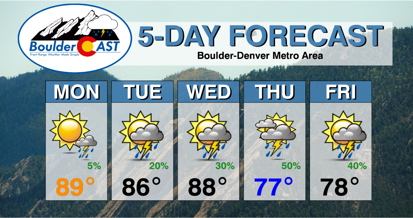
As a result, Monday will be mostly devoid of storms. We certainly can’t rule out a few rogue showers (just 5-10%) over the Denver Metro, but most activity will be over southern Colorado along the moisture axis. The best chance today will be south of interstate 70 and especially along/south of Colorado Springs. As a consequence of the drier and more sunny day, highs will rebound from yesterday to the upper 80s to around 90 degrees this afternoon.
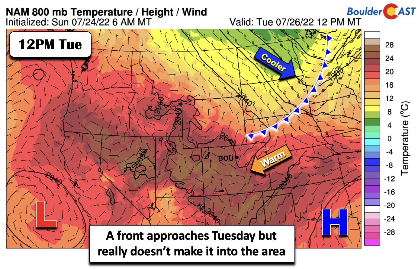
On Tuesday, a cold front currently over Montana will sag south and east into Nebraska and Wyoming. While it is unclear how close the front will get to us during the day, it will help increase our storm chances a tad. The deeper moisture, though, will remain to our south as the mid-level flow continues to be out of the west-northwest, keeping the monsoonal moisture at bay. We’d put the chance of storms on Tuesday around 20%. Temperatures will be a touch cooler from Monday with the frontal approach and increased clouds in the middle 80s.
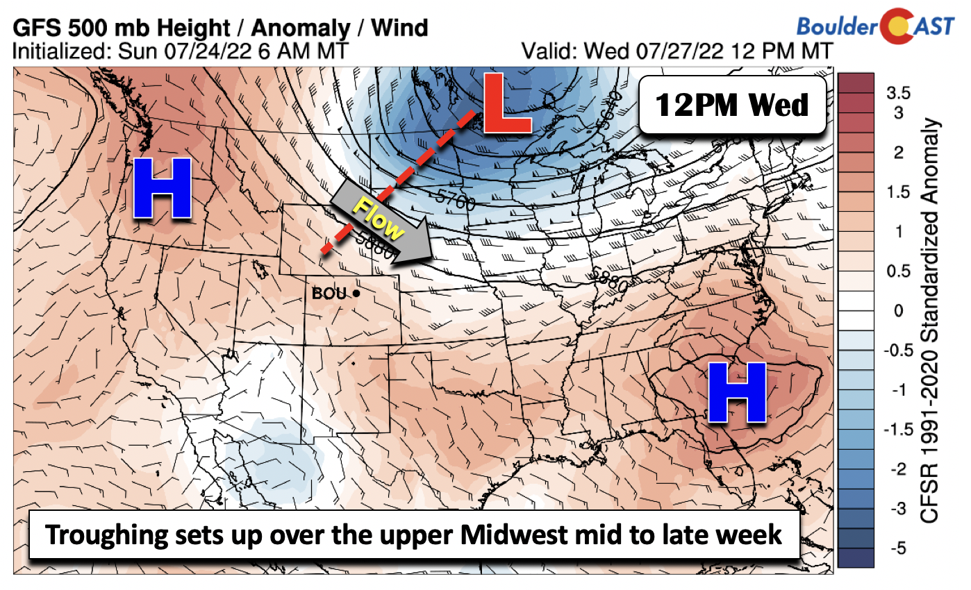
By Wednesday, we’ll start to see the first hints of the pattern change. A deep and impressive mid-level trough over central Canada and the upper Midwest will track east-southeast by late week into the Ohio Valley and Mid-Atlantic region. The impact of this trough will be a cold front that will move through the eastern section of Colorado and stall out over the Front Range for the end of the week. The weather will turn from relatively dry and warm to cool and unsettled. The cold front approaches Wednesday, resulting in an uptick of storm chances (30%) with highs still above average in the upper 80s to around 90 degrees. The front will eventually move through between Wednesday night and Thursday morning. The northwest flow from the trough late in the week may bring wildfire smoke from Idaho and California — but given our increased rain chances during this period, we’d expect fallout from the smoke due to rainfall.
More unsettled and cooler for the end of the week
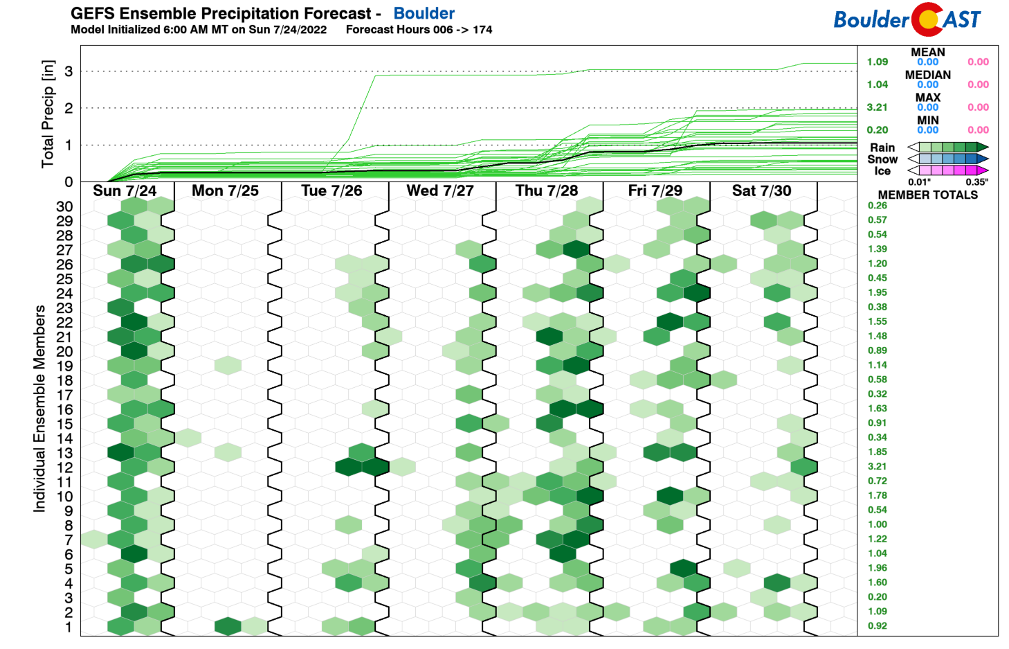
As mentioned earlier, we are looking forward to a more unsettled end to the week as a combination of deeper monsoon moisture flows back in and a stronger cold front enters the picture. The GEFS ensemble also matches up quite well with our pattern, showing relatively dry conditions into Wednesday, then wetter for the latter part of the week and the upcoming weekend.
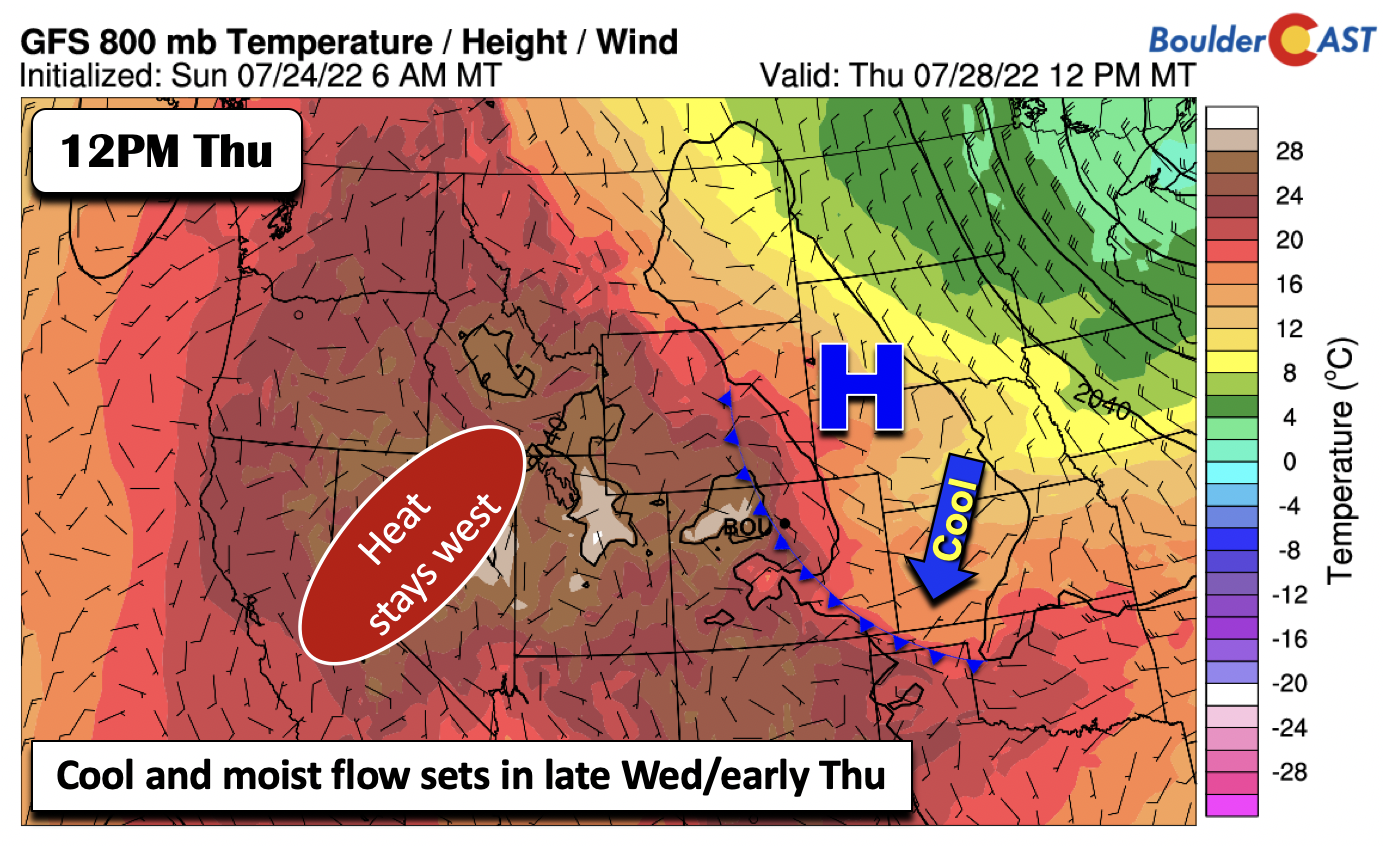
By midday Thursday, the models more or less have the surface cold front banked up along the Foothills of Colorado, with high pressure over Nebraska and South Dakota. Expect a cooler day on Thursday in the upper 70s to around 80 degrees. Mostly cloudy skies and a higher chance of storms (50%) will keep temperatures cool — a welcome change from the heat we’ve seen so far in July. The extreme heat stays over Utah and Nevada in this setup.
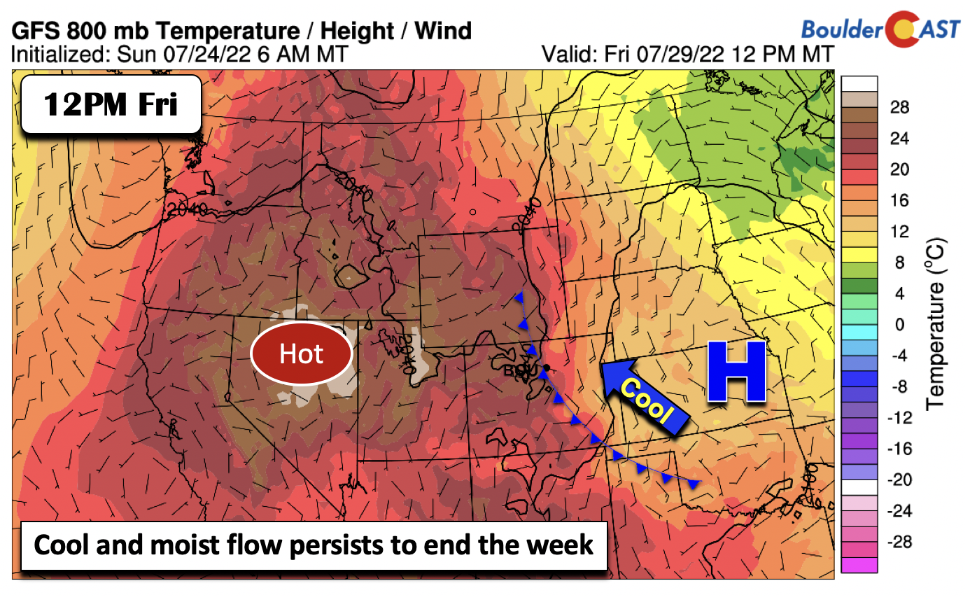
Come Friday, the front will linger across the area, as high pressure settles into Kansas and western Missouri. The heat again remains to our west in Utah, Idaho, and Nevada. Expect a similar probability of storms on Friday.
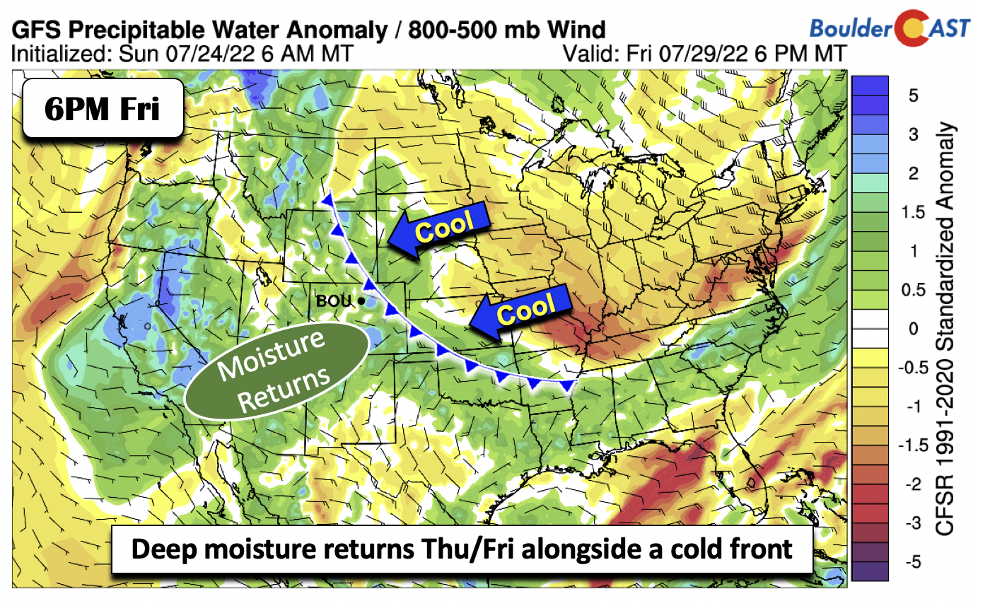
The combination of the front and the return of well above average moisture will feed the storm chances late this week. As you can see below, the plethora of green is quite evident over Colorado, Arizona, and Wyoming.
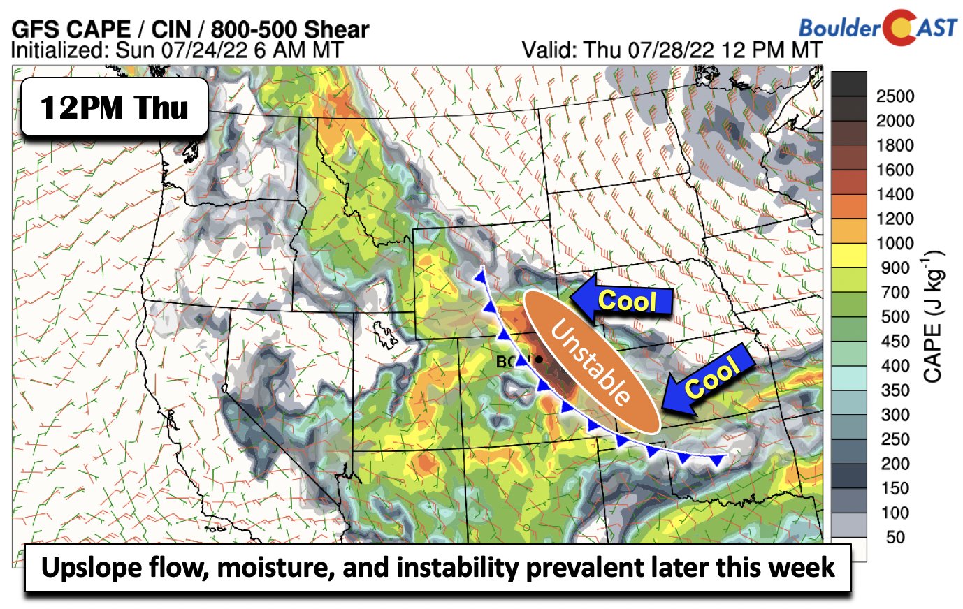
On top of the lift from the front and the moisture, there will be quite an unstable atmosphere as well. The GFS is usually not as bullish on CAPE potential and typically has a low bias. It is therefore alarming when the GFS is indicating CAPE values Thursday as high as 2000 J/kg! Thus, storms later this week will have the potential for heavy downpours and flash flooding. This unsettled pattern should continue for the upcoming weekend, meaning you’ll want to hike early in the day to avoid the threat of lightning.
Those clamoring for a break from the heat are finally getting it this week. Enjoy!
Stay up to date with Colorado weather and get notified of our latest forecasts and storm updates:
Forecast Specifics:
Monday: Mostly sunny and seasonal with highs in the upper 80s to around 90 degrees with only a slight chance of a storm this afternoon and evening, mainly south of the Denver area. Highs in the Foothills in the upper 70s.
Tuesday: A slight increase in isolated afternoon/evening storms as temperatures climb into the middle 80s on the Plains and middle 70s in the Foothills.
Wednesday: Increasing clouds with scattered afternoon and evening storms. Highs in the upper 80s to near 90 on the Plains and upper 70s in the Foothills.
Thursday: Cooler and more unsettled with more widespread rain and storms in the afternoon/evening. Highs in the upper 70s to near 80 for the Plains and upper 60s in the Foothills.
Friday: Staying cool and unsettled with scattered to widespread showers and storms with highs in the upper 70s on the Plains and upper 60s in the Foothills.
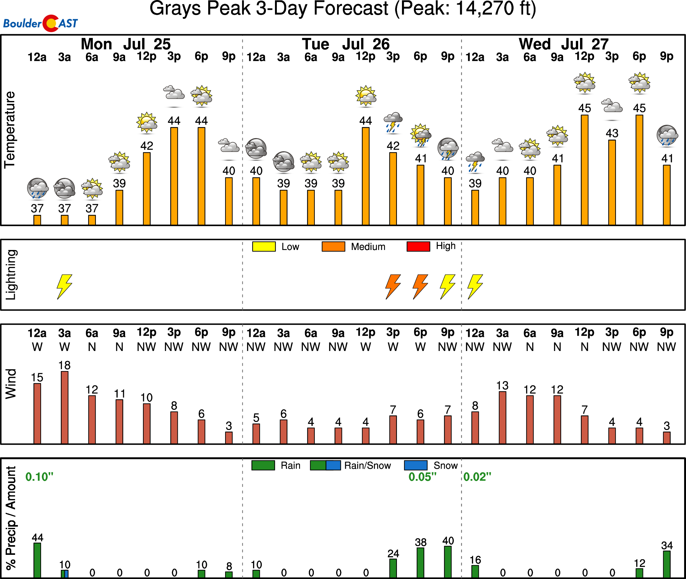
High Country: There will be a chance of storms each day over the High Country. The storm chances are highest over the southern portions of Colorado Monday and Tuesday. Thunderstorm probabilities will increase statewide Wednesday through Friday as moisture reasserts itself over the area.
Help support our team of Front Range weather bloggers by joining BoulderCAST Premium. We talk Boulder and Denver weather every single day. Sign up now to get access to our daily forecast discussions each morning, complete six-day skiing and hiking forecasts powered by machine learning, first-class access to all our Colorado-centric high-resolution weather graphics, bonus storm updates and much more! Or not, we just appreciate your readership!
Spread the word, share the BoulderCAST forecast!




You must be logged in to post a comment.