
A welcomed reprieve from the heat commences on Tuesday, but only lasts but a moment in time, after which temperatures rise back to the low and middle 90’s by the end of the week. We’ll also break down the chances of storms each day.
This week’s highlights include:
- A brief reprieve from the heat starts tomorrow for a day or so thanks to a cold front
- Isolated to scattered storms will exist each day as moisture and weak systems traverse across the area
- A strong ridge late in the week takes over with highs back into the middle 90’s
DISCLAIMER: This weekly outlook forecast is created Monday morning and covers the entire upcoming week. Accuracy will decrease as the week progresses as this post is NOT updated. To receive daily updated forecasts from our team, subscribe to BoulderCAST Premium.

Watching a cold front to chill us off tomorrow
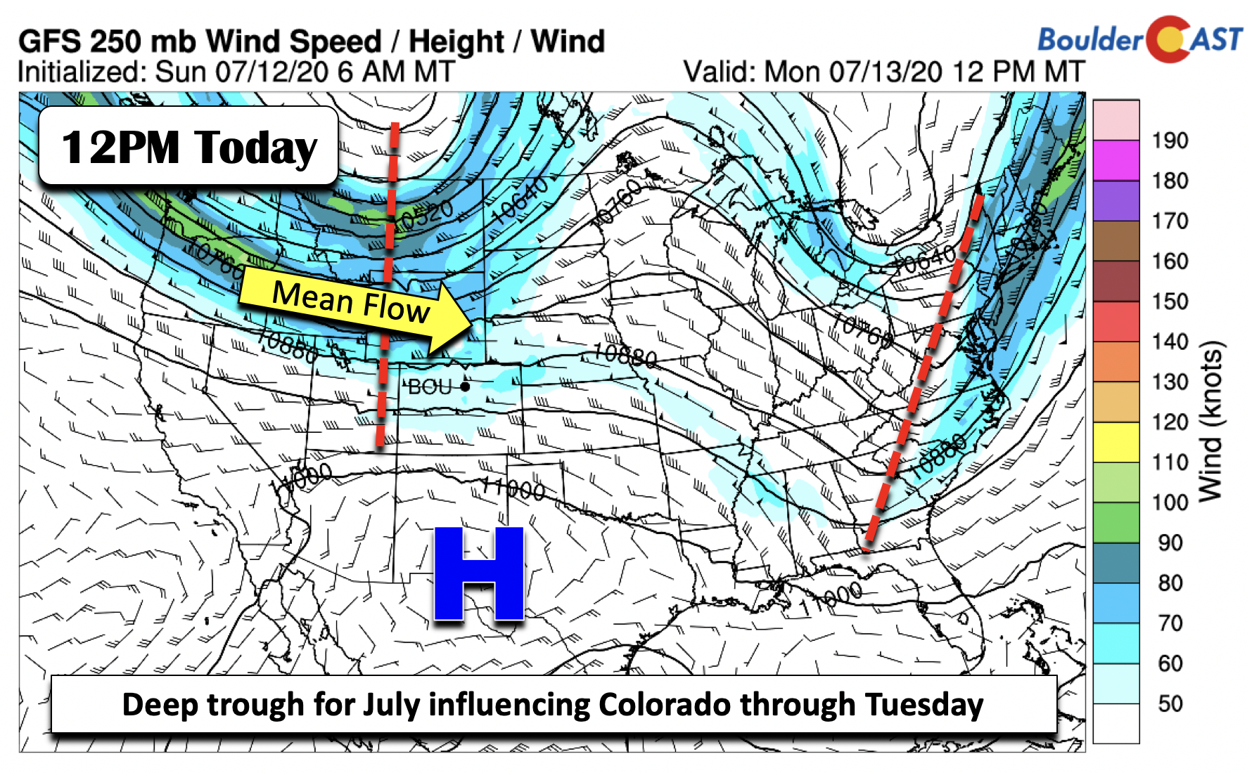
Happy Monday! As we start off the work week, let’s take a look at the upper-level height and wind pattern across the nation. To the east, a trough axis is positioned northeast to southwest from New York into Georgia with scattered showers and thunderstorms. Ridging dominates across the Midwest. Over us and the west, a rather deep trough of low pressure over southwestern Canada will be influencing Colorado today and tomorrow with a cold front. We’ll see some really nice weather on Tuesday but it looks short-lived.
For today, a very similar airmass is in-place compared to Sunday. Thus, middle 90’s or close to it will be the norm again. However, it will probably be a quick warm-up, as clouds will move in for the afternoon and evening with developing showers and thunderstorms.
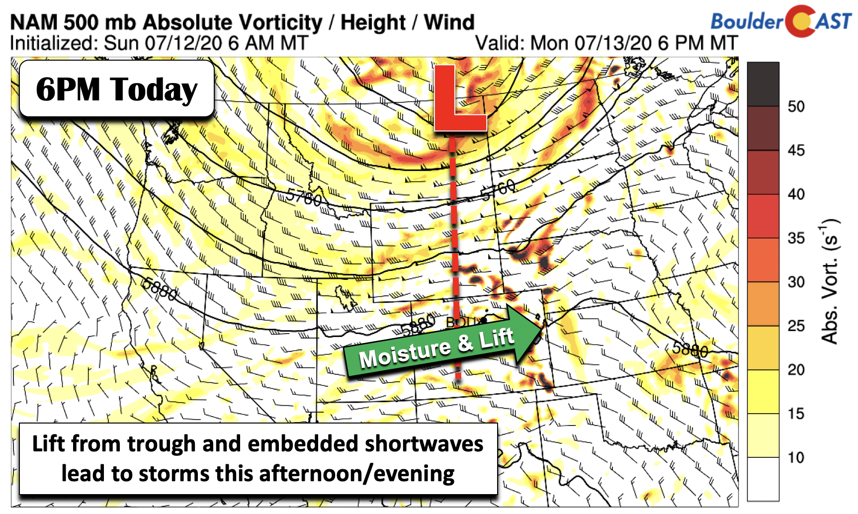
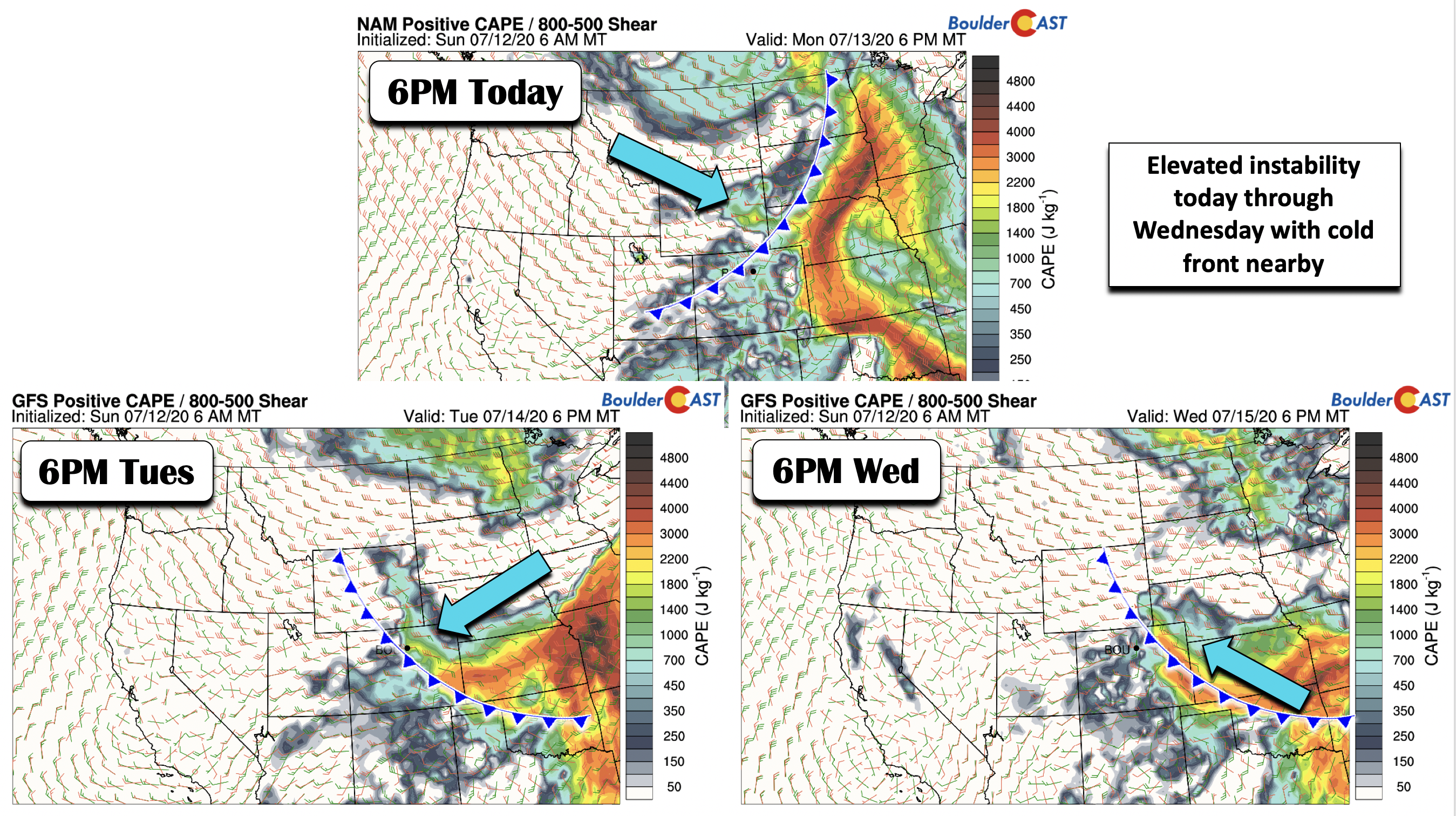
Connected to the deep trough today are several embedded shortwaves traversing across Colorado from west to east. There is also good shear and instability in place, leading to potential for some severe cells of strong gusty winds and hail. Though these would like be well east of Denver towards Kansas (see below). For us, storms will be scattered but a 40% chance is warranted given the lift over our area. Isolated storms may exist into the overnight with the front nearby and shortwave energy still passing through.
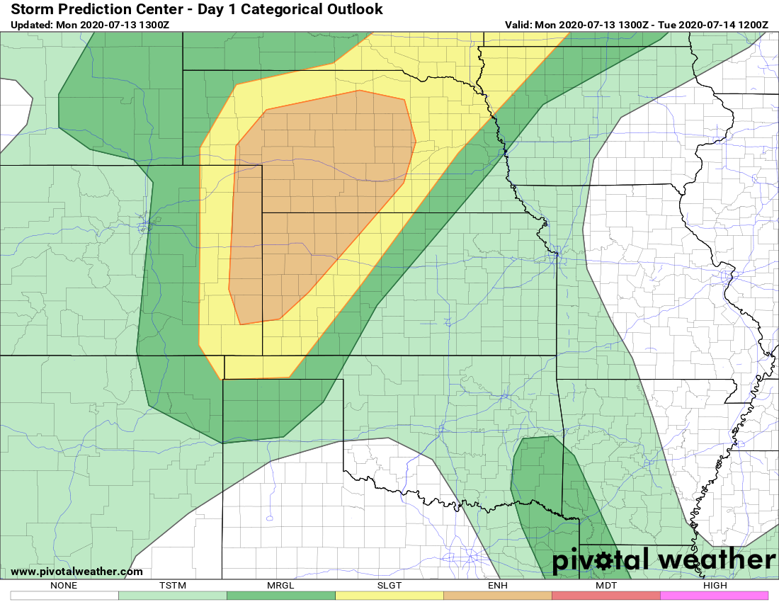
Severe weather outlook for Monday from the SPC
By Tuesday, the cold front passes through in the early morning hours. There are actually some differences in the forecast guidance as to the strength of the front. To the cold side, you have the NAM and the high-resolution NAM-NEST, which bring in much cooler temperatures for tomorrow, with highs possibly not getting out of the upper 70’s (below left). These solutions also bring in some low-level morning cloud cover tomorrow (below right) thanks to upslope and high relative humidity near the surface. The GFS and Euro models, on the other hand, are not as aggressive as the NAM, showing highs in the 80’s. We think the solution is somewhere in between, so our forecast calls for highs near 80 or so. This is a real cool-down more than 10 days in the making!
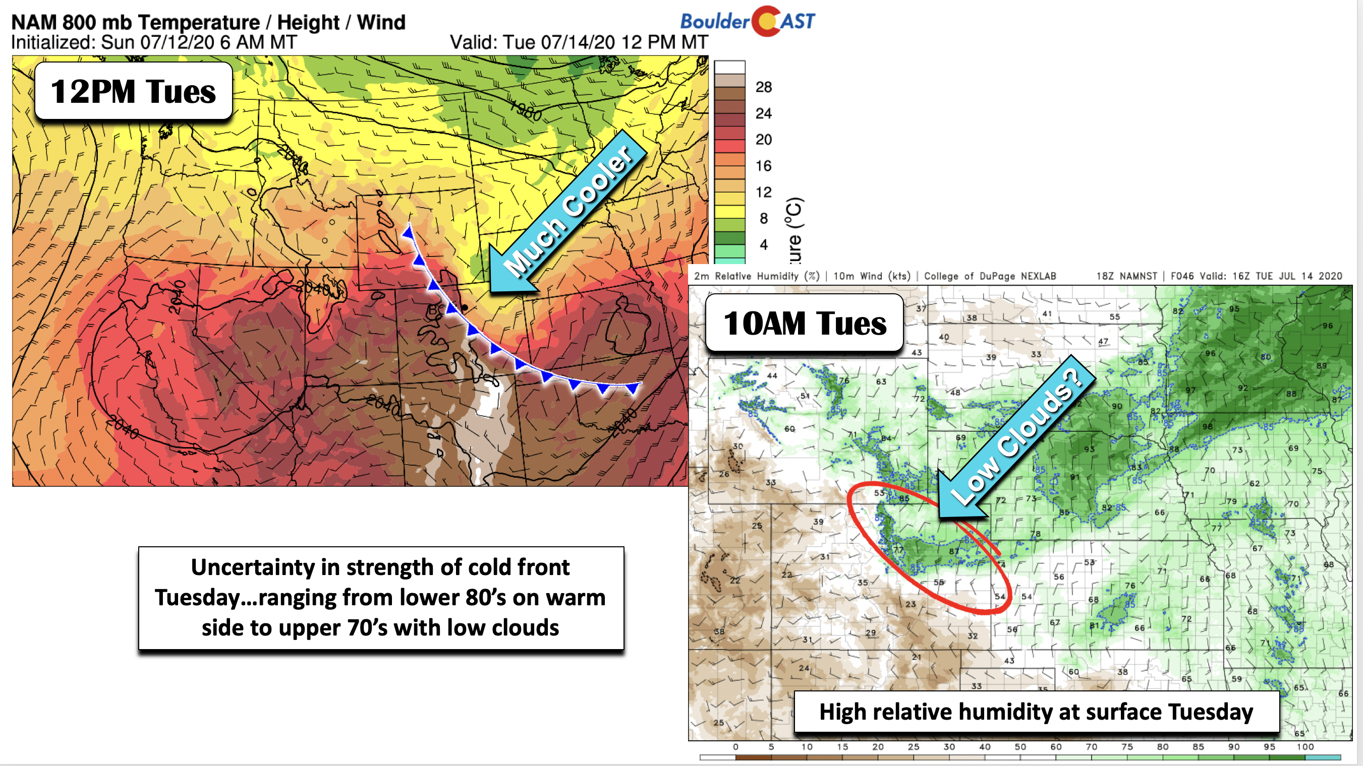
With the front nearby through the day Tuesday, as well as upslope flow, moisture overriding the front on top of mid-level energy and instability will keep thunderstorms (30 to 40%) in the forecast during the afternoon and evening. The thunderstorm extent tomorrow will largely depend on how much cloud cover exists…if the clouds are slow to move out, that may limit daytime heating for storms.
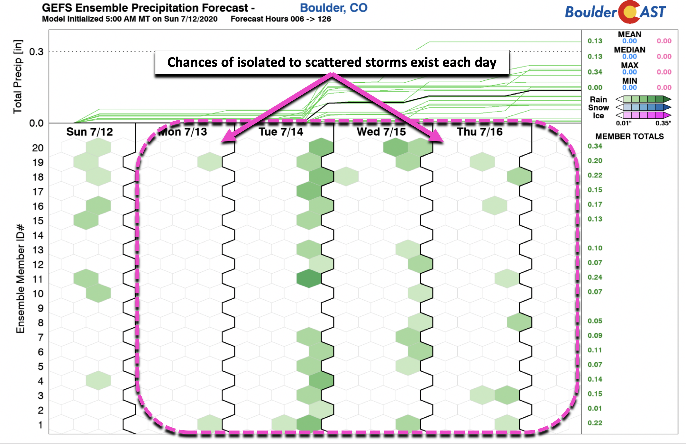
Chances of storms each day this week, especially through Wednesday
The chance of storms will not be restricted to just today and tomorrow, but every day this week with a favorable pattern in place. Obviously, as discussed above, the storm threat these next few days will be tied to the frontal boundary and mid-level forcing.
But, the storm threat for the latter part of the week (below) will be tied to the ridge of high pressure retreating to our east, allowing moisture from the southwest build into Colorado. This is consistent with the ensemble precipitation forecasts in the below figure.
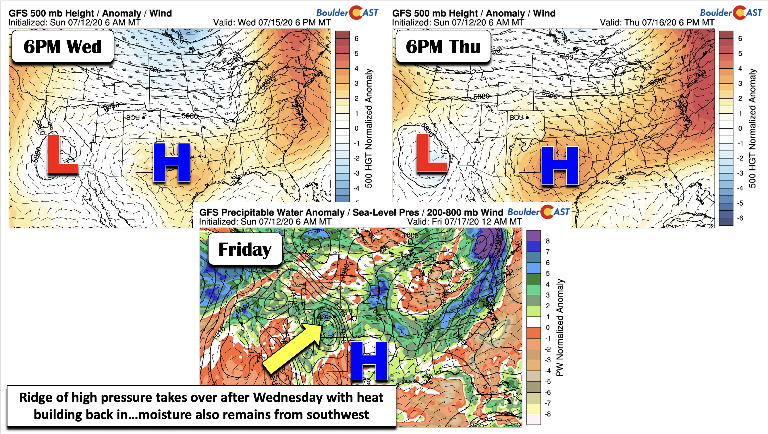
Ridge and heat take over to end the week
Temperatures from Wednesday onward should see a shift from the 80’s back into the low and middle 90’s by Thursday and Friday. The trough which had affected us for the early part of the week will track back north into eastern Canada. At the same time, high pressure over Texas (below left) will slowly move into eastern Texas by Friday (below right). As it does this, it should allow for some moisture-laden air to push in, this time from the tropical Pacific (bottom center). These are finally the first hints of the monsoon taking shape and it’s likely to officially begin sometime later this week.
Enjoy the week, especially the “cool” down on Tuesday! We all need the break from the heat.
Forecast Specifics:
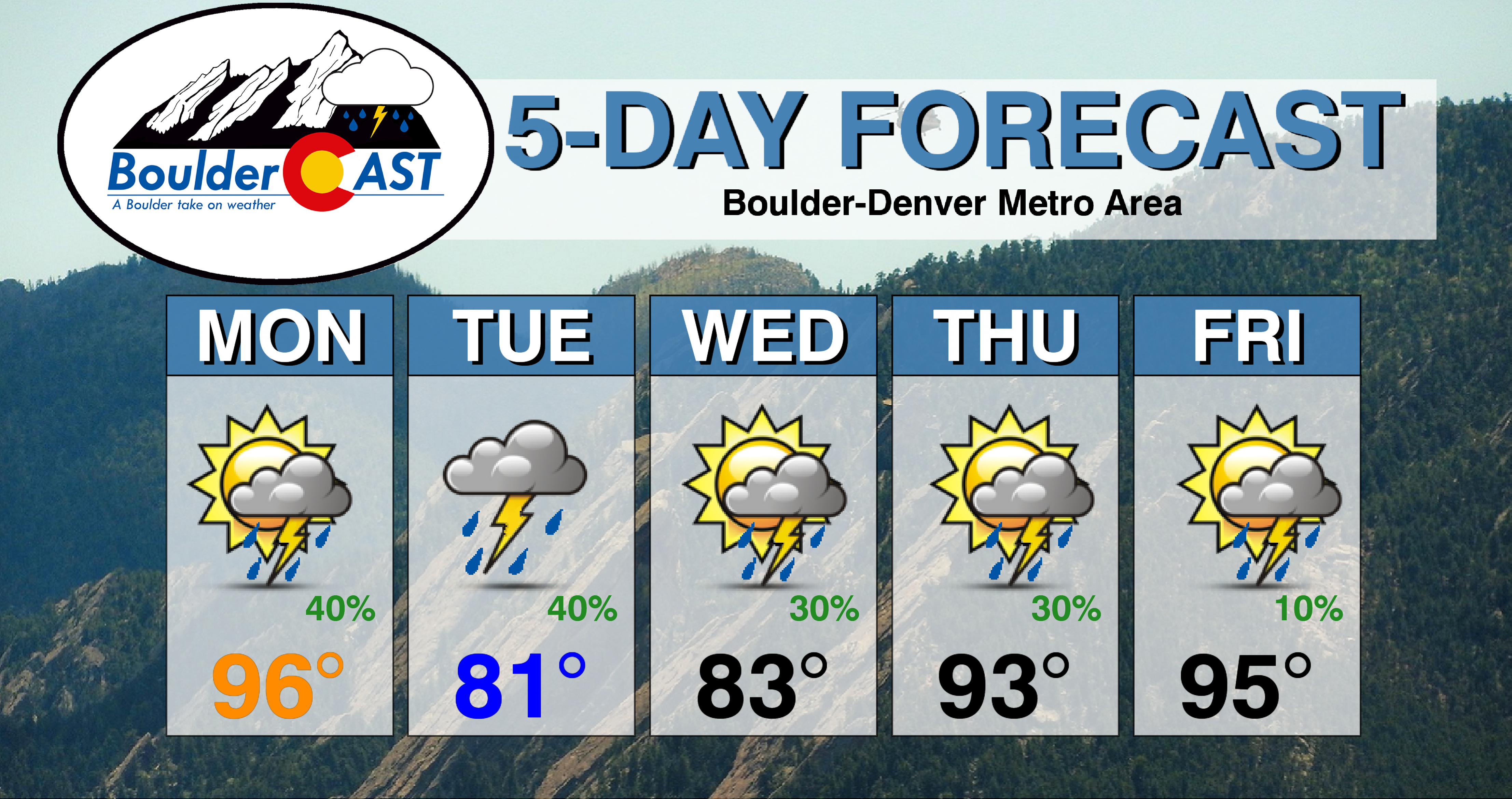
Monday: Sunny skies giving way to increasing clouds with isolated to scattered thunderstorms from the afternoon into the late evening hours. Highs near the middle 90’s on the Plains and low 80’s in the Foothills. Storms will have potential for strong gusty winds and hail east of Denver.
Tuesday: Much cooler. Highs near 80 degrees on the Plains and upper 60’s in the Foothills under morning clouds giving way to afternoon/evening scattered showers and thunderstorms.
Wednesday: Warmer with isolated to scattered storms in the afternoon/evening hours. Highs in the lower to middle 80’s on the Plains and lower 70’s in the Foothills.
Thursday: Mostly sunny skies with scattered thunderstorms once again and highs on the warmer side in the lower 90’s for the Plains and upper 70’s for the Foothills.
Friday: Partly cloudy with isolated showers and storms. Highs in the middle 90’s on the Plains and near the low 80’s in the Foothills.
Weekend: The heat and scattered storms look to continue into the first part of the weekend with high pressure over Texas and moisture-laden air still present over the area.
High Country: Scattered showers and thunderstorms will exist each day across the higher terrain. If you have to hike, get to the summit or peak before noon time to avoid the lightning threat. Check SummitCAST for daily updated forecasts for more than 120 mountain hiking destinations across Colorado.
We beat the heat today w/ a trek up Mt. Ida in RMNP to 12,900 feet. It was a cool 61°F at the summit with a nice breeze!
Dont be caught in unexpected weather conditions. Use SummitCAST to plan for your next mountain adventure: https://t.co/LnczYRiEf8#COwx #hiking #14ers #13ers pic.twitter.com/pb8RQYATQF
— BoulderCAST Weather (@BoulderCAST) July 11, 2020
We discuss Boulder and Denver weather every single day on BoulderCAST Premium. Sign up today to get access to our daily forecast discussions every morning, complete six-day skiing and hiking forecasts powered by machine learning, access to all our Front Range specific weather models, additional storm updates and much more!
.
Spread the word, share the BoulderCAST forecast!


You must be logged in to post a comment.