The week starts off cooler than normal and a breath of fresh air behind a frontal passage. The reprieve from the heat is short-lived, unfortunately, as a strong mid-level ridge of high pressure builds back in as the week progresses. This pattern change will lead to temperatures getting hot once again to near the century mark by week’s end, along with increasing afternoon/evening storms in the monsoonal flow.
This week’s highlights include:
- The week starts off with a breath of fresh air as temperatures top out below normal in the lower 80s behind a cold front
- A ridge of high pressure strengths and sets up over the Intermountain-West as the week progresses, spelling out hot temperatures
- Monsoonal moisture slowly edges back in toward the latter part of the week, increasing afternoon/evening storm chances
DISCLAIMER: This weekly outlook forecast is created Monday morning and covers the entire upcoming week. Accuracy will decrease as the week progresses as this post is NOT updated. To receive daily updated forecasts from our team, among many other perks, subscribe to BoulderCAST Premium.
A cool start to the week
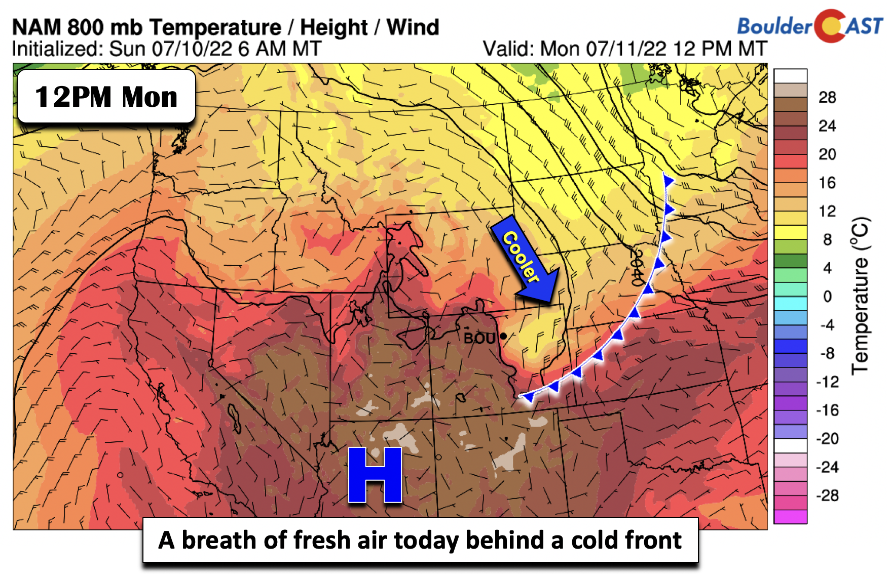
Acold front has moved through the Front Range around sunrise this morning — did you feel the cool northeasterly breezes? Behind that front, a dramatic change in the airmass has occurred. Highs Monday afternoon are going to be below normal in the lower 80s. Be sure to take advantage of this day, as the rest of the week will not be so comfortable…
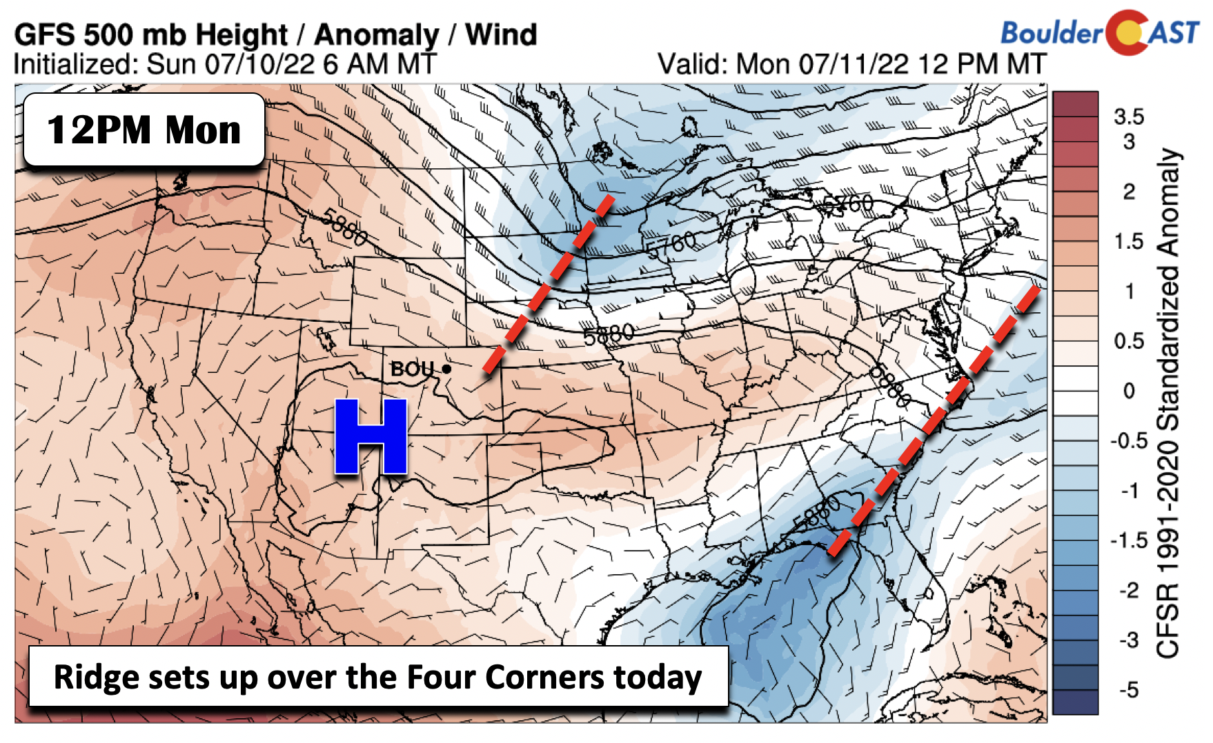
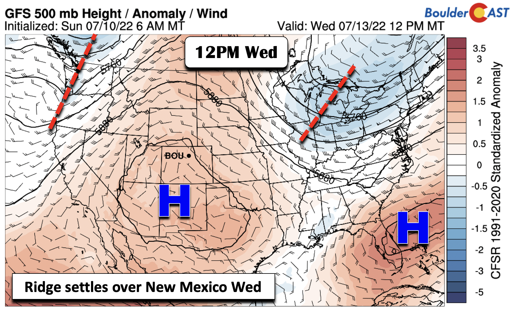
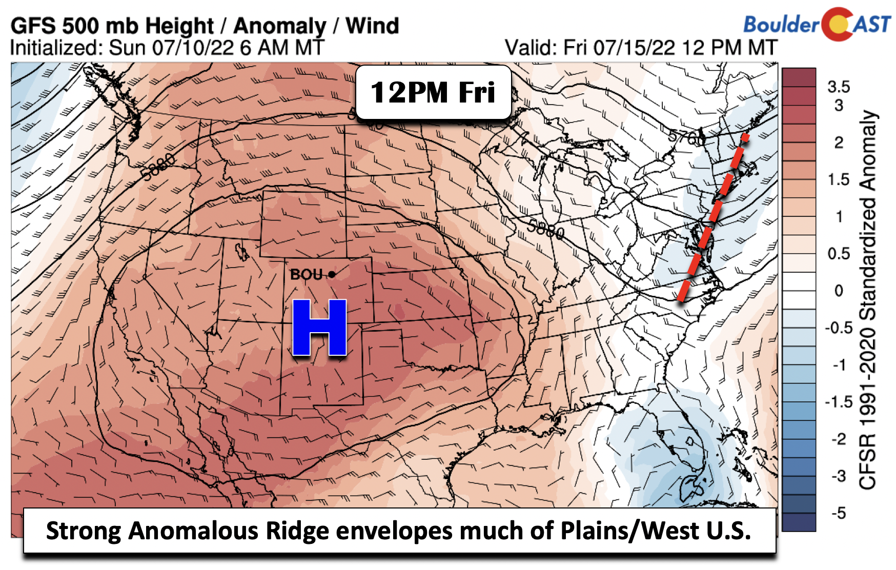
At mid-level on Monday, there is a trough axis extending from Minnesota into northeast Colorado, tied to the aforementioned cold front. High pressure is over the Four Corners area. As the week progresses, this ridge will continue to strengthen and settle over the Rockies and the Great Plains, spelling out hot temperatures toward week’s end for the Denver Metro area.
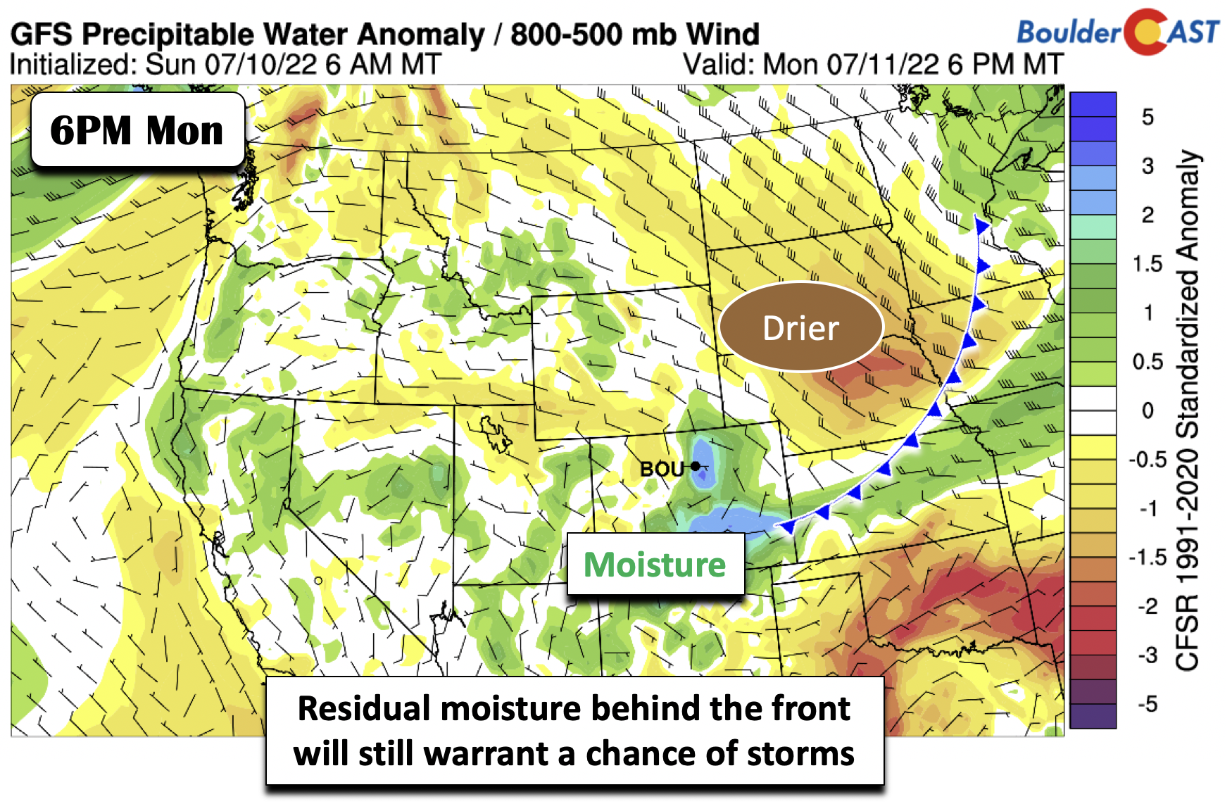
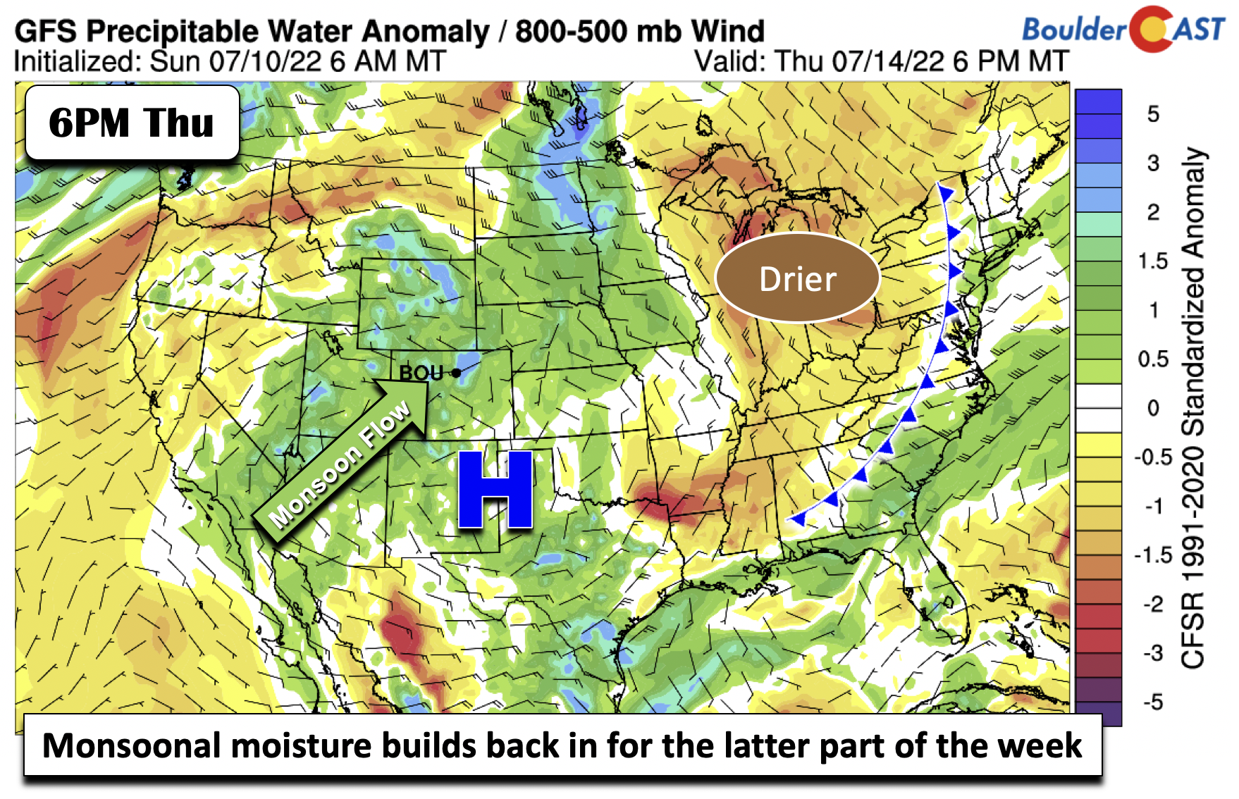
While the front has moved through, there is some residual moisture as evident in the precipitable water anomaly plot below. However, most of that moisture has been whisked away to the south-central part of our state.
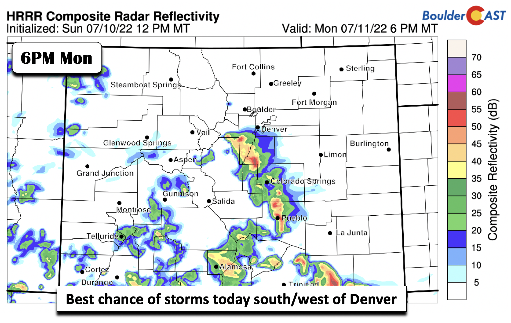
Nevertheless, with some moisture still lingering and weak upslope flow behind the front, storms that form over the higher terrain may reach the Plains Monday afternoon/evening. Most of us will stay dry, but a ~10% chance is warranted. The greatest risk of any storms will be south and southwest of the Denver Metro, towards the Palmer Divide.
Hot with a return to the monsoon as the week progresses
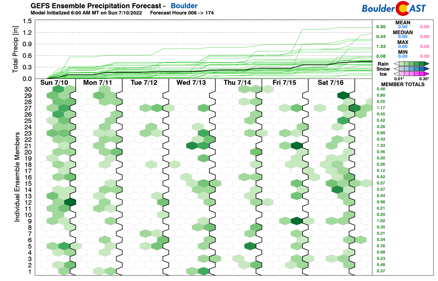
As the week progresses after today, the pattern will more or less resemble the typical summer in Colorado, with hot temperatures and late-day storms making their way from the High Country toward the Plains. The GEFS precipitation forecast indicates the chances each day this week. Tuesday is actually the driest day, mostly because the ridge shifts somewhat to our west and in the process keeps the deeper monsoonal flow in the western part of Colorado and over the higher terrain. But from about Wednesday onward, especially Thursday/Friday, chances should increase.
Temperatures will get back into the lower 90s as early as Tuesday. By Wednesday, the mid-level ridge will set up over northern New Mexico. As it does so, the heat will really start to take hold again as highs get into the middle 90s under the anomalous ridge.
Come the end of the week, the ridge continues to modify and strengthen, stretching from the West Coast all the way into the central Great Plains. Expect upper 90s to near the century mark to close out our week. Increasing chances of storms and afternoon clouds may somewhat limit our potential to break records, but it’s going to be very hot nonetheless.
Also, we need to watch the monsoonal flow starting midweek Wednesday, and especially from Thursday into Friday. The surface ridge will settle in over the panhandle of Texas. That will allow a juicy fetch of moisture from the Pacific to advect back into the area, increasing our storm chances. Chances for precipitation should increase to 30-40% by week’s end, after 10-20% during the beginning part of the week.
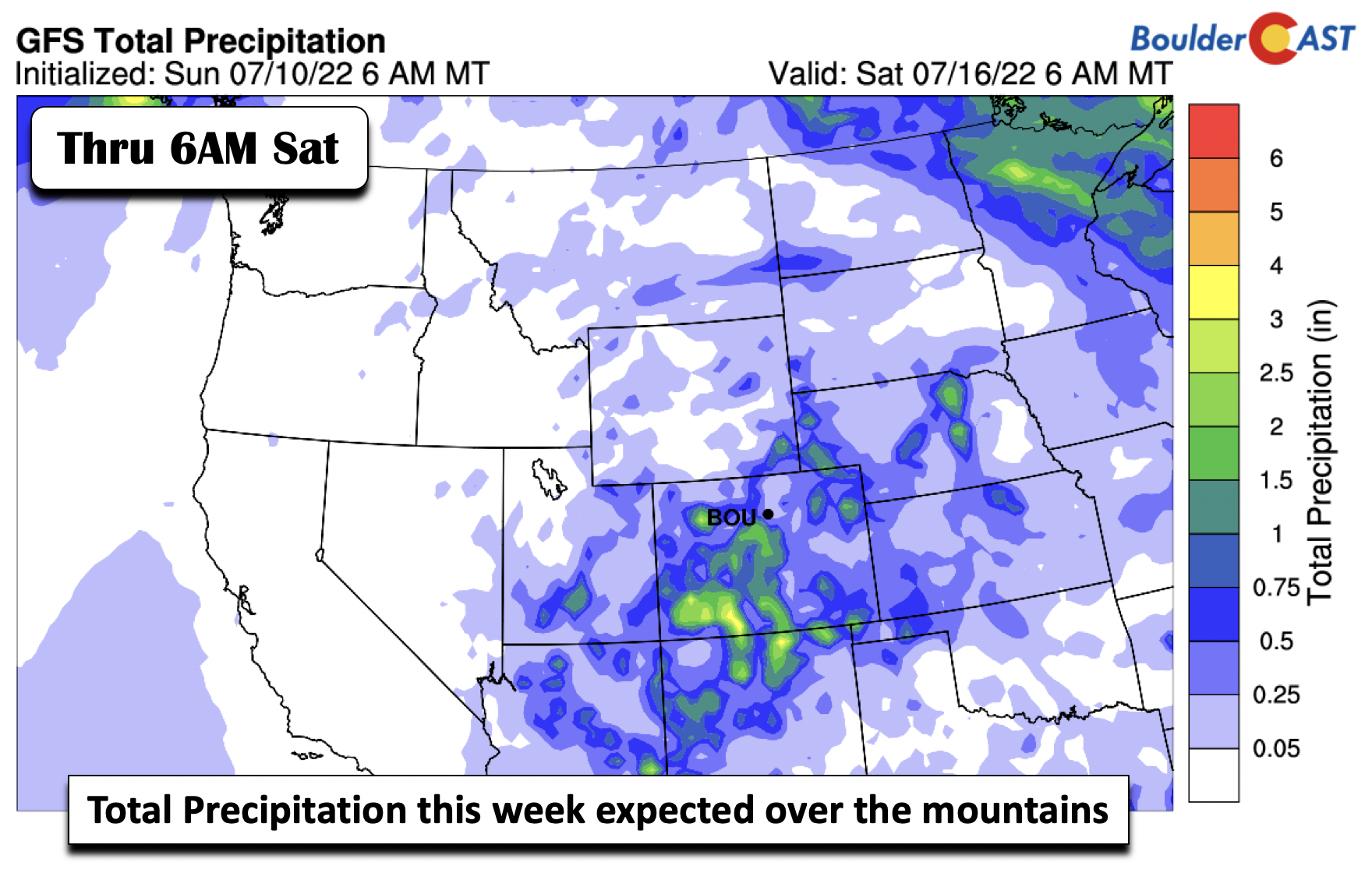
The GFS weekly precipitation amounts highlight the best rainfall amounts are likely to be felt over the higher terrain, especially over the southwestern part of Colorado. For those of us on the lower elevations, we’ll likely need to water our grass for the beginning part of the week, after which mother nature should help somewhat by week’s end.
Have a good week and check back for updates on the developing heatwave later in the week!
Stay up to date with Colorado weather and get notified of our latest forecasts and storm updates:
Forecast Specifics:
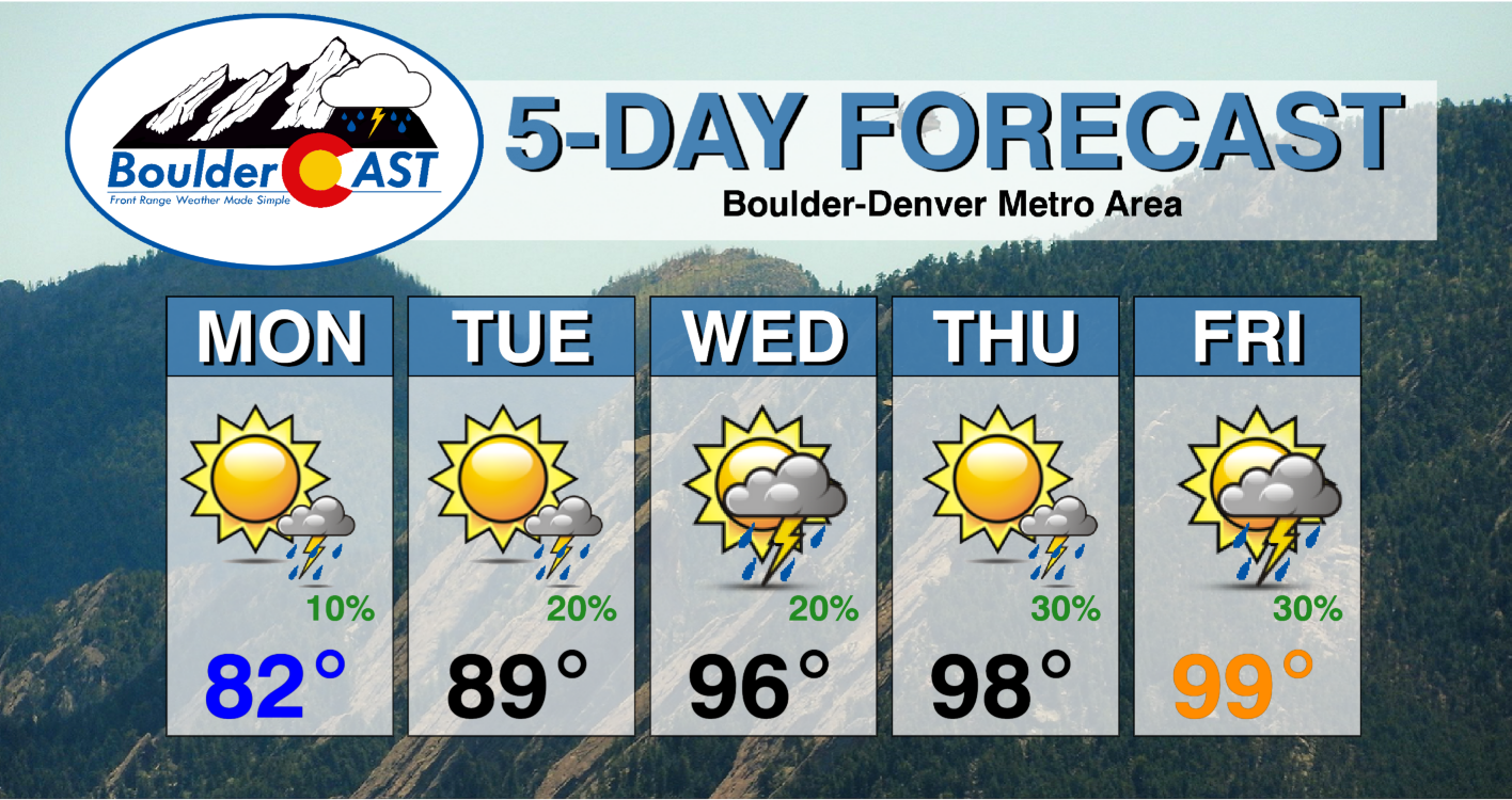
Monday: Some morning low clouds, then mostly sunny and cool following an early morning cold front with highs in the lower 80s on the Plains and lower 70s in the Foothills. There is a 10-20% chance of a storm, mainly south of Denver.
Tuesday: Partly cloudy and warmer with near 90 degrees on the Plains and near 80 in the Foothills. A 10-20% chance of afternoon/evening storms.
Wednesday: Increasing afternoon clouds and hot with highs in the middle 90s for the Plains and near 80 in the Foothills. A 20-30% chance of storms in the afternoon and evening.
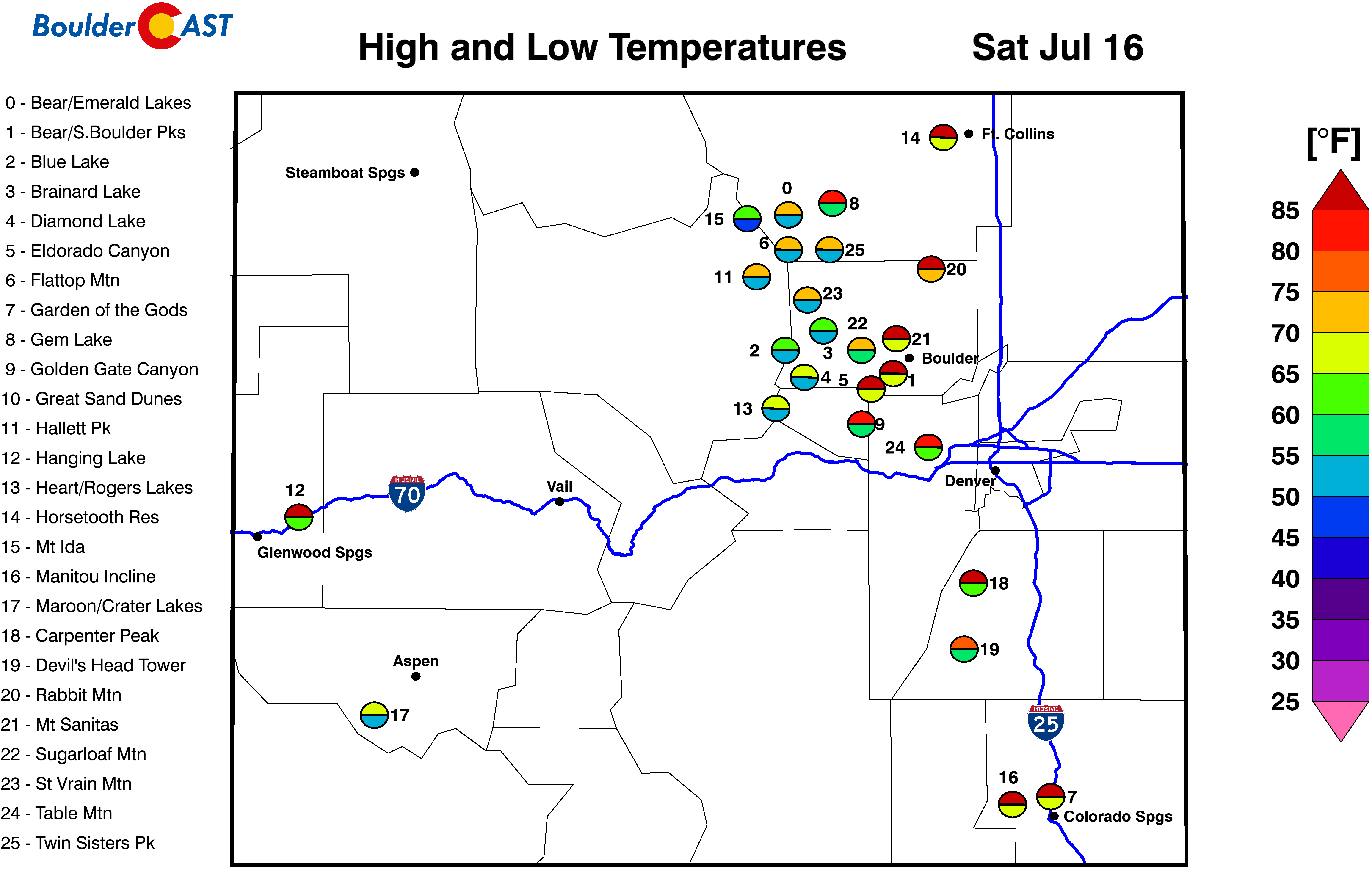
Thursday and Friday: Hot with a 30-40% chance of afternoon/evening storms and highs in the upper 90s to near 100 on the Plains and middle 80s in the Foothills.
High Country: There will exist a chance of storms and dangerous lightning each day over the High Country this coming week. The storm chances will be best during the early part of the week over the western part of the state. Storm chances will increase over much of the higher terrain come Thursday and Friday as monsoonal flow returns with a vengeance!
Help support our team of Front Range weather bloggers by joining BoulderCAST Premium. We talk Boulder and Denver weather every single day. Sign up now to get access to our daily forecast discussions each morning, complete six-day skiing and hiking forecasts powered by machine learning, first-class access to all our Colorado-centric high-resolution weather graphics, bonus storm updates and much more! Or not, we just appreciate your readership!
Spread the word, share the BoulderCAST forecast!




You must be logged in to post a comment.