We warm up briefly before another slight chance of snow returns Wednesday evening. Will we break the snowless January? Looking ahead, well above average temperatures are expected for Super Bowl weekend….we’re talking 60’s and maybe even lower 70’s! Read on for all the details.
Warmer today in brief calm weather pattern
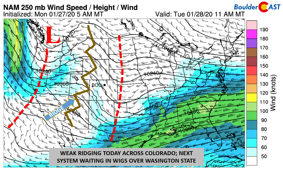
After a chilly start yesterday to our work week where “some” of us saw light snow (trace at DIA, up to 0.5″ in Parker and East Aurora), the weather pattern takes a brief lull and break. Shown in the image below is the upper-level 250 mb jet streaks (stream) and height pattern. Yesterday’s trough axis has pushed east into Kansas and Texas. In the wake of that, weak ridging is present over Utah and will build east today. Expect lots of sunshine with highs in the upper 40’s thanks to warm advection. However, the atmosphere is always in motion. Another system waiting in the wings is over Washington State (below) and is eyeing us tomorrow into Thursday.
Light snow possible Wednesday night
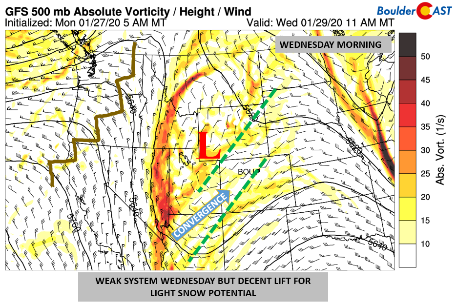
Tomorrow, the aforementioned system over Washington will dive east-southeastward, with its central location roughly positioned over southwest Wyoming (below). Although the trough will actually continue to take a southward track and mostly “miss” our state, a few convergence lines will position themselves over Colorado tomorrow evening. One line will be from Utah into Wyoming, and a second from Arizona through Colorado.
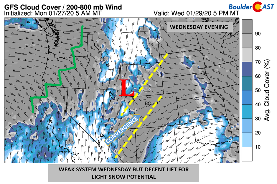
The convergence lines will help to focus lift over our region and the higher terrain to our west. After a brief period of sunshine Wednesday morning, clouds will increase and become overcast by afternoon (below). Highs in the low to middle 40’s will be the norm. The lift with the trough axis is more evident below, as indicated by the wrap-around nature or “comma” shape to the cloud pattern.
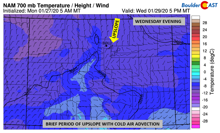
The system tomorrow also looks to have a brief period of NNE-erly upslope at the surface behind a cold front (below), mainly from late afternoon to late evening. Enough cold air is in place as well for this to be an all-snow type of event, if any does actually fall. We’re not overly optimistic given the wind direction, however.
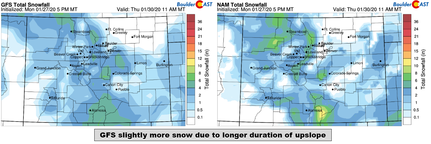
The latest GFS (bottom left) and NAM (bottom right) show mixed snowfall totals for this event. Keep in mind that these totals include a brief accumulation of snow from Monday evening. The GFS has higher amounts than the NAM, in part because the GFS has a longer duration of weak upslope across the Metro area. The GFS has around 1″ in Boulder and generally less than 1″ elsewhere, while the NAM has little to none anywhere. Given the weak nature of the storm, we expect any amounts to be on the light side. Our initial prediction is for a trace to 1″ of snow across the metro area. Areas further north and east may see nothing at all. This will be the final chance we will get to end the snowless month of January in Boulder. If not, this will be the first time in nearly 40 years that Boulder goes without snow in January.
Blow torch of warmth for the weekend
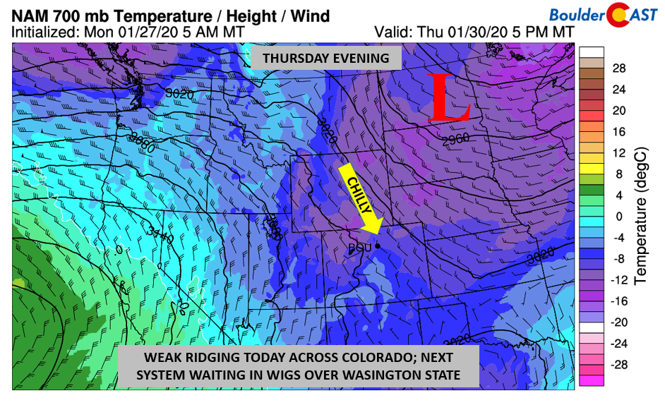
Before we talk about some record warmth for Super Bowl weekend, let’s talk about Thursday. After Wednesday’s passage of the weak light snow event, chilly northwest flow will remain for late in the work week. This is clearly seen below by the cold air entrenched across Colorado into the Upper Midwest. Highs Thursday will likely stay in the low to middle 40’s, although with more sunshine than Wednesday.
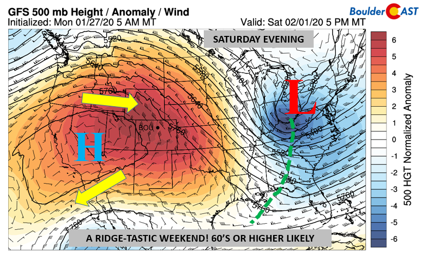
By Friday, northerly flow will still be holding on, but slowly retreating. The latest long-range guidance (below) is pointing to a ginormous ridge of high pressure to anchor across Nevada and California. This would easily send the winter cold back northward and fully out of our beautiful state. Highs should get close to 50 on Friday.
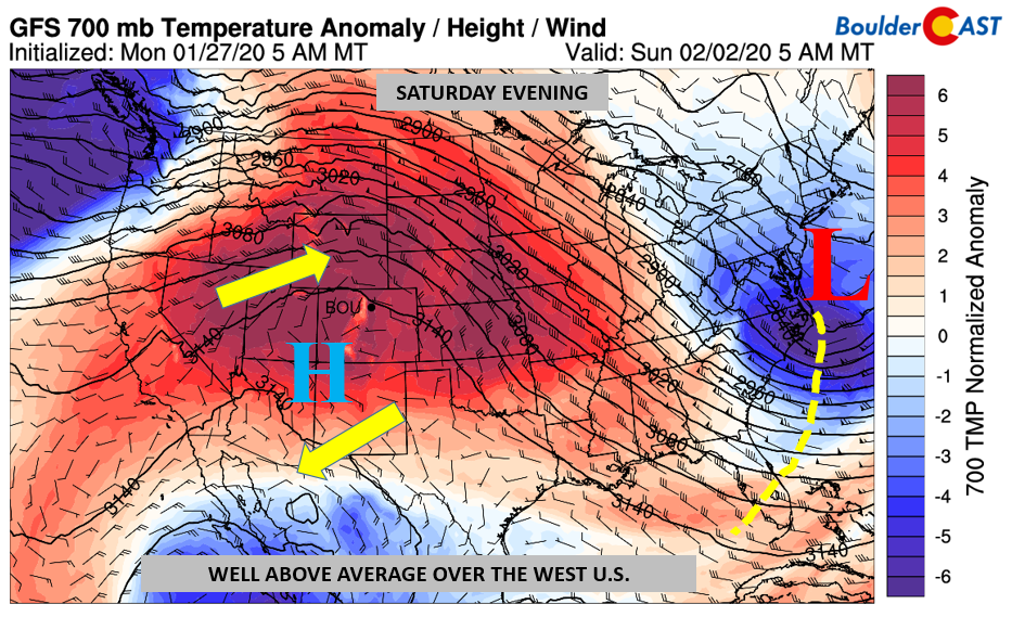
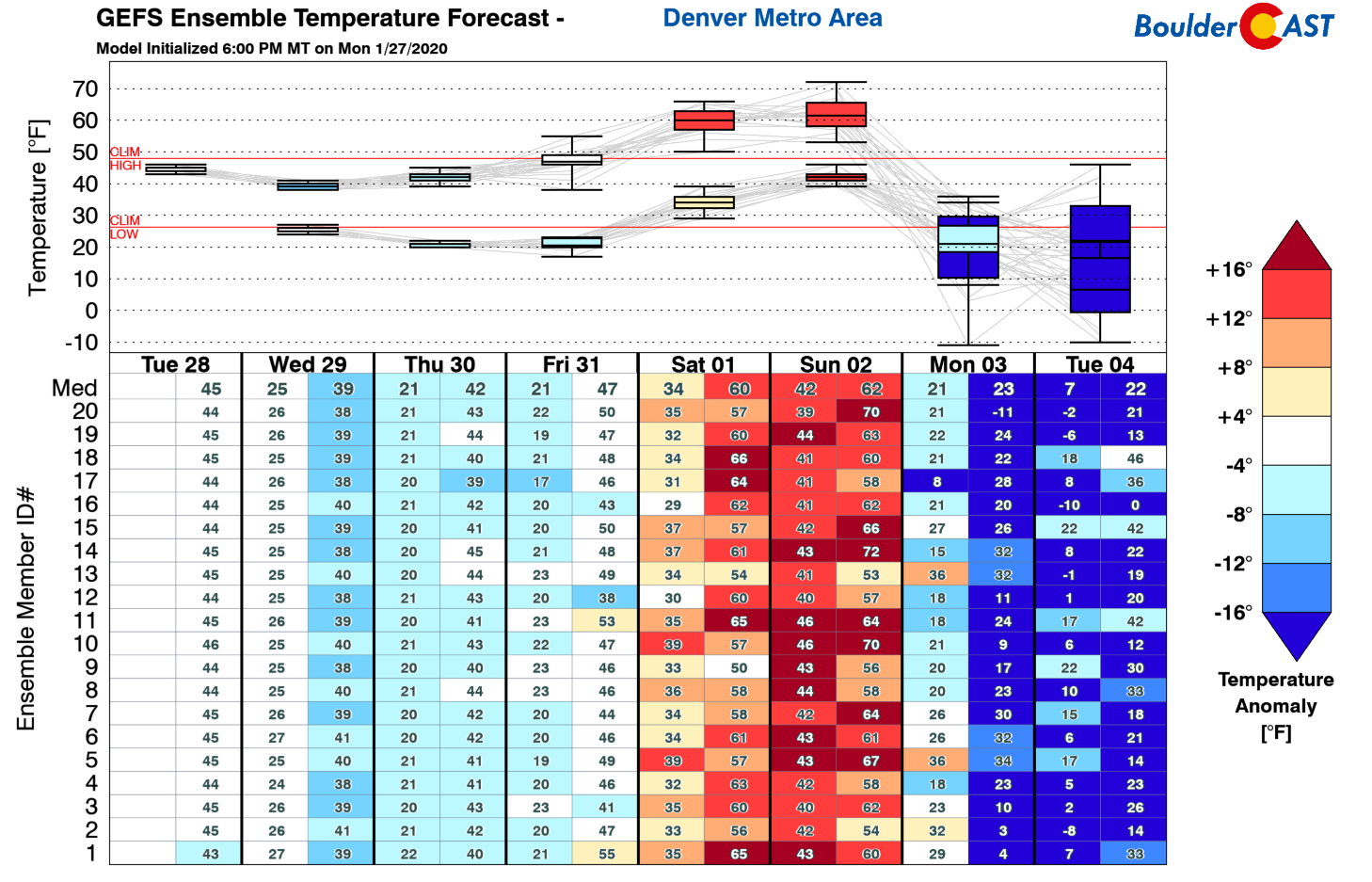
Looking ahead further, the weekend will be strictly amazing! Come Saturday night and Sunday (below), well above average temperatures will be present across much of the nation, with the exception of the far Pacific Northwest and the Eastern Seaboard. For Super Bowl Sunday in Miami, a possible weak cold front will have moved through but gorgeous weather is expected. Over Denver and our neck of the woods, might we touch 70 degrees? It’s definitely possible given this pattern. It will be a great day to get outside and then come back and watch the Super Bowl in the evening!
Winter returns early next week
Not to spoil your excitement for the beautiful weekend ahead, but next week a MUCH colder airmass will drop south out of Canada and target the central United States. It looks probable that this will impact Colorado on Monday with some of the coldest air we’ve seen since late-November spilling into the Front Range and likely bringing a chance or two of snow. It is winter after all, though it has rarely felt as such.
Forecast Specifics:
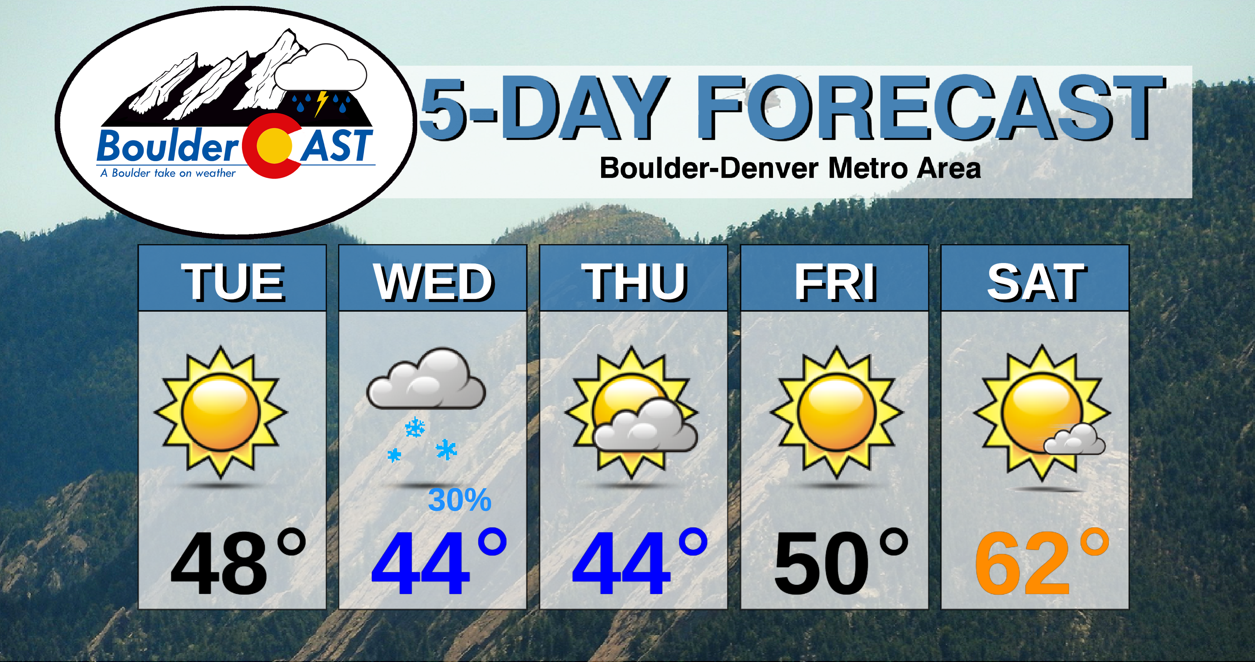
Tuesday: Lots of sunshine and quiet. Highs in the upper 40’s on the Plains and upper 30’s in the Foothills.
Wednesday: Partly cloudy skies quickly becoming overcast. Light snow possible in the late afternoon and evening hours with a trace up to 1″ of accumulation potential. Highs in the low to middle 40’s on the Plains and lower 30’s in the Foothills.
Thursday: Turning partly cloudy with chilly temperatures in the lower to middle 40’s for the Plains and lower 30’s in the Foothills.
Friday: Mostly sunny skies with highs near 50 on the Plains and near 40 in the Foothills.
Saturday and Sunday: Mostly sunny and very warm. Highs in the 60’s to low 70’s for the Plains and 50’s in the Foothills.
High Country: A break in the snowfall takes place today, but ramps up again tomorrow and early Thursday with up to 4″ in some ski resorts. Drier weather takes over to end the work week and into the weekend as a huge high pressure ridge virtually ends any snow chances. Check our PowderCAST page for always-updated weather forecasts for all of Colorado ski resorts.
DISCLAIMER: This weekly outlook forecast is created Tuesday morning and covers the entire upcoming week. Accuracy will decrease as the week progresses as this post is NOT updated. To receive daily updated forecasts from our team, subscribe to BoulderCAST Premium.
.
Spread the word, share our forecast!




You must be logged in to post a comment.