Drier weather takes hold for most of the Front Range through about midweek as high pressure and reduced moisture move in. The latter half of the week will feature an uptick in storm chances with a series of disturbances moving into the area. Temperatures will largely stay close to normal in the 80s as monsoon season comes to an end for northeast Colorado. Read on for more details.
This week’s highlights include:
- A weak shortwave trough dives south Monday, with best storm chances trending south of Denver
- Drier and seasonal temperatures Tue/Wed with high pressure
- An uptick in storm chances Thu/Fri with a trough and cold front nearing the area, along with moisture increasing
DISCLAIMER: This weekly outlook forecast is created Monday morning and covers the entire upcoming week. Accuracy will decrease as the week progresses as this post is NOT updated. To receive daily updated forecasts from our team, among many other perks, subscribe to BoulderCAST Premium.
Trending drier into midweek
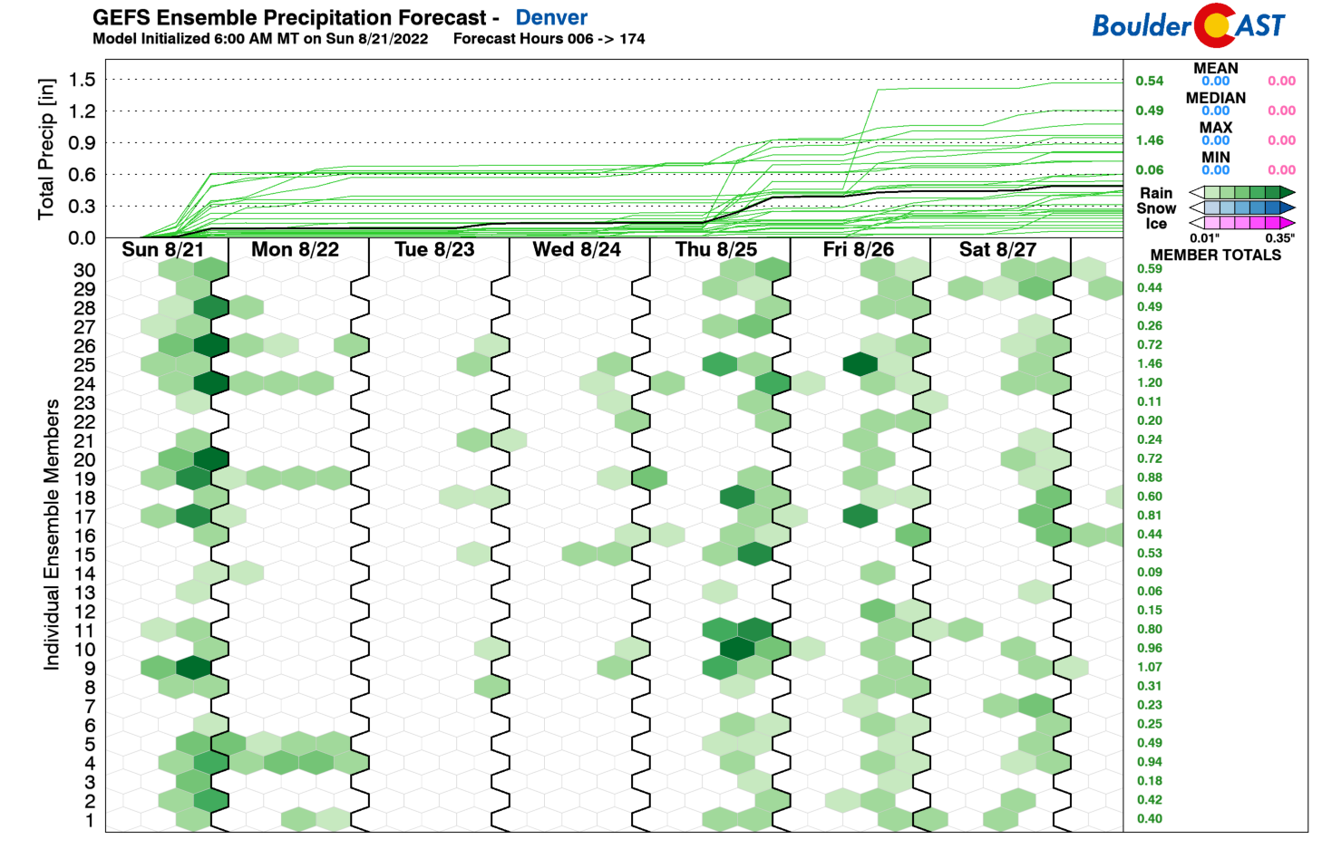
After a relatively active weekend in terms of storm coverage, we are going to see a drying trend take hold later today and into midweek. Below shows the GEFS ensemble for precipitation chances. Very few members and indicating rain chances into Wednesday. We’ll discuss why this is the case below. Expect a trend to drier weather therefore these next few days, but precipitation chances increase towards the end of the week — more on that later.
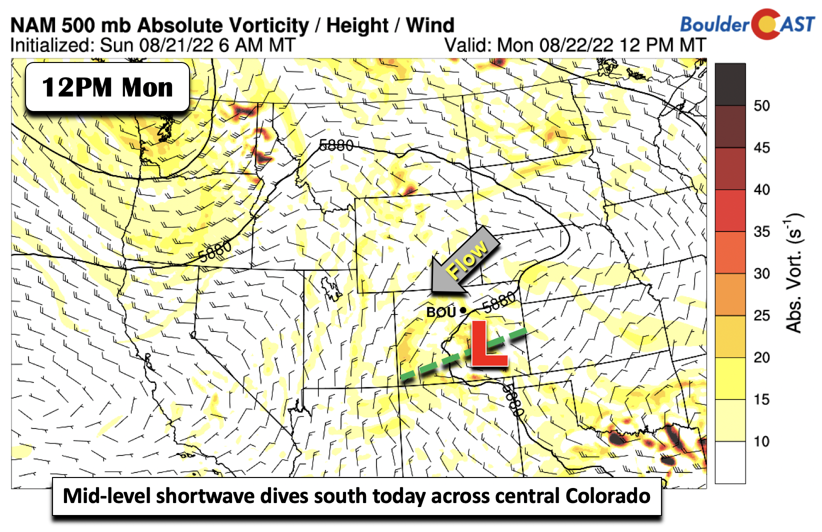
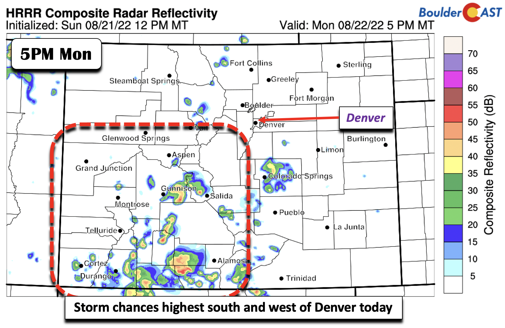
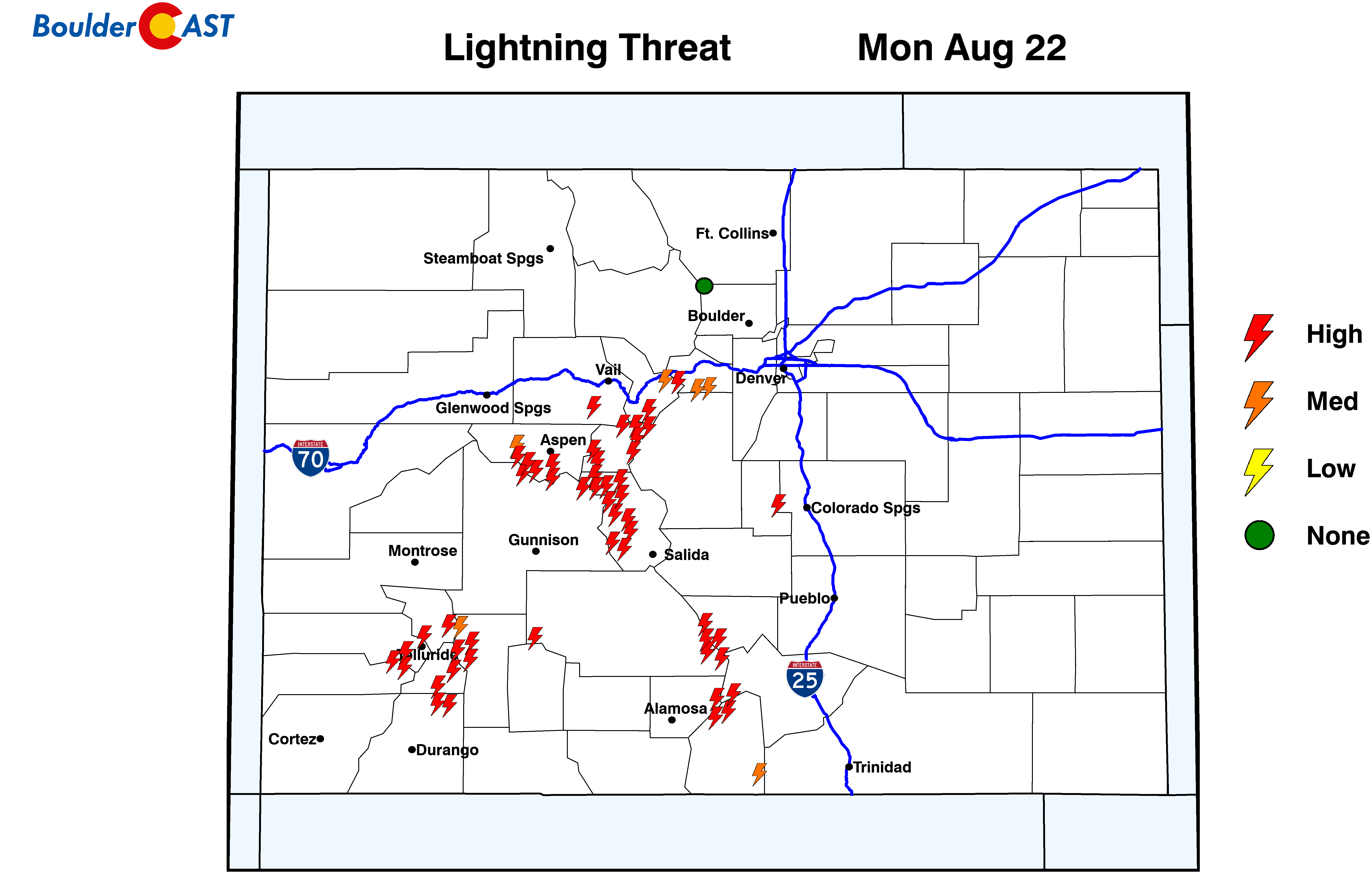
A mid-level shortwave trough, which yesterday was oriented northwest to southeast, is now positioned west to east over southern Colorado. Our flow is out of the east-northeast and the main lift with this trough will be along and south of it, largely south and west of Denver.
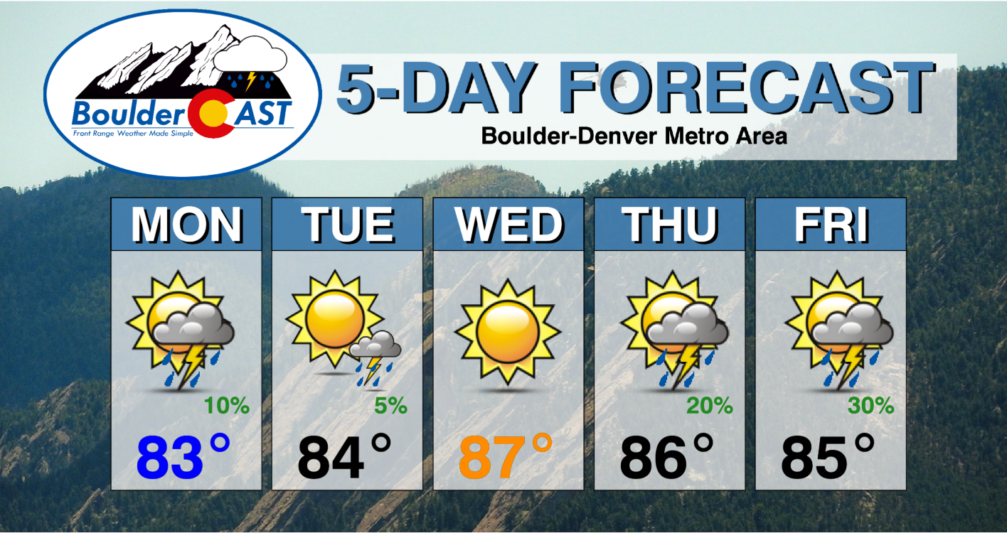
This is predicted quite well in the HRRR and other models, showing the greatest storm coverage over the southwest mountains and along and south of Colorado Springs. We still can’t rule out some very isolated storms in the Denver Metro as surface heating produces enough instability for some brief thundershowers. At best, the chance is 10% in Denver and Boulder. Temperatures on Monday will be pleasant in the low to middle 80s.
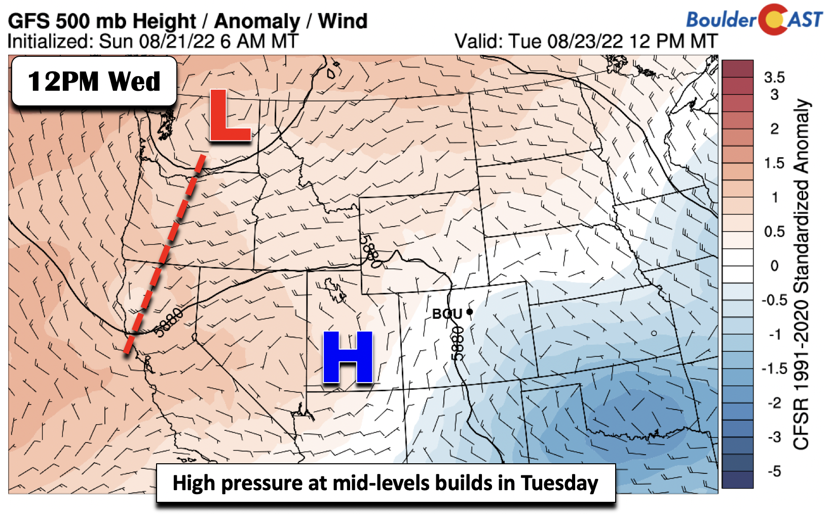
Drier weather really develops Tuesday as the trough axis becomes diffuse over New Mexico. Furthermore, high pressure in Utah starts to spread east. Expect more sunshine and warmer temperatures in the mid to upper 80s.
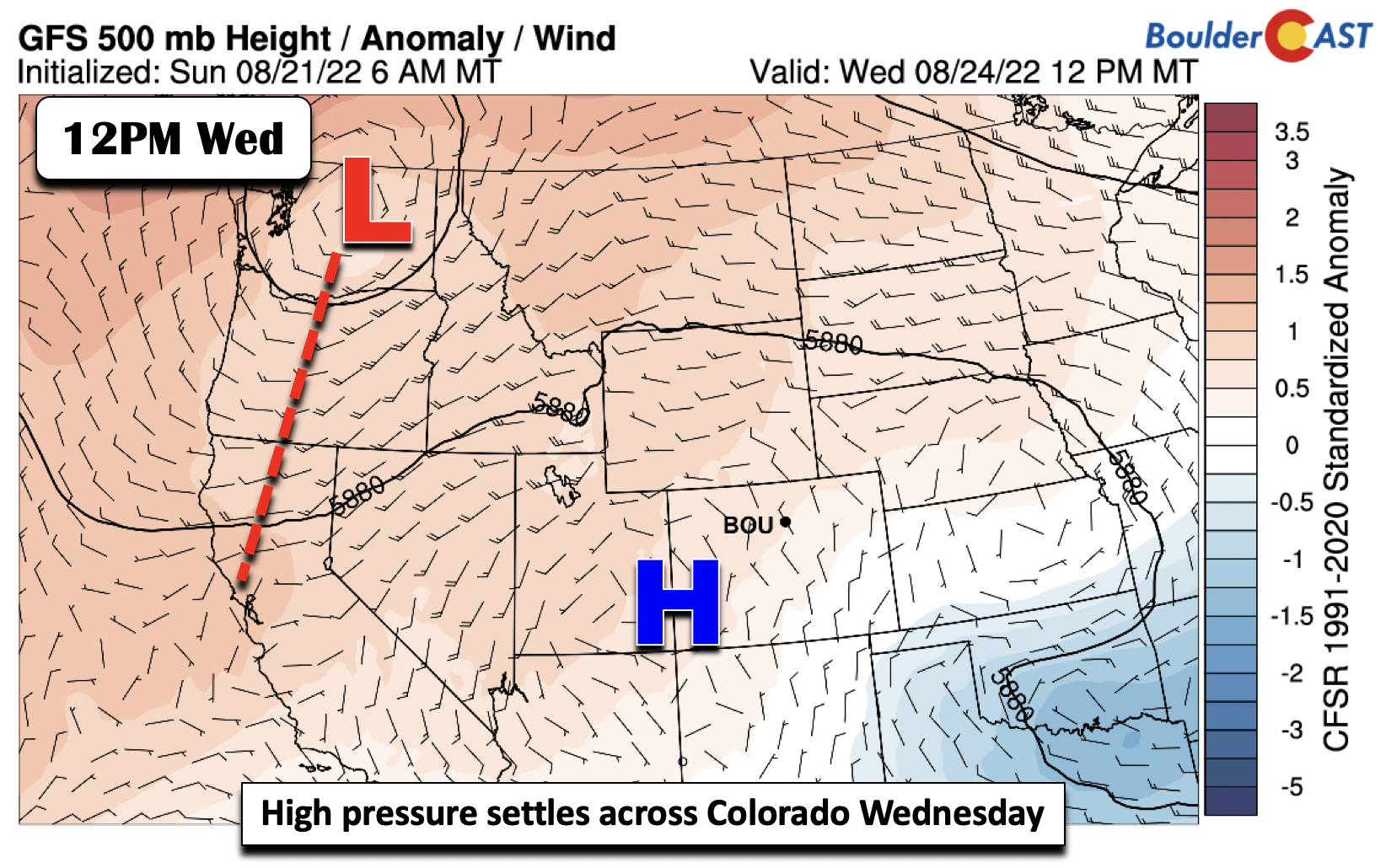
Wednesday may be our warmest day, or close to it, as high pressure sets up over the Four Corners area. Highs reach the upper 80s to lower 90s with little chance of storms.
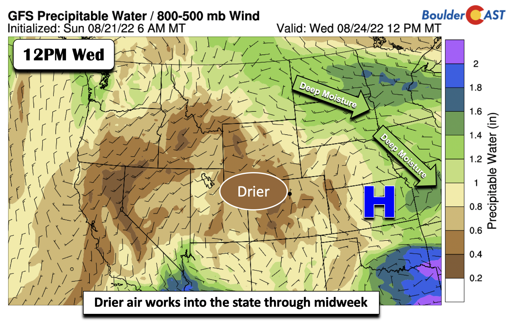
On Wednesday, drier air continues to filter in from the north and west. The deepest moisture sits out over the Dakotas and Mississippi Valley.
Uptick in storm chances later this week
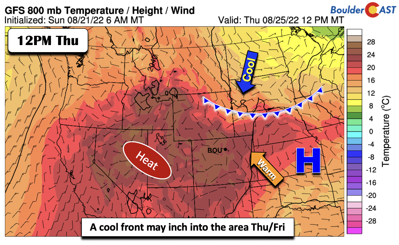
Toward the latter half of the week, we’ll see an uptick in storm chances due to two main factors. The first is that some of the global models are indicating a cold front approaching the area Thursday into Friday. Its position in the GFS at midday Thursday is around Wyoming and Nebraska. However, it isn’t clear whether this weak front will actually make it into the Front Range. Nevertheless, its close proximity should allow for better forcing for ascent of clouds/storms.
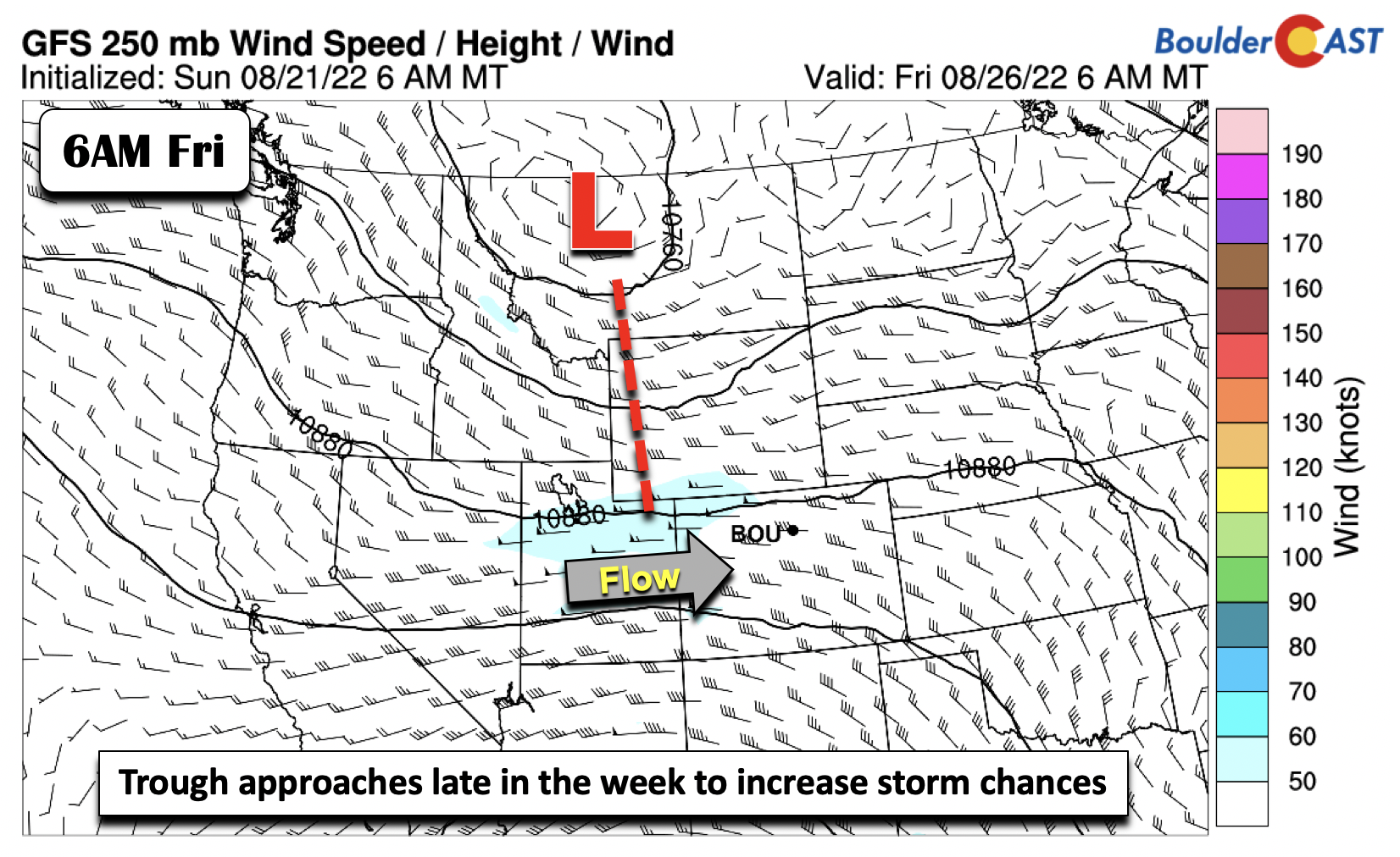
At the same time, most guidance shows a trough at mid and upper-levels to our north and northwest approaching late Thursday and Friday. Out ahead of it, there should be a trough axis allowing better convergence and lift for storm development across both the higher terrain and on the Plains.
By Friday, precipitable water values will also rise to around 1 inch, especially along far eastern Colorado. Temperatures will stay near normal but trend in the middle to upper 80s Thursday and Friday with a better chance of afternoon convection and clouds.
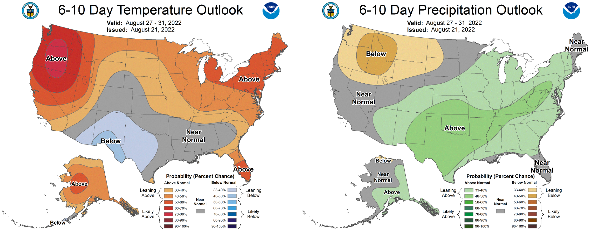
Looking ahead, the Climate Prediction Center has equal chances for our temperature outlook this weekend into early next week, but slightly increased odds of above normal precipitation.
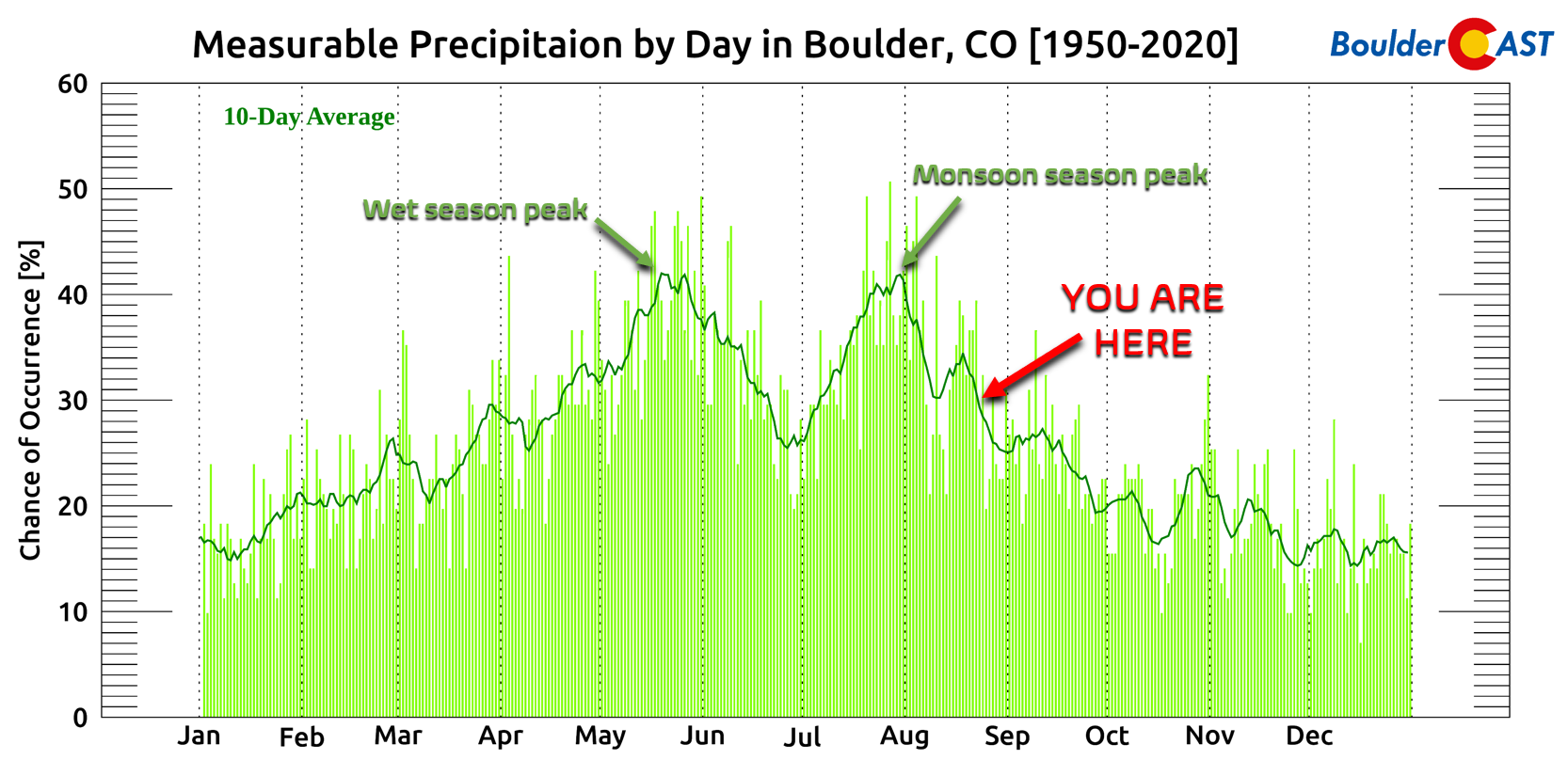
As we head through the last full week of August, monsoon season is wrapping up for eastern Colorado. Climatologically speaking, the best moisture is behind us.
We posted an update late last week recapping what has been been a fickle but ultimately fairly productive monsoon season across the Front Range. You can read that update HERE.
Forecast Specifics:
Monday: Partly sunny with a chance of isolated late-day storms. Highs in the low to middle 80s on the Plains and lower 70s in the Foothills.
Tuesday: Mostly sunny and warmer with highs in the mid to upper 80s for the Plains and middle 70s in the Foothills. A weak storm or two is possible, mainly in the higher terrain.
Wednesday: Sunny and warm with upper 80s on the Plains and upper 70s to near 80 in the Foothills.
Thursday: Increasing clouds with widely scattered afternoon/evening storms. Highs in the middle to upper 80s on the Plains and middle 70s in the Foothills.
Friday: Partly to mostly cloudy with scattered afternoon/evening storms. Highs in the middle 80s on the Plains and middle 70s in the Foothills.
High Country: Showers and storms will be scattered to numerous across the central and southwest part of the state on Monday. Storm coverage lessens Tuesday and Wednesday as drier air overtakes the area with storm coverage isolated at best. An uptick in storms is forecast for Thursday and Friday as a system approaches the area. Storm chances will crease to 40-50%.
Help support our team of Front Range weather bloggers by joining BoulderCAST Premium. We talk Boulder and Denver weather every single day. Sign up now to get access to our daily forecast discussions each morning, complete six-day skiing and hiking forecasts powered by machine learning, first-class access to all our Colorado-centric high-resolution weather graphics, bonus storm updates and much more! Or not, we just appreciate your readership!
Spread the word, share the BoulderCAST forecast!




You must be logged in to post a comment.