After a welcomed cooler start to the week, it will be all about the 90’s through Friday as hot and dry west-southwest flow entrenches across the entire Four Corners region, including Colorado. We are watching a slight resurgence of moisture for the latter part of the week related to Hurricane Elida, but even still, storm coverage is expected to remain isolated at best. The monsoon is all but history at this point.
This week’s highlights include:
- Cool to start week thanks to a cold front early Monday morning
- Hot and dry with mid and upper 90’s Tuesday through Thursday
- A slight reprieve from heat for the latter part of the week with isolated storm coverage returning
DISCLAIMER: This weekly outlook forecast is created Monday morning and covers the entire upcoming week. Accuracy will decrease as the week progresses as this post is NOT updated. To receive daily updated forecasts from our team, subscribe to BoulderCAST Premium.
We are cool to start
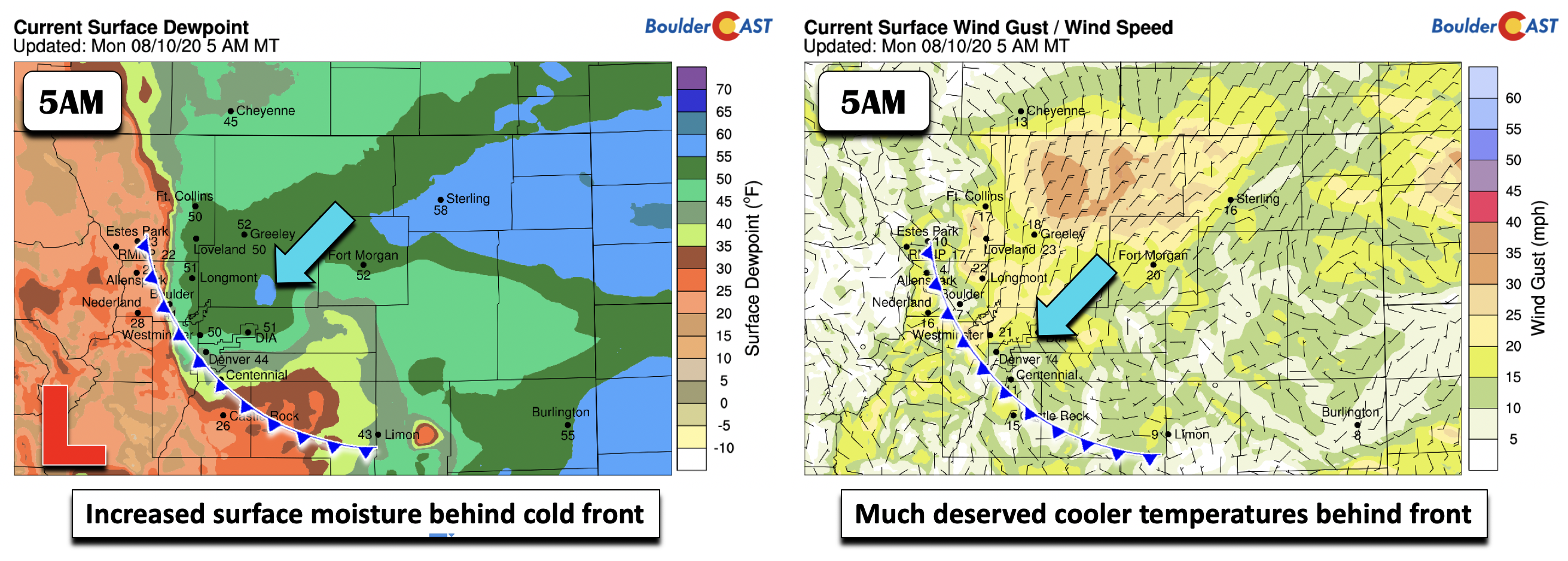
After this weekend’s heat wave in the mid to upper 90’s, we start the work week on the “cooler” side. As of 5:00 AM Monday morning, northeasterly surface winds were evident over the Front Range (below right), along with elevated moisture content (below left) making for a cool and crisp feel! This is thanks to a cold front that slid through during the wee morning hours. As a result, temperatures should be some 10 degrees cooler in the upper 80’s to maybe a few locales briefly touching 90 degrees.
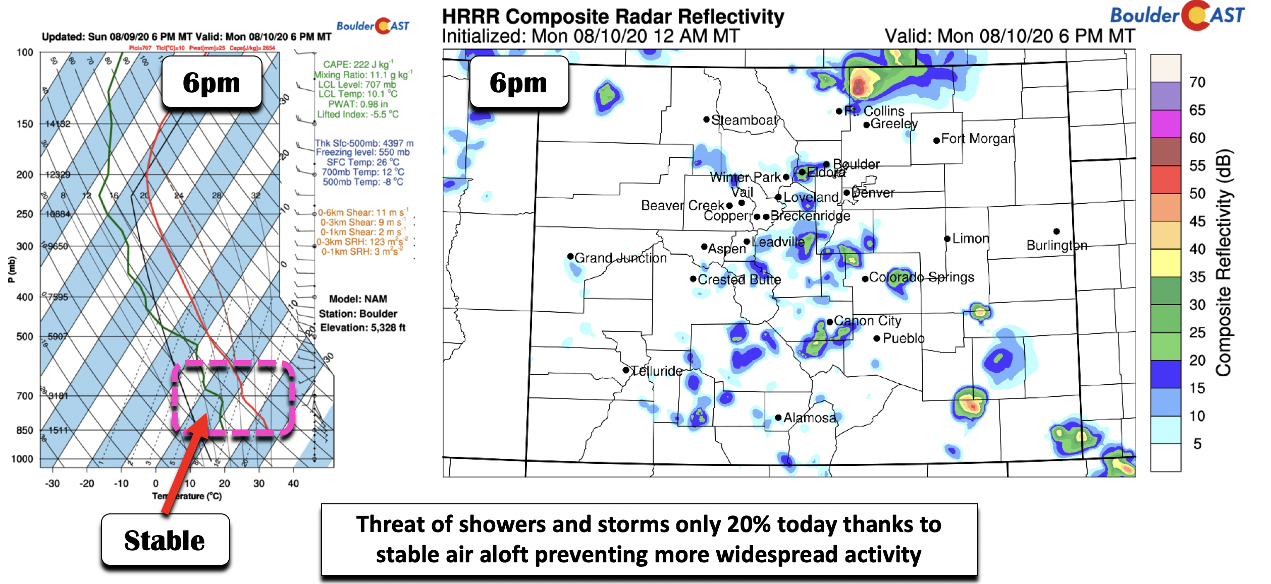
Normally with this frontal position draped along the Front Range and Foothills, we would see an increase in our thunderstorm outlook. There certainly will be an increased chance but not overly high due to one major factor. As we can see in the Skew-T graph in the below left graphic, where temperature is in the red line and dewpoint (moisture) is in green, the low to mid-levels have moistened up a decent amount from the weekend, as evident by the precipitable water near 1 inch and the higher dewpoints. Cloud bases will be around 5,000 feet above the surface. However, notice how the temperature line shows a kink just above 700 mb. This is an inversion where the temperature about 7,000 to 10,000 feet up is warmer than an air parcel rising from the surface. This will act as a lid today to keep storm activity rather isolated in nature (below right). While the front moved through at the surface, it didn’t make much of a dent 5,000 feet up in the atmosphere; hence the reason for this convective “lid” today. Nevertheless, a 20% chance is our forecast as some clouds will rise above this lid, with any storms capable of brief downpours, lightning, and brief gusty winds. Any storms will die down around sunset.
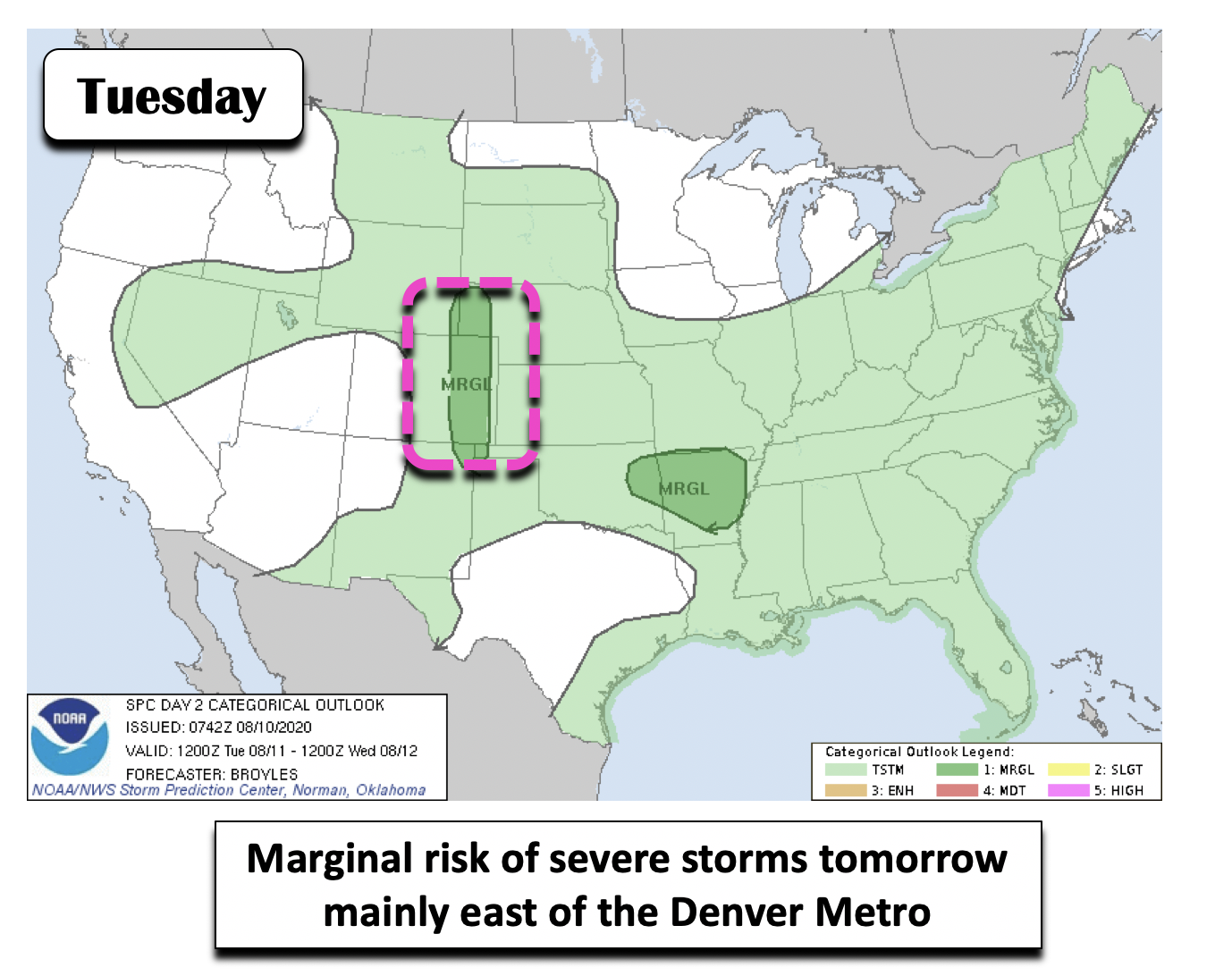
Tomorrow, the heat slowly builds in, as well as drier air from the west and southwest. There will be a boundary that will separate the moisture (over far eastern Colorado) from the drier air (central and western Colorado). While the Denver Metro area will be to the west of this boundary, we could still squeeze out a 10% chance of afternoon storms. Most of the activity should be east of Interstate 25, where a marginal risk of severe weather is predicted by the Storm Prediction Center (below).
Bone dry and hot through Thursday
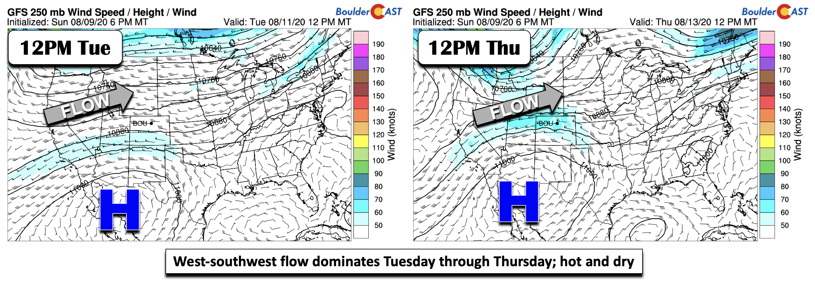
For the Tuesday through Thursday timeframe, the atmospheric pattern will feature a trough of low pressure over the Pacific Northwest and western Canada, along with high pressure over northwestern Mexico at the upper-levels. These two differing pressure patterns will create rather persistent westerly flow across the Desert Southwest into Colorado. This will be a hot and dry flow, not a good sign to our already severe drought. Depending on the strength of the winds aloft later this week, there could be Red Flag Warnings issue for elevated fire danger.
Thanks to this mid to upper-level flow tomorrow through Thursday, the airmass warms considerably during the next few days, after our brief cool down on Monday. Note in the figures below how the 700 mb temperature (5,000 feet up) rises to 18 degrees Celsius by Thursday. Temperatures in the low to middle 90’s tomorrow should reach the upper 90’s by Thursday. If you’re tired of the heat already, perhaps get some ice cream to cool down this week? It’s clear that Mother Nature won’t be helping in any capacity.
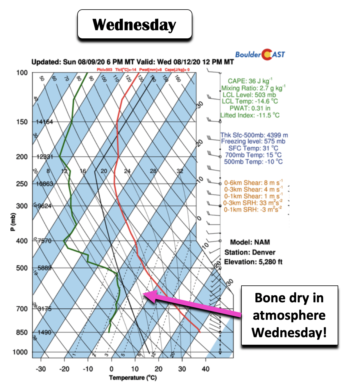
And while we did say the pattern is also dry, we wanted to show you how dry it will be. The Skew-T plot below shows temperature (red line) and dewpoint (green line) for midday Wednesday over Denver. Note how far apart the dewpoint and temperature are between 500 mb and the surface. In fact, the dewpoint at the surface is below zero (Celsius)! This is bone dry! Good luck getting any storms to form out of that! There will be the occasional afternoon clouds though, thanks to surface heating.
Some reprieve in heat along with isolated storms
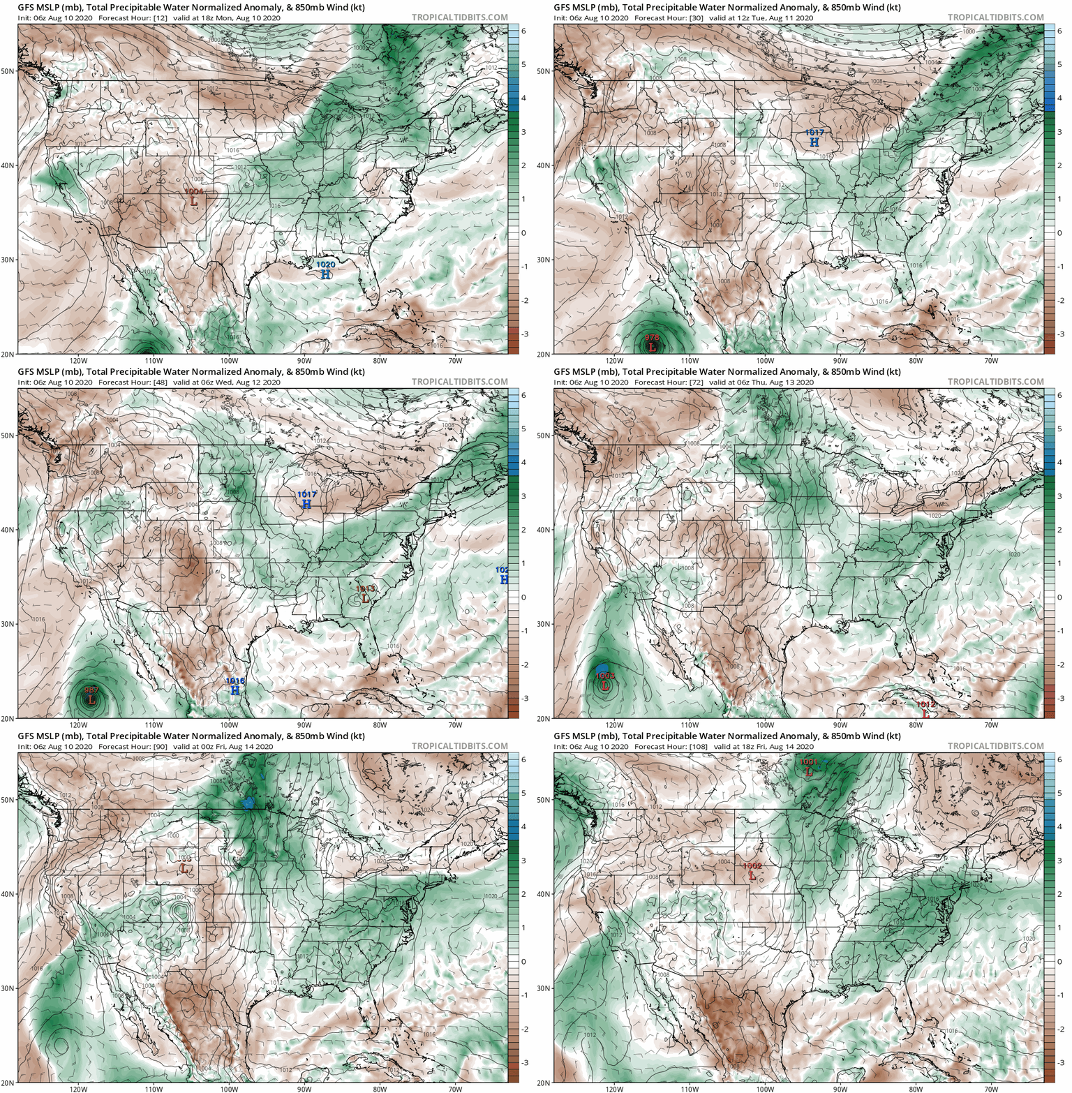
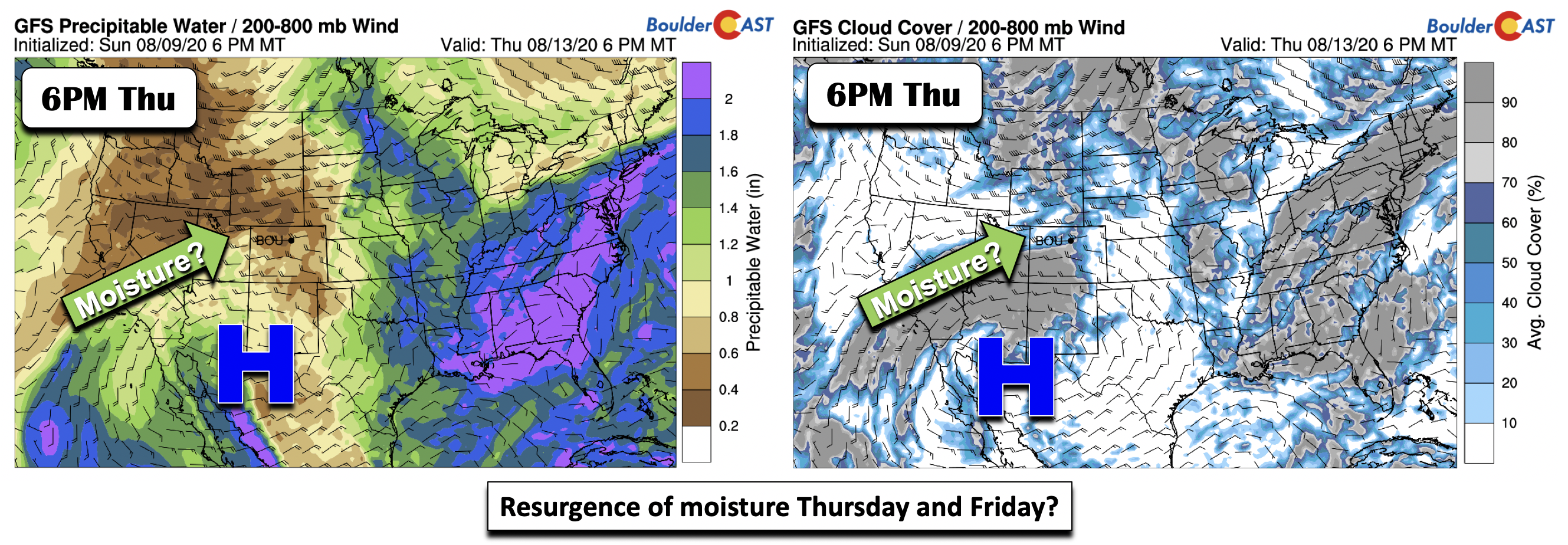
Come late Thursday into Friday and the upcoming weekend, there are some hints in both the guidance and ensembles that a possible resurgence of moisture could build into the area. This recirculated moisture is not the monsoon making a comeback. The northward push of moisture will be aided by Hurricane Elida in the eastern Pacific Ocean off the coast of Baja California. This can be seen in the GFS moisture anomaly forecast animation below covering much of the week ahead.
The higher precipitable water values start to track into southwest Colorado Thursday night (below left) in response to the high pressure moving to a more favorable position to allow for moisture from the Pacific. This is also evident in the cloud cover pattern. How much moisture actually ends up making it onto the Front Range remains to be seen this far out. At best, we think a 10-20% chance of storms is warranted on Friday.
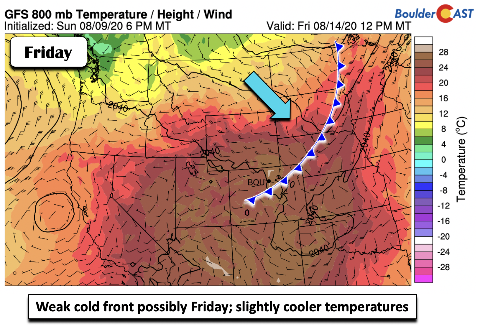
There are also hints of a weak cold front pushing into the area on Friday, ushering in a slight reprieve from the heat to end our work week. Temperatures likely would be in the lower 90’s (instead of upper 90’s!). For the upcoming weekend, the trough over the Pacific Northwest and Canada that was present earlier in the week will sag a little southward to allow for a slightly cooler airmass. The moisture resurgence will also lead to more clouds and that isolated storm threat to keep temperatures near 90 degrees, somewhat of a reprieve.
Forecast Specifics:
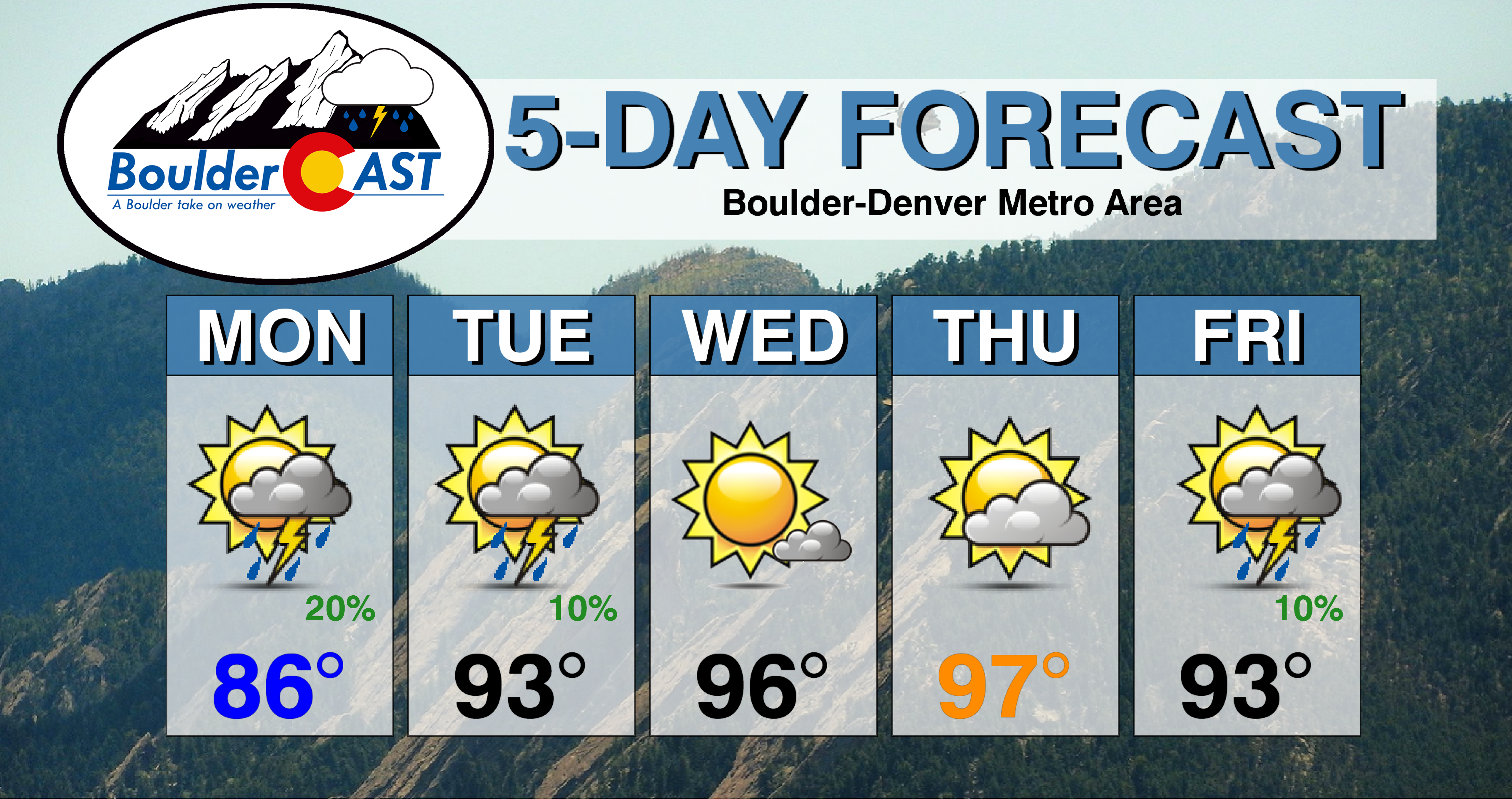
Monday: Cooler with a 20% chance of late afternoon/early evening storms under partly cloudy skies. Enjoy the short cool-down! Highs in the upper 80’s for the Plains and upper 70’s in the Foothills.
Tuesday: Partly cloudy skies with a very slight chance of a weak storm to two, mainly east of Interstate 25. Highs in the low to middle 90’s on the Plains and near 80 in the Foothills.
Wednesday: Sunny and hot with highs in the middle 90’s on the Plains and low 80’s in the Foothills.
Thursday: Partly cloudy and hot with highs in the upper 90’s on the Plains and low 80’s in the Foothills. Isolated storms are possible across the Foothills.
Friday: A 10% chance of storms with highs somewhat cooler near the lower 90’s for the Plains and upper 70’s in the Foothills.
Weekend: Storm chances increase only marginally with 20% chances and increased afternoon clouds with temperatures near 90 degrees.
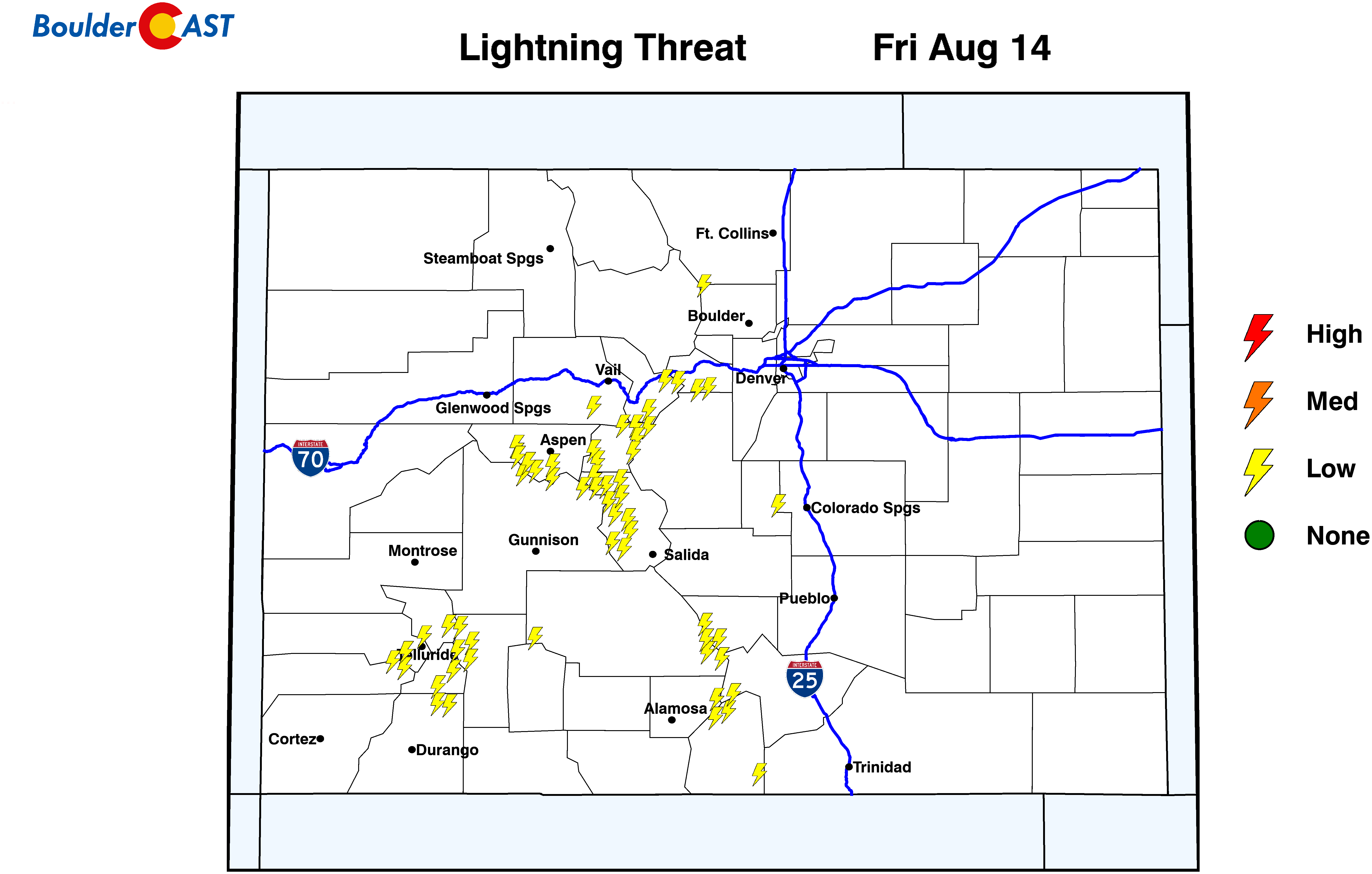
High Country: Storm coverage will be only 10% today and tomorrow and largely non-existent on Wednesday. Certainly this will be great weather for hiking. Scattered thunderstorms increase in coverage and percentage Thursday through the weekend up to 20 to 30% . Check our SummitCAST page for daily updated forecasts for more than 120 mountain hiking destinations across Colorado. Here’s a look at at the lightning threat statewide on Friday.
Help support our team of Front Range weather bloggers by joining BoulderCAST Premium. We talk Boulder and Denver weather every single day. Sign up now to get access to our daily forecast discussions each morning, complete six-day skiing and hiking forecasts powered by machine learning, first-class access to all our Colorado-centric high-resolution weather graphics, bonus storm updates and much more! Or not, we just appreciate your readership!
.
Spread the word, share the BoulderCAST forecast!
.






You must be logged in to post a comment.