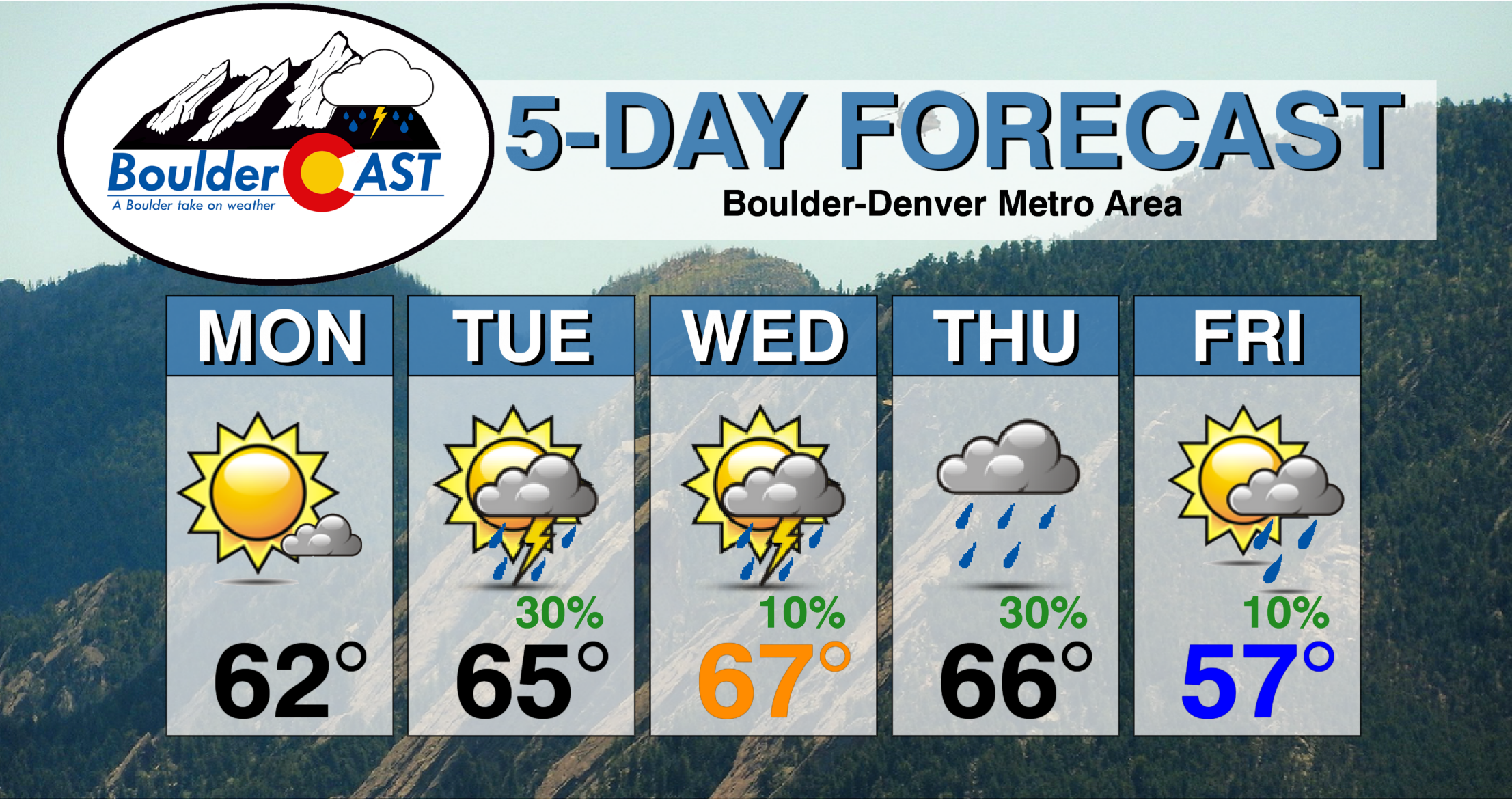
Last week will be a tough act to follow as Boulder received more than three feet of snow and soared to a new seasonal snowfall record. While it won’t be quite as active this time around, there are a few notable weather features to watch out for. Look for generally warmer temperatures into the 60’s for much of the week. A few chances of rain will also be sprinkled into the outlook, mainly Tuesday and Thursday. And the best news? No snow!
We’re celebrating our 5th birthday this week! You can read our announcement post HERE with some cool facts about our journey.

To celebrate our five-year milestone, we have a 30% discount available on our Premium membership. Click the button below and use the promo code FIVE at checkout. This special sale expires on Monday April 20, 2020 at 11:59 PM Mountain Time. Click HERE to learn more about the wealth of benefits available to our Premium members.
Thanks for following along with us as we have covered Colorado’s crazy weather over the years. Here’s to many more!
This week’s highlights include:
- 60’s for much of the week, trending downwards to the upper 50’s on Friday
- Favorable chance of storms Tuesday/Thursday with increased Pacific moisture
- Above average temperatures for the weekend!
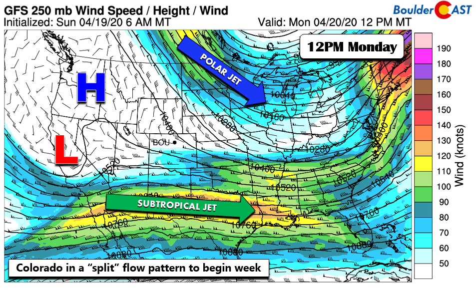
Colorado in “split” flow to begin our week with 60’s
The week starts with Colorado more or less in a “split” flow pattern. What do we mean by this? It might be useful to consult the figure below. The polar jet stream is situated to our north and east over the upper Midwest. Meanwhile, the subtropical jet is off to our south from California into Louisiana. That leaves us in between these two flow patterns, with weak high pressure off to our northwest in Idaho. Temperatures will be a tad warmer than yesterday, close to normal in the low to middle 60’s. Expect more sunshine. Some afternoon cumulus clouds later in the day will ensue thanks to a dissipating area of low pressure near the Four Corners region. We should be dry but southwest and southern Colorado will see some rain showers and snow in the higher terrain.
Increased moisture and instability Tuesday
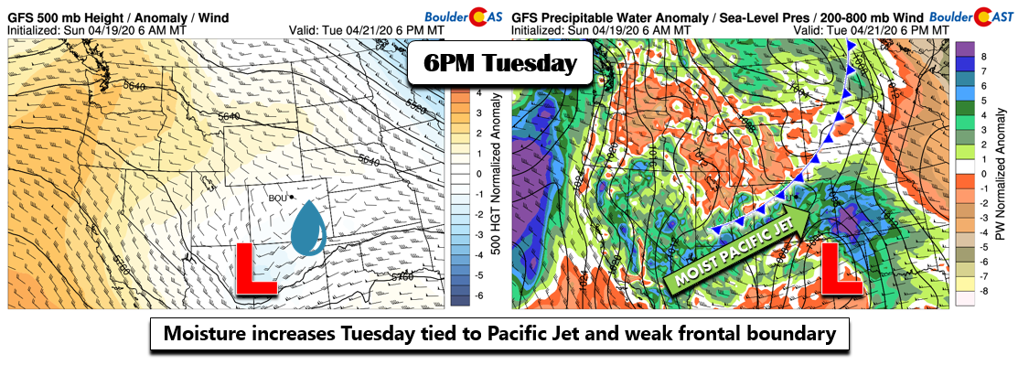
Tomorrow, the subtropical jet stream edges northward just enough to allow moisture to rise above average (below right). Coupled to this will be a weak area of low pressure tracking to our south into early Wednesday. There also will be a weak cool front or trough pushing down from Wyoming during the day Tuesday. This should focus lift over the Plains….and with moisture on the increase, this will lead to a chance of unsettled weather.
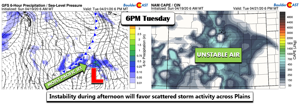
The frontal position is a little more noticeable in the below left image, along with the fetch of increased moisture. The guidance is also showing elevated instability with daytime heating. These combined factors should favor scattered storm development in the late afternoon/early evening across the Front Range. We’ll likely start out sunny, then increasing clouds in the afternoon hours with a 30% chance of isolated to scattered storms. Southern and southwest Colorado will see a mix of rain/snow depending on the elevation.
The front does not “cool” us off, as by Wednesday temperatures should continue to warm into the mid and upper 60’s thanks to a downslope flow ensuing with the storm passage. A slight chance of spotty storms are possible Wednesday with some lingering moisture, but we should overall be much drier.
Trending cooler to end week
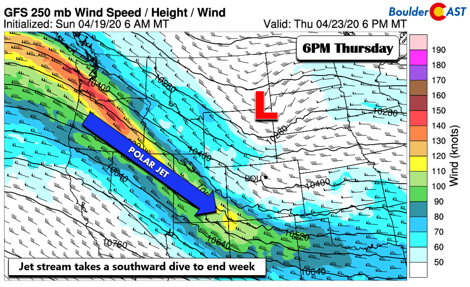
After Wednesday, the atmosphere shifts with the polar jet taking a more southward track to end the week (below). Thursday will again be near average in the middle 60’s, but clouds will increase later in the day with a chance of afternoon/evening showers as weak upslope ensues behind a cold front.
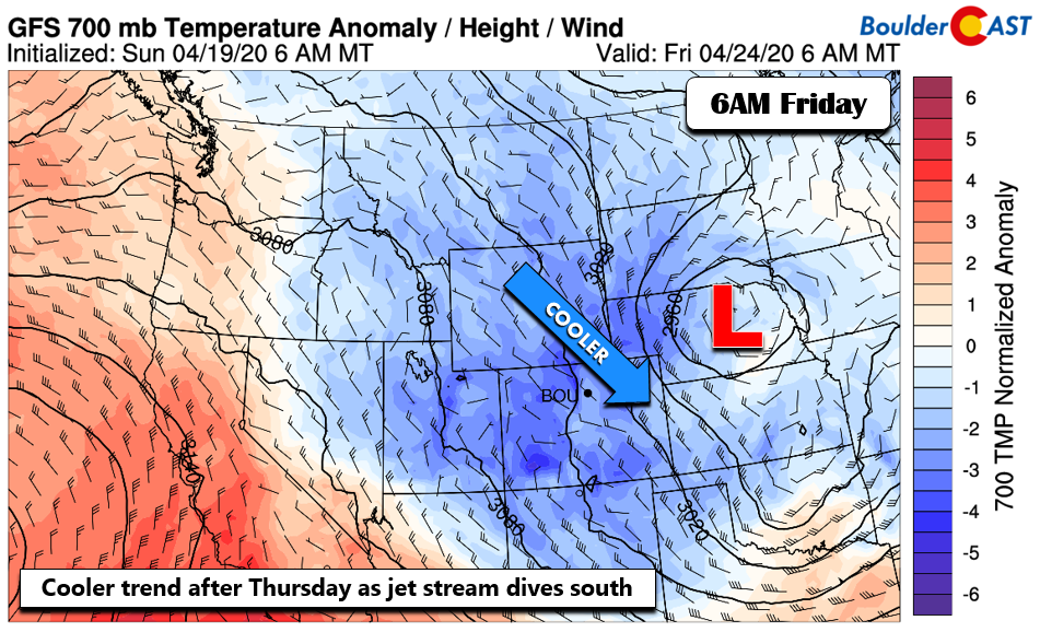
The current late week guidance then shows a cooler trend to end the work week on Friday. This is quite evident below, with below average temperature anomalies over much of the Intermountain West. Now, we are not talking about a dramatic change, but enough to drop us to the mid to upper 50’s for highs on Friday under partly sunny skies.
The mountains will continue to see a few fresh batches of snow this week. The first wave comes through Monday and especially Tuesday, with southern and southwest Colorado favored. Later in the week, northwest flow brushes the central and northwestern parts of the state. Some places by Saturday could pick up another foot.
High pressure to build over weekend
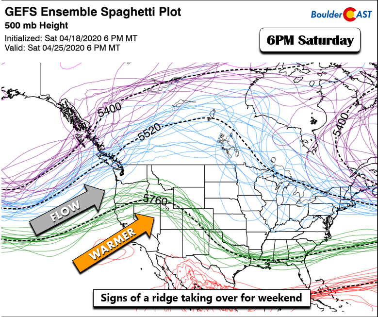
The long-range forecast guidance is in good agreement that after Friday’s brief “chill”, high pressure ridging will build from the southwest (below). There are small differences in how strong and how far north this ridge may extend. Nevertheless, it does look like great weather taking shape, especially by next Sunday. Temperatures may rebound into the lower 70’s.
Forecast Specifics:
Monday: Mostly sunny and warmer. Highs in the lower to middle 60’s on the Plains and lower 50’s in the Foothills.
Tuesday: Sunshine early, then increasing clouds with a 30% chance of late day scattered storms. Any activity tapering off by sunset. Highs in the low to middle 60’s on the Plains and lower 50’s over the Foothills.
Wednesday: Sunny skies giving way to afternoon clouds and a 10% chance of isolated storms. Highs in the mid to upper 60’s on the Plains and middle 50’s in the Foothills.
Thursday: Possible sun early giving way to mostly cloudy skies with a chance of evening showers. Highs in the middle 60’s on the Plains and middle 50’s in the Foothills.
Friday: Partly cloudy skies and cooler with a small chance of rain showers. Highs in the mid to upper 50’s on the Plains and upper 40’s in the Foothills.

We discuss Boulder and Denver weather every single day on BoulderCAST Premium. Sign up today to get access to our daily forecast discussions every morning, complete six-day skiing and hiking forecasts powered by machine learning, access to all our Front Range specific weather models, additional storm updates and much more!
.
Spread the word, share the BoulderCAST forecast!





You must be logged in to post a comment.