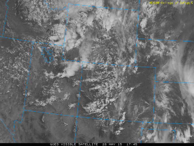
Greetings Boulderites! After some dry days for the beginning of this week and highs rebounding into the upper 60’s and middle 70’s Monday through Thursday, we turn to yet another wet weather pattern to end the week. The visible satellite image above shows an upper-level low pressure system centered over northwestern Wyoming as of this afternoon. This system, along with a cold front, will be the major weather player for tomorrow and Saturday. We take a look at this system and the warmup later this weekend.
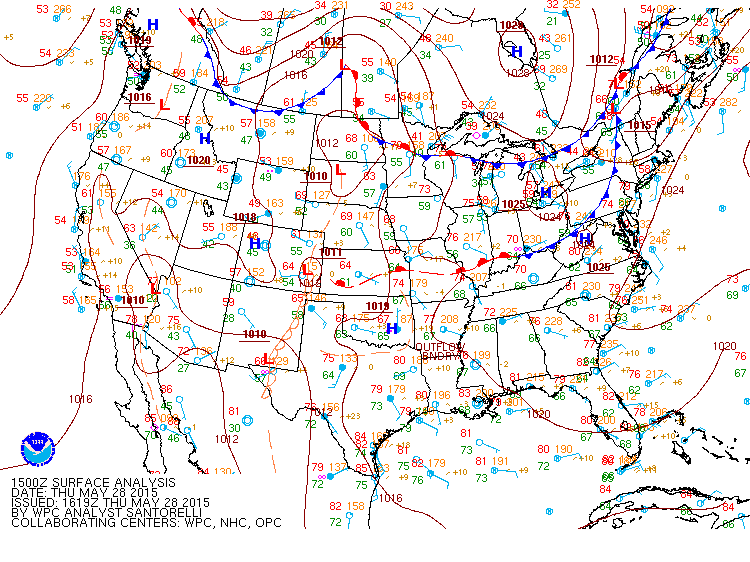
The current surface analysis as of this afternoon on May 28th shows a cold front located north of Colorado over Montana. This cold front will be dropping south through Boulder County tomorrow. The upper level low pressure system will be moving southeast into central Colorado as well. A weak area of high pressure over western Colorado is also evident with a weak lee trough signature over eastern Colorado, detected as the area of low pressure in southeastern Colorado, bringing slight downslope flow to the Plains.
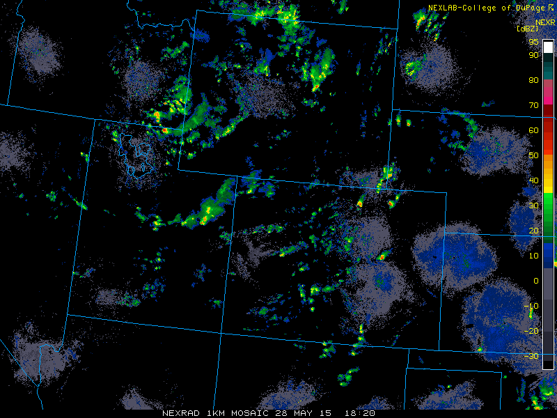
The approaching trough has led to the development of scattered showers and thunderstorms moving southwest to northeast over the high country today. Some of these storms will move east onto the Plains this evening. Expect them to be isolated to scattered in nature, but nothing widespread. Some of the storms could be severe in eastern Colorado tonight, with the biggest concern being large hail and strong winds. The image below shows the current radar image as of this afternoon.
Now let’s lookat the weather for tomorrow and the weekend, focusing on moisture, instability, and lift. The rain event should be an afternoon/evening event, with the weekend turning drier and warmer.
1. Moisture
The map below shows the precipitable water values for Colorado tomorrow. This indicates the amount of moisture available to rain out to the surface from the clouds. These values are between 0.5 and 0.7″, which is decent for this time of year.
2. Instability
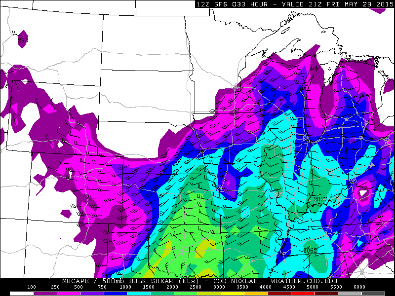
As typically happens in the summer months in Colorado, daytime solar heating during the day leads to afternoon instability to spawn clouds and storms. Tomorrow that will be the case, with afternoon thunderstorms developing alongside upslope flow. The Convective Available Potential Energy (CAPE), which is a measure of instability, shows values between 200 and 400 J/kg. This is a weak to moderately unstable atmosphere, but enough for some thunderstorm development.
3. Lift
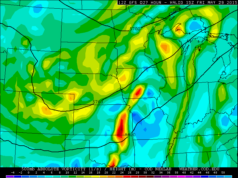
For lift, we have the upper-level low pressure system and a surface cold front moving south from Wyoming. The 500 mb vorticity map from the GFS model valid tomorrow afternoon shows the location of the upper low. It is centered around northern Colorado. It is fairly weak, as evident by low vorticity values, but nonetheless will aid in lift from the divergence aloft.
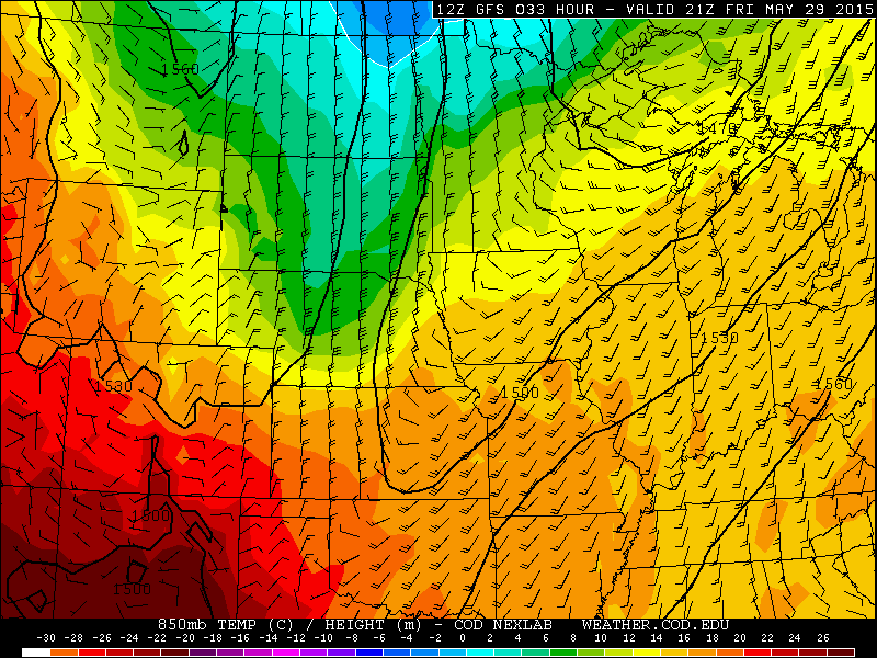
At the surface, a cold front will move through tomorrow during the late morning hours, with temperatures starting out in the upper 50’s to maybe even some lower 60’s, before northeasterly flow takes over behind the front. The 850 mb temperature/wind speed map from the GFS model for tomorrow at 3pm shows the location of the front, primarily along the Front Range with the northeasterly wind shift.
4. Weekend Outlook
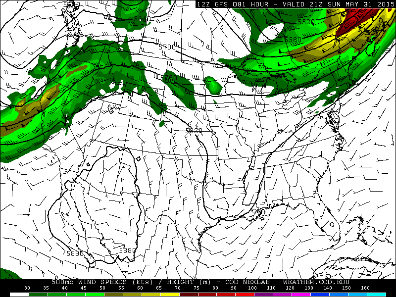
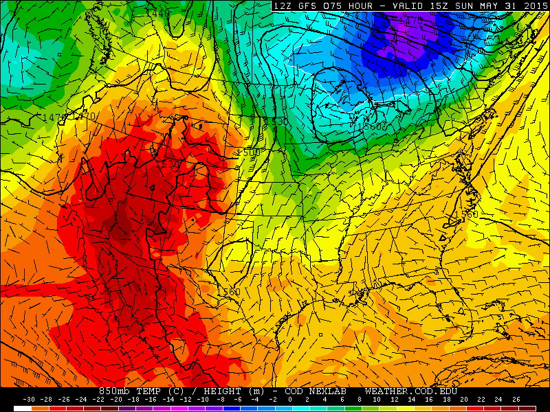
The upper low moves out by Saturday, and behind it a ridge of high pressure will build in from the west by Sunday and into Monday. In addition, 700 mb temperatures will rise along with downslope flow Sunday and Monday. A downslope flow is evident by westerly flow from west to east. This leads to a drier, warmer, and more stable airmass overall. With that, expect warming into the 80’s Sunday and Monday. Any storms should be confined to the mountains over the weekend with Boulder staying dry. Below shows the 500 mb ridge pattern from the GFS and the 850 mb temperature and wind for Sunday. Evident at 500 mb is a strong ridge. At 850 mb, there is a leeward trough centered on eastern Colorado Sunday. This is the signature of downslope flow.
In addition, one way of forecasting temperatures for Boulder is to look at the potential temperature, which is defined as the temperature of an air parcel when brought down to the surface from a particular level. It is particularly useful for predicting an afternoon temperature. For high elevations like Boulder, we look at 700 mb temperatures, roughly 10,000 feet in elevation. These 700 mb temperatures rise to 12 degrees Celsius Sunday, and close to 15 degrees Celsius Monday. This tells us that highs should reach into the 80’s Sunday and early next week.
The forecast for the weekend:
Friday: A mix of clouds and sunshine in the morning with highs in the upper 50’s to possibly some low 60’s with increasing clouds and afternoon storm development. In the Foothills, mid to upper 50’s for highs. Some of the stronger storms could produce rainfall up to a half an inch. However, most of the rainfall should be between 0.2 – 0.5 inches. The total rainfall for the month of May sits at 7.79″, with the record at 9.59″. It is therefore unlikely we will pass this old record. However, May 2015 will likely end up as Boulder’s 5th wettest May and 6th wettest month on record.
Friday night: Scattered storms will continue to be around, but should taper off by 10 pm as lows dip into the mid to upper 40’s overnight.
Saturday: Clouds early, followed by afternoon sunshine and just an outside chance of some afternoon storms, overall dry conditions with lower 70’s in Boulder and upper 60’s in the Foothills.
Extended forecast:
Sunday: Lots of sunshine and much warmer with highs in the low to mid 80’s in Boulder and upper 70’s in the foothills.
Monday: Mostly sunny with highs potentially in the mid to upper 80’s with low 80’s in the Foothills.




You must be logged in to post a comment.