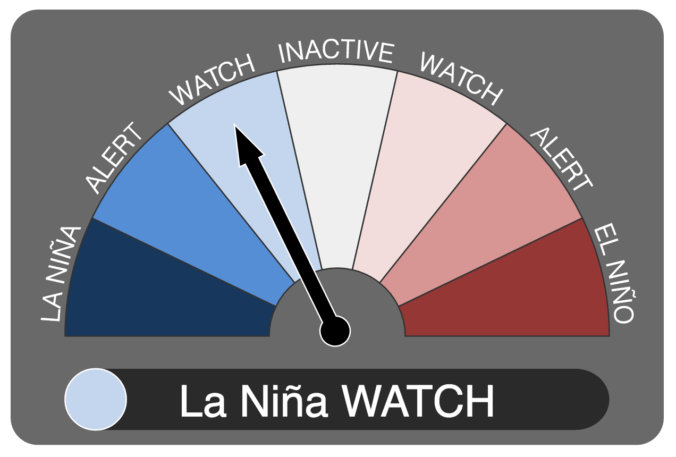
It now appears we may be headed into our second consecutive La Niña winter. We discuss the forecast, remind you what La Niña actually is, and explain potential impacts on Colorado for this winter.
Tag: winter (Page 3 of 14)
Thanks to everyone who entered our “First Snow” contest. We briefly review the entries, which surprisingly follow closely with Boulder’s climatology of late October.
The next few days will solidify the rest of the country’s belief that our weather here is pure insanity. We provide an update on what is shaping-up to be an historic late-season winter storm for the Front Range Foothills. The potential for accumulating snow across the lower elevations is much more uncertain at this time. Read on for the latest details…
More unsettled weather is looming for the week ahead! We’ll squeeze out a few nice days to start, but temperatures will be tumbling by mid week as a formidable storm system heads towards Colorado. Thursday and Friday’s forecast is currently shrouded in a bit of uncertainty, by several models are indicating significant precipitation for the Front Range, and even the potential for accumulating snow across the Plains. Read on for all the details.
As we have been relaying to you all week, another spring snow storm is on the way this evening and will linger into Saturday afternoon. Read on as we detail our final thoughts on the storm and snow amounts for the Foothills and Plains.
Another storm is on the way! These late-season spring systems are almost always a messy forecast with a high potential to bust. The upcoming storm will NOT be an exception to this general rule. We detail the set-up for the storm and provide some initial thoughts and expectations for rain and snow set to begin Friday afternoon and continue into Saturday.
Thanks to everyone who entered our “2017 Late Season Snow” contest. We briefly review the entries. Not surprisingly, most of you are less than optimistic for additional snowfall by the end of May.
Happy First Day of Spring! As smoke spewed from the mouth of Sunshine Canyon yesterday, the extent of the wildfire threat become more obvious than ever. The fire ignited late Saturday night following what has been more than three weeks in Boulder without measurable precipitation. We have some good news…the week ahead should offer some reprieve for the extremely dry weather of late. In fact, we have a chance of precipitation in the forecast each and every day this week. We’re also tracking a potential spring storm late in the week. Continue reading for our complete weekly outlook including our thoughts on the potential for accumulating snow.
© 2026 Front Range Weather, LLC


