From summer to winter in the blink of an eye! There has been quite the weather transition in the last 48 hours. We review yesterday’s snowfall and give some insight into when we may see our next.
Tag: weather (Page 10 of 31)
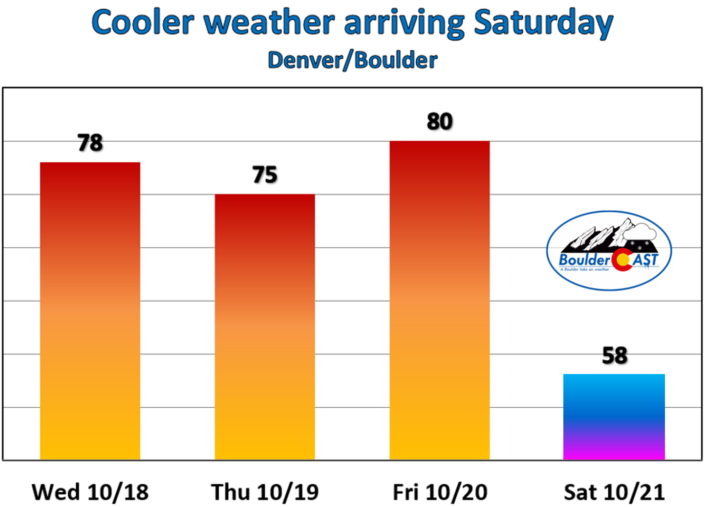
The main story for the week ahead will be the roller-coaster ride of temperatures! They will soar to near 80 degrees by midweek, but then tumble to bring the chance of snow to the region by Thursday. Read on for our complete outlook of the upcoming week.
One reason for the recent stretch of quiet and warm weather in Colorado is that the position of jet stream is FAR to our north in Canada. Weather systems tend to form near the jet stream….along the baroclinic boundary between warm and cold air masses. Without the jet, our pattern has been quiet this week and this will continue through Friday evening.
For today, expect mid-level clouds to dominate the sky in the morning as a swath of elevated moisture interacts with the terrain. However, drier air aloft moves in by lunch which will allow for sunshine this afternoon and evening. High temperatures will be in the upper 70’s today!
After 70’s tomorrow and possibly low 80’s on Friday, a dry cold front sweeps through Friday night. Temperatures will tumble about 20 degrees for Saturday, but at least that sun won’t stop shining…
Remember, these daily forecasts are Premium content. Periodically, we open this forecast up to all of our readers. Today is one of those days!
Sign up today to get the best BoulderCAST experience, including these daily forecasts every morning, complete 6-day skiing and hiking forecasts, chat room and forum access, early viewing of select content and much more!
As a special pre-winter promotion, use the promo code SNOW to receive 30% off our annual subscription. This is our last offer of 2017 and it expires October 31st. LEARN MORE
.
The gorgeous weather pattern of last week will continue into the week ahead with warm sunny days and cool autumn nights. There isn’t much actual weather to discuss this week this week, but we’ll give it our best shot!
We hope you enjoyed the Columbus Day holiday! In this special weekly outlook, we provide a brief recap of yesterday’s snowstorm, announce the winners of our 2017 First Snow Contest, and detail the warm and sunny weather about to make a rebellious stand across Colorado.
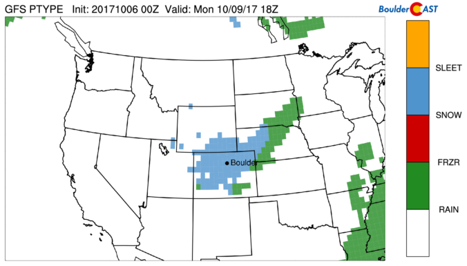
The winter storm advertised by the weather models remains on track to bring snow and much colder temperatures to the region tonight. We provide a timeline for the storm and our final snowfall forecast map.
Things are about to turn white across the region as a quick-hitting storm brings freezing temperatures and snow to the Front Range. Read on for details.
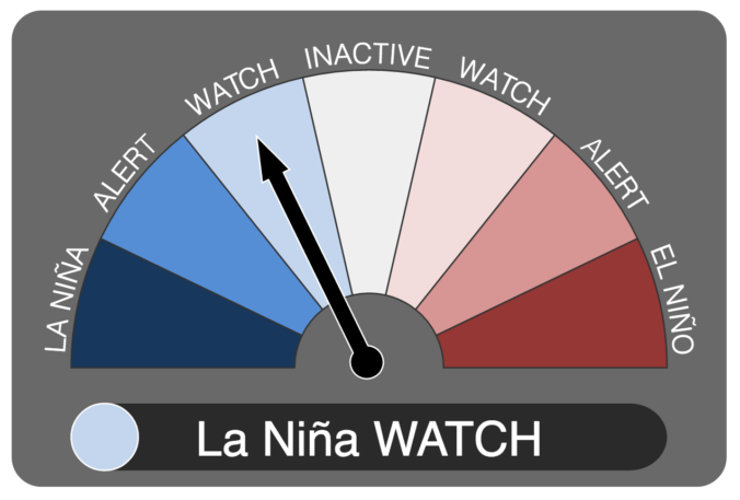
It now appears we may be headed into our second consecutive La Niña winter. We discuss the forecast, remind you what La Niña actually is, and explain potential impacts on Colorado for this winter.
© 2025 Front Range Weather, LLC







You must be logged in to post a comment.