
Page 99 of 569
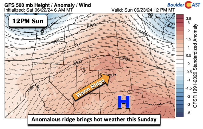
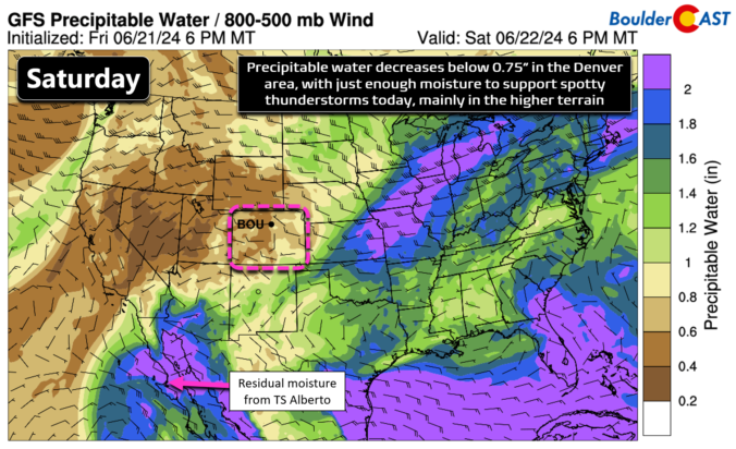
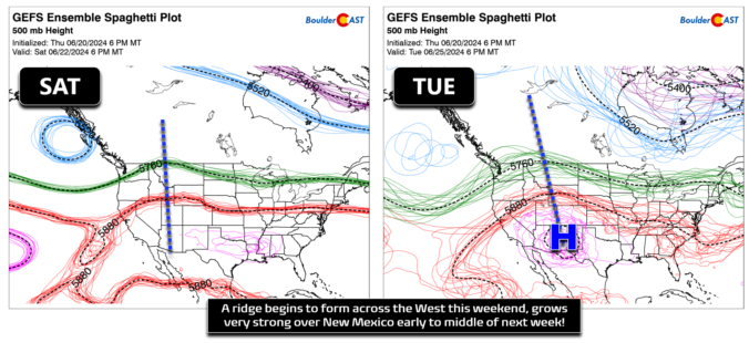
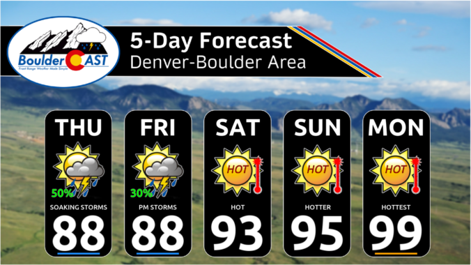
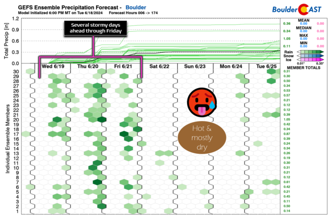
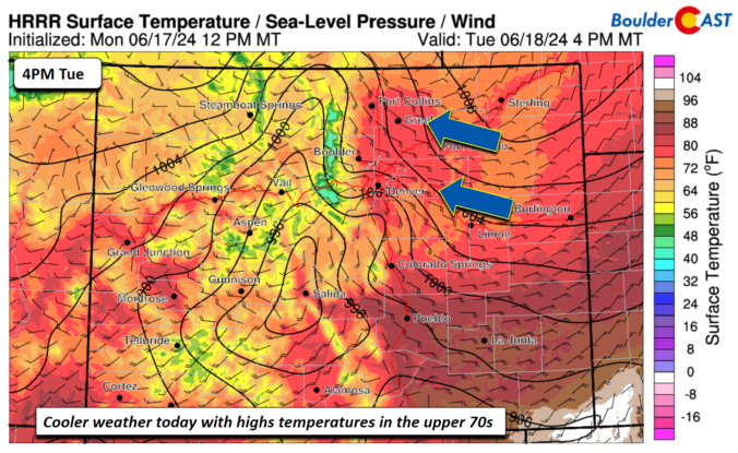

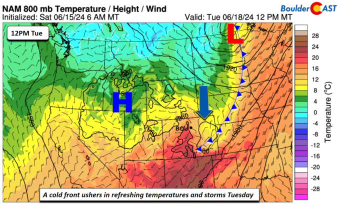
This week in the Front Range will feature a rollercoaster ride of temperatures from 90s to the 70s and back again! There will also be increasing rainfall chances for the mid to late-week period as remnant moisture arrives from a tropical system in the Gulf of Mexico — this is not the beginning of our seasonal monsoon just yet. Temperatures will slowly ramp up back into the 90s for the upcoming weekend. Read on for more details.

Live View of Boulder

Current Conditions

Live Radar

Recent Premium Posts

BoulderCAST Daily – Sun 05/31/26 | Dry and warm today but rain chances increase this week
🌦️ Overall dry and warm Sunday, though cannot rule out a very widely …
BoulderCAST Daily – Sat 05/30/26 | A stray shower today as most activity resides well east of Denver
🌦️ Spotty showers today, mainly well east of the Denver Metro area, where …
BoulderCAST Daily – Fri 05/29/26 | A Marginal Risk of Severe Isolated Storms
🌦️ Spotty showers this afternoon, mainly noon and 4 PM, with highs in …
3-Day Forecast

Trending Content

© 2026 Front Range Weather, LLC