
Page 74 of 568
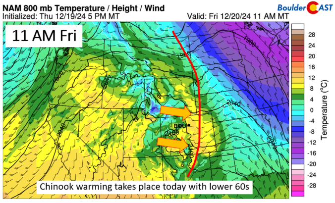
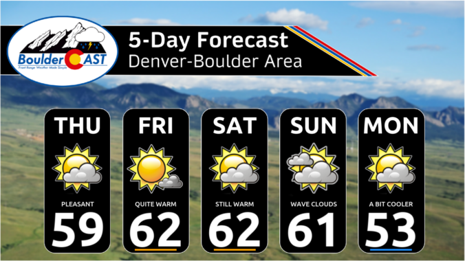
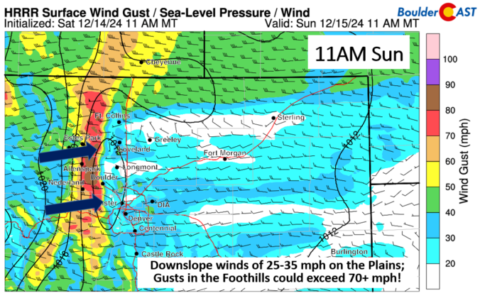
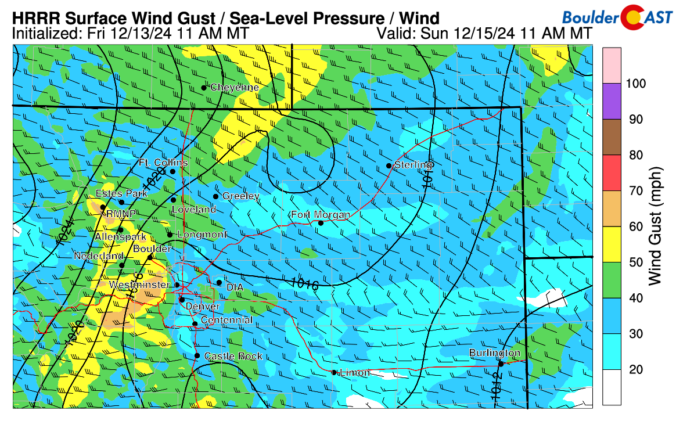
As we rapidly approach the holiday season, the Front Range continues to experience unseasonably warm and dry conditions. This past weekend brought beautiful weather with temperatures warming into the 50s, accompanied by strong downslope winds at times. Looking ahead, the forecast remains mostly quiet with high pressure dominating the central Rockies, including Colorado. While a few bouts of wind are expected this week, precipitation will be nearly non-existent over the next seven to ten days, making a white Christmas highly unlikely for the Denver-Boulder area.

Live View of Boulder

Current Conditions

Live Radar

Recent Premium Posts

BoulderCAST Daily – Sat 05/30/26 | A stray shower today as most activity resides well east of Denver
🌦️ Spotty showers today, mainly well east of the Denver Metro area, where …
BoulderCAST Daily – Fri 05/29/26 | A Marginal Risk of Severe Isolated Storms
🌦️ Spotty showers this afternoon, mainly noon and 4 PM, with highs in …
This Weekend in Colorado Weather: Unsettled but Manageable as Low-End Storm Chances Hang Over the Front Range
🌎 Omega block holds through early next week, but slowly shifts toward the …
3-Day Forecast

Trending Content

© 2026 Front Range Weather, LLC