
Page 74 of 550
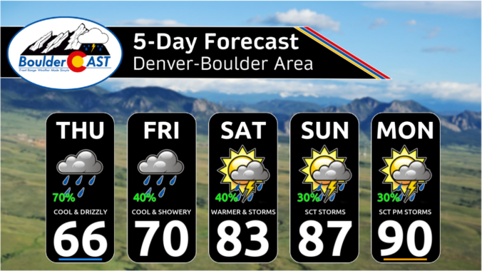
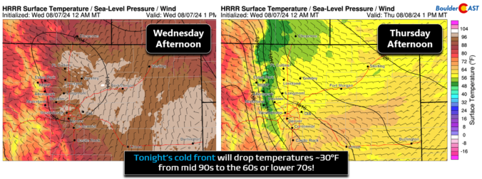
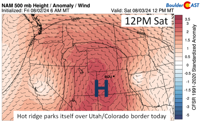
Our scorching hot, two-week-long heatwave will finally come to an end later this week, but not before we endure a few more days. A cold front is slated to arrive into the Denver area late Wednesday finally knocking us out of the 90s. This front will also come with an enhanced chance of rainfall, though monsoon moisture is still largely lacking. Despite daily chances for rain this week, our existing fires will continue to smolder and the risk of new fire ignitions remains uncomfortably high.
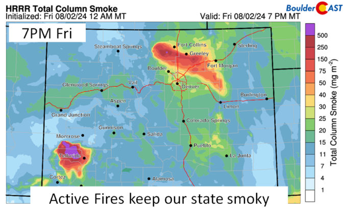
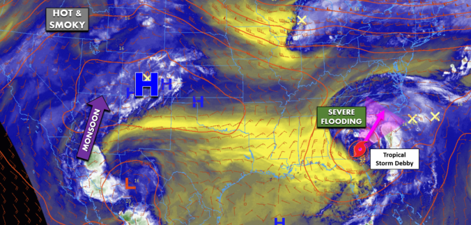
Between the extreme heat, thick smoke and new wildfire ignitions, this week has been quite the disaster in the Front Range! Our fuels have been primed for weeks now and our team has been vocal regarding this inevitable outcome, but things unravelled much quicker than even we expected this week with something like ten wildland fires in the Front Range just since Monday, in total burning more than 9,000 acres of forest! The weekend unfortunately won’t offer much reprieve from the heat, fire or drought, but we are tracking a potential shift next week towards wetter and cooler conditions. We provide an update on the local fires, the ongoing heatwave, the widespread smoke, and when actual raindrops may return to the forecast.

Live View of Boulder

Current Conditions

Live Radar

Recent Premium Posts

BoulderCAST Daily – Thu 01/15/26 | Fire Danger Today Before a Cold Front Tonight
🔥 Fire danger rising — Warm and windy today ahead of a strong …
BoulderCAST Daily – Wed 01/14/26 | A gorgeous Wednesday ahead of increasing fire danger & a stronger cold front tomorrow
🌬️ Weak front overnight — A weak cold front slipped through around 9:30 …
BoulderCAST Daily – Tue 01/13/26 | A thick blanket of high clouds won’t stop us from reaching the 60s again
☁️ Thick cloud deck overhead — Moisture streaming in aloft brings widespread mid‑ …
3-Day Forecast

Trending Content

© 2026 Front Range Weather, LLC