
Page 26 of 550
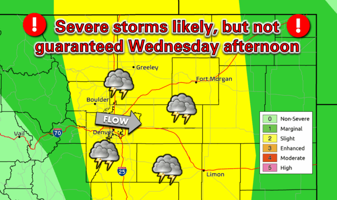
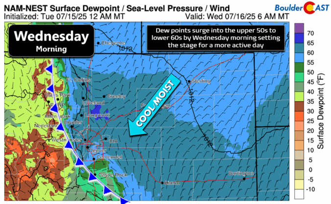
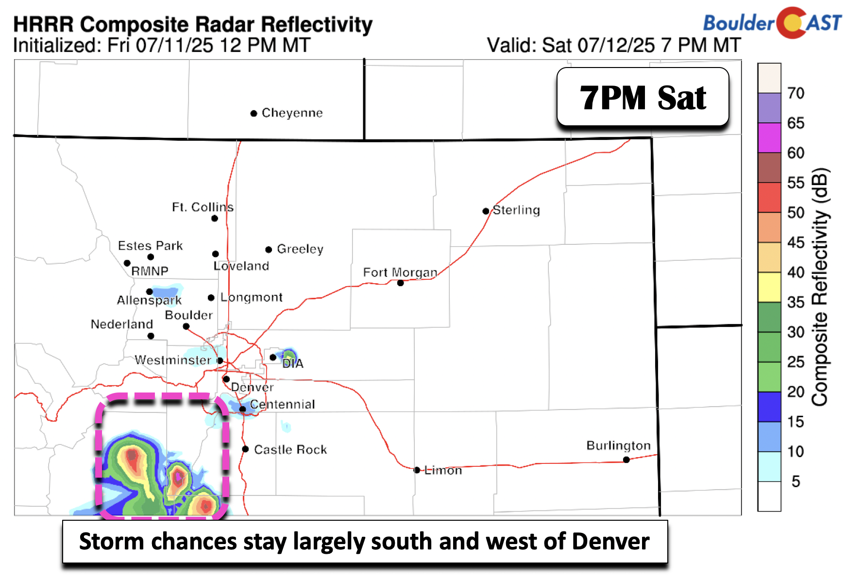
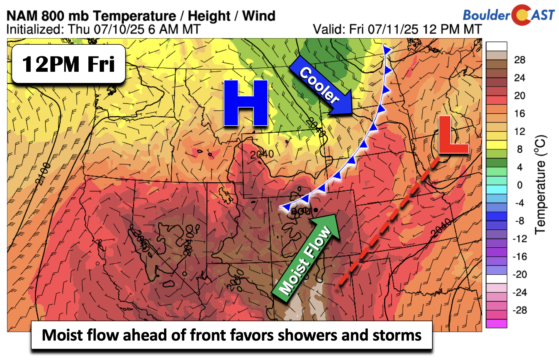
Monsoon season may have officially started earlier this month, but it’s off to a sluggish and lack-luster beginning across Colorado. Boulder has seen frequent storms—yet little meaningful rain—and wildfire smoke from the Western Slope and neighboring states is starting to pool to our west. A cold front arriving Tuesday night will bring cooler temps and a bump in thunderstorm chances for Wednesday, followed by a promising shift toward a more classic monsoonal setup Thursday through the weekend ahead with continued daily storms. This week, we’re tracking some heat, smoky haze, and hopefully, a few solid soakings of rain.
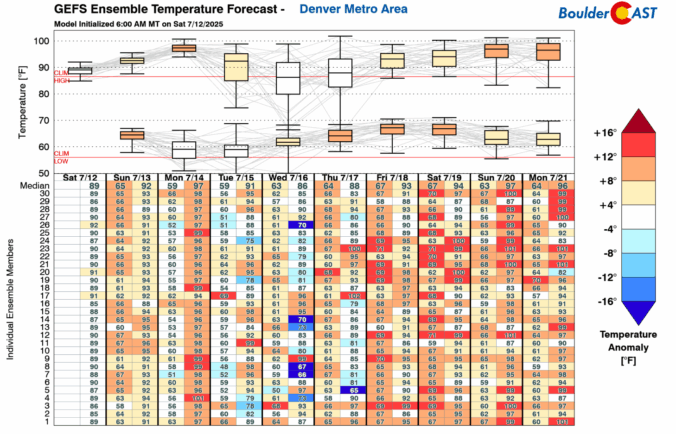

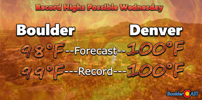
Wednesday brought historic heat across the Front Range, with Boulder hitting a record high of 101°F—the city’s hottest day in over a decade. A weak cold front has since cooled things off slightly, ushering in a good chance of storms the next few days as well. Sunday into Monday turn drier and hotter again as reverse monsoonal flow sets up, potentially stifling our typical summer storm pattern for a bit.

Live View of Boulder

Current Conditions

Live Radar

Recent Premium Posts

BoulderCAST Daily – Sun 01/11/26 | A mild Sunday with readings reaching the 50s
🌤️ Mild & Melty Sunday: Light winds and patchy clouds, with lingering snowpack …
BoulderCAST Daily – Sat 01/10/26| Widespread sunshine and moderating temperatures this weekend as our recent snow melts off
🌤️ Calm Saturday: Winter storm systems have departed the state, leaving behind a …
BoulderCAST Daily – Fri 01/09/26| Snow ends quickly this morning with a quieter weekend in store
❄️ Overnight snow bands: A second push of upslope after midnight sparked narrow …
3-Day Forecast

Trending Content

© 2026 Front Range Weather, LLC