
Page 19 of 550
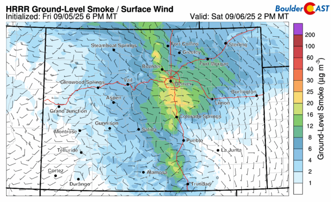
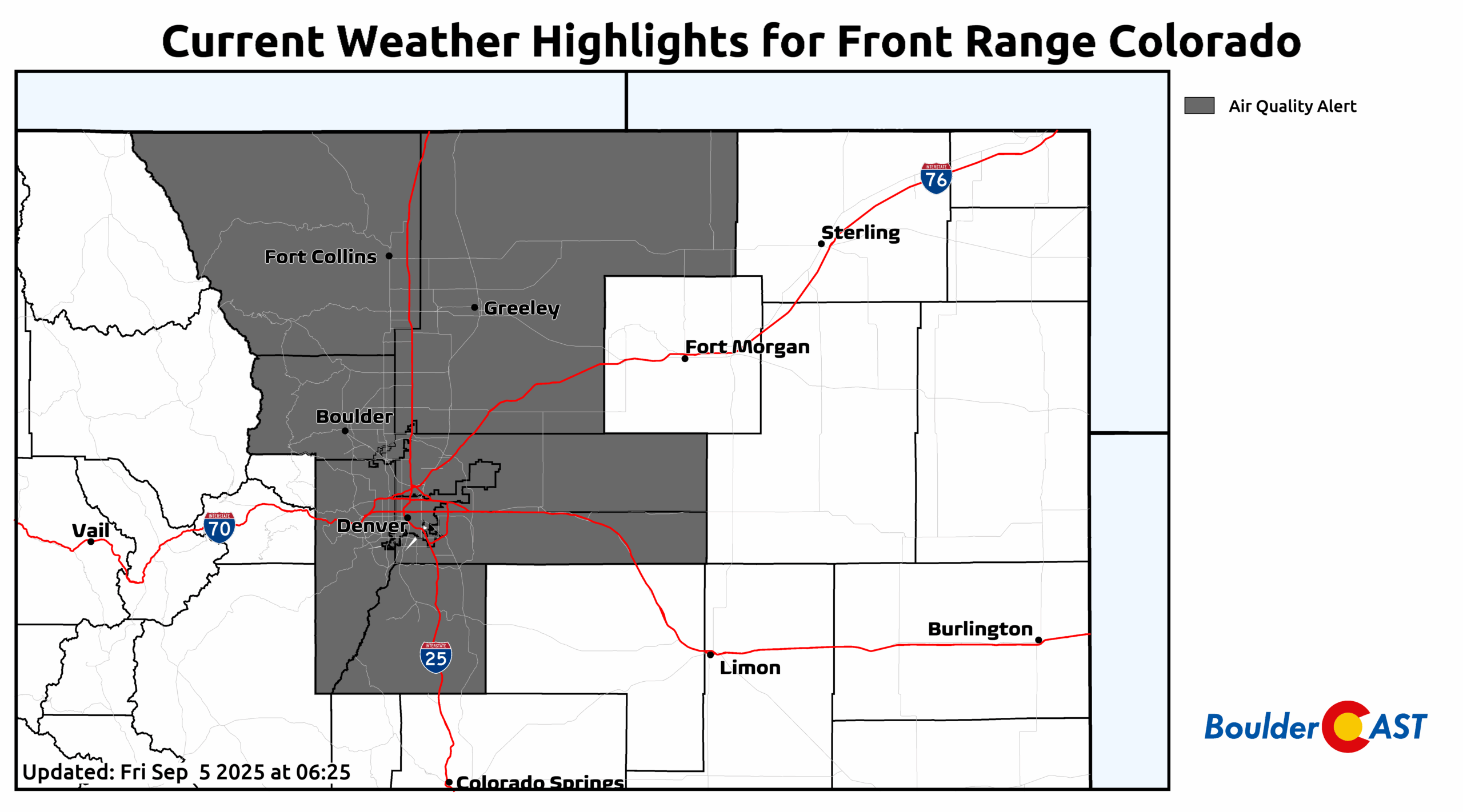
Last week’s cold front didn’t just drop temperatures—it dragged in a wall of chemical-scented smoke that turned the Front Range skies hazy and acrid. The days ahead are shaping up to be much more pleasant with warmer temps, limited storm chances, and a break from the smoke (at least for now) under southwest flow. Read on for a full breakdown of this week’s weather, including when to expect the best shot at rain and whether any smoke may return in the extended.
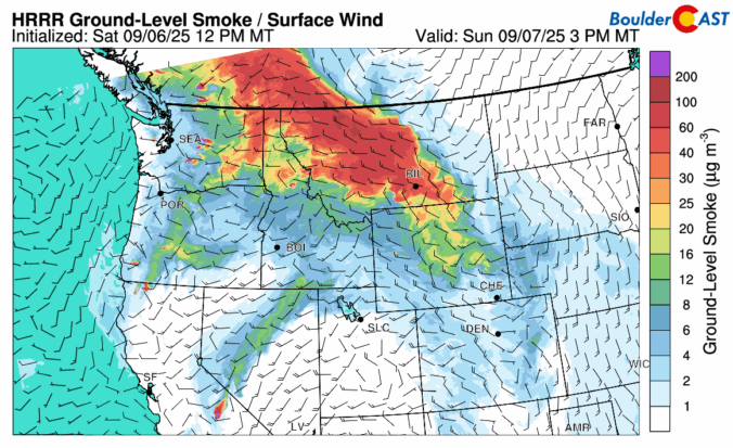
*Premium* BoulderCAST Daily – Sat 09/06/25 | Smoke lingers with an isolated late-day shower possible
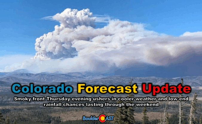
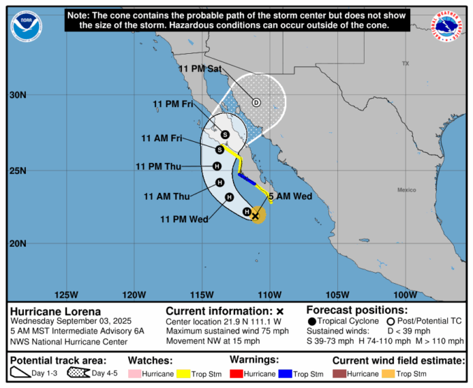
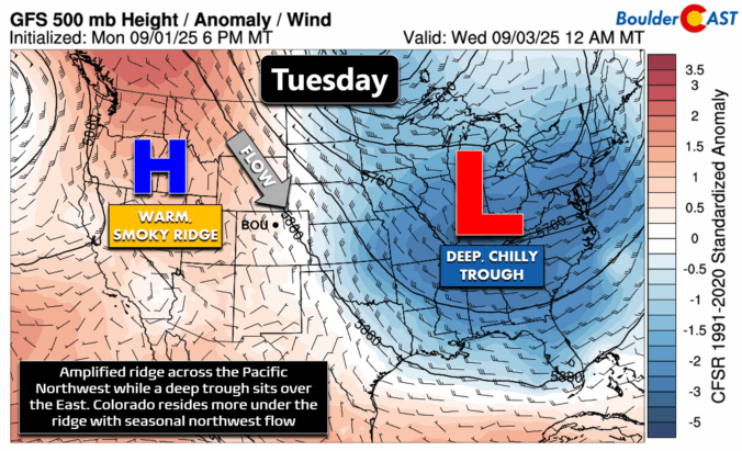
Thursday’s shaping up to be a busy weather day across the Front Range. We’re looking at hot temperatures, gusty winds, and a cold front arriving by evening that’ll bring a noticeable drop in temps — along with a wave of wildfire smoke. We’ll walk through what to expect today, how the weekend is shaping up, and whether any moisture from Hurricane Lorena might sneak into the region.

Live View of Boulder

Current Conditions

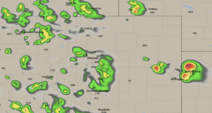
Live Radar

Recent Premium Posts

BoulderCAST Daily – Sun 01/11/26 | A mild Sunday with readings reaching the 50s
🌤️ Mild & Melty Sunday: Light winds and patchy clouds, with lingering snowpack …
BoulderCAST Daily – Sat 01/10/26| Widespread sunshine and moderating temperatures this weekend as our recent snow melts off
🌤️ Calm Saturday: Winter storm systems have departed the state, leaving behind a …
BoulderCAST Daily – Fri 01/09/26| Snow ends quickly this morning with a quieter weekend in store
❄️ Overnight snow bands: A second push of upslope after midnight sparked narrow …
3-Day Forecast

Trending Content

© 2026 Front Range Weather, LLC