
Page 16 of 540
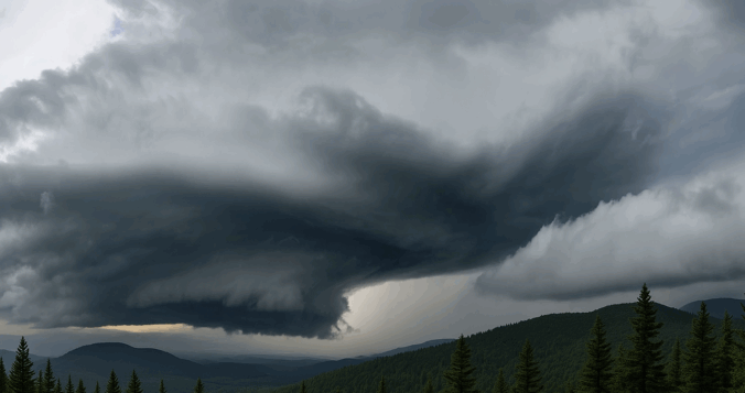
Wednesday may have felt underwhelming across the lower elevations of the Front Range, where lingering low clouds kept things calm and cool for much of the day — but just west of Boulder, up in the sunshine-soaked Foothills, something rare and striking took shape Wednesday afternoon. A graceful funnel cloud twisted above the mountain peaks in a spot where such phenomena almost never occur. We explore why tornadoes (and their funnel-shaped precursors) are so uncommon in Colorado’s higher terrain, and take a closer look at what makes broader Boulder County particularly adverse to tornado development.
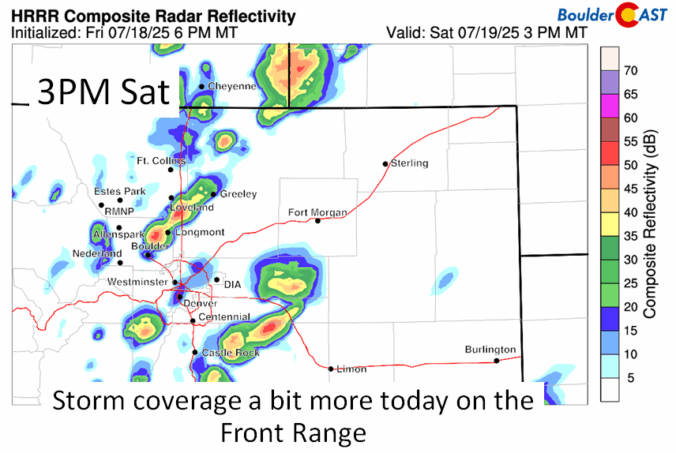
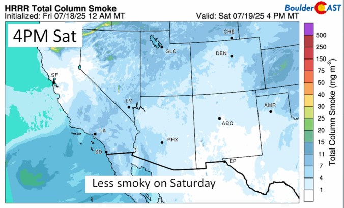
Monsoon season may have officially started earlier this month, but it’s off to a sluggish and lack-luster beginning across Colorado. Boulder has seen frequent storms—yet little meaningful rain—and wildfire smoke from the Western Slope and neighboring states is starting to pool to our west. A cold front arriving Tuesday night will bring cooler temps and a bump in thunderstorm chances for Wednesday, followed by a promising shift toward a more classic monsoonal setup Thursday through the weekend ahead with continued daily storms. This week, we’re tracking some heat, smoky haze, and hopefully, a few solid soakings of rain.

Live View of Boulder

Current Conditions

Live Radar

Recent Premium Posts

BoulderCAST Daily – Thu 11/13/25 | Staying well above normal for highs
🌤️ Ridge of high pressure remains over the Rockies, keeping us warm these …
BoulderCAST Daily – Wed 11/12/25 | Staying warm, increased wave cloud activity will limit Northern Lights viewing tonight
🌤️ Ridge of high pressure remains over the Rockies, bringing moisture and wave …
BoulderCAST Daily – Tue 11/11/25 | Exceptional November warmth holds strong through Friday
☀️ Warm and quiet stretch: Ridge of high pressure keeps the Front Range …
3-Day Forecast

Trending Content


© 2025 Front Range Weather, LLC