Everything is on-track with our spring (winter?) storm. We provide a few last details, potential bust scenarios, and our final snowfall forecast map.
T
he main mid-level storm system is about to enter western Colorado. Showers and thunderstorms are already breaking out across the High Country. This wave of very potent atmospheric lift will move east and pass over the Front Range from late morning into the evening hours. This lift is fueled by a passing jet streak, divergence ahead of the incoming trough, low-level frontogenesis, and strong instability in the atmosphere. All of this will facilitate moderate to heavy rainfall developing by mid-day changing to heavy snow by mid-afternoon and continuing into the evening hours.
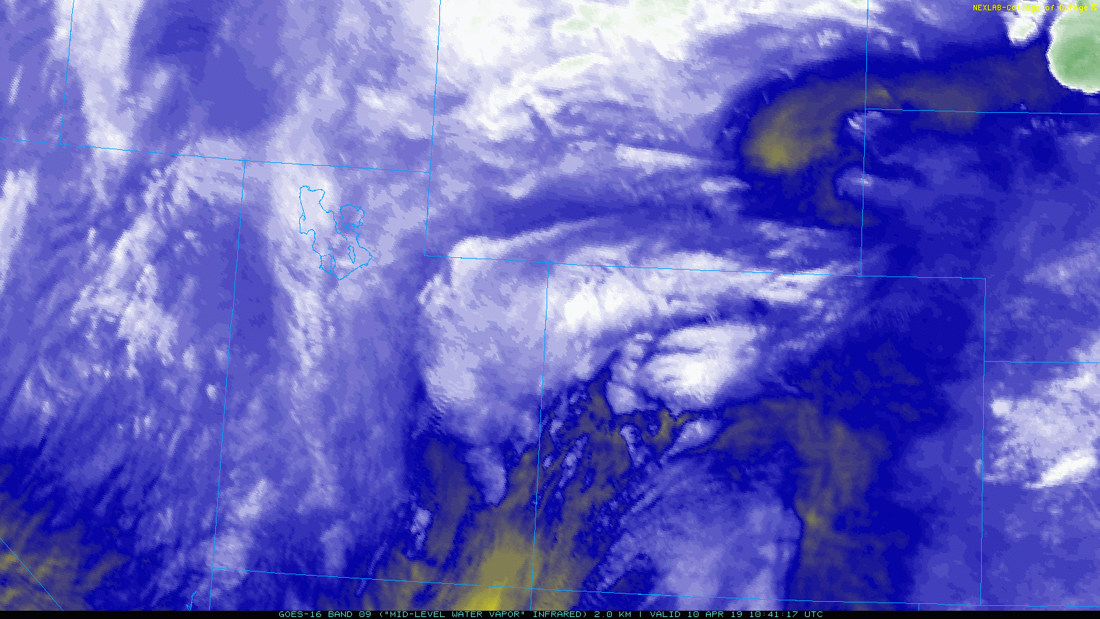
GOES-East water vapor animation from Wednesday morning
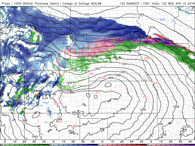
Despite media hype about this storm being “Bomb Cyclone 2.0”, this is actually NOT the case. While the developing storm will intensify rapidly across southeast Colorado this afternoon and evening, it will be a far cry from the extremely strong and historic storm we experienced just four weeks ago. The central pressure is forecast to drop to around 980 mb. This is not a bombogenesis scenario. Nonetheless, it still will be a formidable storm. Just don’t expect as wild of conditions as we saw from our last blizzard.
Everything we discussed in our forecast update yesterday is still on-track. As the surface low intensifies across southeast Colorado, so too will the north-northeasterly flow into the Front Range. This will pull southward the colder air through the afternoon, changing rain to snow for everyone between noon and 4 PM.
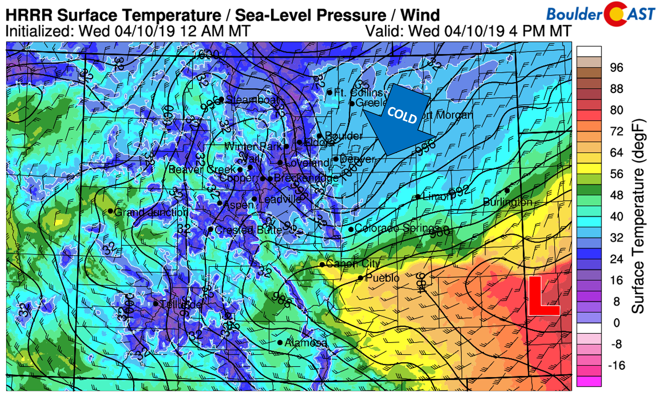
HRRR surface temperature forecast for 4PM today. Cold air filtering in will change rain to snow quickly
The atmosphere will be very unstable through early evening, which will make for embedded pockets of very heavy snow during the first several hours after change-over. We’re talking snowfall rates of 1 to 2″ per hour. This combined with winds gusting at times from 25 to 45 mph will make for intermittent white-out conditions and troublesome travel. We do think that the Blizzard Warning that is in effect for Denver (but not Boulder) is definitely overkill… We recommended not travelling after the change-over to snow Wednesday afternoon, if possible. Sorry to say, but it seems moderately likely the flights into and out of DIA will be impacted late afternoon through the entire evening.
Our only lingering concern is the potential for localized higher snow totals resulting from a stationary heavy snow band. While most of the Metro area can expect between 0.5 and 1.0″ of beneficial moisture from this storm, some models are hinting that localized areas could potentially see double this amount. This is the result of strong northeasterly winds meeting with northwesterly winds in the low and middle levels of this atmosphere. Along the line where these winds meet, air is forced upward very sharply which creates intense snowfall. The GFS temperature and wind map for 700 mb (10,000 feet elevation) below shows this convergence line.
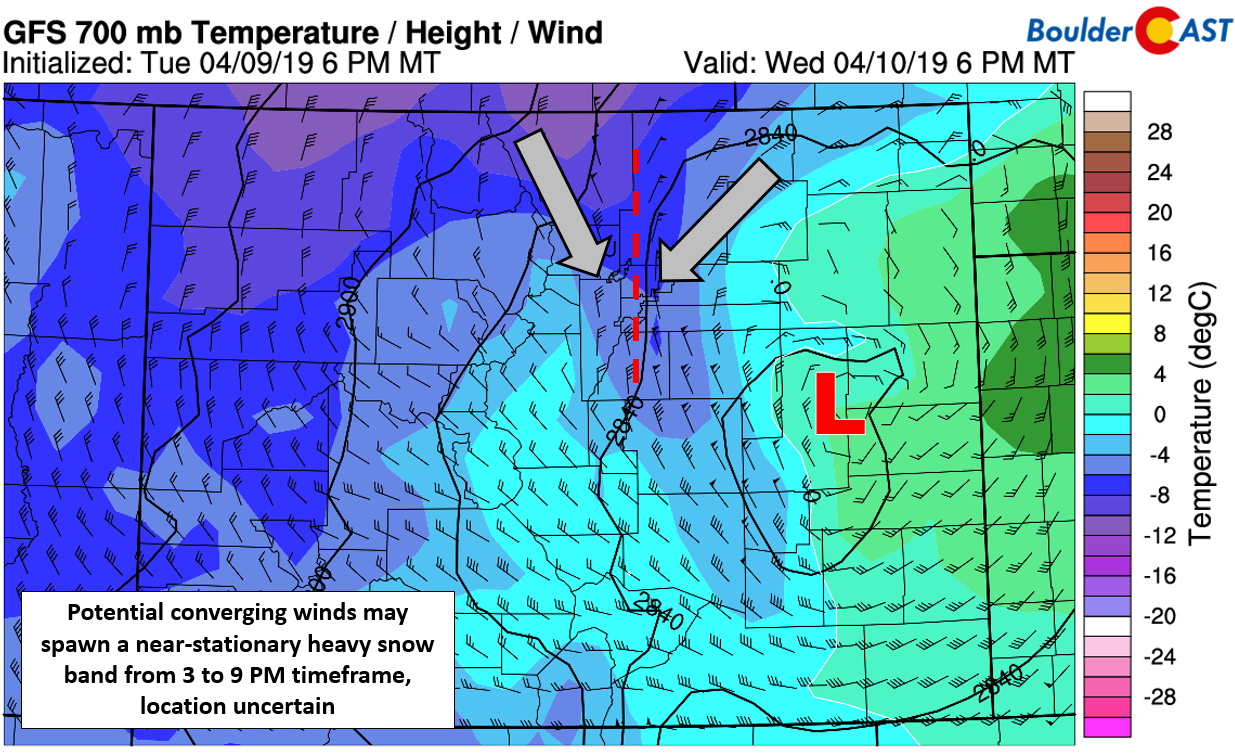
We want to stress that the location (and even the existence) of this potential convergence line is not known. Not all models are showing as sharp of convergence (or convergence at all), and each successive model run develops the band over a slightly different location. The area between Boulder, DIA, and Greeley seems to be at the highest risk, but we still think the odds of this happening at all are less than 20%.
Our latest snowfall forecast map is shown below, with no changes from our preliminary map issued yesterday. Predominantly northerly flow will favor the southern Metro area. The higher amounts in the Foothills are due to the colder temperatures and earlier onset of the snow (as of 10AM it’s already snowing up there!).

“Blizzard-like” conditions are questionable for most of the Denver-Boulder area. The true blizzard, however, will be further southeast across the farmlands where gusts up to 60 mph are possible (Limon, Burlington, Sterling).
The threat of heavy snow should be over by 9 PM, with lighter snow lingering overnight. Snow will wind down early Thursday morning from west to east, with temperatures remaining cool in the 30’s and overcast skies.
We stress again, keep your expectation for this storm low and you won’t be disappointed with what ensues…
Stay safe, stay warm, stay home!
Through Thursday April 11th, save 25% on BoulderCAST Premium with discount code SNOW. [Sign up now]
Spread the word, share our forecast:
.


You must be logged in to post a comment.