Today will bring the best chance of precipitation for the week to the Front Range as a small but potent wave treks across western Colorado.
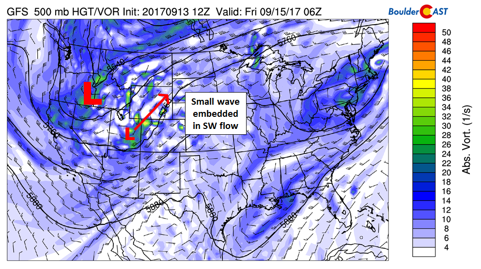
The 500 mb vorticity map below shows a autumn-like trough digging into the Pacific Northwest (big “L”), and also the small wave moving through Utah and western Colorado tonight (little “L”). Moisture in eastern Colorado, especially at the lower levels, will be fairly low today and tonight. The bulk of the precipitation will remain in western Colorado and Wyoming. However, there will be a decent chance of storms today across the Metro area…maybe 20% between 3PM and midnight this evening as the disturbance approaches. Highs will be cooler today in the low to middle 80’s with mostly cloudy skies developing by afternoon.

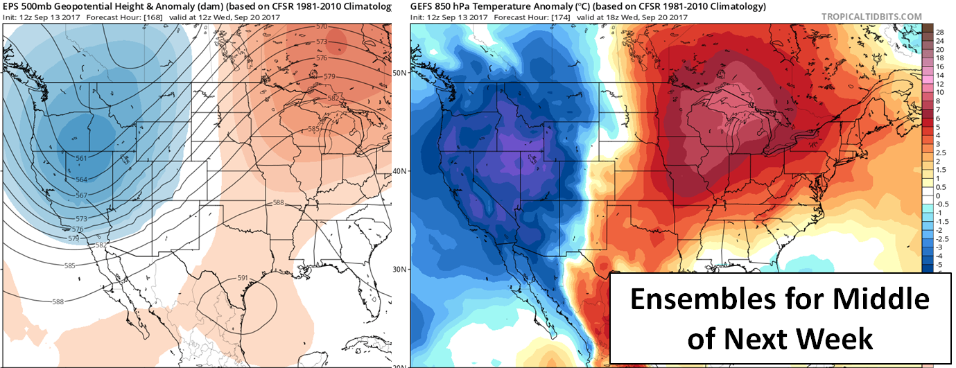
This big trough across the Northwest is actually cold enough for snow in the higher elevations of western Wyoming and Montana! Those wondering when snowfall may return to our Mountains should keep an eye on the middle of next week as ensembles are coming into agreement for an even colder and deeper trough developing across the West…

LEFT: 500 mb height anomaly for the middle of next week from the ECMWF. RIGHT: GFS ensemble 850 mb temperature anomaly
Remember, these daily forecasts are Premium content. Periodically, we open this forecast up to all of our readers. Today is one of those days!
Sign up today to get the best BoulderCAST experience, including these forecasts every day, extended and enhanced graphical forecasts, chat room and forum access, complete 6-day hiking forecasts, early viewing of select content and much more!
In celebration of the recent introduction of our SummitCAST hiking forecasts, use the promo code SUMMIT15 to receive 15% off our annual subscription. LEARN MORE


You must be logged in to post a comment.