Today’s forecast covers the “cool” front that will move through later today, the heavy snow dumping in the Mountains, and the on-going atmospheric river event in the southwestern United States.
Remember, these daily forecasts are Premium content. Periodically, we open this forecast up to all of our readers. Today is one of those days!
Sign up today to get the best BoulderCAST experience, including these daily forecasts every morning, complete 6-day skiing and hiking forecasts, access of all our Front Range specific weather models, additional storm updates and much more!
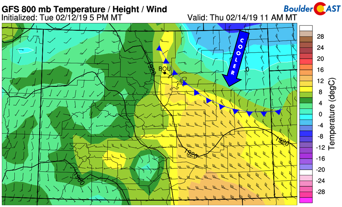
We may actually be able to squeeze out two more additional half-decent winter days before the colder air truly arrives this weekend. With today’s trough passing so far north, the associated cold front will only brush northeast Colorado this afternoon and evening, with the coldest air remaining out east across the farmland. The timing of the cooler airmass into the Denver Metro area is looking to be early to middle afternoon from the north and east. Most areas should easily get into the lower to middle 50’s before weak cold air advection kicks in. The furthest south and west suburbs could possibly reach near 60 degrees.
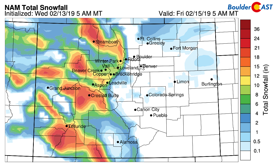
Moderate snow started in the Mountains yesterday afternoon and will continue through tomorrow morning. With all that moisture from the atmospheric river flooding into the region, the long duration, and the strong orographics from the overhead jet, we’re expecting impressive snow totals in the High Country by the time it wraps-up tomorrow afternoon. Widespread totals of 7 to 14″ are possible, with up to 24″ in localized areas near Crested Butte and Telluride. The I-70 corridor should easily pick up 5 to 12″.
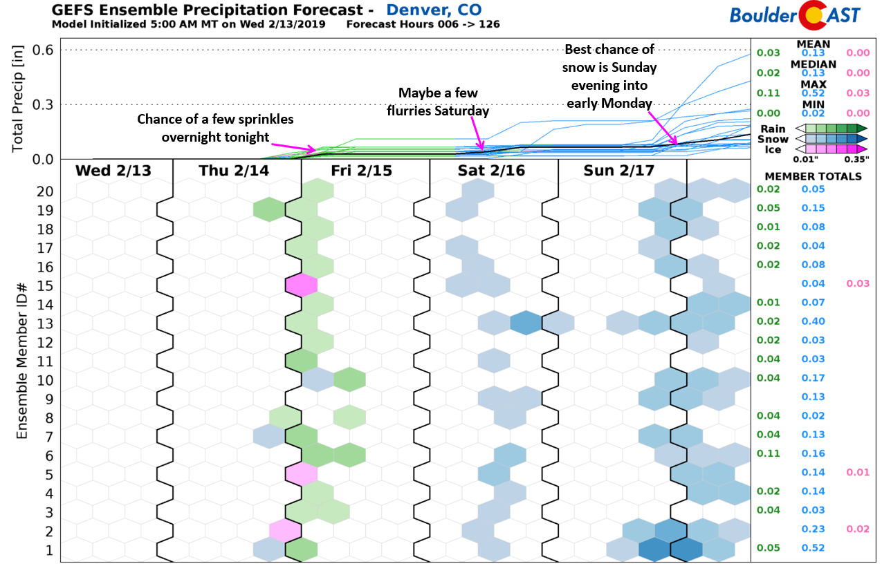
Across the Plains, downslope will keep the area mainly dry despite the deep moisture overhead and weak lift from the trough. It wouldn’t been surprising if a few light rain or snow showers occur late this evening and overnight tonight. Nothing to worry about, however.
The weather pattern in the coming days is still a complicated one as series of disturbances are planned to impact the region. While earlier in the week there was an outside chance of the atmospheric river event persisting into the weekend and thus possibly allowing for a merger with a mid-latitude storm system, that no longer appears to be the case. This is not surprising….An atmospheric river is a delicate, 3000 mile long conveyor belt of moisture. If any portion of that belt gets interrupted, those at the end of the line, like California and Colorado, see the moisture dwindle quickly.
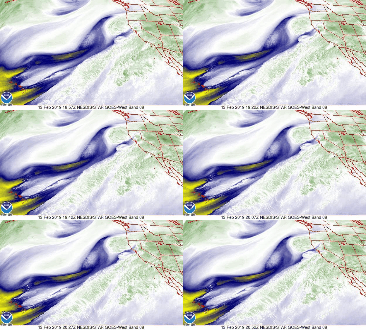
A look at water vapor loop from the brand new GOES-West satellite yesterday when the atmospheric river was hammering California. Impressive!
As you can observe in the panels below, the narrow river of deep moisture will push southward into Mexico by Friday evening. This means Colorado will slip back into a more typical winter pattern.
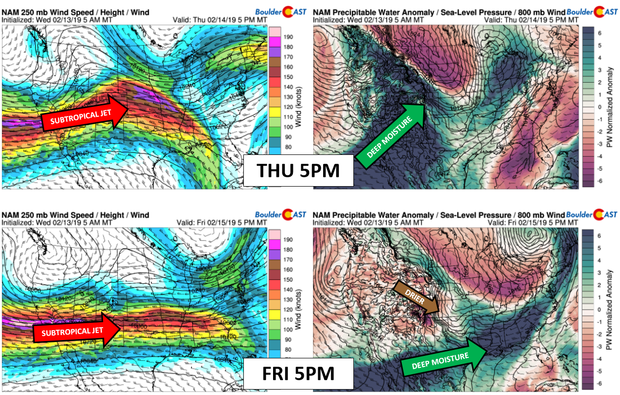
NAM 250 mb winds (left) and moisture anomaly (right) for this evening (top) and Friday evening (bottom).
As mentioned, there will be a chance of a few rain drops or snowflakes tonight, then a chance of a few light snow flurries or showers on Saturday as a similar storm system passes to our north and mainly downslopes the Front Range. At this time, our best chance of snow appears to be towards the end of the weekend and right now it’s not looking like a very good chance at that…




You must be logged in to post a comment.