Today’s forecast covers the changing weather pattern that will lead to much cooler temperatures and a chance of accumulating snow tonight.
Remember, these daily forecasts are Premium content. Periodically, we open this forecast up to all of our readers. Today is one of those days!
Sign up today to get the best BoulderCAST experience, including these daily forecasts every morning, complete 6-day skiing and hiking forecasts, access of all our Front Range specific weather models, additional storm updates and much more!
Building clouds, cooler, and the chance of snow
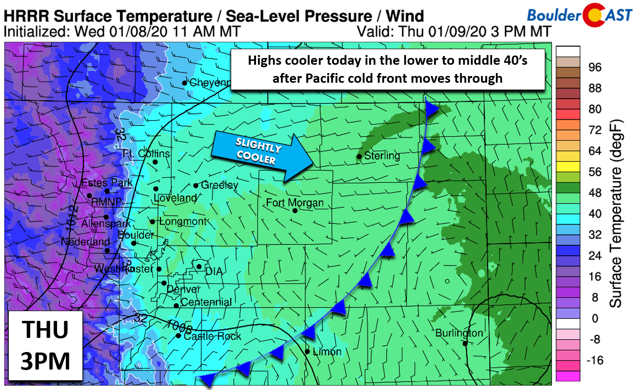
A weak Pacific cold front is progressing from west to east across the central Rockies this morning. It’s hard to pinpoint its location exactly (mountains tend to cause trouble deciphering surface observations to locate weak fronts), but it really doesn’t matter. Temperatures will start mild for January this morning, but then remain cool the rest of the day as the Pacific airmass filters across the Metro area from the west-northwest. Look for highs more than 15 degrees cooler than yesterday. Boulder and Denver should both land in the low to middle 40’s by this afternoon.
As the day wears on, elevated moisture embedded in the southwest flow aloft will work into the Front Range forcing overcast skies upon us. This set-up will favor light snow in the Mountains, but little if any in the Metro area. Still it is possible that a few light rain drops or snow flakes could impact us late this afternoon into the evening hours. No accumulation is expected.
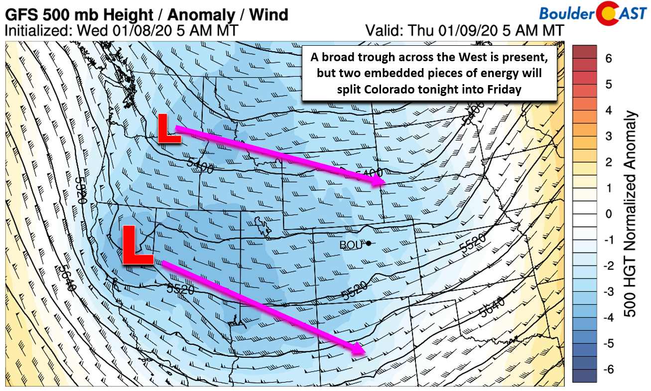
By tonight, two small disturbances embedded in the larger troughy pattern will trek eastward. The southern one will be the stronger of the two. At this juncture, it looks like they will do their darnedest to avoid Colorado, with one skirting just north, and the stronger system passing to our south.
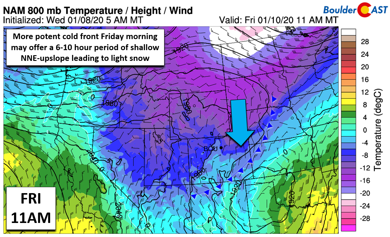
Though there will be some lift moving through tonight into Friday with the passing shortwaves, the lack of a truly consolidated system anywhere near us will mean most of the lift will be cancelled out by a general downslope flow during this time. One glimmer of hope: a stronger cold front is expected to work into our area early Friday morning with perhaps a weak shot of shallow upslope and low-level convergence. This could produce pockets of brief moderate snowfall. If this materializes, we could see minor impacts to the Friday morning commute.
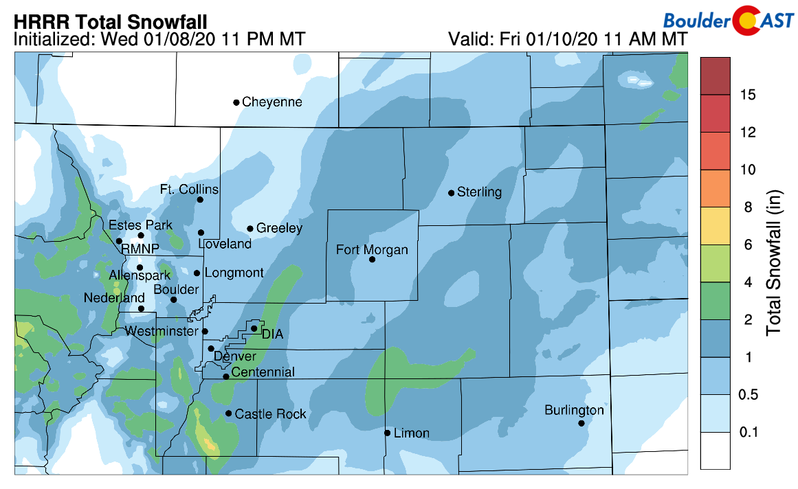
It seems probable that there will be a period of light snow for most of us overnight tonight into Friday morning, with the best chance being south and east of Denver. Accumulation will be minimal, up to 1″ in the luckiest spots. It’s also possible that nothing at all falls for the northwestern areas towards Broomfield, Boulder and Longmont where downslope will be a factor. Highs Friday will stay cold in the low to middle 30’s.


You must be logged in to post a comment.