A stubborn weather pattern is settling in this week, and Colorado finds itself right in the middle of the action—or the lack of it. While the coasts deal with weather extremes, the Front Range gets a quieter blend of mild spells, a couple of cold fronts, and just enough uncertainty to keep things interesting. Read on for our full outlook of the next seven days to see if this translates into meaningful moisture or just more dry January days.
Category: Winter Weather (Page 6 of 139)
These posts contain some discussion of the white stuff, whether it be mountain snow pack or a Front Range snowstorm.

A tandem of low pressure systems — one warm and moisture‑rich, the other colder and more dynamic — teamed up just enough to deliver a surprisingly efficient burst of snowfall across the Front Range to end the week. We break down how this two‑part event unfolded, why the timing mattered so much, and where our forecast over‑ and under‑performed. Continue reading
Winter is about to make a move again along the Front Range for the first time in 2026. After one last mild day Wednesday, a pair of storm systems will team up to bring moisture, colder air, and a decent shot at accumulating snow to finish the week. The setup is a little tricky, the timing isn’t perfect, and the details are still fuzzy due to some uncertainty—but there’s plenty to be hopeful for as this event plays out Thursday into Friday. We discuss the broader setup, how things may unfold and where the biggest impacts could land alongside heavy wet snow.
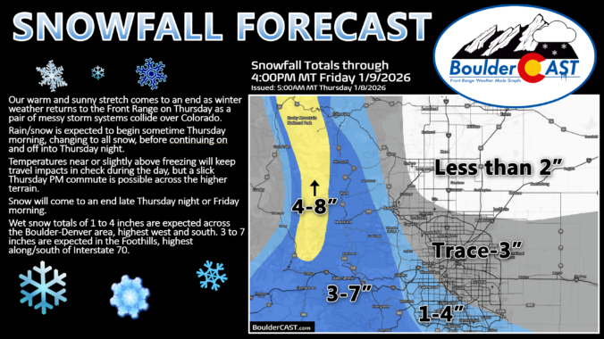
Update (Thu 1/8/26 5AM): Lower end scenarios now appear more likely with this tricky pair of storm systems not phasing together well. Based on latest guidance, we have reduced snow amounts by 1 or 2 inches across the board. Snow map and discussion of amounts are updated. Timing looks fine with rain/snow developing Thursday morning, snow on-and-off during the day into the evening, and snow coming to an end Thursday night or early Friday.
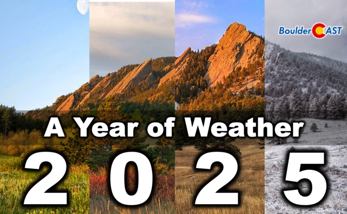
2025 was one of those years where Boulder’s weather never seemed content with a single storyline. We opened with a bitter Arctic punch that delivered our coldest January in nearly two decades, only to swing into a summer packed with 90°+ heat, smoky afternoons, and the hottest day since 2012. The monsoon showed up often but rarely with much enthusiasm, fall dried out in a hurry, and our first snow didn’t arrive until November 29th — the latest on record by a country mile. Now that the dust (and smoke, and snow) has settled, we’ve pulled together a full graphical recap of the temperature swings, precipitation quirks, record‑setting moments, and long‑term trends that defined Boulder’s and Colorado’s atmosphere in 2025. If you want the full story behind the chaos — and a clearer picture of where 2025 truly landed — this is a fun one to dive into. Be warned, there really are 100 charts and visuals to explore. Enjoy!

Warm, gusty weather is kicking off the first full week of 2026, but the atmosphere has a few twists lined up as we move toward the weekend. A stubborn ridge will keep us mild early on as downslope winds ramp up fire concerns. However, a developing trough later in the week will turn us much colder — with even the possibility of snow for Boulder and Denver if the storm track cooperates. The details are still evolving, but there’s plenty to watch in the days ahead.
After a quick burst of weekend snow and our coldest temperatures since early December, the week ahead turns much quieter across Colorado. Temperatures will climb steadily as Boulder and Denver stay dry into the New Year, while the Mountains prepare for a well‑timed round of snow for the holiday weekend. We’ll walk you through the day‑to‑day weather this week, where the snow will fall, and check in on long‑range guidance which still isn’t advertising much in the way of winter for eastern Colorado.
A few wobbly overnight snow bands dropped a light, fluffy coating of powder across the Front Range—right on target with our forecast. We break down where the bands hit, why the snow ratios were so sky‑high, and what this tiny event means for our growing seasonal deficit. We also look ahead to the warm, dry pattern set to carry us into the New Year.
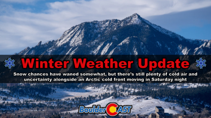
After a stretch of December warmth so extreme it rewrote some record books across the Front Range, we’re finally staring down a pattern shift—though not quite the snowy one we initially hoped for. A pair of cold fronts will bring a sharp temperature drop, a few chances for rain and snow, and at least the feeling of winter back to Boulder and Denver. The details have changed quite a bit in the last 24 to 48 hours, but we’ll walk you through what’s still on the table, what’s no longer likely, and where a few surprises could still sneak in Saturday night.

Live View of Boulder

Current Conditions

Live Radar

Latest Smoke Forecast

Recent Premium Posts

BoulderCAST Daily – Sat 07/11/26 | Here comes the heat!
🥵 Heat start today: Upper 90s start today and continue well into next …
BoulderCAST Daily – Fri 07/10/26 | The heat builds into the weekend
⛈️ Storms around today: A weak impulse of energy favors some isolated storms …
BoulderCAST Daily – Wed 07/08/26 | The Front Range Has Broken Out of the Haze — Storms Fire After Noon
🌬️ Smoke has (mostly) cleared out: Westerly flow pushed the thick plume south/east, …
3-Day Forecast

Trending Content

© 2026 Front Range Weather, LLC