


A secondary weather system will bring a return of rain and snow to our region on Wednesday. This system is slightly warmer and weaker than the one earlier in the week. Nonetheless, some accumulating snow is possible later tonight. Read on for details.
Category: Winter Weather (Page 127 of 161)
These posts contain some discussion of the white stuff, whether it be mountain snow pack or a Front Range snowstorm.
Monday evening’s wet snow brings us closer to normal precipitation for the month of March. We review the snow totals from across the region and discuss our next chance of snow.
We have gotten numerous requests to streamline your ability to monitor upcoming winter weather. To answer this call, we’d like to introduce you to SnowTracker, a new hub that consolidates a wealth of weather information related to forecasting and tracking Mother Nature’s most wintry moments. SnowTracker acts as a focal point to keep an eye on developing winter storms for Colorado and what is already on the ground.
Available information includes…
- Models snowfall forecast maps from the GFS and NAM
- Ensemble forecasts, including our Snowfall Probability Charts
- A quick glance at the latest PowderCAST forecasts for all the Colorado ski resorts
- Current weather conditions, live radar, and more than a dozen live webcams from across the region
- Daily snow observations and cumulative seasonal snow totals for Boulder and Denver
- Current snowpack and drought coverage for Colorado
SnowTracker will be seasonally available on BoulderCAST during the months of September through May. Please do enjoy!
.
Despite the warm weather of late, snow is once again headed to our region Monday evening and night. We provide details on the timing and potential snowfall amounts for this quick-moving spring storm.
Premium Storm Update (Mon Mar 26 at 7:00 AM) Minor northward adjustments for tonight’s rain/snow: READ NOW
We often include at least some discussion in our wintry forecasts about snow-to-liquid ratios. In this post, we explain what they are, why they matter, and examine the historical snow ratio record for Front Range Colorado.
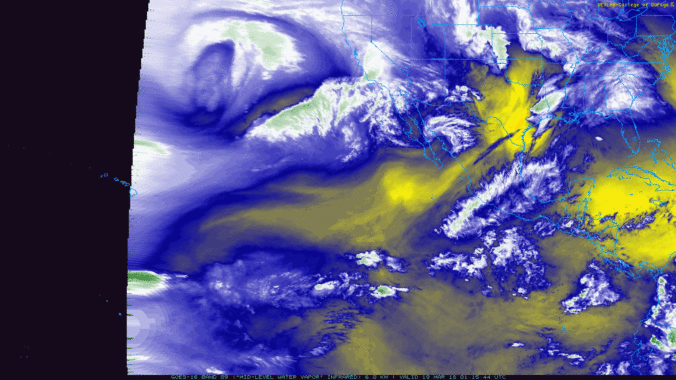
As we mentioned in our weekly outlook, a true atmospheric river event is underway, pumping deep tropical moisture into the southwestern United States right now! The moisture influx will mainly be impacting California and Nevada, but Colorado won’t escape totally unscathed. Plus we take a look ahead to a soggy/snowy forecast for early next week.
Live Radar

Trending Content


Recent Premium Posts

BoulderCAST Daily – Tue 11/10/26 | Clouds Increase Today, But Colorado’s Dry Pattern Rolls On
🌤️ A Few More Clouds Today – Mountain wave clouds are developing along …
BoulderCAST Daily – Sun 11/08/26 | Mild November Weather Continues, Even With A Cold Front Midweek
☀️ Sunny and warm for early November – Temperatures in the middle to …
BoulderCAST Daily – Sat 11/07/26 | A Pleasant Weekend With Dry Weather For a While…
☀️ Sunny and Pleasant – Highs in the lower 60s this afternoon trend …
© 2026 Front Range Weather, LLC