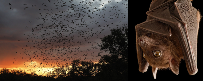
We examine the fascinating amount of information about bats that can be gleaned from their signatures on weather radars!
Category: Weather in the News (Page 11 of 16)
These posts cover interesting weather phenomena from around the world, and won’t be specific to Boulder County. However, Earth is very diverse in the world of weather, so you will surely learn a thing or two.
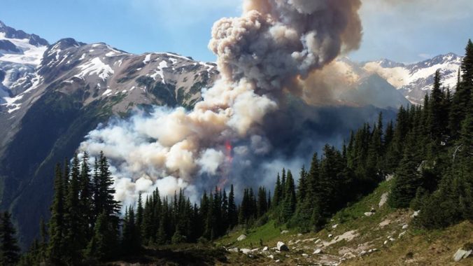
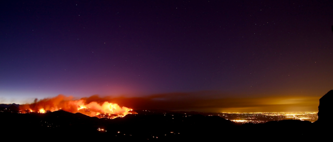
Historical warmth and persistently dry conditions have spawned numerous wildfires across the Pacific Northwest and British Columbia over the past few weeks. With a change in our synoptic flow direction yesterday, thick smoke has pushed into the Denver Metro area creating reduced visibility and air quality. We examine how the smoke got here and how the forecast for the weekend is shaping up.
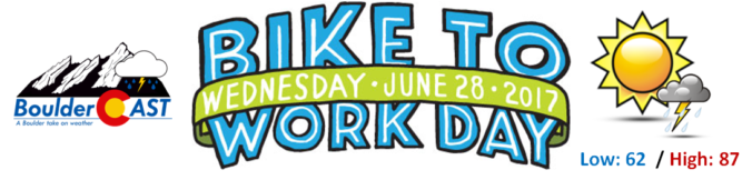
The last Wednesday in June has arrived, the day when thousands of hard-working citizens take to the bike paths for their morning and evening commutes. Yes, it’s Bike to Work Day 2017 tomorrow! Five out of the last ten Bike to Work Days have seen measurable precipitation in Boulder. How does tomorrow’s forecast look for the Metro area? Read on to find out if the bikers will be getting wet this year….

May 2017 has already cracked the top 10 for wettest Mays on record in Boulder. Unfortunately, this trend looks to continue right until the end of the month. Read on for the soggy details as we provide our complete forecast for Memorial Day weekend.
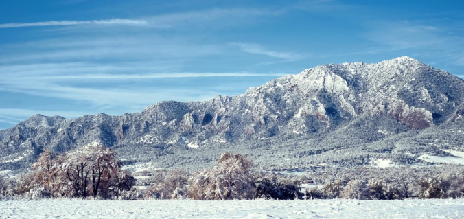
After experiencing near-record snowfall last winter with a historically strong El Niño in place, the better part of the last year has seen below normal precipitation across most of eastern Colorado. Drought has continued to expand and intensify through the winter season. However, a fruitful pattern shift is ahead, beginning with our first spring storm of the year! Continue reading as as we provide an update on the drought and our thoughts on the upcoming storm.
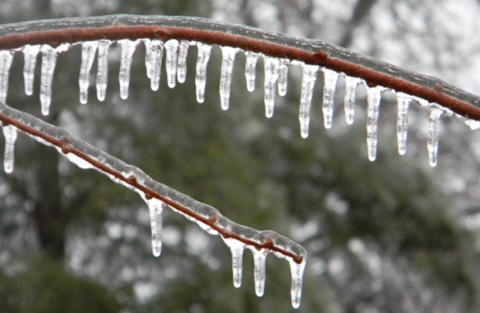
Yesterday saw a mix of wintry precipitation fall across the Denver Metro area. Snow pellets and snowflakes were observed in spots, but closer to the Foothills near Boulder, freezing drizzle produced a dangerous glaze of ice that was responsible for numerous car accidents (and probably many pedestrian slips and falls). We explain the rare weather set-up the led to the somewhat unexpected occurrence of ice in Boulder.
As one would expect during the month of January, our driest month of the year, this week will be relatively quiet across the Front Range. We’re tracking continued Mountain snowfall early in the week, and with a large trough moving in, cooler temperatures will linger statewide through the weekend. Continue reading for our complete weekly outlook.
While the fire ban has been recently lifted in many Front Range counties, September did little to relieve the parched landscape with yet another month of well below normal precipitation. Will October offer up the soaking rain and mountain snow that we desperately need? Read on as we examine Boulder’s climatology and consider the current state of the atmosphere to give our outlook for the next month.

Live View of Boulder

Current Conditions

Live Radar

Recent Premium Posts

BoulderCAST Daily – Wed 11/05/25 | Relatively cooler today, but far from cool by November standards
🌡️ Cooler but still mild today: A weak cold front has pushed south, …
BoulderCAST Daily – Tue 11/04/25 | Soaring into the 70s today, but a tad cooler tomorrow behind another dry cold front
🌡️ Morning temperature split: Thanks to weak downslope winds, some areas are waking …
This Week in Colorado Weather: November 3, 2025
Sunday’s record-breaking November heat will give way to a dramatic cooldown on Monday, …
3-Day Forecast

LATEST SMOKE FORECAST

Trending Content


© 2025 Front Range Weather, LLC