
This week’s weather begins cooler but seasonal with a chance of a rain/snow mix. Don’t worry though. Warmth returns later in the week with near 70-degree temperatures. Read on for more in-depth forecast discussion.
These posts take a look back at recent weather events, like snow storms or severe weather outbreaks, and evaluate how the forecast played out. We evaluate how well the models predicted what actually occurred, and offer insight into what can be learned and applied moving forward.
This week’s weather begins cooler but seasonal with a chance of a rain/snow mix. Don’t worry though. Warmth returns later in the week with near 70-degree temperatures. Read on for more in-depth forecast discussion.
In the wake of a gorgeous spring-like weekend, sunshine and above normal temperatures will continue for the week ahead. However, a cold and likely snowier pattern change is finally on the horizon. Read on for full details of our forecast, and a quick review of the toasty month of February.
After a three-week snow hiatus, the flakes have returned! While most of us awoke to only a few inches of snow, some spots got dumped on by more than a foot. We review our forecast and go over the snow totals from across the region.
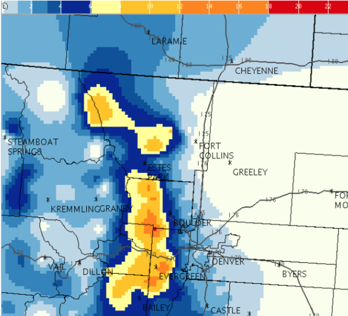
After a mild weekend, we return to winter starting this evening as an upper-level shortwave dives southeast bringing snowfall to Boulder, the adjacent Foothills, and Denver. After the snow moves out early Tuesday, temperatures moderate with sunshine and low 50’s to round out the week. How much snow is on tap? Read on to find out!
With a strong northwesterly jet overhead and some stable air aloft, conditions were primed for a downslope wind event Monday across the Front Range. It was therefore no surprise that the National Weather Service issued a High Wind Warning for the Foothills yesterday afternoon and evening, excluding the Plains. We review some of the peak wind gusts and discuss the potential for a second wind event later this week.
After a breezy and mild Sunday, this week’s weather is all about the wind and warmth. The upper-level jet will be overhead these next few days, producing west-northwest winds as high as 70 mph at times, especially in the Foothills. A ridge then rebuilds by midweek, sending our highs soaring into the low 70’s. Nothing to speak of in terms of precipitation, though the mountains will see some snow. Time to get those shorts out!
On paper, the 2015-16 super El Niño became everything that it was forecast to be, with water temperatures across the equatorial Pacific Ocean warming to near-record levels. However, the location and extent of the warming, and the global impacts, have been anything but typical. We discuss how well our last El Niño forecast verified and the outlook for the remainder of our winter season. What can Boulder expect in the way of precipitation, snowfall, and temperatures heading forward? Read on to find out.
Are you beginning to anticipate those hot, sunny, and at times, stormy summer afternoons? You’re definitely not alone. Winter in Colorado can be long, with snow possible (and dare I say, common) nine months out of the year, even on the Plains. Following our biggest single-storm snow event in nearly three years, we check in on our snow totals and mountain snowpack thus far for the 2015-16 winter season.


© 2026 Front Range Weather, LLC
You must be logged in to post a comment.