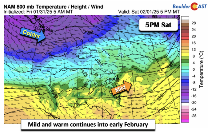
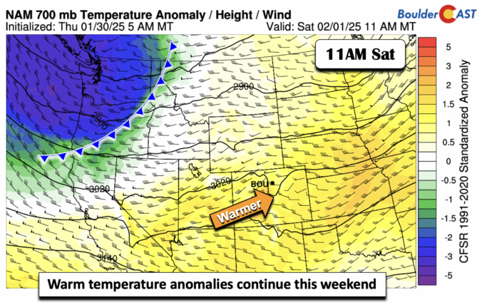
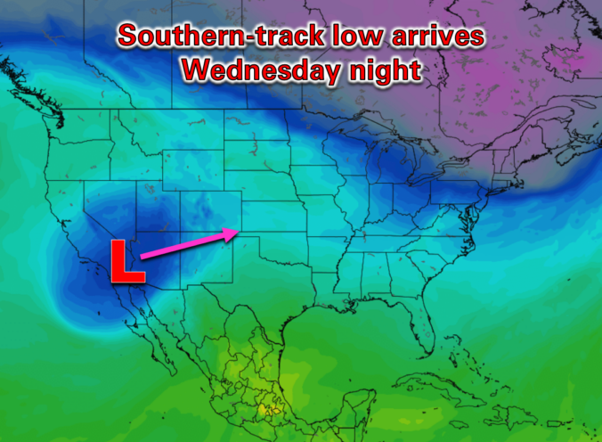
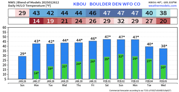
Mild weather continues today and the remainder of this weekend. Zonal flow aloft will continue a westerly downslope flow on the Plains, spelling out highs in the middle to upper 50s today and tomorrow. In fact, some guidance suggests we could get into the 60s early next week. We will need to watch for a potential cold front that could …
The last day of January and the last day of our work week (for most of us!) closes out with mild temperatures. Ridging in the wake of the departing closed upper low will spell out upper 50s across the Plains. Lots of sun today will make for a great afternoon to spend some time outdoors after or during your work …
Today will be almost a carbon copy of Monday with the broader pattern across the West remaining nearly identical. We do see about 1°C of warming noted at the 700mb level aloft, which would translate into slightly warmer temperatures through the Metro area, but only by ~1 to 3°F at the surface. Highs today should top out between 44°F (north …
After more than 18 hours of continuous snowfall, the flakes finally came to an end overnight across the Boulder-Denver area. Skies remain socked in this morning with low clouds and even some patchy fog in areas, but things will be improving rather quickly as we move through our Sunday with drier air working into the region from the southwest aloft. …
All is quiet today under another afternoon of below normal temperatures in the lower 30s. Winds, however, will pick up later today and tonight ahead of a front that will move through mid to late afternoon Friday. Increasing warm downslope winds will develop tonight and continue into the morning hours of Friday. That should lead to gusts on the Plains …
Owarmup from yesterday with lower 40s thanks to Chinook winds is over. A cold front moved through late last night and ushered in a return of chilly to cold temperatures. These temperatures are not Arctic like we saw several days ago, but do return us to lower 30s the next few days. All is expected to be dry, however, given …
Warm Chinook winds will take over today, spelling out highs some 30 or so degrees warmer today compared to Monday. While it was bitter cold yesterday, our highs this afternoon with west-northwest downslope winds will bring highs approaching the lower 40s. Some wave clouds may limit that warmup, but nevertheless it will feel balmy compared to the Arctic air we …