

Category: Premium Content (Page 58 of 450)

This content is for Premium Members only.
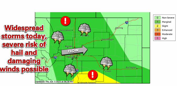
Premium BoulderCAST Daily – Fri 06/06/25 | Highs in the 60s with numerous storms, some being severe

Adisturbance to our north in Wyoming will track east-southeast into Nebraska over the next 24 hours. As it does so, it will bring strong mid-level energy across the state. This energy will peak during the daytime, fueling scattered to numerous showers and storms. A persistent easterly flow will exist across Colorado today with highs generally in the low to mid …

Premium This Weekend in Colorado Weather: Stormy skies give way to warmer days

For the next couple of days, a broad trough will linger over the region, keeping temperatures cooler than normal with plenty of chances for rain. But starting Saturday, a ridge will begin forming over the Pacific Northwest and will bring warmer, drier conditions to our area. Not scorching hot, and not completely dry—just a shift toward more typical early summer …

Premium BoulderCAST Daily – Wed 06/04/25 | A bit warmer with scattered storms this evening, more of the same tomorrow

Adisturbance will approach Colorado today from the southwest bringing warmer temperatures but continued chances for late-day thunderstorms. The system can be seen below as a petite closed-low pressure spinning over the Sonoran Desert in southwestern Arizona. Notice the clouds already streaming into the Front Range this morning well out ahead of this system. Much of the moisture and energy from …

Premium BoulderCAST Daily – Tue 06/03/25 | Drizzle ends early but we stay chilly; warmer with more storms tomorrow

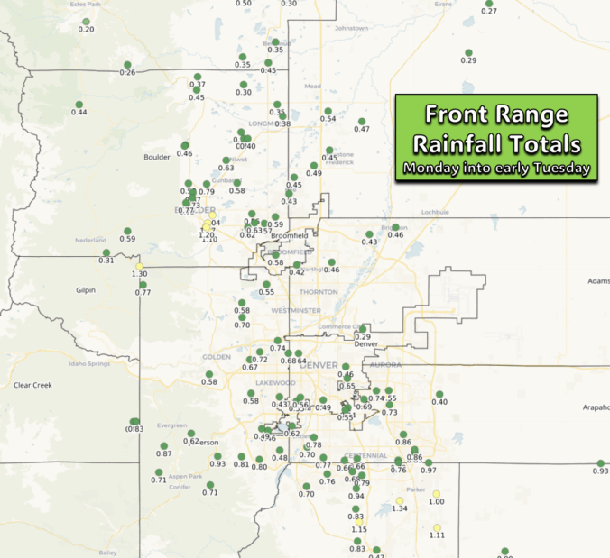
Yesterday’s thick cloud cover prevented thunderstorm development across the region during the afternoon and early evening, reducing the risk of severe storms. However, a cold front pushed through later in the evening, combined with upslope flow overnight, bringing widespread rainfall—especially to areas west and southwest of Denver where the upslope had the greatest impact. The regional radar animation below captures …

Premium BoulderCAST Daily – Sun 06/01/25 | Trending unsettled as we head into the first part of the week

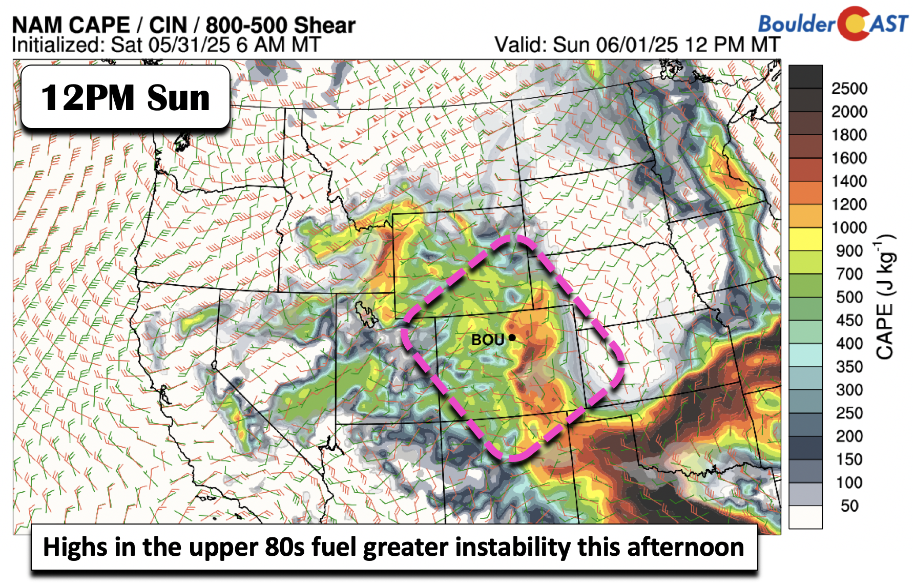
Instability will be higher this afternoon compared to Saturday. In addition, a surface trough will aid storms to partly survive their trek east from the Foothills. Temperatures will be warmer as well in the mid to upper 80s on the Plains and mid to upper 70s in the Foothills. No severe storms are expected today, but some brief gusty winds …

Premium BoulderCAST Daily – Sat 05/31/25 | Drier conditions for the last day of May but unsettled early next week

High pressure ridging will build in from the west today and tonight. An area of low pressure remains to our east over Kansas, Nebraska, and Missouri. It is far enough removed that with the subsidence over us, we should see much drier conditions today. While we cannot rule out a stray isolated shower or two, mainly for areas along the …

Premium BoulderCAST Daily – Fri 05/30/25 | Afternoon and evening scattered thundershowers once again

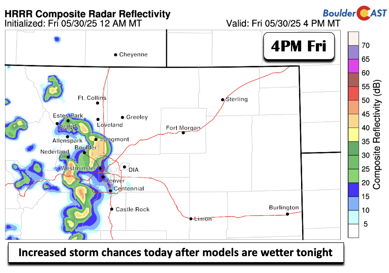
That pesky unsettled northwest flow continues again today and much of this weekend. That will continue to spell out the chances for afternoon and evening scattered showers and thundershowers. At this stage, no storms are expected to be severe, but heavy downpours and frequent lightning are the main threats. For today, we increased our rain chances somewhat compared to what …

« Older posts Newer posts »