Category: Premium Content (Page 270 of 452)

This content is for Premium Members only.
BoulderCAST Daily – Thu 05/21/20 | Closer to normal after a cold front last night

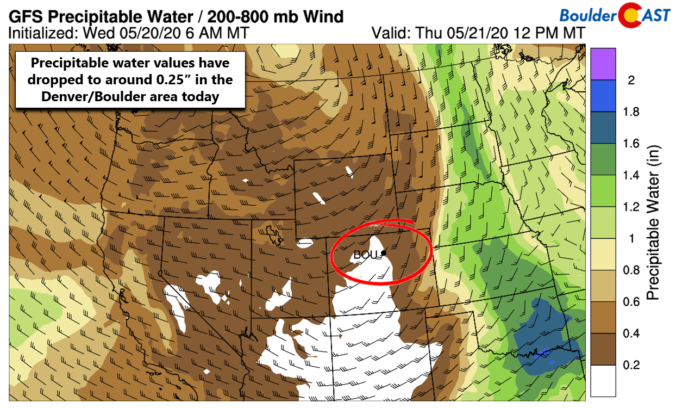
Detailed Forecast Discussion: The next two days will be defined by a drier, cooler and more stable airmass across Colorado following a cold front that moved through last night. A stagnant, blocking weather pattern across the eastern United States has prevented the trough coming ashore into the Pacific Northwest from making much eastward progress. The lows across the northern Rockies …

BoulderCAST Daily – Wed 05/20/20 | Dry and warm as the severe threat shifts slightly east

Detailed Forecast Discussion: Conditions are more favorable for severe weather today but that threat is fortunately just to our east. The same surface frontal boundary (dry line) that split the Denver Metro area in half yesterday has pushed eastward with the juicy air now fully located across the eastern Plains of Colorado. It's right along this boundary that we once …

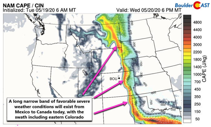
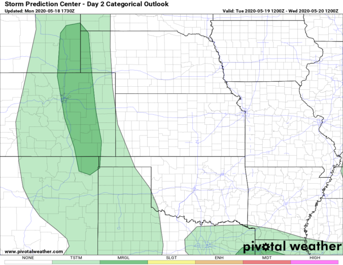
BoulderCAST Daily – Tue 05/19/20 | Near 90 with a slight chance of severe storms

Detailed Forecast Discussion: An impressive dipole pattern is present from west to east across the Rockies today with a strong trough of low pressure moving through Nevada and a potent ridge of high pressure across eastern Colorado and the western Great Plains. Between these two systems, a tight gradient is leading to brisk southerly flow through a deep layer of …

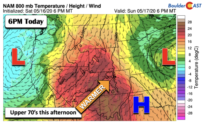
BoulderCAST Daily – Sun 05/17/20 | Another gorgeous day with upper 70’s

Detailed Forecast Discussion: Well, if you enjoyed Saturday, you'll continue to love today as well. Temperatures will soar about 10 degrees from yesterday thanks to a bubble of warmer air filtering in from the southwest. The flow at the surface remains out of the east-southeast, so highs should top out in the upper 70's. Though, we can't rule out a …

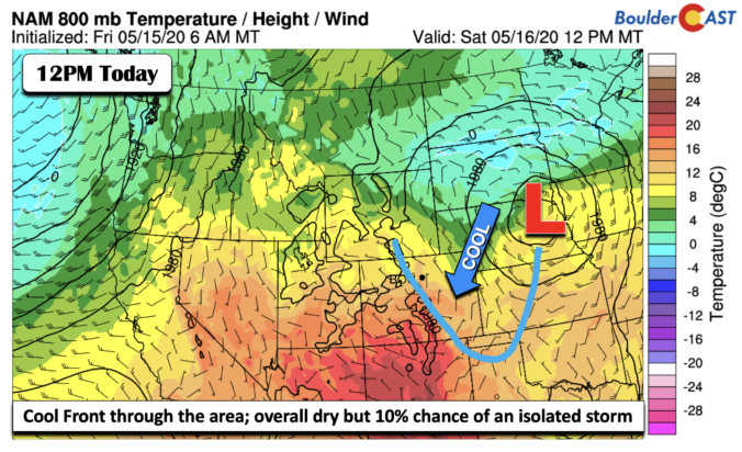
BoulderCAST Daily – Sat 05/16/20 | Drier with more sunshine

Detailed Forecast Discussion: Yesterday's trough of low pressure has moved out into the Midwest, centered over eastern Nebraska this afternoon (below). The system has left behind a weak cool frontal boundary draped along the Foothills today. As a result, some slightly drier air has worked in from the north and northwest, though the air is still on the moist side …

BoulderCAST Daily – Fri 05/15/20 | Upper 60’s with another round of afternoon/evening storms

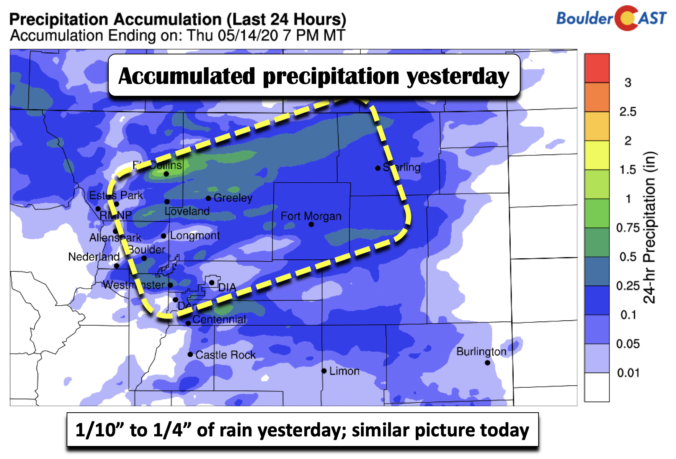
Detailed Forecast Discussion: Yesterday's storm activity dropped one tenth to one quarter of precipitation across the region (below). Portions further north near Ft. Collins received closer to an inch thanks to some localized stronger storms. Today's weather will feature a similar scenario later today and this evening. Another shortwave disturbance will be tracking through the state early this evening in …

BoulderCAST Daily – Thu 05/14/20 | Afternoon/evening showers and storms

Detailed Forecast Discussion: Following last night's cool frontal passage, the stage is set for scattered to widespread showers and storms to develop today as a shortwave disturbance passes across Colorado during peak heating. The NAM 500 mb vorticity animation below shows the energy embedded in the southwest flow moving across the area. Moderate large-scale lift and dew points in the …

« Older posts Newer posts »