Category: Premium Content (Page 264 of 452)

This content is for Premium Members only.
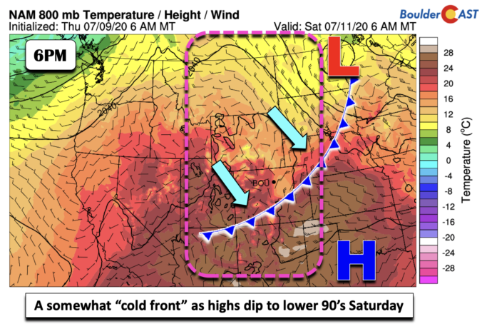
BoulderCAST Daily – Sat 07/11/20 | “Cooler” by relative standards

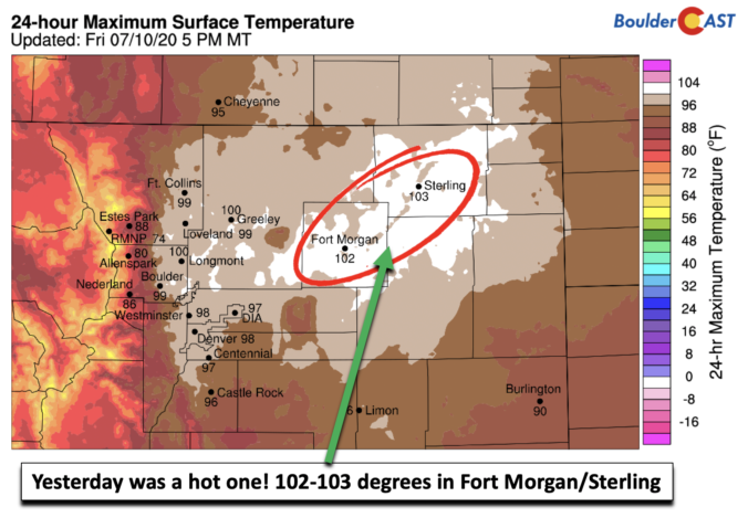
Detailed Forecast Discussion You don't need me to tell you that yesterday was quite the hot one. Highs across the Front Range were in the upper 90's to lower 100's. The two locations that were the highest were Fort Morgan and Sterling with highs of 102 and 103 degrees (below). But there is a welcomed cooling today, but in relative …

BoulderCAST Daily – Fri 07/10/20 | Hottest day of the week!

Detailed Forecast Discussion It has been all about the heat this week and it is no surprise that it continues to end the work week. Highs will top out in the upper 90's to lower 100's today with the ridge still to our south (below). A fast moving area of low pressure will race from Montana into North and South …

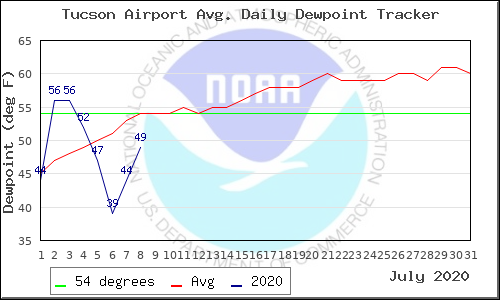
BoulderCAST Daily – Thu 07/09/20 | Lower 90’s as the monsoon is now officially “late”

TDetailed Forecast Discussion he heat is on again today with highs in the lower 90's. It will be slightly cooler following the influx of moist, rain-cooled air overnight from storms well out across the eastern Plains. The ridge of high pressure will really begin to intensify today into tomorrow with 500mb heights reaching near 6000 meters across New Mexico by …

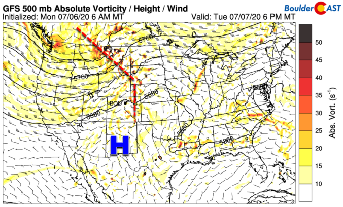
BoulderCAST Daily – Tue 07/07/20 | Toasty with isolated storms

YDetailed Forecast Discussion esterday's temperatures soared well into the 90's across all of eastern Colorado. The official high was 92°F in Boulder and 97°F at Denver International Airport. For today, a shortwave disturbance will be tracking mostly to our north along the northern flank of a relatively flattened ridge of high pressure. There will be a slightly boosted chance of …

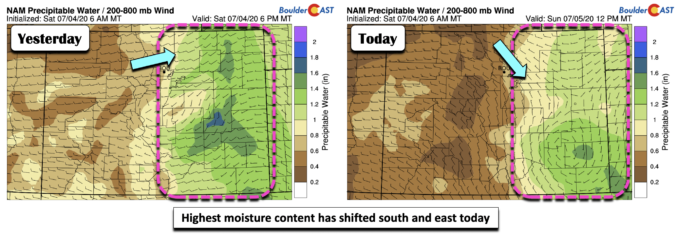
BoulderCAST Daily – Sun 07/05/20 | Storm chances lessen a little

Detailed Forecast Discussion Hope you had a safe and enjoyable 4th of July! A few minor changes to the atmosphere today relative to the 4th. Yesterday's thunderstorms allowed for the formation of a small scale mid-level low pressure circulation. This system is currently located across the western Oklahoma panhandle (below). This setup is actually going to changes things a little. …

BoulderCAST Daily – Sat 07/04/20 | Happy 4th of July!

Detailed Forecast Discussion For many of us, this is not a typical Independence Day holiday given the COVID-19 situation. Many firework displays are cancelled so things are certainly different this year. But still, enjoy your 4th and do be safe out there, as well as take in some outdoors. As we saw yesterday, thunderstorms will again be in the forecast …

BoulderCAST Daily – Fri 07/03/20 | Storm threat arrives today and continues through holiday weekend

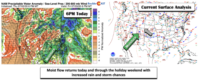
Detailed Forecast Discussion Scattered showers and thunderstorms make their way into the forecast today through the holiday weekend thanks to some upper and mid-level moisture pushing in from the southwest. This is not the "monsoon" moisture but it is welcomed! You'll notice in the bottom left figure that moisture anomalies have creeped up above average. At the surface (below right), …

« Older posts Newer posts »