Category: Premium Content (Page 254 of 452)

This content is for Premium Members only.
BoulderCAST Daily – Wed 09/30/20 | Sunny & just a tad cooler

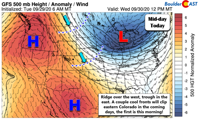
ODetailed Forecast Discussion: n this last day of September, dry and sunny weather will continue as a persistent and dominant ridge of high pressure aloft remains across the western third of the country. There are actually two high pressure centers embedded in this ridge (shown below): one in the Pacific Northwest and a second in northern Mexico. Since we are …

BoulderCAST Daily – Tue 09/29/20 | Back to above normal temperatures

FDetailed Forecast Discussion: ollowing the brief cooldown we saw over the last two days, we get right back to above normal temperatures as northeasterly flow turns towards a warmer northwesterly direction across the area today. This quick shift in temperatures is the result of the pronounced dipole pattern across North America which we foreshadowed last week. Colorado lies right in …

BoulderCAST Daily – Sun 09/27/20 | Much cooler and breezy

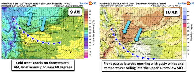
Detailed Forecast Discussion: The cold front as of 7 AM this morning was positioned along the Colorado/Wyoming border, with temperatures in the middle 40's behind it near Cheyenne. Later this morning, around 9 AM, the front will be knocking on our doorstep (below left), passing Loveland at that time and nearing Longmont. We should see a brief warmup into the …

BoulderCAST Daily – Sat 09/26/20 | One more day of warmth ahead of cold front

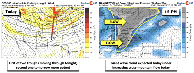
Detailed Forecast Discussion: Trough number one of a total of two will pass through tonight. It's position as of this evening will be along the Montana/North Dakota border (below left), with the trough axis stretching southward into central Colorado. Increasing westerly flow today, both at the surface and at mid-levels, will aid uplift along the higher terrain this afternoon. As …

BoulderCAST Daily – Fri 09/25/20 | Potential record warmth next few days before cooler weather Sunday

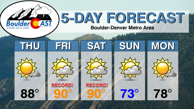
Detailed Forecast Discussion: A very subtle but noticeable weak cool front has moved through the Front Range earlier this morning. The surface boundary is shown below in blue. A weak small-scale high pressure has set up just northeast of Greeley. As a result, surface winds today will be out of the east-southeast, giving us a slight upslope component. While there …

BoulderCAST Daily – Thu 09/24/20 | Record heat likely in the coming days

YDetailed Forecast Discussion: esterday's high temperature was 84°F at BoulderCAST Station. We'll be a few degrees warmer than this today as 700mb temperatures edge even higher. There is a notable tilted ridge axis sliding across Colorado today (shown below). It stretches from the Desert Southwest into central Canada. Once this axis passes around mid-day, warm air advection under southwesterly flow …

BoulderCAST Daily – Wed 09/23/20 | The beginning of a long dry stretch

LDetailed Forecast Discussion: ittle change is expected in our weather for the first full day of autumn. Relatively warm and dry west-northwesterly flow is situated across Colorado. Meanwhile, a strong Pacific storm system is coming ashore into the Pacific Northwest. This system will move eastward and could bring a dry cold front through our area sometime Saturday leading to a …

« Older posts Newer posts »