Category: Premium Content (Page 237 of 452)

This content is for Premium Members only.
BoulderCAST Daily – Fri 02/19/21 | Breezy today ahead of our next system

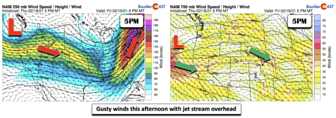
GDetailed Forecast Discussion: usty winds are expected today as the jet stream is overhead and across Colorado. Winds out of the west and northwest will range from 30 mph in the Denver Metro to the lower to middle 40's in Boulder, so hold on to your hats. This will likely create blowing and drifting snow. Although we have fresh snow …

BoulderCAST Daily – Thu 02/18/21 | Staying cold & clearing out, next snow chance comes late Saturday

FDetailed Forecast Discussion: or all the constant attention that the Arctic outbreak last week and weekend got, it barely produced any snowfall for our area. However, yesterday's unique convective setup flew under the radar of most and was able to put down some impressive snow in localized areas last night. We're seeing reports of 10" or more in Jamestown, Larkspur, …

BoulderCAST Daily – Wed 02/17/21 | Watch out for pockets of convective snow later today!

FDetailed Forecast Discussion: ollowing yesterday's isolated snow showers which amounted to little or no accumulation, we'll have another more numerous round to deal with later today. A large trough remains anchored across the center of the country with colder weather prevailing in many areas. Across Colorado, yet another shortwave disturbance has kicked up along the base of this trough. This …

BoulderCAST Daily – Tue 02/16/21 | Back into the 30’s with isolated snow showers

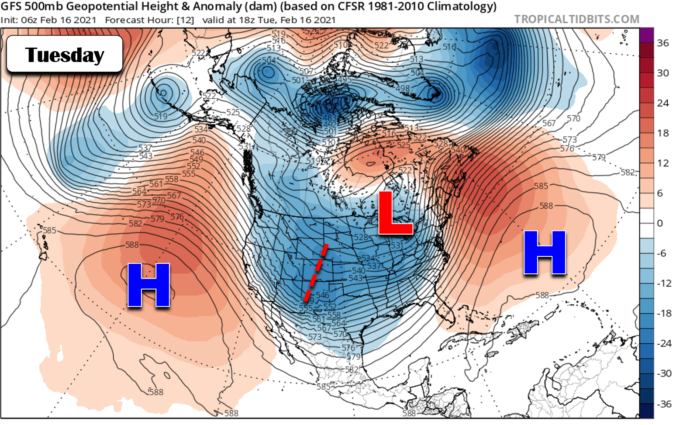
TDetailed Forecast Discussion: he coldest weather of the last decade is now behind us with the potent low pressure center responsible having weakened and shifted eastward into Québec. However, there won't be a magical switch flipped with warmer temperatures taking over immediately. Most of the continental United States is still within a deep polar trough. As such, high temperatures today …

BoulderCAST Daily – Sun 02/14/21 | Bitter cold today and tonight

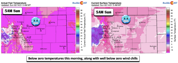
BDetailed Forecast Discussion: itter cold temperatures were evident this morning across the Front Range (below), with all cities below zero, along with well below zero wind chills (as low as -25 degF in Fort Morgan). Snow showers will taper off by midday, with no more than a half inch of additional accumulation expected. We may see some partial clearing, but …

BoulderCAST Daily – Sat 02/13/21 | Very cold and snowy is the forecast

BDetailed Forecast Discussion: itter cold air continues to filter in as the Arctic surge continues. Yesterday, our forecast high temperatures were off by about 10 degrees. Today, we are not being fooled! Another surge of arctic air has pushed in from the northeast and will continue to strengthen and envelope the Front Range tonight and tomorrow. We will likely not …

BoulderCAST Daily – Fri 02/12/21 | Arctic air remains in place with likely snow tomorrow

TDetailed Forecast Discussion: he Arctic airmass continues to remain in place, with the arctic front draped along the Foothills. It hasn't wavered much this week! Temperatures today will only reach the upper teens to around 20 degrees under mostly cloudy skies. Another surge of arctic air is responsible for temperatures being colder than yesterday. There are going to be some …

« Older posts Newer posts »