Category: Premium Content (Page 201 of 452)

This content is for Premium Members only.
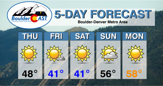
Weekend Weather Snapshot: December 16, 2021

WDetailed Forecast Discussion: ow! From the morning magnificent rainbows, to the rain/snow squall line, to the epic dust storms and of course the main event of damaging winds...it turned out to be quite the day on Wednesday! The big and windy low pressure center has rapidly moved northeastward and has crossed over the border into Canada overnight near Lake Superior. …

*Premium Storm Update* Wed 12/15/21 2:00PM

The potent storm system continues to pull eastward and away from the Front Range. The associated surface low pressure has now moved into northwestern Kansas with a central pressure around 985 mb! The visible satellite animation below from GOES-East is impressive. It shows the coating of fresh snow in the Foothills and Mountains, and also the massive amount of dust …

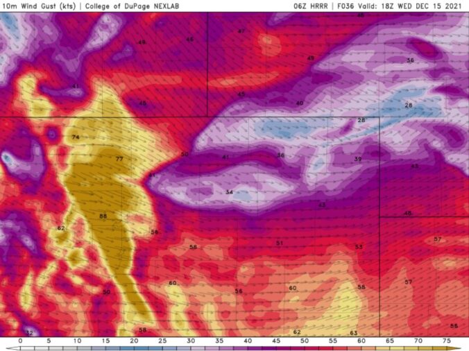
BoulderCAST Daily – Tue 12/14/21 | All eyes on a widespread damaging wind event tomorrow!

ADetailed Forecast Discussion: ll is quiet today across northern Colorado under prevailing warm but brisk southwesterly flow. To our west, a strong trough is coming ashore and taking aim on Colorado. This system will race across the area during the day tomorrow. Expect continued mild temperatures across the Front Range with highs today similar to yesterday under a Denver Cyclone …

BoulderCAST Daily – Sun 12/12/21 | An epic wave cloud slowly dissipates with highs in the 50s

TDetailed Forecast Discussion: upper-level jet stream slowly shifts north this afternoon and evening. As the figure below shows, the jet stream by this evening will extend from the Pacific Northwest, into the upper Midwest and northern Great Plains, and into the Great Lakes. With the jet stream still overhead this morning, gusty winds, as well as an epic wave cloud …

BoulderCAST Daily – Sat 12/11/21 | Warmer and breezy

ZDetailed Forecast Discussion: onal flow takes over today at mid-levels, ushering in a warmer today this afternoon. That will aid downslope warming with highs in the middle 40s. The westerly winds at the surface are a result of an upper-level jet stream nearby, over Wyoming and Idaho. We were originally concerned that this jet stream would impact the Plains in …

BoulderCAST Daily – Fri 12/10/21 | A quick burst of snow, followed by blustery and cold conditions

LDetailed Forecast Discussion: ittle has changed in the forecast for today compared to our snowfall post yesterday, but here are the latest details. The high-resolution NAM-NEST has latched on to a quick-hitting snow band develop around the Denver Metro this morning. While it remains to be seen how the snow band, if any, evolves and develops, the placement and formation …

Weekend Weather Snapshot: December 9, 2021

TDetailed Forecast Discussion: he main event of the week, a sharp Pacific trough, has finally come ashore this morning and will be moving towards Colorado through the day and tonight. Ahead of this trough, strong west-southwesterly flow will continue to hammer away at the Mountains with widespread orographic snowfall occuring statewide. There's about a 36-hour window where the Mountains will …

« Older posts Newer posts »