Category: Premium Content (Page 170 of 451)

This content is for Premium Members only.

BoulderCAST Daily – Fri 09/02/22 | Highs around 90 with just a slim chance of a storm

Northwest flow will take over at mid and upper-levels this afternoon (below). This change in the flow will allow a surface trough to push south and east of the Front Range today and tonight. The impact of this surface trough (see below) will aid in favoring a more upslope-driven surface wind this afternoon. The more extreme heat will get shunted …

Colorado Weekend Weather Outlook: September 1, 2022

GOES-East water vapor imagery shows the departing shortwave in Kansas and Nebraska which produced a few thunderstorms across northeast Colorado yesterday. Two additional shortwave systems are visible across Montana this morning --- these will be rotating through later today and early Friday. While they are unlikely to produce any precipitation for us, they will allow for more clouds and a …

BoulderCAST Daily – Wed 08/31/22 | 90s again with isolated storms possible, some turn severe east of Denver

The strong ridge remains situated over Utah and Nevada, with our area still under northwest flow aloft and largely dry air. The main change for today is the introduction of a weak disturbance that will clip northeast Colorado and spawn a few thunderstorms this afternoon and evening. The subtle feature is hard to detect in the graphic above, but is …

BoulderCAST Daily – Tue 08/30/22 | A big ol’ ridge takes hold for the foreseeable future

Today is the day where the ridge really begins to take control of the Rockies as it strengthens over Colorado, Utah and Nevada. The most unseasonable warmth will take place on the western portion of the ridge where deep southerly flow will bring north hot air from the Deserts. In our area, west-northwest flow will keep things warm but not …

DayCAST: Sun 8/28/22 | Hot and slight chance of scattered showers

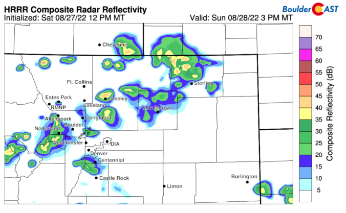
Detailed Forecast Discussion: Sunday starts a bit warmer than recent days with a morning low around 66.  Clear skies will help the day warm up faster than we've seen in the last few days.  Sunday's high will be around 90 degrees with some westerly flow and a small chance of an afternoon shower.   The HRRR and NAM-NEST models below agree …

BoulderCAST Daily – Sat 08/27/22 | Temperatures warmer near 90 with added sunshine

The trough from Friday has pushed into Canada, while the trough axis stretches from the Dakotas into far eastern Colorado. The passage of the trough, in conjunction with drier air settling in this afternoon, will produce a dry downslope flow on the Plains and also across the central to northern parts of the mountains. Both of the above mentioned factors …

BoulderCAST Daily – Fri 08/26/22 | Highs lower today with increased clouds and storms

Apotent upper-level disturbance will track through the state in the westerly flow over the Rockies. While the jet is not overly impressive, it is approaching 80 mph, which is decent for late-summer. This approach and passage of this mid-level wave will organize scattered to numerous showers and storms across the higher terrain today, moving onto the Plains later this afternoon …

« Older posts Newer posts »