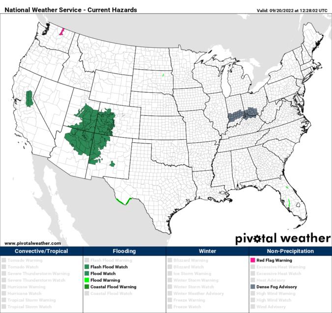
We have one more unseasonably hot afternoon for today before changes take shape tonight with rain and much colder temperatures arriving by tomorrow. The large-scale pattern across the nation has a deep cut-off low pressure just offshore from San Francisco and an expansive ridge of high pressure located in east Texas. Between these two anomalous but opposing weather systems, strong …
Alarge and impressive storm system is still churning out west near California today. The system is far enough west of us that it will not influence us in terms of precipitation. However, it will lead to rain/storm chances come the middle of this coming week, so more on that in our weekly outlook. The system will lead to a return …
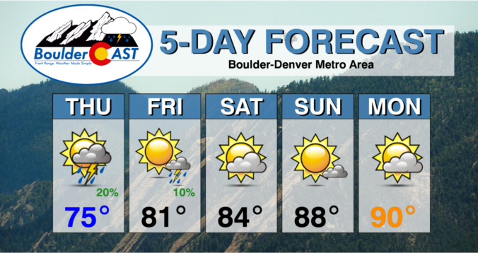
Alingering cool front remains draped from South Dakota into northwest Kansas and into eastern the Front Range of Colorado. Easterly flow will be the norm for much of the day. The airmass will thus remain similar to yesterday as the warmest air remains shunted to southwest Colorado. That will lead to highs in the upper 70s to lower 80s. A …
Astrong ripple of energy will track from southwest Colorado into eastern Wyoming and western Nebraska this evening. Aloft, the mid-level flow is also quite strong, exhibiting some 30-45 mph of speed to support storm development and strong cells. As such, there is a risk of severe weather mainly in eastern Colorado. A look at instability shows that combined with the …
Most Front Range cities saw some wet weather on Wednesday, but as expected it didn't amount to much across the lower elevations. It rained several times in Boulder, but it was barely enough to even wet the pavement. The map below shows estimated rainfall totals over the last 24 hours. The southern half of the Denver Metro area did notably …
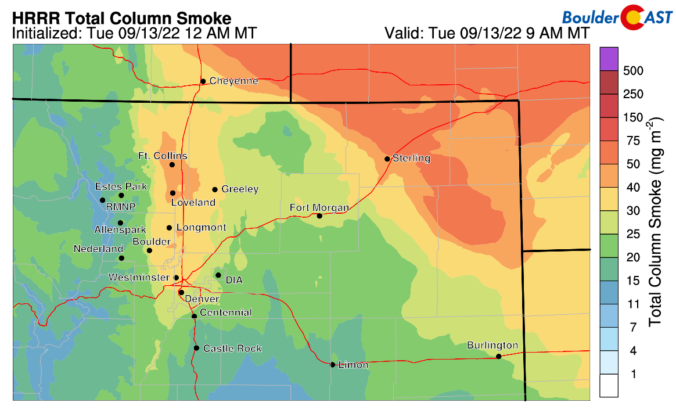
The main weather concern today for the Denver Metro area will be increased smoke arriving from wildfires burning in Oregon, California, Idaho and Montana. The smoke will be thickest across far northern Colorado along the Wyoming Border. Still, southeasterly upslope flow into our area will help to concentrate the smoke in and near the Front Range as well. The HRRR …
Yesterday's trough that aided in upslope drizzle/rain and temperatures rather chilly in the 50s to near 60 has moved into the Midwest. In its wake, a high pressure ridge at mid-levels will shift closer to the region this afternoon and evening. That will aid in a warming trend today. However, highs will still be rather comfortable and near normal in …