Category: Premium Content (Page 159 of 451)

This content is for Premium Members only.

BoulderCAST Daily – Sat 12/03/22 | Increasing clouds with temperatures in the 40s

Amid-level trough is located offshore of California today, spreading southwest flow into the intermountain West with weak zonal flow over us. Temperatures will rise from their cold start into the low to middle 40s, about 5 degrees below average and about 7 degrees below our highs yesterday. Even though the airmass moderates today, the reason for the cooler temperatures is …

BoulderCAST Daily – Fri 12/02/22 | High winds on the Plains and in the Foothills

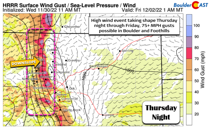
Avery strong 120+ mph jet streak, oriented from west to east over the state today will usher in strong, gusty winds for the Foothills and Plains into the early evening hours. The cross-barrier flow will result in this strong downslope flow. The latest HRRR shows these strong winds not only affecting the Foothills, where wind gusts will exceed 65+ mph, …

BoulderCAST Daily – Thu 12/01/22 | Warming up, but brace for high winds tonight through Friday

Abig warm-up is expected today as the Arctic airmass moderates and ultimately gets washed out by warm downslope from the west. Similar to yesterday, there will be a sizable spread in temperatures today across the Denver Metro area despite everyone seeing plenty of sunshine. Areas around Boulder and Fort Collins will be cooler, likely staying in the 40s (boo!), but …

BoulderCAST Daily – Wed 11/30/22 | Mostly sunny but cold, dangerous wind chills out east

Fresh snow cover and clear skies overnight allowed temperatures to drop into the single digits in most areas across the Front Range. This is close to the coldest night we've had so far this season. Thankfully winds are nearly non-existent this morning in the immediate Denver Metro area and thus wind chills are not too much colder overall. Out east …

Premium Storm Update – Tue 11/29/22 4:00AM | Plan for a dicey A.M. commute as bitter cold & snow impact the area

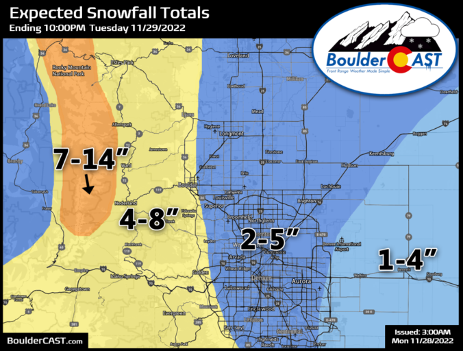
MPREMIUM STORM UPDATE: 4:00 AM Tuesday November 29th oderate to heavy snow arrived right on-schedule early this morning reaching Boulder just after midnight and Denver around 3AM. A liaison between a favorable jet stream overhead and a cold front are spawning this intense snow which has sagged southward overnight into our area.  Here's a portion of the radar animation from …

BoulderCAST Daily – Sun 11/27/22 | Snow ending with sunshine and some gusty winds in the Foothills

The system which brought us snow last night and earlier this morning will be moving into Texas by this evening, leaving behind dry northwest flow at mid-levels. This will lead to clouds breaking up today and giving way to sunshine for the remainder of the afternoon. Highs will reach the upper 40s in most of the Denver Metro area after …

BoulderCAST Daily – Sat 11/26/22 | Lower 50s trending colder with light snow tonight

Aweak cool front has moved through and will result in cooler temperatures today in the upper 40s to lower 50s for the Plains, lowest in Boulder and closer to the Foothills. Expect sunny skies giving way to increasing clouds this afternoon. Another cold front will move through tonight, ushering in colder temperatures into the mid to upper 20s by early …

« Older posts Newer posts »