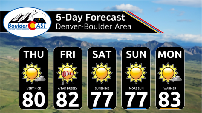
Astrong trough of low pressure over northwest Wyoming this afternoon and evening will bring dry and gusty winds today into Saturday. Broad southwest flow at the surface and aloft will bring warm and dry downslope flow for the Plains. That should keep us mostly sunny with no real precipitation chances. The low pressure system will bring southwest wind gusts of …
Alarge closed-low pressure is currently spinning in eastern Oregon --- this is the primary weather player across the west right now. Here's the latest GOES-East infrared satellite imagery of this impressive system from early this morning. Out ahead of this trough, yet another shortwave system is passing through this morning into midday (notice the vorticity maximum in southeast Utah above), …
Things will be largely quiet today across the Front Range as shortwave energy passes by just to our north and west. This energy, as well as additional waves the next few days, are rotating around a brough trough across the Pacific Northwest right now. This trough is forecast to stall out near Idaho and eventually does move east, but latest …
Westerly flow will be situated over Colorado today with a weak embedded shortwave progressing through the area this afternoon and evening from west to east. Increased moisture in this flow will lead to more clouds and a better chance of storms today, two factors that will keep our temperatures a few degrees cooler as well (relative to Monday). The best …
Aweak surface trough will promote downslope warming across the Front Range. High pressure will reside across northern Texas, promoting a broad warm southwest flow over the intermountain west. Expect another great day, just with a touch warmer in the lower 80s. The chance of isolated or scattered storms will return this coming week as guidance indicates a series of shortwave …
Aridge will envelope the state this afternoon and evening. This will replace the chilly and wet trough that brought us clouds and light morning rain on Friday. This trough reaches the Mid-Mississippi valley this evening. Abundant sunshine and warm advection will support temperatures rebounding into the middle 70s. Wind speeds will be light from the east around 5 mph. Warm …
Aslow-moving trough will be with us again today. The system brought widespread rain showers to the Front Range for our Thursday and it will continue to influence us today. We can expect our day to start off gloomy with light rain/drizzle in the morning, slowly trending toward some peeks of sunshine by late-afternoon to early evening. The trough axis roughly …
🌨️ Light Mountain Snow – Some light mountain snow showers possible today – …
3-Day Forecast

Did You Know?
The Marshall Fire sparked under some of the most extreme fire conditions possible in the Front Range on December 30, 2021 along Marshall Road south of Boulder. Winds were gusting near 100 MPH in this area that day. The fire destroyed more than 1000 homes as it spread eastward into Superior and Louisville.