We hope you didn’t put your cold weather gear away for the season yet — another Arctic Blast will ooze into eastern Colorado this week! A strong Arctic high will entrench the region in bitter cold air through midweek, with highs during this period well below normal in the teens and 20s with lows in the single digits or slightly below zero. A few weather systems moving through in the westerly flow aloft will bring several chances for snow to the area, but for the most part accumulations will remain relatively light east of the Mountains. Temperatures will moderate by the end of the week and especially the weekend as ridging builds in from the west and the dense Arctic air retreats eastward with surprisingly warm weather not too far off on the horizon.
Category: Forecast (Page 15 of 163)
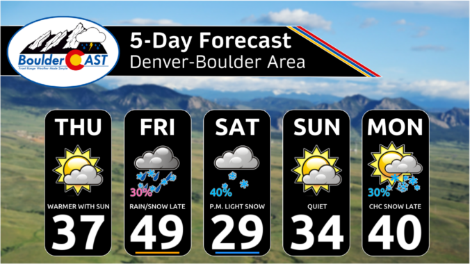
*Premium* This Weekend in Colorado Weather: Staying chilly with at least three chances for light snow
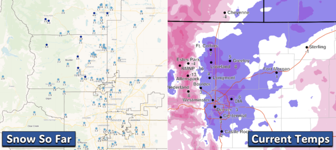
*Premium* BoulderCAST Daily – Wed 02/12/25 | A bitter cold day with just a smidge of additional snow, slightly below zero temps tonight
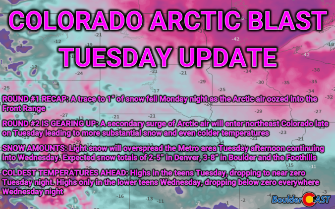
Arctic Blast Tuesday Update: The frigid air is already here, but the worst is still to come with several inches of snow and sub-zero temperatures on the way!
Our second Arctic Blast of 2025 is already underway! The first round of bitter cold has already gripped the Front Range, with light snow falling last night and temperatures plunging into single digits this morning. However, the worst is yet to come! Another wave of Arctic air is set to sweep through later on Tuesday, bringing several inches of snowfall and eventually sub-zero temperatures to the entire area. We discuss the latest forecast details, including when this next round of snow will begin and end, expected snowfall amounts across the area, and just how cold it will get in the days ahead.
Following a bitter cold and snowy January in the Front Range, the month of February so far has brought with it milder conditions. Last week we had our first 60-degree day in Boulder since just before Christmas, and even our first 70-degree day since late October. The warmer weather has been a welcomed reprieve, though it has rightfully confused some flowering plants across the area with early blooms. This warm weather was never going to last though — we’ve still got plenty of winter to go and this week will get us right back on-track with a two-part blast of Arctic air and snow headed for the Front Range. Read on for the latest details on the snowfall timing, amounts, and expected temperatures.
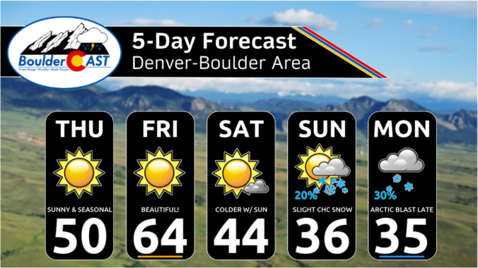
*Premium* This Weekend in Colorado Weather: Beautiful through Friday, Mountain snow this weekend, and the Arctic blast early next week
While Punxsutawney Phil and Flatiron Freddy both saw their shadows Sunday morning solidifying their predictions for six more weeks of winter, we’ll start off February with wildly above normal temperatures in the 60s to lower 70s here in the Front Range. However, we are watching an Arctic cold front that will peskily waver back and forth across northeast Colorado as the week progresses leading to fluctuating temperatures and plenty of uncertainty. The brunt of the cold air, though, likely will not plunge into our area until sometime next week alongside increasing chances for snowflakes.

*Premium* Storm Update – Thu 01/30/25 8:00AM | Bands of snow creating slick travel across the southeast Metro this morning, bone dry in Boulder
As expected, bands of snowfall pushed into the southeast Denver Metro area earlier this morning. While Boulder and the northwestern Front Range are dry, the southern and southeastern suburbs are facing a slick morning commute with heavy snowfall rates at times. We discuss the latest forecast, including how far westward these snow bands will make it and discuss the warm weekend ahead!
© 2026 Front Range Weather, LLC

