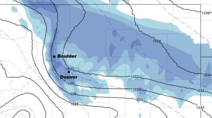
Though the Front Range has been feeling warmer of late, the Arctic air has never been far away. This boundary has remained just across the border in Nebraska and Kansas for the last few days. This changes tonight as the cold front pushes back south and west along with some moisture to bring light snow to everyone. Read on to find out the exact timing and snowfall amounts.
Category: Forecast (Page 132 of 169)
These video forecasts are Premium content. Periodically, we open videos up to all of our readers. Today is one of those days! Enjoy!
.
Only $4.99 Per Month
Weekly Outlook Every Monday
Major Storm Updates & Recaps
Daily Forecast Discussion & Email
Weekend Outlook Every Thursday
Skiing & Hiking Forecasts
Wildfire Smoke Forecasts
Chat Room & Forum Access
Request Custom Forecasts
Access Select Content Early
Advertisement Free
BASIC
Free
Weekly Outlook Every Monday
Major Storm Updates & Recaps
Daily Forecast Discussion & Email
Weekend Outlook Every Thursday
Skiing & Hiking Forecasts
: 2 Days Only
Wildfire Smoke Forecasts
: 30 Hours Only
Chat Room & Forum Access
Request Custom Forecasts
Access Select Content Early
Advertisement Free
PREMIUM
$6.99
PER MONTH
Weekly Outlook Every Monday
Major Storm Updates & Recaps
: (+Extra Updates)
Daily Forecast Discussion & Email
Weekend Outlook Every Thursday
Skiing & Hiking Forecasts
: Full 6 Days
Wildfire Smoke Forecasts
: Up to 72 Hours
Chat Room & Forum Access
Request Custom Forecasts
Access Select Content Early
Advertisement Free
Share this video:
The week ahead begins warm before the arrival of a southern-track winter storm by mid-week. Unfortunately, the path of the upper-low is not very favorable for Colorado. We’ll see some snow, but not much. Temperatures will then rebound to end the week on a mild note.

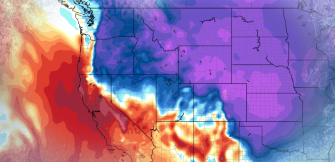
From everyone at BoulderCAST, we wish you all a Happy New Year! This week, the main weather story will be a warming trend as high pressure settles in across the Southwest. The Arctic air, which has entrenched much of the CONUS the past week, will be pushing off to our east, allowing for an early January thaw. Read on for more details.
We hope you had a safe and festive holiday weekend! Despite the very cold start to the week, warmer weather is on the way! Read on for our outlook covering the upcoming week, including when we expect our next chance of snow.

We discuss the forecast for more snow Saturday night across the Front Range, and detail the locations that will see a White Christmas!
Accumulating snow and frigid temperatures are on the way for most of Colorado! Read on as we discuss the arrival of the first Arctic cold front of the season, one which has good timing to coincide with the winter solstice on Thursday.
Changes to the forecast bring the return of accumulating snow to the Front Range. We detail when we expect the snow to start and how much will fall.

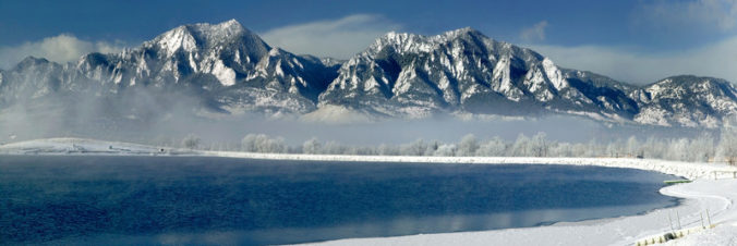
Live View of Boulder

Current Conditions

Live Radar

Latest Smoke Forecast

Recent Premium Posts

BoulderCAST Daily – Fri 07/17/26 | Hot and dry continues through the weekend
🥵 Heat tightens its grip this weekend — Ridge strengthens slightly over the …
This Weekend in Colorado Weather: Several More Scorching Days Ahead Before the Long‑Awaited Monsoon Pattern Arrives
☀️ Persistent heat continues — Low to mid‑90s through Saturday, spiking towards the …
BoulderCAST Daily – Wed 07/15/26 | The Ridge Rules the Rockies as Hot, Dry Pattern Holds Firm
🔥 Heat dome setup continues — A strong, stationary 500 mb ridge keeps …
3-Day Forecast

Trending Content

© 2026 Front Range Weather, LLC