Category: Forecast (Page 12 of 163)

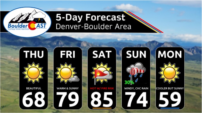
Following a chilly and unsettled first week of April, this week will be much quieter across Colorado with generally warm and dry conditions favored throughout the entire week under the protection of high pressure. Temperatures will fluctuate a tad due to a pair of dry backdoor cold fronts, but otherwise this week will offer-up gorgeous spring weather. That theme will continue right into the upcoming weekend with the first 80-degree temperatures of the year likely. Read on for all the details.
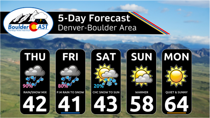
*Premium* Storm Update – Thu 04/03/25 11:00AM | Rain/snow mix turning to all snow later, a similar event will unfold again tomorrow
Today’s gloomy mix of rain/snow remains on-track for the Front Range, spreading into the area quickly this afternoon before ending around midnight. Most of the actual snow accumulation will occur in/near the Foothills, with minor travel impacts in the higher terrain where slushy roads will occur. Another similar round of mixed precipitation will unfold again Friday afternoon into Friday night, with light accumulations possible as well, especially after the sun goes down Friday evening. We discuss the latest forecast details, inbound snowfall potential and when warmer weather will return.
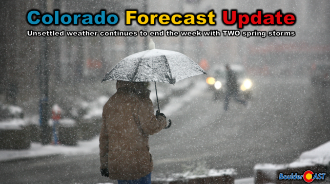
Colorado Forecast Update: Two spring storms will bring a prolonged mixed bag of precipitation to end the week
A big dip in the jet stream across the western United States will funnel two weak storm systems eastward in the coming days leading to a prolonged period of cool and gloomy weather to the Front Range that will take us right into the weekend. Our discussion here focuses mainly on the first storm set to move across Colorado on Thursday with a mixed bag of rain and snow. We’re expecting minimal travel impacts across the Boulder-Denver area due to warm temperatures, but some problems may occur in the higher terrain. Continue reading
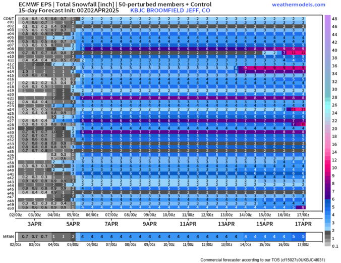
*Premium* BoulderCAST Daily – Wed 04/02/25 | A cool & quiet day between systems, but two rounds of snow are brewing to end the week
The week ahead will remain fairly active across Front Range Colorado as a series of upper-level disturbances track through the region with a broad trough of low pressure over the Four Corners and Intermountain West. Our warmest day will be Monday near 60 degrees, with cooler temperatures and unsettled weather taking over the remainder of the week. We are especially focused in on the Friday/Saturday timeframe when a strong storm system could bring several inches of spring snow to the area. Read on for more details.
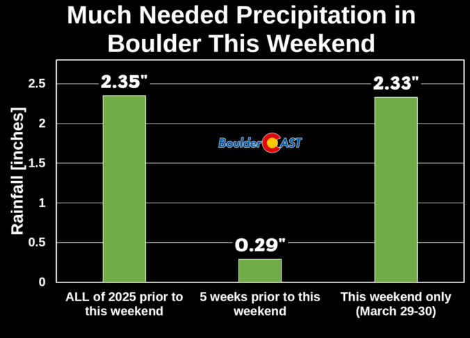
Thanks to multiple rounds of steady rain, a hail-producing thunderstorm, and even a few snowflakes, Boulder has remarkably received about as much precipitation this weekend as we’ve seen in all of 2025 combined beforehand! We review the rain (and snow!) totals across the area and discuss briefly what unfolded over the last 36 hours during what was a rather atypical spring storm.
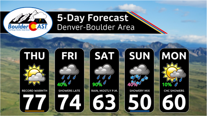
*Premium* This Weekend in Colorado Weather: Near-record warmth Thursday, but cool & wet weather will take hold for the entire weekend!
© 2026 Front Range Weather, LLC

