Category: BoulderCAST Daily (Page 30 of 370)
This page contains an index of our BoulderCAST Daily forecast updates. If you are NOT a Premium member, you will only see a tiny sample of this content below. Subscribe to BoulderCAST Premium to gain access to all of our daily forecasts which get published every morning.
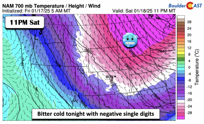
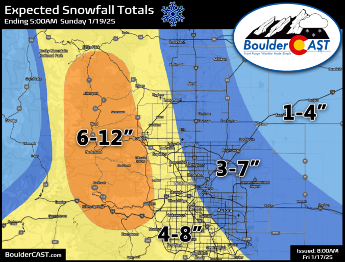
Our anticipated Arctic cold front is pushing southward across northern Wyoming right now and is on-track to arrive into the Denver area this afternoon. Snowflakes will be slightly delayed, but are expected to quickly develop early this evening impacting at least some of the commute window as travel turns very treacherous through the evening. The latest model data points to a slightly more impactful snow event unfolding, especially for Boulder County. We’ve increased snow totals in these areas. We also discuss the temperature outlook for the rest of the frigid holiday weekend ahead.
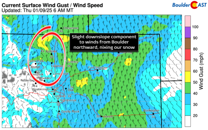
Snow has quickly developed this morning across southern portions of the Denver Metro area, while things remain mostly dry throughout Boulder County under the protection of downslope flow. We take a look at current conditions across the region, the expected blustery wind speeds for today, and how much snow will fall throughout the morning.

Live View of Boulder

Current Conditions

Live Radar

Recent Premium Posts

BoulderCAST Daily – Sat 11/08/25 | Turning chillier tonight and Sunday
🌡️ Turning chillier tonight: Cooler highs in the middle 50s. We turn colder …
BoulderCAST Daily – Fri 11/07/25 | Quiet conditions – still no snow
🌡️ Mild temperatures: Mild in the lower 60s 💨 Cold front brings us …
This Weekend in Colorado Weather: Red Flag Conditions Thursday, a cooler weekend ahead, and chances increase for a record late first snowfall
🔥 Windy with fire danger Thursday: Gusts of 20–30 MPH across the Metro …
3-Day Forecast

LATEST SMOKE FORECAST

Trending Content


© 2025 Front Range Weather, LLC