Category: BoulderCAST Daily (Page 229 of 465)

This page contains an index of our BoulderCAST Daily forecast updates. If you are NOT a Premium member, you will only see a tiny sample of this content below. Subscribe to BoulderCAST Premium to gain access to all of our daily forecasts which get published every morning.
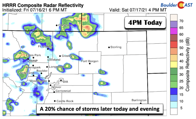
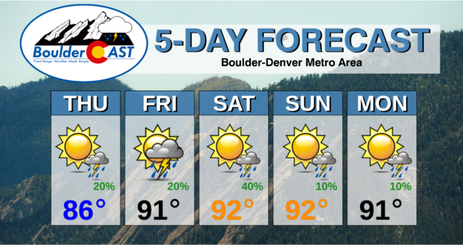
BoulderCAST Daily – Sat 07/17/21 | Lower 90’s once again with a 20% chance of storms

HDetailed Forecast Discussion: igh pressure is centered right over south-central Colorado today (below), keeping us in that warm and monsoon-like pattern. We'll start off with lots of sunshine with high temperatures rising into the lower 90's, similar to our Friday. There will be some development of showers and storms over the higher terrain, however a somewhat less chance for the …

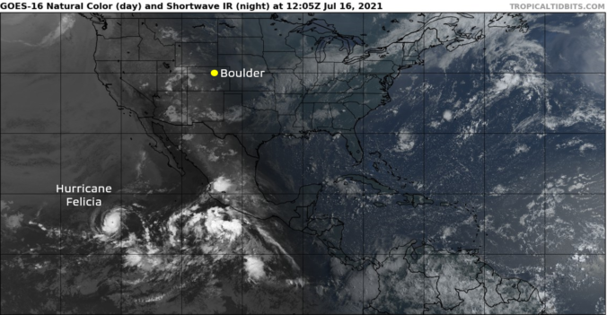
BoulderCAST Daily – Fri 07/16/21 | Lower 90’s with isolated storms, plus the first major hurricane of 2021 has formed!

VDetailed Forecast Discussion: ery little change in the overall weather pattern is noted today compared to yesterday for the area. A weak trough stretches from Minnesota southward into northeast Colorado. This trough will act as a focal point for storm development later today. West of this trough axis in the Front Range, drier westerly flow and slight subsidence will inhibit …

BoulderCAST Daily – Thu 07/15/21 | More sun & less storms as drier air has taken over

RDetailed Forecast Discussion: ainfall totals yesterday were far from impressive in most areas due in large part to the stubborn cloud cover we mentioned in yesterday's discussion. Shown below are the observed precipitation amounts from Wednesday (radar estimated). Most everyone saw at least a few sprinkles, with upwards of 0.5" in the heavier cells. Overall the abundant cloud cover really …

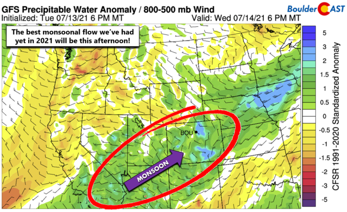
BoulderCAST Daily – Wed 07/14/21 | Numerous afternoon showers and storms are expected, but uncertainty is elevated

YDetailed Forecast Discussion: ou know it's going to be an active monsoon day when notable precipitation is already falling at sunrise across portions of southwest Colorado, which is upstream from us in the current monsoonal flow pattern. As of 6:00AM, there's a large batch of mainly light to moderate rainfall occurring in the southwest corner of the state which is …

BoulderCAST Daily – Tue 07/13/21 | Near 90 degrees with lots of elevated smoke & gusty showers

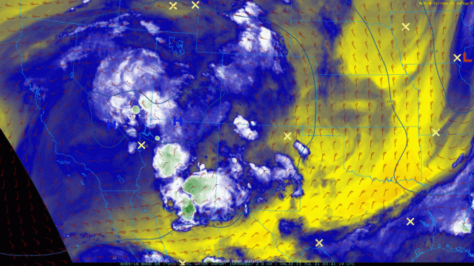
MDetailed Forecast Discussion: oisture has been on the increase overnight as mid-level flow shifts to be from a more westerly direction. The overnight satellite animation below shows the increase in moisture and a wind shift across the Front Range, with everything rotating around two lobes of high pressure in southern California and southern Nevada. Ironically this setup is not great …

BoulderCAST Daily – Sun 07/11/21 | A Pleasant Sunday

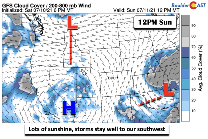
MDetailed Forecast Discussion: id-level pattern shows a trough of low pressure over northeast Oklahoma and southwest Missouri today, along with a ridge of high pressure over the desert southwest. That places Colorado in that continued northwest flow for the remainder of our weekend. This should keep us dry with below normal precipitable water values. Correspondingly, that will favor large amounts …

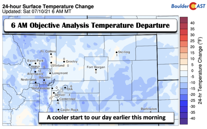
BoulderCAST Daily – Sat 07/10/21 | A much cooler day

MDetailed Forecast Discussion: UCH cooler weather has moved into the Front Range today. Below shows the temperature departure earlier this morning around 6 AM. Most areas around the Denver Metro were between 5 and 14 degrees cooler compared to the same time Friday morning. This is all thanks to a cold front that has pushed through the area. The cold …

« Older posts Newer posts »