Category: BoulderCAST Daily (Page 225 of 465)

This page contains an index of our BoulderCAST Daily forecast updates. If you are NOT a Premium member, you will only see a tiny sample of this content below. Subscribe to BoulderCAST Premium to gain access to all of our daily forecasts which get published every morning.

BoulderCAST Daily – Thu 08/19/21 | Watch out for severe weather this afternoon, including hail, strong winds & a couple tornadoes

TDetailed Forecast Discussion: oday's main concern is the development of scattered severe thunderstorms across much of northern and northeastern Colorado as the upper-level closed-low pressure system draws closer. This morning the low is spinning in southern Idaho, just a little west of Salt Lake City. Southerly flow of 40 MPH is noted aloft over Colorado this morning, with surface flow …

BoulderCAST Daily – Wed 08/18/21 | One more hot day, much cooler tomorrow with severe storms possible

TDetailed Forecast Discussion: he primary concern for our weather the next few days will be the approaching trough from the Pacific Northwest, a system which is unseasonably strong for mid-August. The center of the upper-trough is located across eastern Oregon this morning. Thick smoke is wrapping around the base of this trough... first southward into portions of Nevada, then northeastward …

BoulderCAST Daily – Tue 08/17/21 | Hot & smoky with isolated gusty showers, the cooldown is still on-track for Thursday

TDetailed Forecast Discussion: hough the smoke never really vacated our area, over the past weekend it was largely high up in the atmosphere with relatively clear air near ground-level. We even had a few days WITHOUT Air Quality Alerts issued for the Denver Metro area, about the only such occurrence of this in the last five weeks. However, the smoke …

BoulderCAST Daily – Sun 08/15/21 | Thick smoke returns today and tonight

MDetailed Forecast Discussion: id-level convergence will be in place this afternoon and evening thanks to a disturbance drifting south from Wyoming. This is evident in the figure below. What this help with doing is aid some scattered showers and storms, especially across the higher terrain to our west. If you are hiking, you'd want to start very early as a …

BoulderCAST Daily – Sat 08/14/21 | Highs in the lower 90’s with just a slight chance of storms

HDetailed Forecast Discussion: ot temperatures return to the state this afternoon. With high pressure over northern California, largely stable air will allow for plenty of sunshine for the first half of the day. Aloft, temperatures increase, enough to get us into the lower 90's this afternoon, about 6-7 degrees warmer than our Friday. Northwest flow exists in the mid and …

BoulderCAST Daily – Fri 08/13/21 | Friday the 13th brings a slight risk of severe storms this evening

VDetailed Forecast Discussion: ery little is going on in the mid-levels of the atmosphere over the CONUS. In our area, high pressure remains anchored in place over western Utah. However, there is a trough of low pressure over the Great Lakes, which has brought a frontal boundary near the Front Range this afternoon and evening. This boundary will be the …

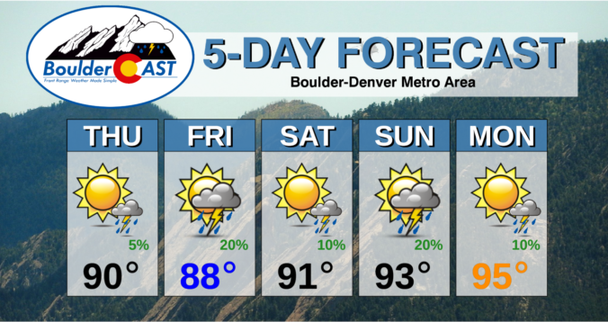
BoulderCAST Daily – Thu 08/12/21 | One final day of thick smoke with highs around 90°F and a chance of a LATE storm

⦁❶⦁ High pressure has pushed into California redirecting the thickest smoke northward into the Pacific Northwest

⦁❷⦁ One more day of moderately thick smoke is expected across the Front Range before we clear out considerably

⦁❸⦁ High temperatures near 90 degrees, but watch for isolated storms LATE tonight

⦁❹⦁ A slightly better chance of storms tomorrow, some of which could produce large hail

Continue reading

« Older posts Newer posts »