fleeting brush with winter may have swept across the Front Range this past weekend, but the atmosphere isn’t planning to stick with the theme for long. That sharp Arctic plunge—while refreshing for snow lovers—was more of a brief interruption than a true turning point. A closer look at the pattern ahead shows Colorado snapping right back into its now‑familiar routine of warm afternoons, bone‑dry air, and a statewide snowpack sitting at record‑low levels. Winter may have knocked on the door, but it certainly isn’t moving in.
Category: Climatology (Page 1 of 66)
These posts contain information about the long-term weather patterns of Boulder County. Potential topics may include 30-day weather outlooks, El Nino/La Nina, and seasonal forecasts. You will find less about the day-to-day weather, with more focus on longer trends and patterns.
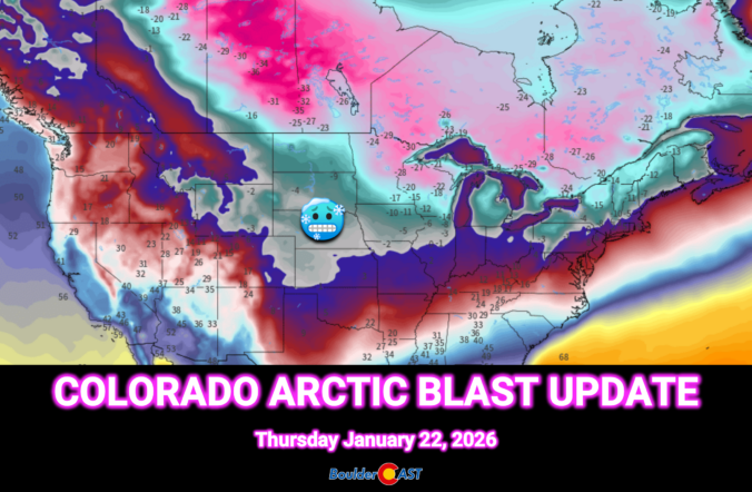
This weekend’s forecast looks nothing like the mild stretch we’ve been coasting through so far in 2026. A sharp pattern shake‑up is finally knocking on eastern Colorado’s door. An Arctic airmass is set to spill into the Front Range Thursday night, bringing the coldest temperatures of the season and eventually a round of light, fluffy snow. We break down the timing, impacts, and just how low those temperatures will go—plus why the rest of the country is gearing up for a far bigger and historic winter storm.
A stubborn weather pattern is settling in this week, and Colorado finds itself right in the middle of the action—or the lack of it. While the coasts deal with weather extremes, the Front Range gets a quieter blend of mild spells, a couple of cold fronts, and just enough uncertainty to keep things interesting. Read on for our full outlook of the next seven days to see if this translates into meaningful moisture or just more dry January days.

A tandem of low pressure systems — one warm and moisture‑rich, the other colder and more dynamic — teamed up just enough to deliver a surprisingly efficient burst of snowfall across the Front Range to end the week. We break down how this two‑part event unfolded, why the timing mattered so much, and where our forecast over‑ and under‑performed. Continue reading
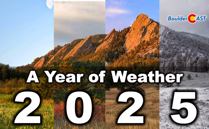
2025 was one of those years where Boulder’s weather never seemed content with a single storyline. We opened with a bitter Arctic punch that delivered our coldest January in nearly two decades, only to swing into a summer packed with 90°+ heat, smoky afternoons, and the hottest day since 2012. The monsoon showed up often but rarely with much enthusiasm, fall dried out in a hurry, and our first snow didn’t arrive until November 29th — the latest on record by a country mile. Now that the dust (and smoke, and snow) has settled, we’ve pulled together a full graphical recap of the temperature swings, precipitation quirks, record‑setting moments, and long‑term trends that defined Boulder’s and Colorado’s atmosphere in 2025. If you want the full story behind the chaos — and a clearer picture of where 2025 truly landed — this is a fun one to dive into. Be warned, there really are 100 charts and visuals to explore. Enjoy!
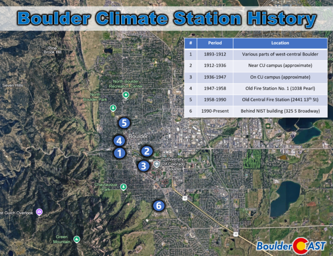
Boulder’s “official” climate record has never lived in one place for long. Over the past 130 years, the instruments that track our temperature, precipitation, and snowfall have been relocated again and again—sometimes only a few blocks, other times miles away into landscapes with completely different quirks and microclimates. Each move left its own imprint on the long‑term dataset we use today, subtly shaping how we compare modern conditions with the Boulder of decades past.

Warm, gusty weather is kicking off the first full week of 2026, but the atmosphere has a few twists lined up as we move toward the weekend. A stubborn ridge will keep us mild early on as downslope winds ramp up fire concerns. However, a developing trough later in the week will turn us much colder — with even the possibility of snow for Boulder and Denver if the storm track cooperates. The details are still evolving, but there’s plenty to watch in the days ahead.
After a quick burst of weekend snow and our coldest temperatures since early December, the week ahead turns much quieter across Colorado. Temperatures will climb steadily as Boulder and Denver stay dry into the New Year, while the Mountains prepare for a well‑timed round of snow for the holiday weekend. We’ll walk you through the day‑to‑day weather this week, where the snow will fall, and check in on long‑range guidance which still isn’t advertising much in the way of winter for eastern Colorado.

Live View of Boulder

Current Conditions

Live Radar

Recent Premium Posts

BoulderCAST Daily – Tue 01/27/26 | Early morning clouds will give way to a sunny Tuesday
🌤️ Clouds Clearing Fast — Early morning mid‑level clouds from northwest flow fade …
BoulderCAST Daily – Sun 01/25/26 | Light snow develops later today into this evening
❄️ Light snow this afternoon and tonight: A fast-moving clipper type system brings …
BoulderCAST Daily – Sat 01/24/26 | Bitter Cold This Weekend With Light Snow Again Sunday
🥶 Arctic blast is here: Arctic Air lingers through the weekend with teens …
3-Day Forecast

Trending Content

© 2026 Front Range Weather, LLC