⦁❶⦁ Today will be a day to remember in Colorado weather — one that should be worthy of telling the grandkids about someday!
⦁❷⦁ Warm and windy conditions will exist ahead of the front with elevated fire danger — highs in the upper 40s
⦁❸⦁ The Arctic front remains on-track to bring an incredible temperature change between 4 and 6PM with snow beginning an hour or two afterwards
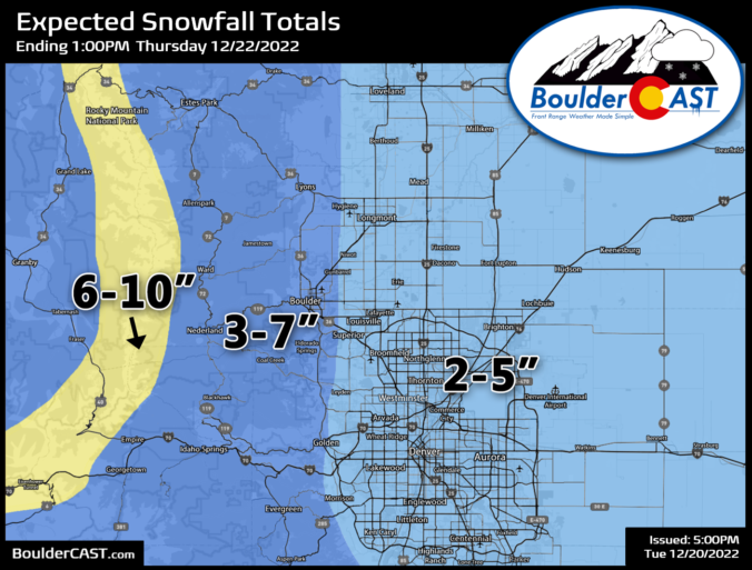
⦁❹⦁ Heaviest snow will fall during the evening hours, but lighter snow lingers into the overnight — 2 to 7″ expected across the Front Range
⦁❺⦁ Temperatures go negative before midnight and likely stay below zero until Friday morning with wind chills ranging from -15 to -30°F much of the time
This content is for BoulderCAST Premium members only. Join Premium now to get access to our detailed forecast discussions for Boulder and Denver every single day, plus a bunch of other perks!


You must be logged in to post a comment.