⦁❶⦁ Hot and mostly dry with just a 10% chance of an afternoon shower or weak storm
⦁❷⦁ Due to a very dry lower atmosphere, strong gusty outflows expected but brief light rainfall
⦁❸⦁ Hot with temperatures peaking in the lower 90’s by early afternoon
⦁❹⦁ Deeper moisture arrives tomorrow from the southwest with an uptick in storm activity expected
Remember, our daily forecasts are Premium content. Periodically, we open this forecast up to all of our readers. Today is one of those days so please do enjoy!
Sign up today to get the best BoulderCAST experience, including these daily forecasts every morning, complete 6-day skiing and hiking forecasts, access of all our Front Range specific weather models, additional storm updates and much more!
Detailed Forecast Discussion:
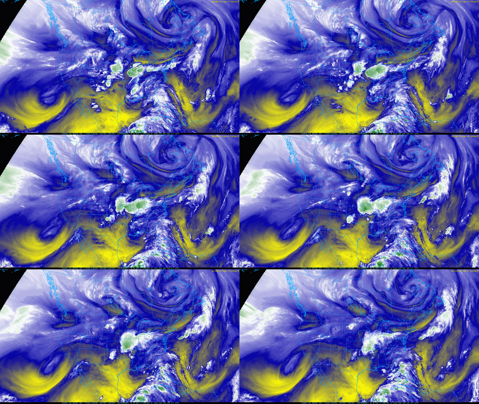
GOES-East water vapor imagery depicts a rather impressive cut-off low pressure system offshore of southern California this morning.
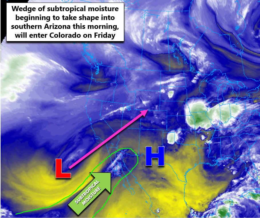
Adding in some annotations to this loop, we see that once again high pressure sits to our south in New Mexico. A wedge of deeper, subtropical moisture is just beginning to edge northward into southern Arizona. This moisture will be a major player for Colorado tomorrow into Saturday bringing with it more widespread showers and storms, particularly across the Western Slope. but also for the Front Range as well to some degree.
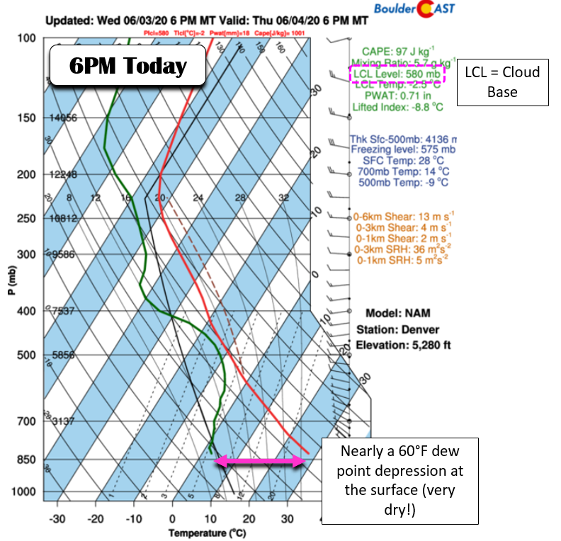
Today will feel very familiar if you’ve been paying attention the last few days. Morning sunshine will shift to increasing clouds by early afternoon with just isolated showers and a few weak thunderstorms expected. Model soundings, like the one from the NAM below, show a significant dry layer in the lower atmosphere that will be difficult to overcome. Any thunderstorms that do form will produce almost no rain but brief gusty outflow winds. These winds should feel great considering the area is headed for the lower 90’s this afternoon.
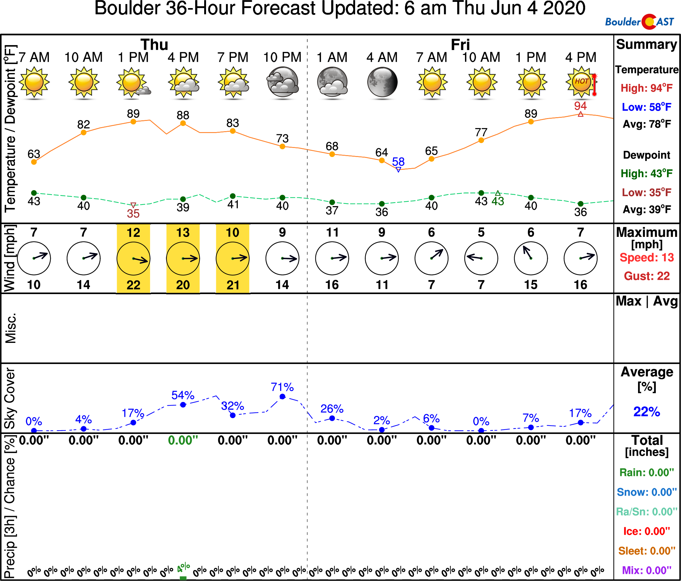
Our NowCAST forecast for today in Boulder is shown below. Notice the huge spread between the temperature and dew point (55+°F by early afternoon) and the very slim chance of rainfall impacting the area. By and large, it will be a great Thursday if you can tolerate the “dry heat” and occasional gusty winds.
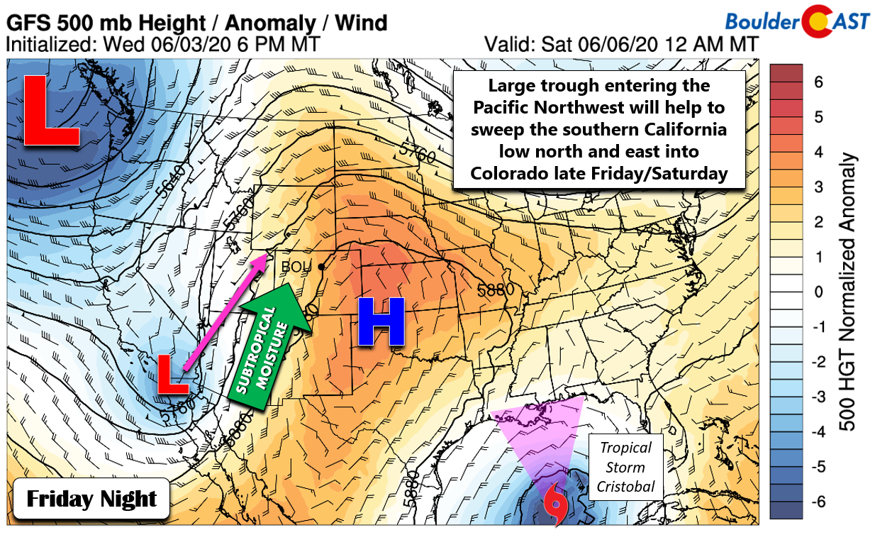
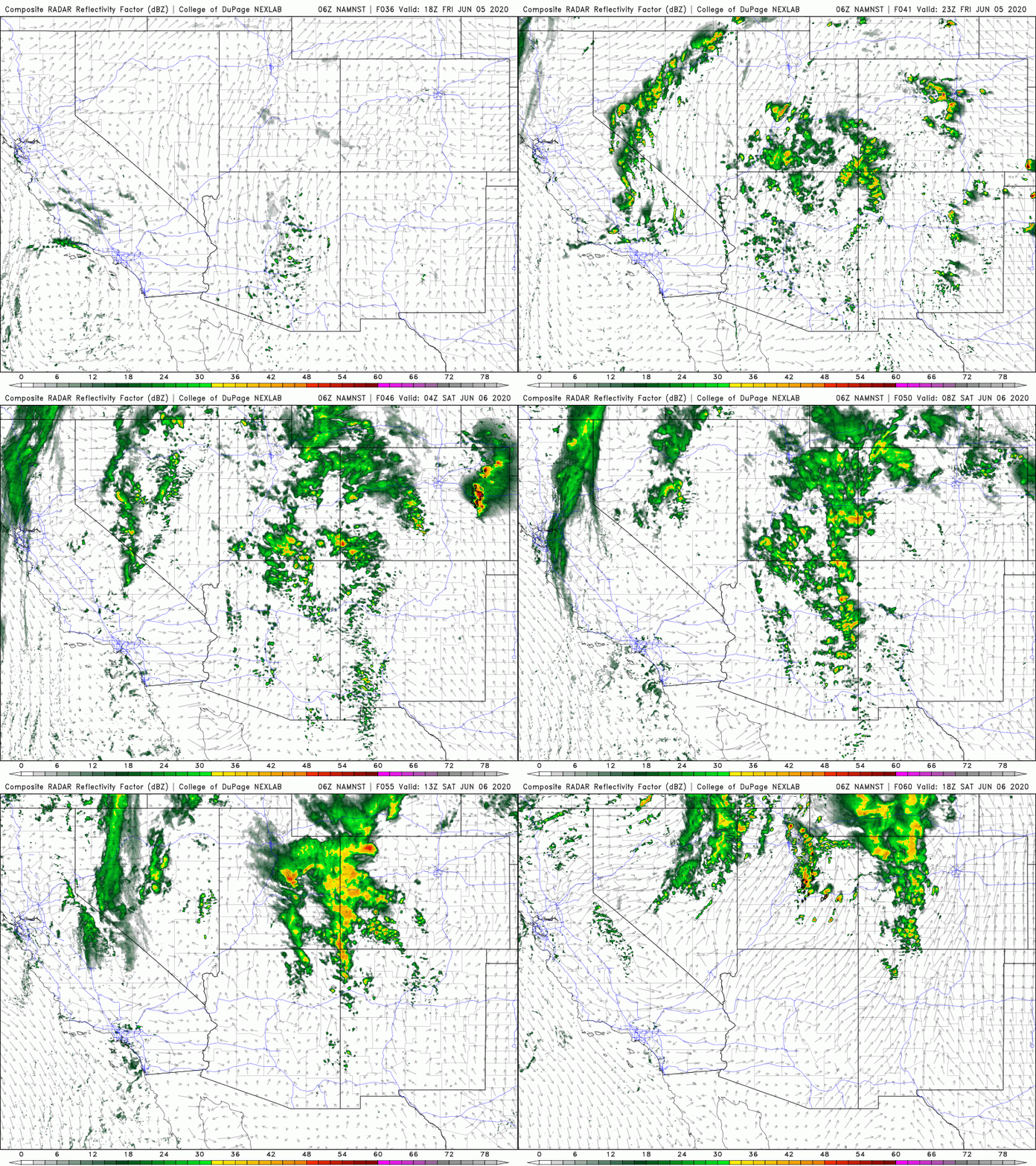
Tomorrow the chance for rain increases somewhat across our area as the incoming low pressure and associated moisture begin to impact Colorado. Models are still torn on the timing of this system. This isn’t surprising considering it is a cut-off low getting swept northward by a large trough advancing into the Pacific Northwest. The overall model trend in the last few days has been to SLOW this system’s arrival, so it won’t be surprising if things ultimately hold off until Saturday.
While it looks like the overall track will favor western Colorado for the best rains, the Front Range should see an uptick in storm chances as well both Friday and Saturday, perhaps around 20-30% each day. Not an overwhelming chance, but definitely higher than we’ve seen most of the week.
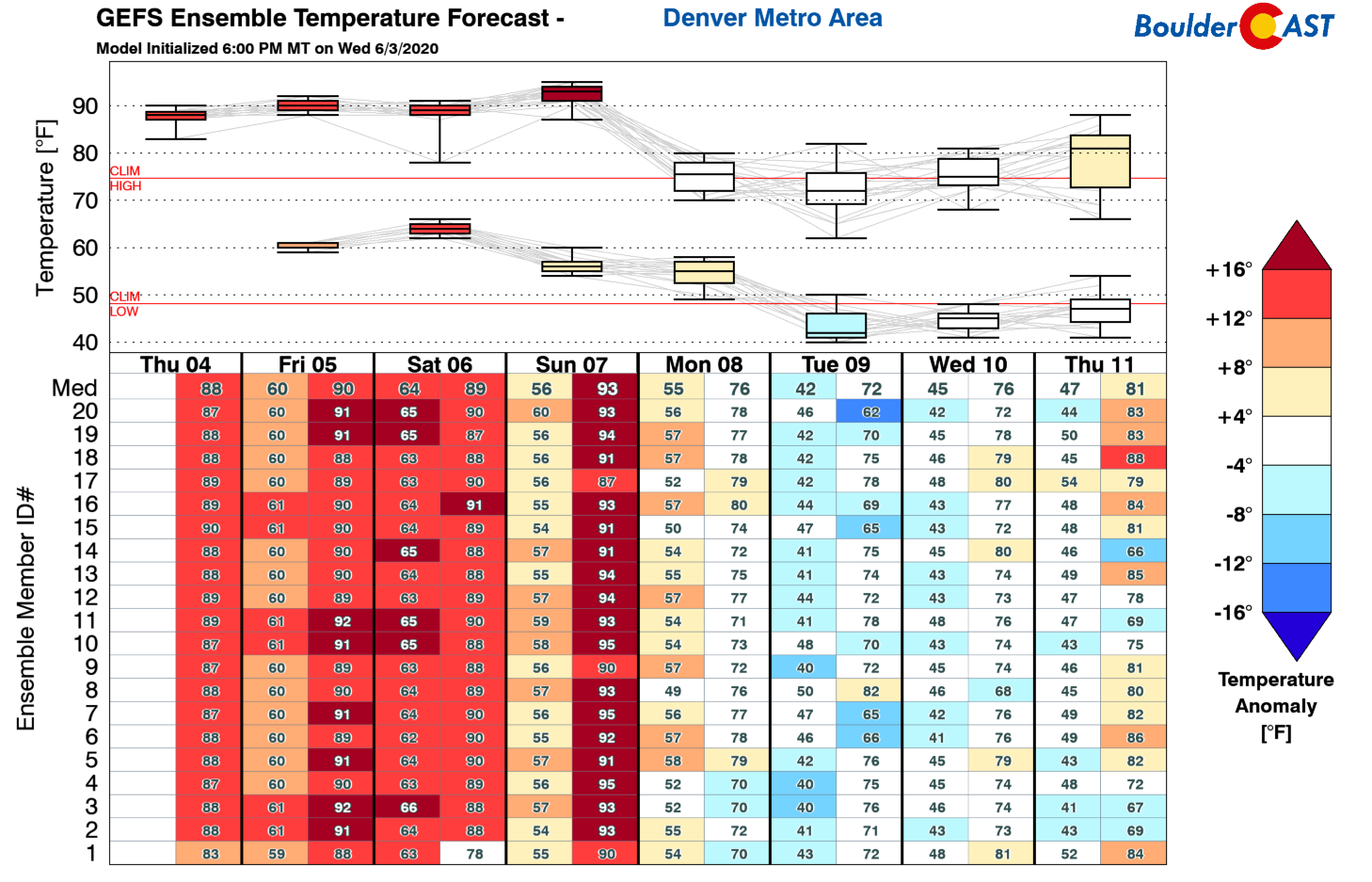
When will we kick the 90’s and start to cool off? Probably not until Tuesday, but maybe Monday if we are lucky! The trough just now entering the Pacific Northwest will do the trick….eventually.




You must be logged in to post a comment.