The next several days are going to be unseasonably cool and active across the Front Range. We discuss the outlook for large hail and tornadoes Friday afternoon, accumulating snow in the Mountains, the potential for flooding, and the gloomy weather sticking around for the weekend. Yes…all of that!
Author: BoulderCAST Team (Page 40 of 48)
This post had major contributions from at least two members of our team. The more meteorologists the better, right?
A potent spring storm and stark disagreement in the solutions offered up by the weather models made for a difficult forecast leading into last night’s snow event. We talk totals and take a look at just how uncommon snow in late May is for Boulder.
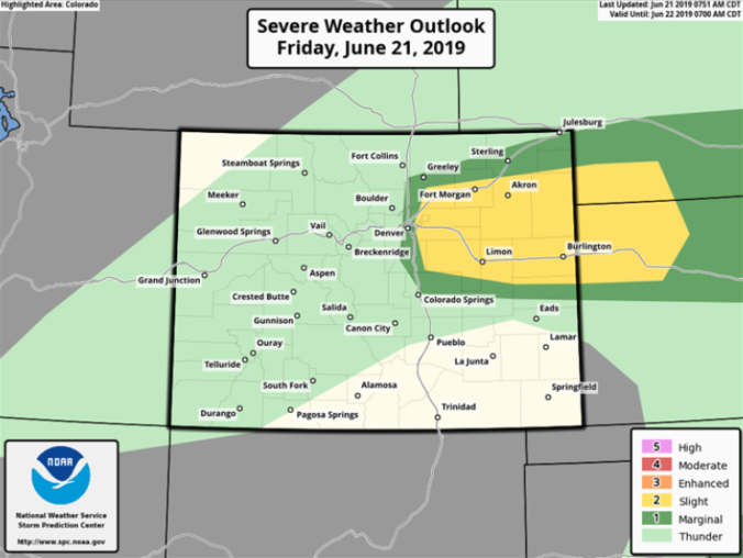
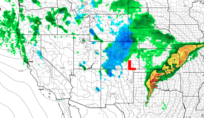
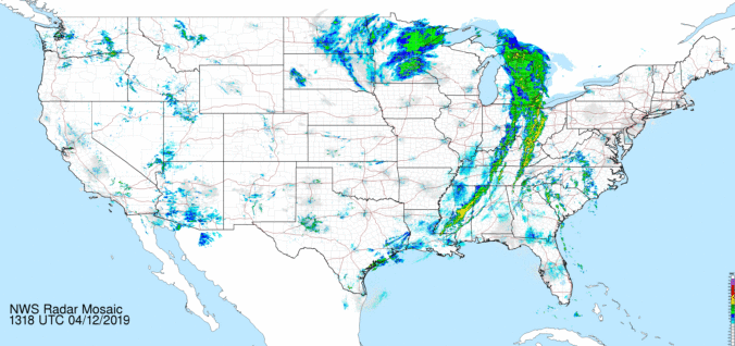
Several factors are coming together this afternoon for a fairly significant severe weather outbreak. Though the focus will be well northeast of the Front Range in Nebraska and South Dakota, storms that develop this afternoon and evening across the Metro area will have the potential to be strong and borderline severe, with hail and strong winds the main threats. We take a look at the forecast for a stormy Friday and the cooler weekend ahead.
The weather pattern over the next few days is one that will be favorable for widespread and persistent precipitation across the Front Range. We’re even predicting temperatures to cool enough early Thursday to allow for a change-over to snow. Read on for a complete forecast on the prolonged, dreary weather expected in the coming days and our thoughts on preliminary snow amounts.

Mother Nature does some of her best work this of year! No other place and time can offer the extremely rapid changes in weather like Front Range Colorado can during the month of April. We take a look at how Boulder went from near 80 degrees on Sunday afternoon to a blanket of snow in just over 24 hours.

Through the day yesterday, models trended slightly warmer for the storm system as it targets northeast Colorado Monday evening and night. We had hoped that the overnight model runs would reverse these changes, but this unfortunately does not appear to be the case. In lieu of this, we are left with a warmer overall storm…one which has numerous sources of lift and plenty of moisture to squeeze out significant precipitation across the Metro area, but is lacking in the cold air department. This will ultimately make for a very tricky forecast across the Boulder and Denver area this evening and tonight. We discuss our concerns, potential impacts, and provide our snowfall forecast map.

As we move towards the tail-end of snow season here in Front Range Colorado, we can’t help but think this winter has been longer, colder, and snowier than years passed. We examine the data to confirm this and discuss the chance for more accumulating snow in the coming weeks.
Rain and snow return to the forecast Friday and Saturday, but better weather lies ahead for Sunday. Read on for our updated forecast covering the entire weekend.

Live View of Boulder

Current Conditions

Live Radar

Recent Premium Posts

BoulderCAST Daily – Thu 06/25/26 | On-and-Off Showers and Storms with a Lower Severe Threat
🌩️ Severe setup today but overall threat is much lower than past few …
BoulderCAST Daily – Wed 06/24/26 | Another Day of Severe Weather
🌩️ Severe setup once again today with the threat of very large hail …
BoulderCAST Daily – Tue 06/23/26 | High‑End Hail Threat Targets the Denver Area, with the Risk Lingering into the Overnight
🌩️ Severe setup persists with upslope + strong westerlies aloft + copious moisture/instability …
3-Day Forecast

Trending Content

© 2026 Front Range Weather, LLC