Author: BoulderCAST Team (Page 14 of 45)
This post had major contributions from at least two members of our team. The more meteorologists the better, right?

April 2023 concluded as Boulder’s sixth consecutive month with below normal temperatures. At the same time, the Front Range area saw below normal snowfall and precipitation leading to increased drought coverage, though a soggy conclusion to the month did help things a bit. Here’s a quick and colorful graphical recap of our weather during April and how it relates to climatology.

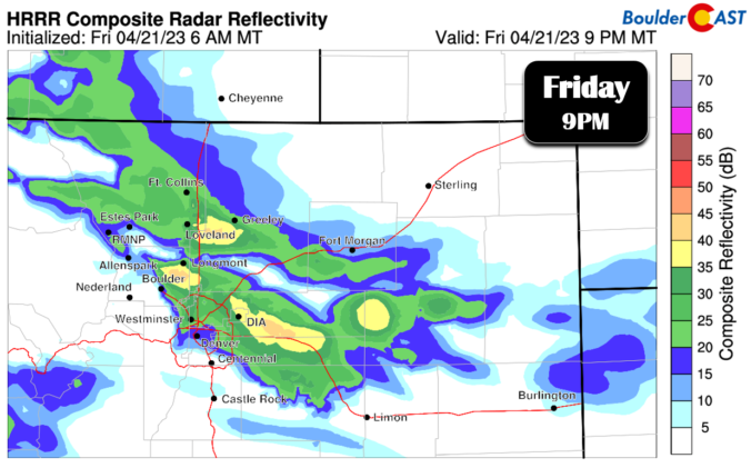
The cold front which will initiate the bands of snowfall Friday night is still located approximately 150 miles north of Denver but it is heading this way quickly. We discuss the latest on the approaching system and provide a few final details on timing for what should be a widespread light accumulation of snow for everyone overnight.
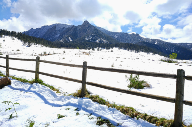
We hope you enjoyed the taste of summer as temperatures soared into the 70s and 80s the last several days because we will be paying for that warmth in short order as much colder temperatures and snowflakes take over the Front Range to end the week. A tricky forecast is set to unfold over the area Friday into Saturday with rain changing to wet spring snow for everyone. Up to 10″ could fall in the higher Foothills communities with even slushy accumulations on the table for the Denver-Boulder area. Let’s discuss the latest on the approaching winter storm.

Live View of Boulder

Current Conditions

Live Radar

Recent Premium Posts

BoulderCAST Daily – Sun 01/11/26 | A mild Sunday with readings reaching the 50s
🌤️ Mild & Melty Sunday: Light winds and patchy clouds, with lingering snowpack …
BoulderCAST Daily – Sat 01/10/26| Widespread sunshine and moderating temperatures this weekend as our recent snow melts off
🌤️ Calm Saturday: Winter storm systems have departed the state, leaving behind a …
BoulderCAST Daily – Fri 01/09/26| Snow ends quickly this morning with a quieter weekend in store
❄️ Overnight snow bands: A second push of upslope after midnight sparked narrow …
3-Day Forecast

Trending Content

© 2026 Front Range Weather, LLC