Author: Ben Castellani (Page 44 of 303)
Ben grew up in southwestern Pennsylvania and holds both a bachelor's and a master's degree in Meteorology, the latter being from CU Boulder. His hometown received nearly three feet of snow from the Storm of the Century back in March of 1993, sparking his initial interest in impactful weather. Ben currently works on remote sensing and data analysis software at NV5 Geospatial Software in Boulder.
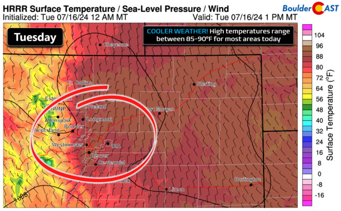
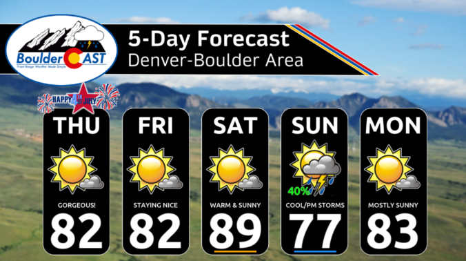
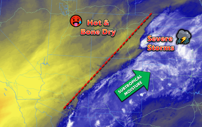
After days of scorching heat, this week will fortunately trend cooler and wetter with the return of monsoon moisture to Colorado — perfect timing considering severe drought has now returned to the area and fire danger continues to explode. Following one more toasty outing on Monday, temperatures will tumble below normal by midweek with daily chances for monsoon thunderstorms, some of which could be severe. We review the ongoing heatwave, the recent Dinosaur Fire in Boulder, why the pattern is now shifting and look ahead to which days will offer the best chance of rain this week.

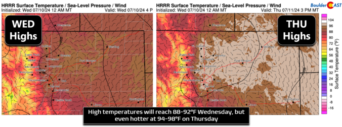
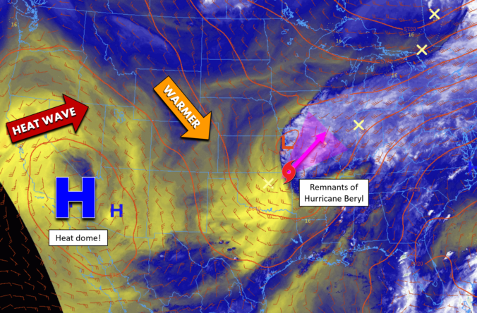
An impending pattern shift is expected to bring record-breaking triple-digit temperatures to the Front Range this weekend. This latest round of extreme heat is due to a superheated airmass moving into Colorado from the Desert, an airmass which has already produced all-time record highs in other western states. We review the climatology for rare triple digit heat, discuss why Denver is often several degrees warmer than Boulder during the summer, go over the forecast for just how hot it will get this weekend and look ahead to when we may finally cool off.
Following right in the footsteps of May, June was another incredibly dry month across much of the Front Range, concluding as Boulder’s driest June in exactly 100 years. As a result, drought has returned to the area, including both Boulder and Denver. June also landed as one of the hottest on record for many Colorado cities. Here’s a quick and colorful graphical recap of our weather during June and how it relates to climatology.

Live View of Boulder

Current Conditions

Live Radar

Recent Premium Posts

BoulderCAST Daily – Sat 05/30/26 | A stray shower today as most activity resides well east of Denver
🌦️ Spotty showers today, mainly well east of the Denver Metro area, where …
BoulderCAST Daily – Fri 05/29/26 | A Marginal Risk of Severe Isolated Storms
🌦️ Spotty showers this afternoon, mainly noon and 4 PM, with highs in …
This Weekend in Colorado Weather: Unsettled but Manageable as Low-End Storm Chances Hang Over the Front Range
🌎 Omega block holds through early next week, but slowly shifts toward the …
3-Day Forecast

Trending Content

© 2026 Front Range Weather, LLC