Author: Ben Castellani (Page 4 of 294)
Ben grew up in southwestern Pennsylvania and holds both a bachelor's and a master's degree in Meteorology, the latter being from CU Boulder. His hometown received nearly three feet of snow from the Storm of the Century back in March of 1993, sparking his initial interest in impactful weather. Ben currently works on remote sensing and data analysis software at NV5 Geospatial Software in Boulder.
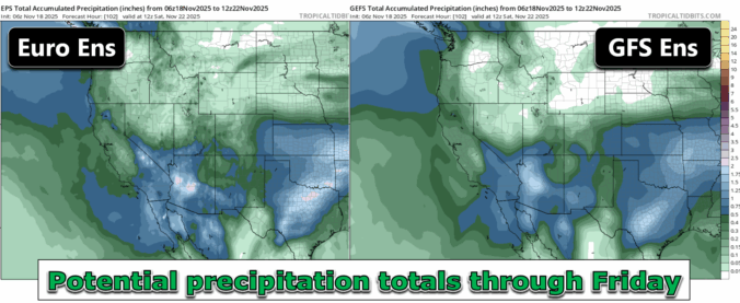

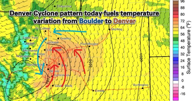
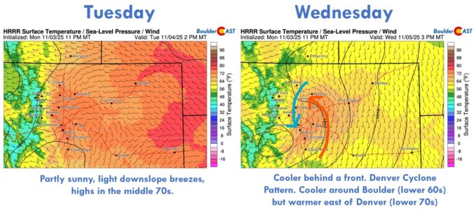
After weeks of unseasonable warmth and bone‑dry skies, the Front Range is finally staring down a pattern shift this week. But will it deliver the moisture we’ve been waiting for—or just more wind and disappointment? In this update, we break down some stats from our parched autumn so far, and take a look at several storm systems moving through Colorado this week, one of which will offer an excellent chance of rain (and maybe some snow) in the Boulder-Denver area.

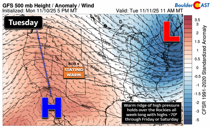
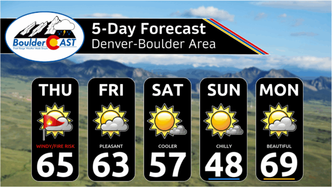
*Premium* BoulderCAST Daily – Tue 11/11/25 | Exceptional November warmth holds strong through Friday

Live View of Boulder

Current Conditions

Live Radar

Recent Premium Posts

BoulderCAST Daily – Thu 01/08/26 | Snow develops today but still some uncertainty, amounts have been lowered
❄️ Snow develops today: Snow develops today, but uncertainty still lingers with two …
BoulderCAST Daily – Wed 01/07/26 | Quiet today but snowflakes are on the horizon tomorrow
⛅ Quiet Weather Today: Highs will be mild in the upper 50s in …
BoulderCAST Daily – Tue 01/06/26 | Critical Fire Conditions Today
🔥Critical Fire Conditions: Fire Weather conditions could be critical today with gusty winds …
3-Day Forecast

Trending Content

© 2026 Front Range Weather, LLC